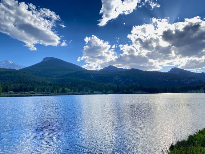
Lily Lake Trail at Rocky Mountain National Park in Estes Park, Colorado is an easy 0.9-mile universally-accessible loop hike that features views of the lake and surrounding mountains like Longs Peak. The Lily Lake Trail is also a great spot to watch wildlife.
Hike
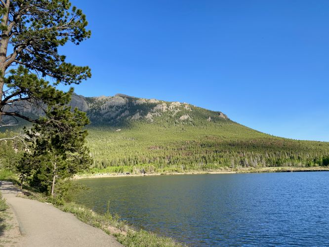
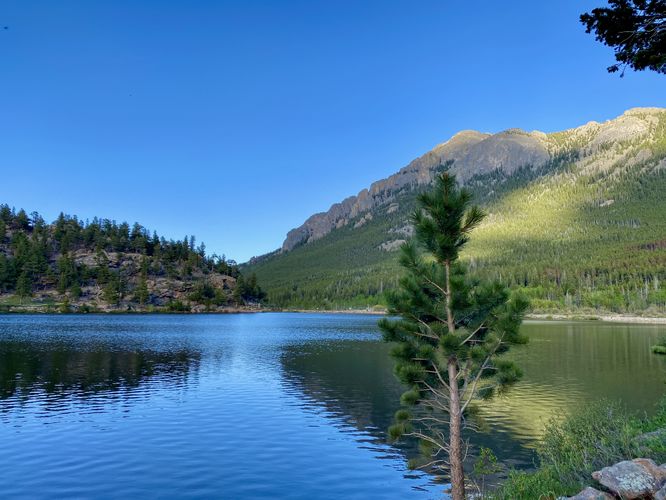
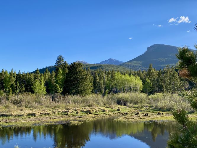
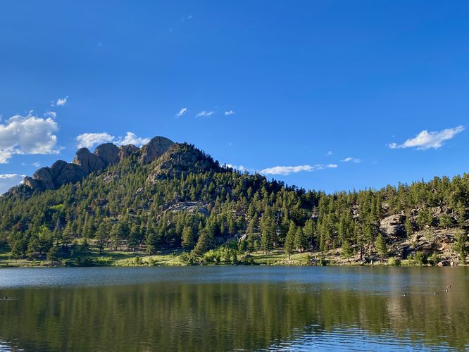
This short and mostly-flat hike begins at the main trailhead for Lily Lake and follows the trail counter-clockwise by following the north shore first. During our hike here in the early evening in June 2024, we started the hike along the north shore to find a muskrat run up a hiker's leg after getting scared - the muskrat, realizing the hiker's legs were not a tree or bush, darted off and jumped into Lily Lake -- likely one of the funniest hiking experiences I've had. Your experience may vary, but Lily Lake is a beautiful place to take a walk regardless of startled muskrat or not. From the north shore of Lily Lake, hikers will find stunning views of Rocky Mountain National Park's highest peak, Longs Peak in addition to other mountains like Estes Cone and Mount Meeker.
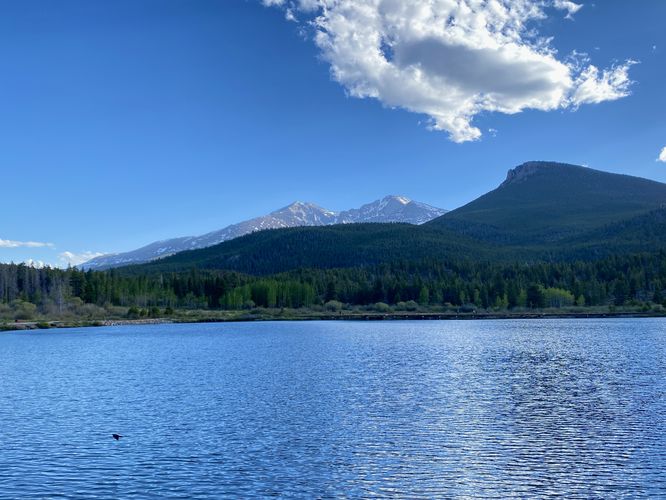
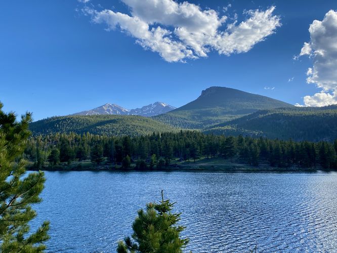
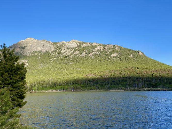
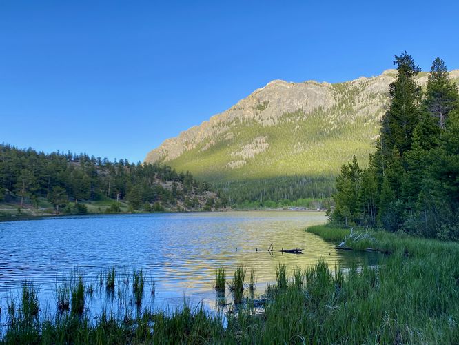
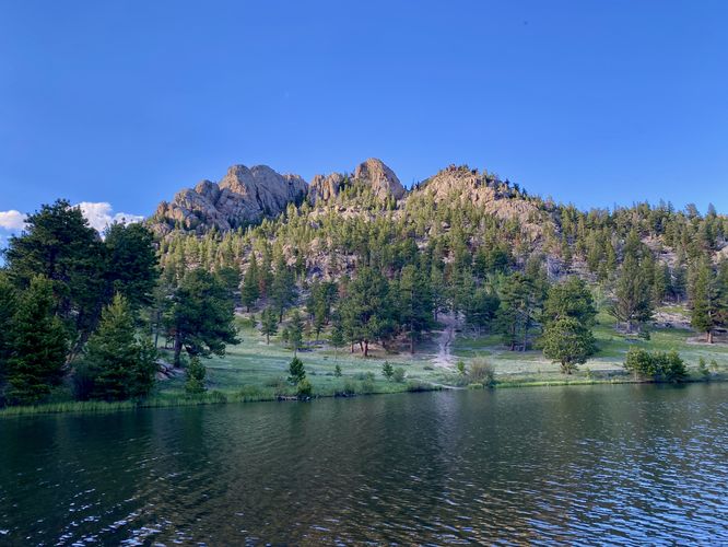
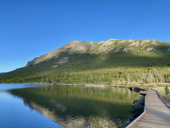
The trail bends around the lake and from the western shore, hikers will get views of Twin Sister Mountain as it towers over Lily Lake. The south side of Lily Lake includes additional views like that of Lily Mountain, located to the north. Just before the hiker reaches the southeastern corner of the lake, you'll find a boardwalk that spans over the water - providing more wildlife viewing opportunities to find fish, birds, moose, or elk. Finally, hikers will swing around to the eastern side of Lily Lake to find similar views that you found at the trailhead.
During our hike here in June 2024, we found an elk on our way out - the animal was on the central part of Lily Lake's north shore, but just out of sight for a decent photo. Again, if you wish to find wildlife here, aim for early morning or early evening and maybe you'll find something neat!
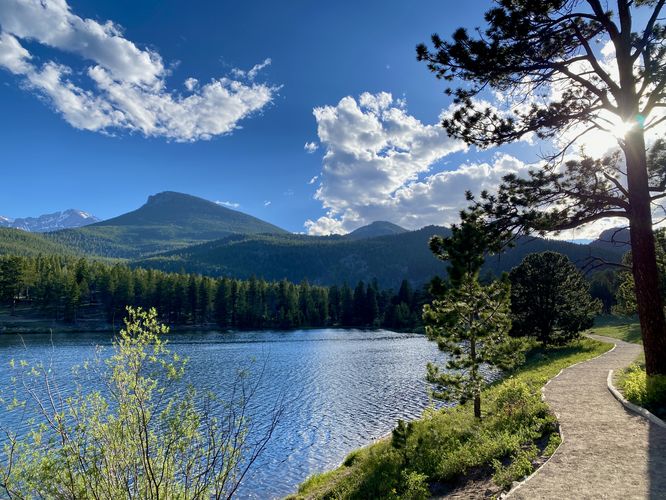
The trail wraps up at the main trailhead around mile 0.9 to complete the loop.
Pets
Dogs are not allowed on this trail.
Parking
Hikers will find a parking lot located at the coordinates provided on the west side of S Saint Vrain Ave in Estes Park, Colorado. The lot is large enough to fit a dozen vehicles or so. Overflow parking is located on the street or across the street in a separate lot.
Wildlife Viewing
This trail is great for viewing wildlife, especially deer, elk, and moose due to the open spaces for grazing and finding food in addition to the lake's water source for drinking. If you wish to spot wildlife, your best chances are in the early morning or in the early evening. Always keep a safe distance while viewing - approx. 75-feet for elk and longhorn sheep; 120-feet for bear and moose.
Timed-Entry Reservations
Between the months of late May through early October you must purchase a timed-entry pass to visit Rocky Mountain National Park. If you wish to visitor and hike anything off of the Bear Lake Road, you must purchase a dedicated Bear Lake timed-entry pass. You can find more information about timed entry on the park's website.
Restrooms
As of June 2024, there are restroom facilities at the parking lot.
Warnings
Elevation sickness: This trail brings hikers through terrain that ascends up to 8,900-feet above sea level. Around the 7,000-foot mark above sea level, hikers may start to experience symptoms of elevation sickness including headache, muscle aches, shortness of breath, among other warning signs. In order to avoid elevation sickness it's recommended to ascend to higher elevations and take short walks to acclimate over the course of several days before taking a long or physically-demanding hike. At any time you feel elevation sickness kicking in, that's the time to turn back and head for lower altitude or the parking lot.
Wild animals: While rare, hikers may encounter bears or mountain lion along the trail. Again, this is rare due to the insane amount of people who hike these trails each day; however, it's smart to know that these wild animals could be on-trail. Please read-up on how to properly handle a bear or mountain lion encounter before hitting the trails.
Hike
This short and mostly-flat hike begins at the main trailhead for Lily Lake and follows the trail counter-clockwise by following the north shore first. During our hike here in the early evening in June 2024, we started the hike along the north shore to find a muskrat run up a hiker's leg after getting scared - the muskrat, realizing the hiker's legs were not a tree or bush, darted off and jumped into Lily Lake -- likely one of the funniest hiking experiences I've had. Your experience may vary, but Lily Lake is a beautiful place to take a walk regardless of startled muskrat or not. From the north shore of Lily Lake, hikers will find stunning views of Rocky Mountain National Park's highest peak, Longs Peak in addition to other mountains like Estes Cone and Mount Meeker.
The trail bends around the lake and from the western shore, hikers will get views of Twin Sister Mountain as it towers over Lily Lake. The south side of Lily Lake includes additional views like that of Lily Mountain, located to the north. Just before the hiker reaches the southeastern corner of the lake, you'll find a boardwalk that spans over the water - providing more wildlife viewing opportunities to find fish, birds, moose, or elk. Finally, hikers will swing around to the eastern side of Lily Lake to find similar views that you found at the trailhead.
During our hike here in June 2024, we found an elk on our way out - the animal was on the central part of Lily Lake's north shore, but just out of sight for a decent photo. Again, if you wish to find wildlife here, aim for early morning or early evening and maybe you'll find something neat!
The trail wraps up at the main trailhead around mile 0.9 to complete the loop.
Pets
Dogs are not allowed on this trail.
Parking
Hikers will find a parking lot located at the coordinates provided on the west side of S Saint Vrain Ave in Estes Park, Colorado. The lot is large enough to fit a dozen vehicles or so. Overflow parking is located on the street or across the street in a separate lot.
Wildlife Viewing
This trail is great for viewing wildlife, especially deer, elk, and moose due to the open spaces for grazing and finding food in addition to the lake's water source for drinking. If you wish to spot wildlife, your best chances are in the early morning or in the early evening. Always keep a safe distance while viewing - approx. 75-feet for elk and longhorn sheep; 120-feet for bear and moose.
Timed-Entry Reservations
Between the months of late May through early October you must purchase a timed-entry pass to visit Rocky Mountain National Park. If you wish to visitor and hike anything off of the Bear Lake Road, you must purchase a dedicated Bear Lake timed-entry pass. You can find more information about timed entry on the park's website.
Restrooms
As of June 2024, there are restroom facilities at the parking lot.
Warnings
Elevation sickness: This trail brings hikers through terrain that ascends up to 8,900-feet above sea level. Around the 7,000-foot mark above sea level, hikers may start to experience symptoms of elevation sickness including headache, muscle aches, shortness of breath, among other warning signs. In order to avoid elevation sickness it's recommended to ascend to higher elevations and take short walks to acclimate over the course of several days before taking a long or physically-demanding hike. At any time you feel elevation sickness kicking in, that's the time to turn back and head for lower altitude or the parking lot.
Wild animals: While rare, hikers may encounter bears or mountain lion along the trail. Again, this is rare due to the insane amount of people who hike these trails each day; however, it's smart to know that these wild animals could be on-trail. Please read-up on how to properly handle a bear or mountain lion encounter before hitting the trails.