The Lena Lake Hike within
Olympic National Forest near Eldon, Washington is a moderate 5.3-mile out-and-back hike that leads to the south shore of Lena Lake, featuring beautiful views of its turquoise-tinted waters.
Hiking to Lena Lake
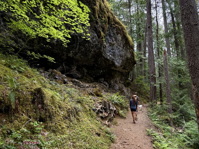
The hike to Lena Lake begins at the Lena Lake Trail #810 trailhead, located at the trailhead coordinates provided. The trail begins by passing an information kiosk before heading up into the mountains along a series of switchbacks. For most hikers, the switchback's grade is no more difficult than moderate, however, some hikers may find the hike more on the "hard" or difficult side.
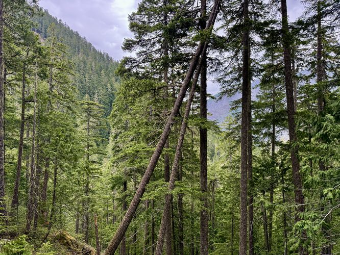
Along the way up the switchbacks, the trail provides wildflowers and old-growth trees that can be found throughout. Around mile 1, the trail inches closer to Lena Creek, where you can hear larger waterfalls below. Do not try to head off-trail to locate them as the terrain is super steep and sketchy.
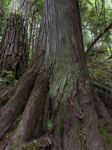
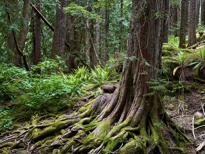
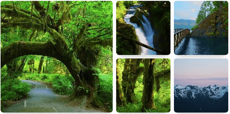
Old-Growth Tree - Mile 1.6
While the trail offers several opportunities to find old-growth trees, around mile 1.6, hikers may notice one old-growth that stands out a bit more than the others. This massive ancient tree is a fun point-of-interest on the hike up.
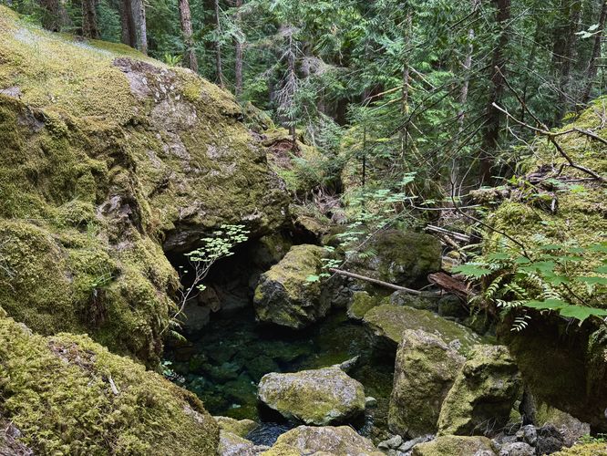
Turquoise Pool - Mile 1.8
Farther up the trail lies a clear-watered turquoise pool located down a steep hillside. If you need to filter water or simply want to cool down, this is a great spot to do either.
Obstructed View - Mile 2.1
Around mile 2.1, hikers will reach an exposed section of bedrock located just off-trail where you'll find an obstructed view of the neighboring mountain's slopes. While the view isn't all that great, it's actually the perfect spot to take a break on the hike, especially if you haven't taken too many breaks earlier. Located just up-trail from here are some very large rock ledges within a rocky outcropping that makes for interesting pictures.
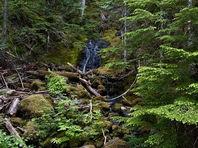
Lena Creek Falls - Mile 2.55
The trail flattens out quite a bit between the obstructed view and Lena Lake, however, on the way you'll find Lena Creek Falls located around mile 2.6. This short, multi-tiered waterfall slopes down the bedrock to converge with Lena Creek. Note that the waterfall technically exists within a tributary to Lena Creek and is fed by a small pond located in higher elevation terrain.
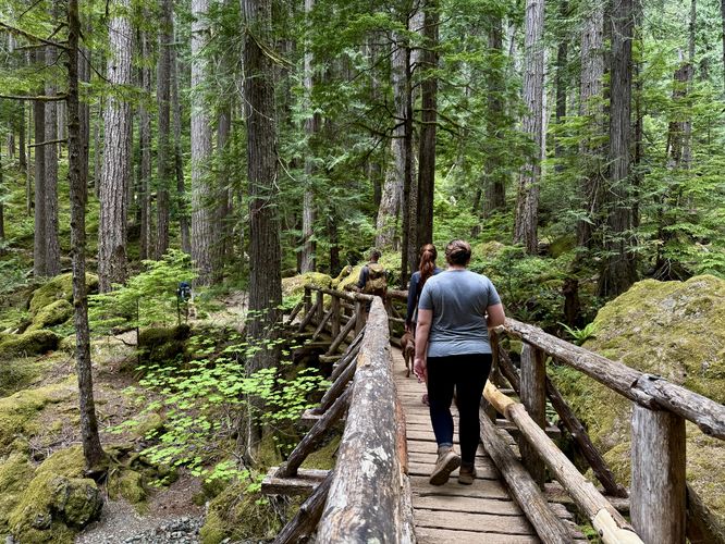
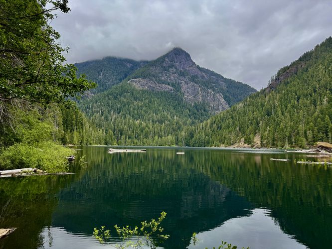
Lena Lake's Shore & Views - Mile 2.56 to 2.67
The last stretch of the hike leads you down to the southern shore of Lena Lake. This hike brings you along an unmaintained and unofficial path to reach the southern shore of Lena Lake. While most hikers will continue onward to reach the Lena Lake Campground (located ~1 mile north), this quick-hit trail is worth taking if you want to see the lake with the exposed bedrock of the alpine mountains to the north. Simply look for a brown forest sign and take the trail located behind it, which can be found immediately after the footbridge at Lena Creek Falls. The trail had a couple of blowdown trees in June 2025, but the rest of the path is easy to follow. Take the path down to the shore of Lena Lake to find your turn-around point at mile 2.67 at the banks of the water. Once you reach the water, you've hit your half-way point and can sit, eat snacks and refuel before you hike back. Depending on when you show up and the cloud cover for that day, the water may appear a vibrant turquoise-tinted green or may appear like a very dark-green, almost black, to the eye. Regardless of the sunlight, the shallow water near the southern end of the lake is almost always a turquoise-tint to the eye and makes for spectacular visibility to look for fish or other wildlife in the water.
Hiking Out - Mile 2.67 to 5.3
After visiting Lena Lake's southern shore for a while, you'll need to haul yourself off the trail to get back to parking. The hike out is far easier than the hike-in as it's almost all downhill. You will have to hike uphill from Lena Lake to reach the trail, possibly hopping over blowdowns along the way. Eventually you'll reach the trailhead to wrap up the hike at approximately 5.3-miles out-and-back.
Pets
Dogs are allowed if leashed and must be cleaned up after.
Parking
Hikers will find a large parking lot at the coordinates provided, located very-far down Forest Road 25. The lot is large enough to fit several dozen vehicles as of June 2025. During weekends, popular holidays, or on a Friday evening, the parking may be overflowed where hikers will park along the street, mostly located to the west of the main parking lot. Do not block the road if you need to park on the street. Do not park in the Lena Lake Campground either.
Fees
You must have a National Parks Pass or pay the daily rate of $5/vehicle to park for Lena Lake. If you have a National Parks Pass, you can leave it on the dashboard of your vehicle. There likely is not cell reception, so plan accordingly and pay any day fees ahead of time if you can.