The Kenyon Hill Loop at Kenyon Hill Preserve in South Berwick, Maine is an easy 1.4-mile loop trail that features large rock outcroppings that offer rock scrambling and a nice hike through the woods.
Trails
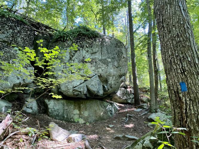
This hike follows one named trail with apparently two names: "Ledge Trail" (blue blazes) - named on the park's PDF; "Blue Square Trail" (blue blazes) - named on the trail map at the trailhead - likely a typo.
Nikkiseeseverything's Review
This mile long loop trail was a nice little walk in the woods. I originally came here for the many blueberry bushes along the trail, but I was a few weeks too late to pick them. There are a few interesting rocky areas, but this is mostly just a nice hike if you're looking to spend a little time in the woods.
Admin's Edits
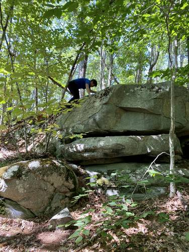
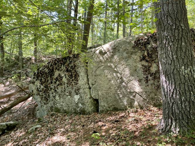
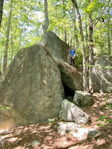
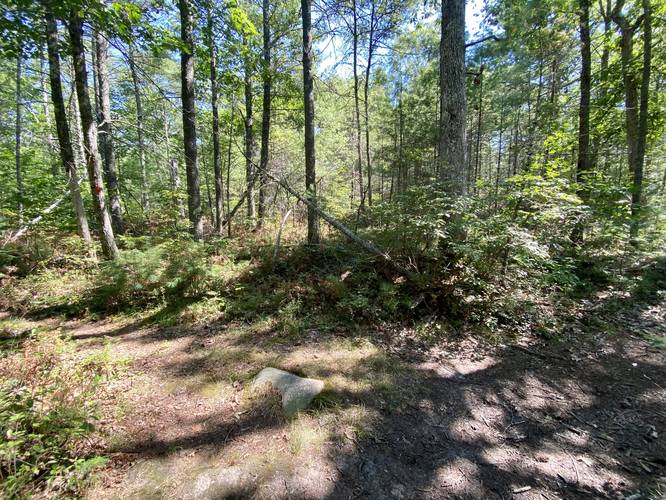
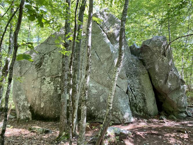
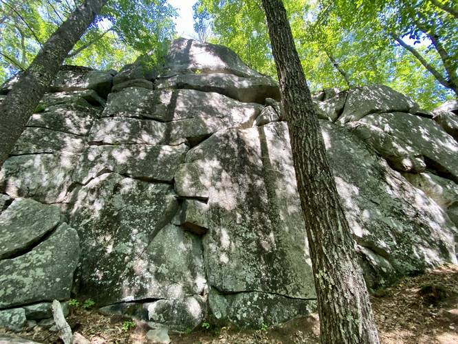
After exploring this in early September 2022, I was glad I came here to explore the boulders. I updated the main map to include a bit more to explore than the original write-up from Nikkiseeseverything. We hiked this loop counter-clockwise, starting with the ledges and boulders first. This section was really neat because it allows hikers to explore slightly differently - by light bouldering and non-technical climbing along easy routes up to the top of ledges. Some routes may be technical climbing routes, but it's unclear if the land trust allows it. We found a "rock face" in one of the large boulders before the official "ledges" area and also hiked to the top of the tallest ledges, which were about 40-feet tall. Note that if you hike to the top of the ledges, there's an unofficial deer trail that connects back to the main Ledges Trail - either connecting back to parking or to close the loop, depending on which way you hike (counter/non-counter clockwise). If you wish to follow the blue blazes in full and accidentally hiked back, head back down the ledges to find a hairpin turn with blue blazes. Note that as of September 2022, this turn does not include 2 blazes on the tree, but one, which makes it seem like the trail leads up the ledges instead of the turn.
Length: The Ledges Trail is approximately 1.1-miles long as a loop, without hiking or scrambling on any of the ledges. This track is about 1.4-miles long which includes a hike to the top of the tallest ledge.
Bugs: I recommend wearing bug-spray because the mosquitoes were everywhere.
Hours: The park is open from dawn to dusk daily.
Pets: Dogs are allowed if leashed and their waste must be carried out by the hiker.
Parking: The parking lot is large enough to fit 4 vehicles comfortably, with just enough space to maybe fit a couple more.
Trails
This hike follows one named trail with apparently two names: "Ledge Trail" (blue blazes) - named on the park's PDF; "Blue Square Trail" (blue blazes) - named on the trail map at the trailhead - likely a typo.
Nikkiseeseverything's Review
This mile long loop trail was a nice little walk in the woods. I originally came here for the many blueberry bushes along the trail, but I was a few weeks too late to pick them. There are a few interesting rocky areas, but this is mostly just a nice hike if you're looking to spend a little time in the woods.
Admin's Edits
After exploring this in early September 2022, I was glad I came here to explore the boulders. I updated the main map to include a bit more to explore than the original write-up from Nikkiseeseverything. We hiked this loop counter-clockwise, starting with the ledges and boulders first. This section was really neat because it allows hikers to explore slightly differently - by light bouldering and non-technical climbing along easy routes up to the top of ledges. Some routes may be technical climbing routes, but it's unclear if the land trust allows it. We found a "rock face" in one of the large boulders before the official "ledges" area and also hiked to the top of the tallest ledges, which were about 40-feet tall. Note that if you hike to the top of the ledges, there's an unofficial deer trail that connects back to the main Ledges Trail - either connecting back to parking or to close the loop, depending on which way you hike (counter/non-counter clockwise). If you wish to follow the blue blazes in full and accidentally hiked back, head back down the ledges to find a hairpin turn with blue blazes. Note that as of September 2022, this turn does not include 2 blazes on the tree, but one, which makes it seem like the trail leads up the ledges instead of the turn.
Length: The Ledges Trail is approximately 1.1-miles long as a loop, without hiking or scrambling on any of the ledges. This track is about 1.4-miles long which includes a hike to the top of the tallest ledge.
Bugs: I recommend wearing bug-spray because the mosquitoes were everywhere.
Hours: The park is open from dawn to dusk daily.
Pets: Dogs are allowed if leashed and their waste must be carried out by the hiker.
Parking: The parking lot is large enough to fit 4 vehicles comfortably, with just enough space to maybe fit a couple more.