The Kanakadea Nature Loop at Kanakadea Park in Hornell, New York is an easy 0.4-mile loop hike that features interpretive signage to learn about native trees and nature and includes views of Almond Lake.
Hike
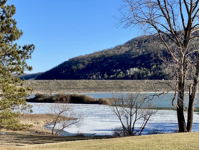
This very short trail begins at the eastern end of the park. Hikers will walk through an open field to start, passing views of Almond Lake and the Almond Lake Dam on your way to the official trailhead -- these views are the only views you'll have while visiting this trail, but they can be enjoyed on the way out too.
Once at the trailhead, labeled "NATURE" on a large wooden post, hikers will begin the Nature Loop as it follows white blazes circling this section of Kanakadea Park's forest. Note that the eastern side of the loop is technically part of the Finger Lakes Trail (FLT), but hikers will follow that portion of the FLT for a short 0.1-mile distance before the loop continues.
Hikers will find the continuation of the loop around mile 0.15 where it starts to curve back around toward the trailhead. Along the way, hikers will find more interpretive signs that label tree species and other nature-related facts. Finally, the trail loops back to the trailhead and hikers can enjoy views of Almond Lake on their way back to the parking lot.
Parking
Hikers will find a very large parking lot on the eastern side of Kanakadea Park. The lot is large enough to fit several dozen vehicles.
Pets
Dogs are allowed if leashed and must be cleaned up after.
Hike
This very short trail begins at the eastern end of the park. Hikers will walk through an open field to start, passing views of Almond Lake and the Almond Lake Dam on your way to the official trailhead -- these views are the only views you'll have while visiting this trail, but they can be enjoyed on the way out too.
Once at the trailhead, labeled "NATURE" on a large wooden post, hikers will begin the Nature Loop as it follows white blazes circling this section of Kanakadea Park's forest. Note that the eastern side of the loop is technically part of the Finger Lakes Trail (FLT), but hikers will follow that portion of the FLT for a short 0.1-mile distance before the loop continues.
Hikers will find the continuation of the loop around mile 0.15 where it starts to curve back around toward the trailhead. Along the way, hikers will find more interpretive signs that label tree species and other nature-related facts. Finally, the trail loops back to the trailhead and hikers can enjoy views of Almond Lake on their way back to the parking lot.
Parking
Hikers will find a very large parking lot on the eastern side of Kanakadea Park. The lot is large enough to fit several dozen vehicles.
Pets
Dogs are allowed if leashed and must be cleaned up after.