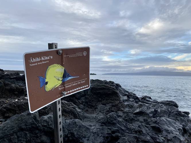
The Kanahena Trail at the Ahihi-Kinau Natural Area Reserve in Wailea, Hawaii (Maui) is an easy 0.9-mile out-and-back hike that runs along a coral beach and features views of Molokini Crater, the islands of Kaho'olawe, Lanai, and Molokai; the West Maui Mountains, Haleakala's southern slopes, and the cinder cone Pu'u Ola'i.
Hike Description
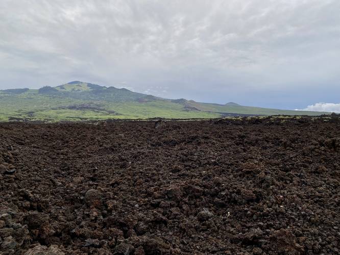
This hike begins at the main parking lot for the Ahihi-Kinau Natural Area Reserve and follows the one and only trailhead, for the Kanahena Trail, as it leads through an old lava flow rock field and out to a rocky coral beach.
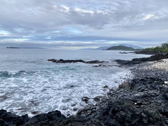
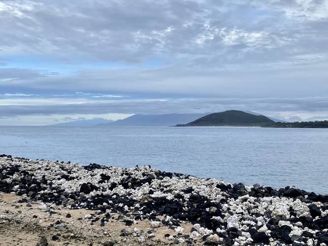
Once on the rocky beach, the trail follows a skinny path, outlined in large dead coral. From the shoreline, hikers get stunning views of the surrounding area as well. Along the entire hike, you'll get views of Molokini Crater, the island of Kaho'olawe, and the island of Lanai which sit on the horizon on the "left-hand side" if facing northwest. On the "right-hand side", facing northwest, you'll get views of the island of Molokai (furthest), the West Maui Mountains (middle), and the cinder cone Pu'u Ola'i (closest).
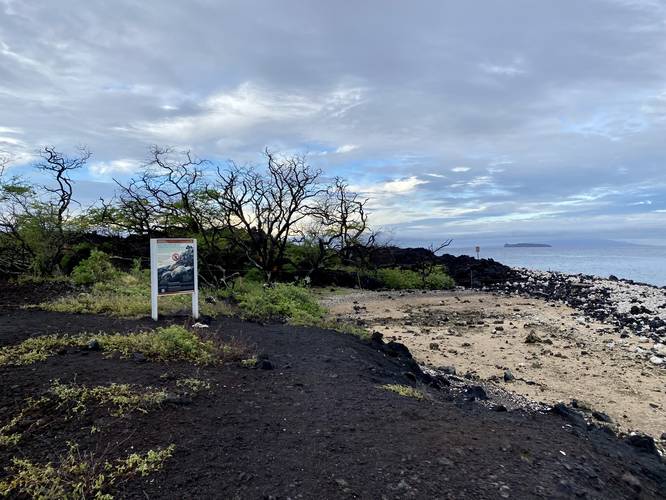
The trail eventually makes its way up an embankment with a 10-foot drop-off to one side - giving hikers views of Haleakala's southwestern slopes and lava rift zone. Just beyond this area is where the public trail ends, with signage. Beyond this area, the Hawaiian Monk seal claims the land as their own - one of the only coastlines where people are not allowed to go on Maui.
Pets
Dog are not allowed on this trail.
Parking
Hikers will find a very large parking lot at the coordinates provided, which is large enough to fit several dozen vehicles.
Non-Resident Fee
For non-residents, there's a $5 fee to park and explore the natural area. For Hawaiian residents, you must get a free "payment slip" from the pay station to display on your dashboard.
Warnings
Unexploded ordinances: This area was once used by the military to test explosives and chemical devices during WWII. As such, the area has only been cleaned up in certain locations (public trails, parking lots, and likely around those places), but there are still unexploded ordinances and chemicals hidden away in the jagged lava rock fields. For this reason, it's against the law to go off-trail here. If you happen to find an ordinance or something weird in the rocks (from the trail), do not touch it, take note of where you found it and report it to authorities immediately.
Coral reef protection: Another reason to stay on-trail here is to keep the coral reef safe. There's only one snorkel entry point into the coral reef, if you plan to snorkel around the coral-filled beach. Please stay on-trail at all times and only enter the ocean at the proper spot if you intend to swim/snorkel. Additionally, if you plan to get into the water, you must wear reef-safe sunscreen so you don't accidentally kill any coral while recreating.
Do not take coral: As stated on the signs, please do not take coral from the beach. This beach is made-up of crushed dead coral and lava rock. The existence of the dead coral, washed up on the beach, is critical to keeping this beach's ecosystem intact.
Respecting the Land
Hawaiian land is considered sacred to native Hawaiians and many locals, so please stay on-trail, take nothing but photos, and leave nothing but footprints. Respect the locals - don't stay for long and have a backup hike planned in case the parking lot is full.
Hike Description
This hike begins at the main parking lot for the Ahihi-Kinau Natural Area Reserve and follows the one and only trailhead, for the Kanahena Trail, as it leads through an old lava flow rock field and out to a rocky coral beach.
Once on the rocky beach, the trail follows a skinny path, outlined in large dead coral. From the shoreline, hikers get stunning views of the surrounding area as well. Along the entire hike, you'll get views of Molokini Crater, the island of Kaho'olawe, and the island of Lanai which sit on the horizon on the "left-hand side" if facing northwest. On the "right-hand side", facing northwest, you'll get views of the island of Molokai (furthest), the West Maui Mountains (middle), and the cinder cone Pu'u Ola'i (closest).
The trail eventually makes its way up an embankment with a 10-foot drop-off to one side - giving hikers views of Haleakala's southwestern slopes and lava rift zone. Just beyond this area is where the public trail ends, with signage. Beyond this area, the Hawaiian Monk seal claims the land as their own - one of the only coastlines where people are not allowed to go on Maui.
Pets
Dog are not allowed on this trail.
Parking
Hikers will find a very large parking lot at the coordinates provided, which is large enough to fit several dozen vehicles.
Non-Resident Fee
For non-residents, there's a $5 fee to park and explore the natural area. For Hawaiian residents, you must get a free "payment slip" from the pay station to display on your dashboard.
Warnings
Unexploded ordinances: This area was once used by the military to test explosives and chemical devices during WWII. As such, the area has only been cleaned up in certain locations (public trails, parking lots, and likely around those places), but there are still unexploded ordinances and chemicals hidden away in the jagged lava rock fields. For this reason, it's against the law to go off-trail here. If you happen to find an ordinance or something weird in the rocks (from the trail), do not touch it, take note of where you found it and report it to authorities immediately.
Coral reef protection: Another reason to stay on-trail here is to keep the coral reef safe. There's only one snorkel entry point into the coral reef, if you plan to snorkel around the coral-filled beach. Please stay on-trail at all times and only enter the ocean at the proper spot if you intend to swim/snorkel. Additionally, if you plan to get into the water, you must wear reef-safe sunscreen so you don't accidentally kill any coral while recreating.
Do not take coral: As stated on the signs, please do not take coral from the beach. This beach is made-up of crushed dead coral and lava rock. The existence of the dead coral, washed up on the beach, is critical to keeping this beach's ecosystem intact.
Respecting the Land
Hawaiian land is considered sacred to native Hawaiians and many locals, so please stay on-trail, take nothing but photos, and leave nothing but footprints. Respect the locals - don't stay for long and have a backup hike planned in case the parking lot is full.