Indian Head & Rainbow Falls at
Adirondack Park in
Keene Valley, New York is a moderate 10.1-mile out-and-back hike that leads to the iconic view of the Lower Ausable Lake atop Indian Head and leads to the ~130-foot tall waterfall, Rainbow Falls.
Trails
This hike follows several named roads and trails in the following order: Ausable Road, Lake Road, Gill Brook Trail (red blazes), Indian Head Crossover Trail (blue blazes), Indian Head Trail (yellow blazes), Rainbow Falls Trail, and finally Lake Road and Ausable Road back to parking.
Hiking to Indian Head
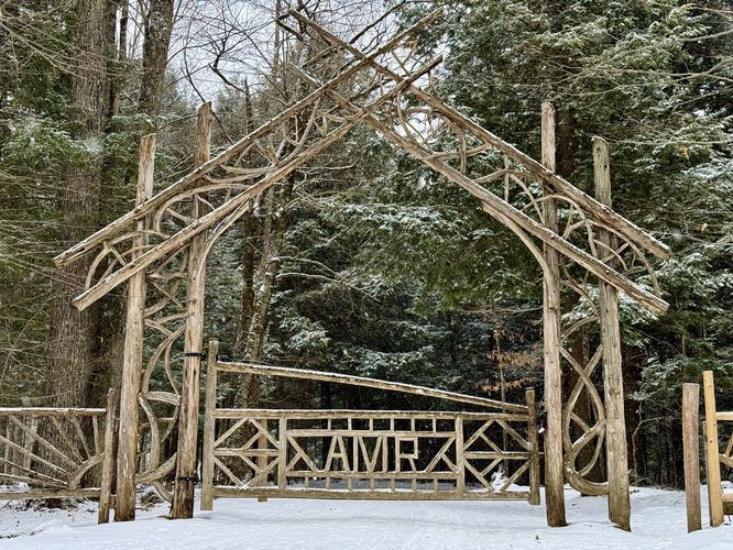
The hike to Indian Head is fairly straight forward as most of the hike follows a road. You'll begin at the main parking lot, located along Ausable Road just a stones-throw from NY-73, as you follow Ausable Road uphill toward the Ausable Club (golf club). Hikers must stay on the road at all times while hiking through this private land, but you can still enjoy the scenic mountain views of the High Peaks Wilderness surrounding you as you make your way past the wide open golf course. Hikers will be on the lookout for signs pointing the way to AMR lands and Indian Head where, around mile 0.6, you'll find a turn that leads downhill to the AMR entrance gate.
AMR Gate to Gill Brook Trail - Mile 0.78 to 2.65
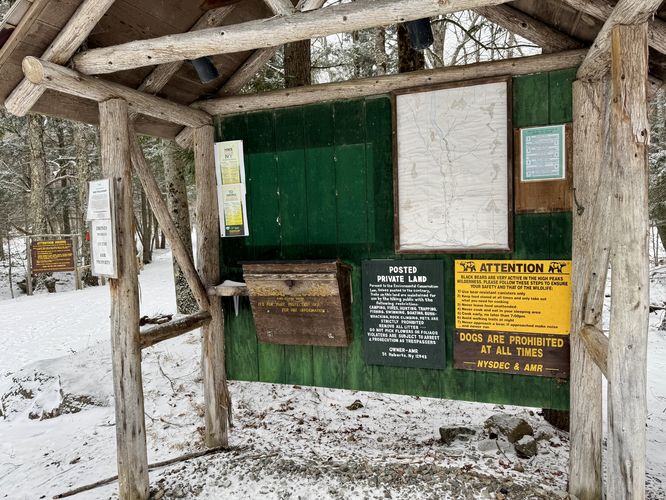
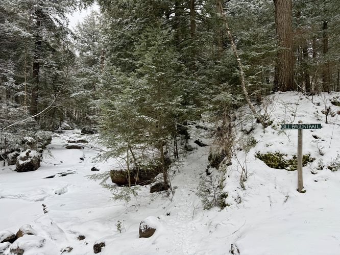
Hikers will find the trail registry at the AMR around mile 0.76 where you should sign-in just in case something were to happen while out in the woods. Next, you'll pass the scenic AMR gate around mile 0.78 where the hike truly begins. The walk up Lake Road is pleasant and scenic with Gill Brook trickling by. While there isn't much to see along this stretch of the hike, the walk through the woods is generally peaceful -- especially during quiet winters. Eventually, you'll reach mile 2.65 (from parking) where you'll find the Gill Brook Trail. This route leads up the Gill Brook Trail as it passes a plethora of waterfalls along the way.
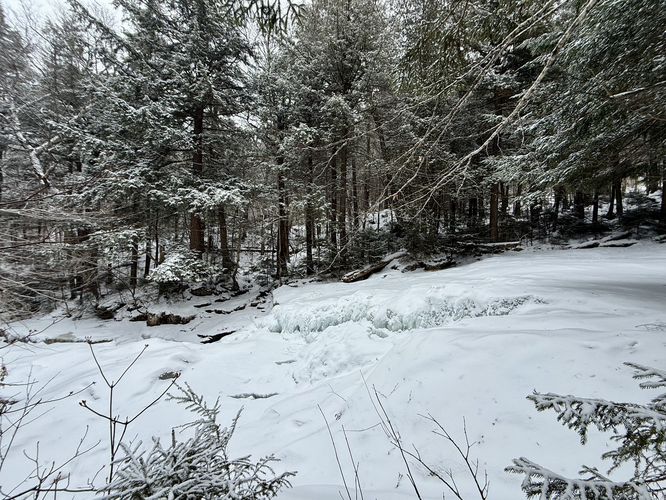
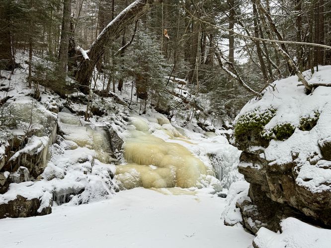
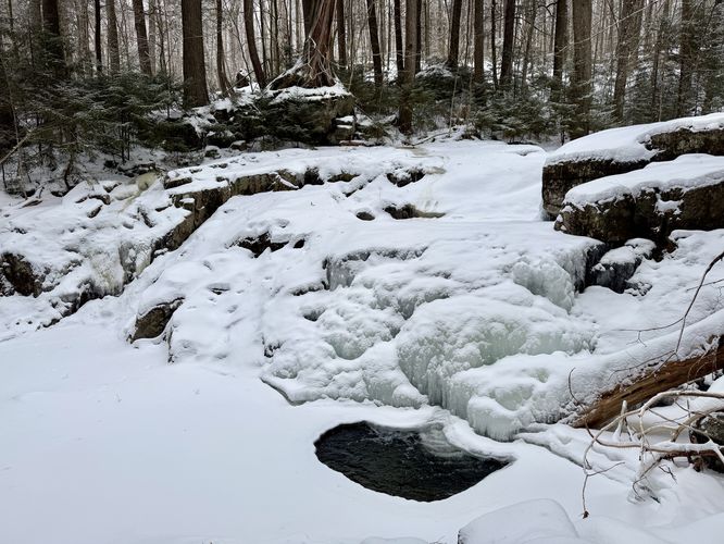
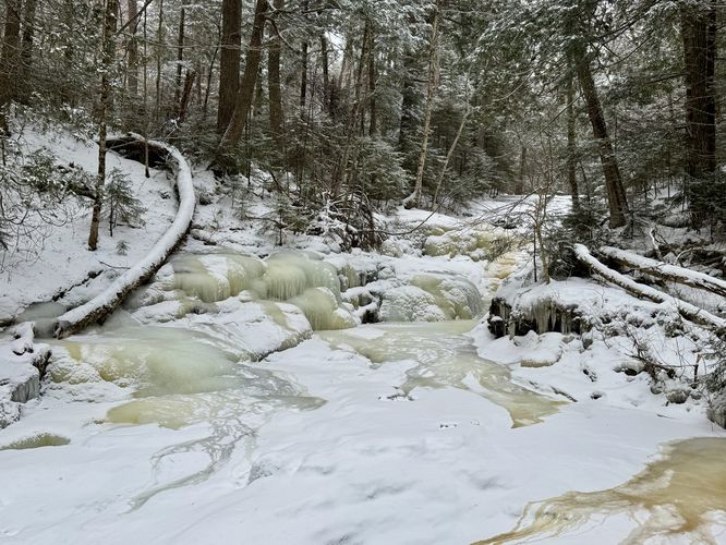
Gill Brook Trail and Waterfalls - Mile 2.65 to 3.88
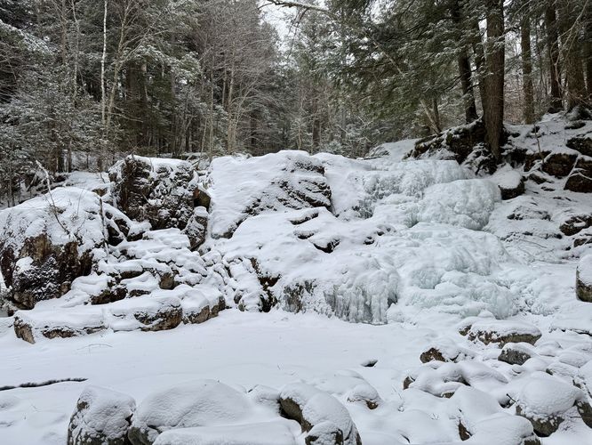
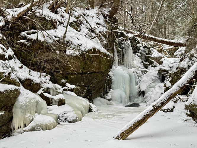
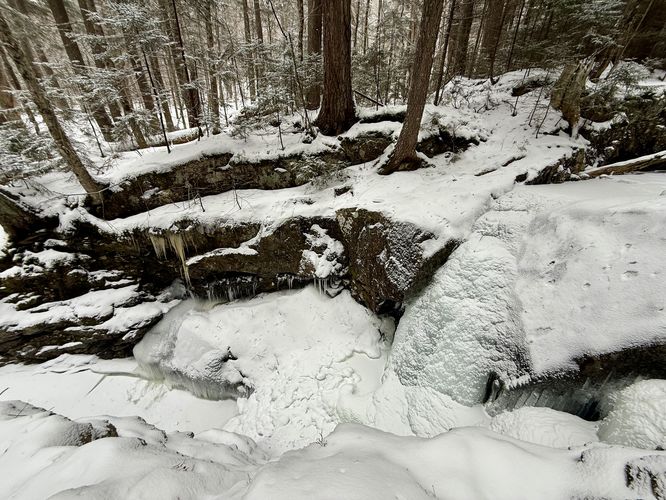
Once on the Gill Brook Trail, you'll slowly make your way uphill as it ascends closer to Indian Head. The trail tends to skirt along the side of Gill Brook and passes some sections of steep creek banks, so watch your step. During the winter, it's bes to wear ice spikes along this trail. Along the Gill Brook Trail are a bunch of waterfalls, albeit not super tall, but scenic nonetheless. The most noteworthy waterfall is Artists Falls, located around mile 3. Artists Falls is a series of waterfalls that tumble down Gill Brook starting at higher elevations in the brook. Around mile 3 is the lower section for Artists Falls which can be easily appreciated from the trail. Uphill, around mile 3.1 is another view of a waterfall (in between a large slide cascade) that creates Upper Artists Falls. The trail continues up before reaching a neat gorge and waterfall, Gorge Falls, around mile 3.17. Gorge Falls plummets into Gill Brook at about 20-feet tall. Next up are two waterfalls upstream -- one of which is about 7-feet tall around mile 3.23 and the other is about 15-feet tall, Plunge Falls, located around mile 3.27. The trail continues upstream before hitting another waterfall, around 7-feet tall, at mile 3.36 and a 6-foot tall cascade just behind it at mile 3.39. The largest waterfall at about 30-feet tall, Gill Brook Falls, can only be viewed from downstream is located around mile 3.42. At mile 3.48 is yet another cascade at about 5-feet tall that spans Gill Brook. After passing this series of waterfalls, the trail leads uphill for a while before reaching anything else of interest. Hikers will pass the Gill Brook Cutoff Trail junction and just beyond it is a scenic ~12-foot tall waterfall, Upper Gill Brook Falls, around mile 3.8.
Indian Head Crossover Trail to Summit - Mile 3.87 to 4.5
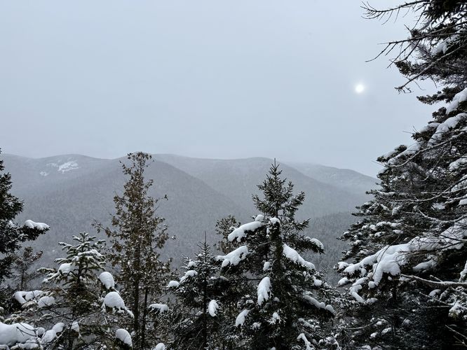
Around mile 3.87, hikers will finally reach the bottom of Indian Head with a trail that leads up the steepest way to summit the mountain. This trail follows blue blazes and cannot be missed -- just look for the "Indian Head" signs with arrows pointing the way. The trail ascends at a fairly moderate grade before it reaches a steep uphill where you'll find a ladder to help. At the top of the ladder are south-facing views from the north end of the mountain. These views are not spectacular, but are a nice change of scenery from the woods and waterfalls you passed earlier. The trail then reaches the "top" of the mountain before the route leads to the North Overlook, located around mile 4.35. The North Overlook on Indian Head is a decent view of the surrounding mountains to the north, but does not compare to the South Overlook, coming up next. After exploring the North Overlook, the trail runs the ridge of Indian Head and passes the summit area around mile 4.5.
Indian Head South Overlooks - Mile 4.6 to 4.7
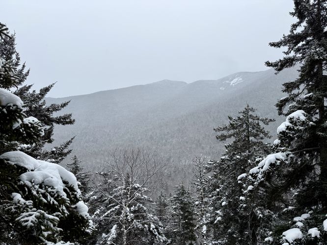
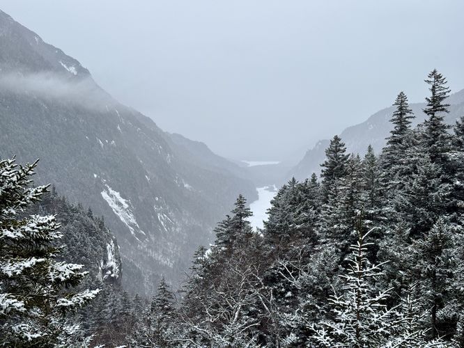
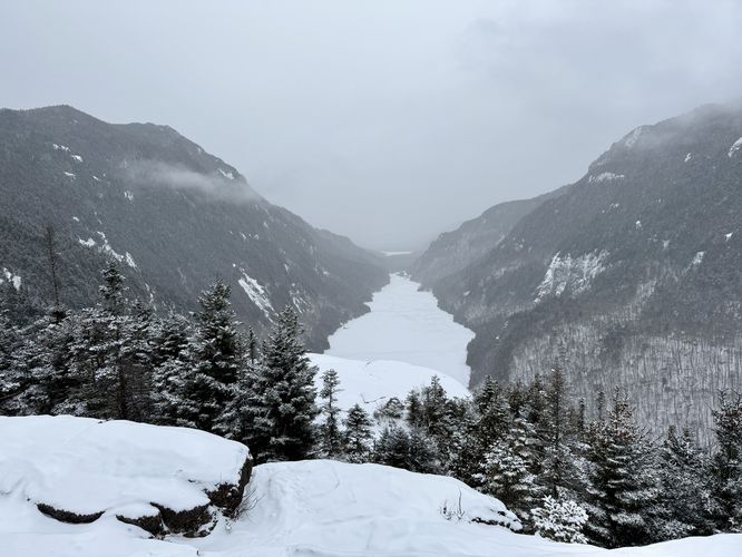
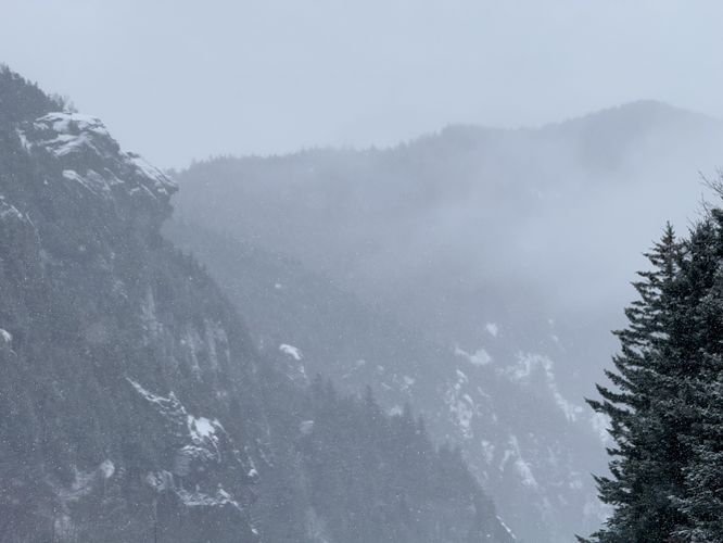
As you descent from the summit of Indian Head, the trail leads out to a cliff that provides your first view of the Lower Ausable Lake and surrounding mountains. This view is awesome, but not as good as the South Overlook just below. After exploring this cliff overlook, hike down to reach a junction -- stay straight to hike directly to the South Overlook on Indian Head at mile 4.7. South Overlook sits high atop Lower Ausable Lake and is one of the most iconic and popular views in all of the Adirondacks. Lower Ausable Lake sits below with Mount Colvin to the south and Sawteeth mountains to the north. The steep slopes of the mountains provide a dramatic alpine view that some consider unmatched. During popular hiking seasons, this overlook might be crowded, but during this winter hike we had it literally all to ourselves with almost no other hikers around.
Gothic Window - Mile 5.15
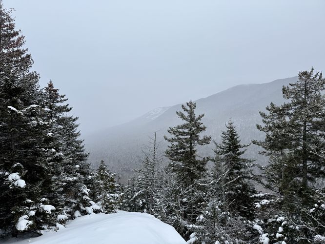
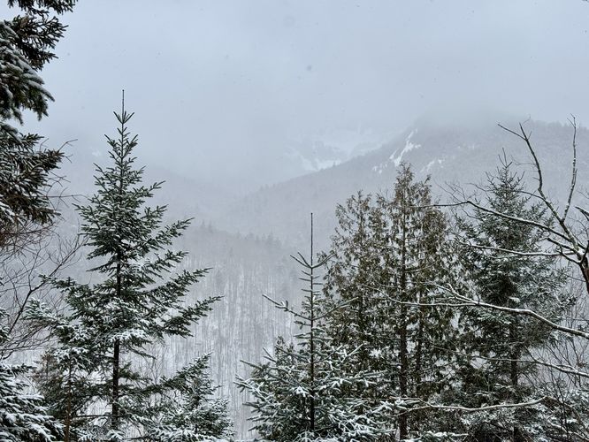
After taking in the scenic views atop Indian Head, the hike down leads to the Gothic Window. Along the way, you'll reach another set of stairs that can be used to easily descend. During the winter, the top of the ladder is covered in a thick layer of ice so watch out. You'll hike easy switchbacks down the mountain to reach the Gothic Window at mile 5.15. This little view on the north slopes of Indian Head provide a view of Gothics Peak on a clear day.
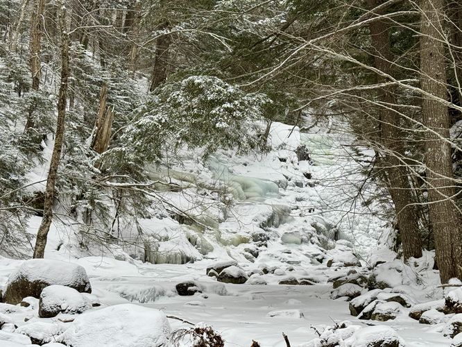
Indian Head to Rainbow Falls - Mile 5.45 to 5.8
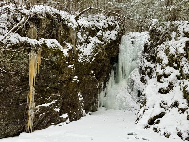
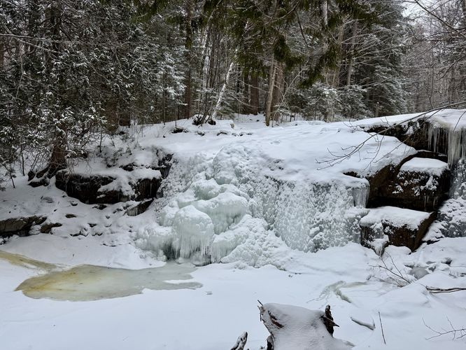
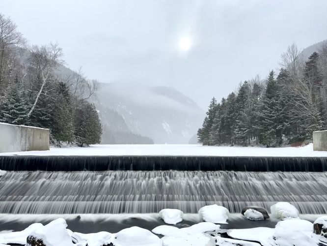
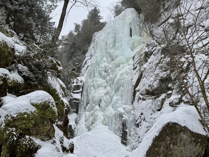
After hiking down the last of Indian Head's slopes, you'll reach Lake Road at mile 5.45. Hiking to Rainbow Falls from here, just take a left-hand turn and then an immediate right-hand turn to reach the Lower Ausable Lake Dam. Hike across the footbridge, which provides scenic views and a view of the cliffs atop Indian Head, to reach the other side of the river. From here, follow the "Rainbow Falls" signs, which cannot be missed. The trail eventually leads through a scenic rock gorge to the base of Rainbow Falls. Rainbow Falls is a behemoth at approximately 130-feet tall and plummets over a tall rocky cliff. During the winter, the waterfall is mostly all frozen over but even in sub-20-degree temperatures there was still water flowing from the top, freezing over on its way down. This massive waterfall is well-worth the extra mileage if planning to hike to Indian Head, so don't rule it out.
Hiking Back - Mile 5.8 to 10.1
After exploring Rainbow Falls, this route leads straight back to parking via Lake Road. Simply hike over the footbridge once again to reach Lake Road and then follow the road back to parking. Lake Road doesn't have much to offer hikers in terms of views of waterfalls, but it's a peaceful and long walk through the woods back to parking. Remember that once you leave the AMR you must stay on the road at all times.
Parking & Fees at AMR
The most important part of this hike is understanding that this hike exists within
Adirondack Mountain Reserve
lands, which is open to the public. Note that to reach the AMR land,
you must first hike along Ausable Road and Lake Road, which permit foot
traffic only, no dogs allowed. There is a parking reservation system and
entrance fee which ends around November 1st each year. For parking
reservations please check out
AMR's website
for more details. Until you reach the designated AMR land with public
trails, always stay on the public road, do not bother residence, park at
the designated parking area (coordinates provided), and never drop-off
or pick-up hikers along either entrance road. By following the rules,
everyone can continue to enjoy this magical place.
Pets
Dogs are
not allowed on the private roads or within the AMR.