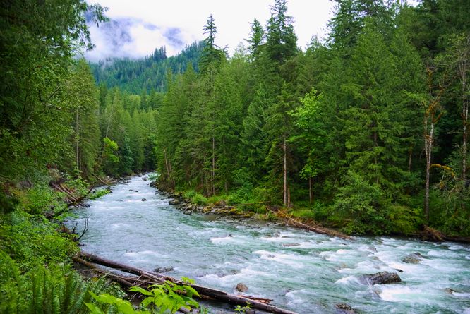
The Horseshoe Bend Trail hike at Mt. Baker National Forest near Glacier, Washington is an easy 1.6-mile out-and-back hike that follows the turquoise-tinted, glacier-fed Nooksack River and features beautiful views of the water.
No swimming: Due to the sheer force of the river's flow, it's best to enjoy these turquoise waters from the trail, as swimming in the river may be extremely dangerous.
Hike Horseshoe Bend
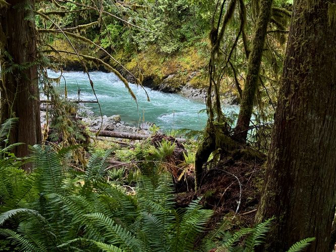
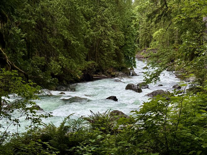
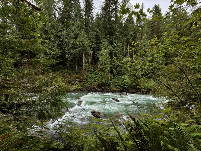
This trail is one of the more popular day hikes near Glacier, Washington and for good reason. The glacier-fed waters of the Nooksack River, along with the lush vegetation of ferns, mosses, and old-growth stumps provides unmatched scenery for visitors. The trail begins along the east side of the Mt. Baker Highway where you'll find a trailhead kiosk with information about the route. Please note that this GPS track is only a 0.8-mile one-way (1.6-mile out-and-back) hike and does not follow the entire 3-mile one-way trail, which would ultimately be a 6-mile out-and-back day hike. If you're simply looking to get stunning views of the Nooksack River without too much time or effort, you really don't need to hike more than 1.6-miles out-and-back along the trail.Turquoise River Views - Mile 0 to 0.6
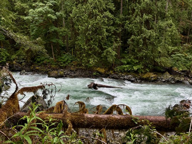
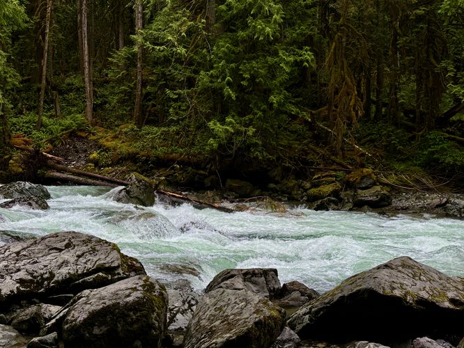
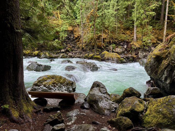
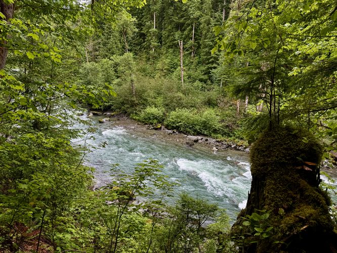
From the trailhead, you'll start by passing through a lush forest full of massive ferns and moss-covered trees with window views of the Nooksack River's turquoise water flowing through the valley below. You don't have to wait very long before these views become more open as the trail leads to banks that sit high above the river. Starting around mile 0.05, you'll start to find these views open up more. One awesome viewpoint of Horseshoe Bend can be found at mile 0.08, just a few-hundred feet from the trailhead. If you really don't have much time to explore, you can appreciate this view of the glacier-fed river without putting in much effort at all. The views continue to pop-up as the trail runs along the Nooksack River, heading east. Some noteworthy views can be found near miles 0.25, 0.3, and 0.4. One of the best views of the river can be found at mile 0.55 where hikers will find a large wooden bench that sits alongside the water. At the bench, you'll find the turquoise water of the Nooksack River rushing by as it swoops over large boulders, creating very-small cascades or rapids. This bench is a favorite for hikers as it sits adjacent to massive boulders and a scenic fern and moss-filled forest. Just up trail from the bench is one more view of the river before the trail dips into the forest.Turn Around - Mile 0.84
After passing the views near the riverside bench, the trail continues eastward as it passes through the forest. There are some window views of the river here, but they weren't photo-worthy. Around mile 0.8, the trail begins to head northward where it starts to head uphill. At mile 0.84, there's a nice view of the river, high up on the hill that surrounds the water. While this view isn't spectacular, it's another nice view of the glacier-fed, turquoise water below. Here, we decided to hike back as we felt like we'd seen the bulk of what the trail had to offer. You can pick and choose your own adventure and keep hiking to extend your time and distance, but this route heads back to parking around mile 0.84.Hiking Out - Mile 0.84 to 1.6
As mentioned, we decided to hike back around mile 0.84 as we felt we'd seen the majority of what Horseshoe Bend had to offer. The hike back is easy, just head west along the Horseshoe Bend Trail, passing the same views you passed on the way in. Remember to stop and enjoy the turquoise-hued, glacier-fed Nooksack River from any viewpoints that you may have missed on your hike in. Finally, arrive at the parking lot at mile 1.6 to wrap up the hike.Parking
Hikers will find a large parking turnout at the coordinates provided, located on the east side of the Mt. Baker Highway near Glacier, Washington. The turnout is large enough to fit a couple dozen vehicles as of June 2025.Pets
Dogs are allowed only if leashed and must be cleaned up after.Warning
Steep unstable terrain: This trail follows the Nooksack River with viewpoints that sit along steep embankments high above the rushing water. These embankments are not totally stable and as such, soil can erode without warning. Keep back from the edge for your own safety.No swimming: Due to the sheer force of the river's flow, it's best to enjoy these turquoise waters from the trail, as swimming in the river may be extremely dangerous.