The Hopewell Furnace & Lake Loop at Hopewell Furnace National Historic Site and French Creek State Park in Elverson, Pennsylvania is an easy 3-mile hike that encompasses Hopewell Lake, featuring views of the water, and passes through the historical Hopewell Furnace site.
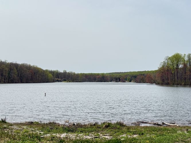
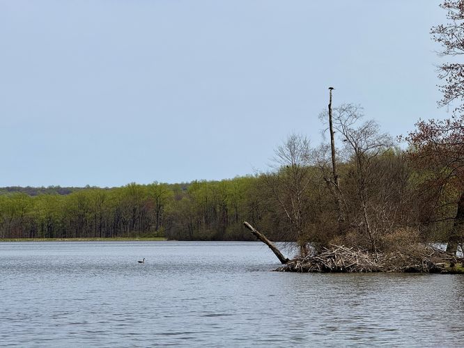
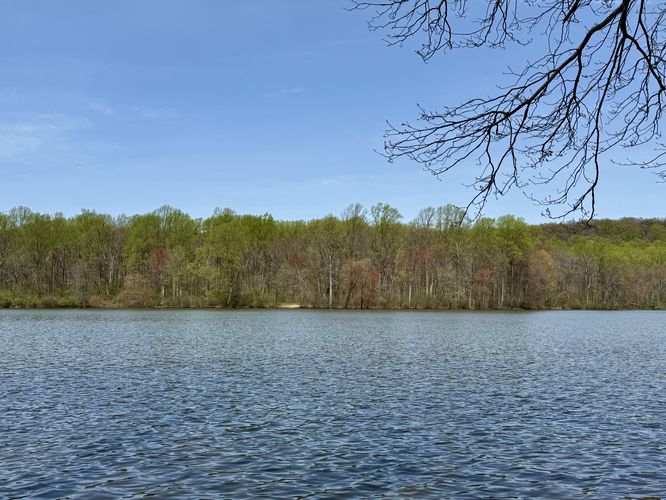
On the west side of Hopewell Lake sits a scenic picnic area, adjacent to the parking lot, where you'll find views of the water, a place to sit and relax, and a small island located off of the shore. On the island, as of April 2025, was a beaver hut and plenty of bird activity in the trees above it. This is a great spot to take a break and watch for wildlife. The trail crosses the parking lot and heads south to reach a small inlet before it follows the southern half of Hopewell Lake. Along this inlet, during our hike, we found about 20 turtles sunbathing on a fallen tree that was left floating in the water. This is yet another good spot to be on the lookout for wildlife.
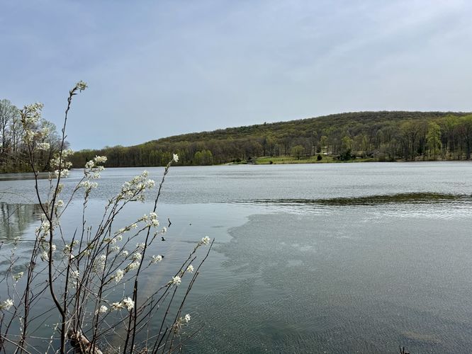
As the trail follows the southern half of Hopewell Lake, you'll pass several more viewpoints of the water, a small picnic area with tables and benches, and then you'll follow a paved section of trail as it makes its way toward the lake's spillway waterfall.
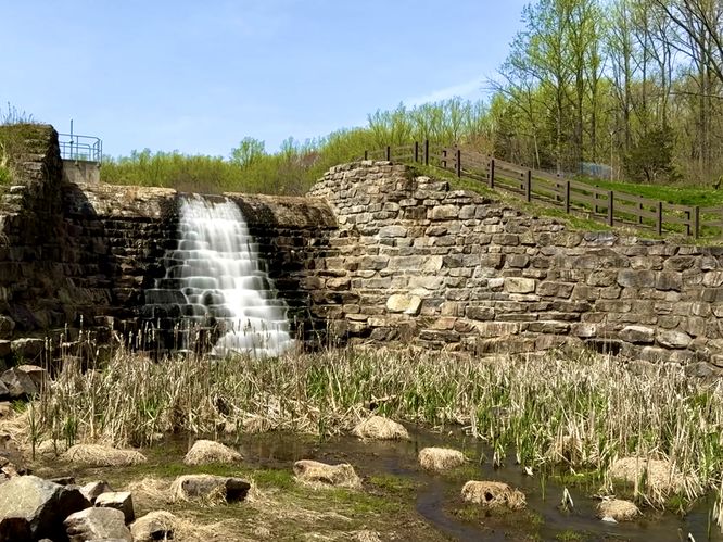
If you followed this route, you'll save the best point-of-interest (POI) for last, Hopewell Lake Falls. This 25-foot tall waterfall cascades over the human-made spillway at Hopewell Lake. The water from the lake flows eastward to reach the Hopewell Furnace area, where you'll hike to next. Before leaving, you can hang out on the footbridge that spans the creek as you take in sights of the waterfall's tranquil scenery.
Parking
Important note: Hikers should be aware that parking at Hopewell Furnace National Historic Site is only available Wednesday through Sunday from 9AM to 5PM. The parking lot is blocked-off with a metal gate when closed. If you wish to hike around Hopewell Lake at the state park, please park at these coordinates instead: 40.200075, -75.789514.Hiking Hopewell Lake & the National Historic Site
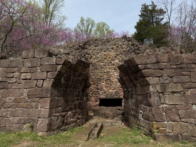
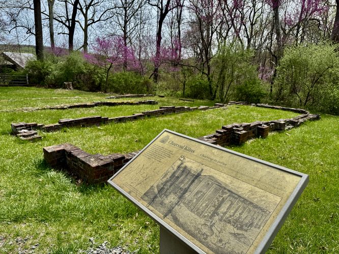
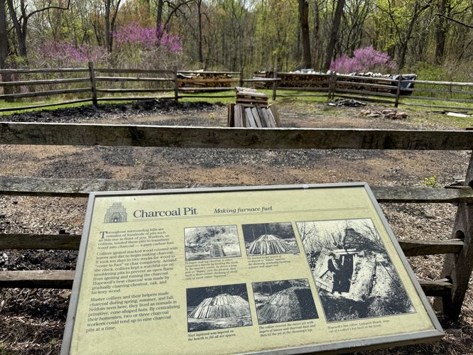
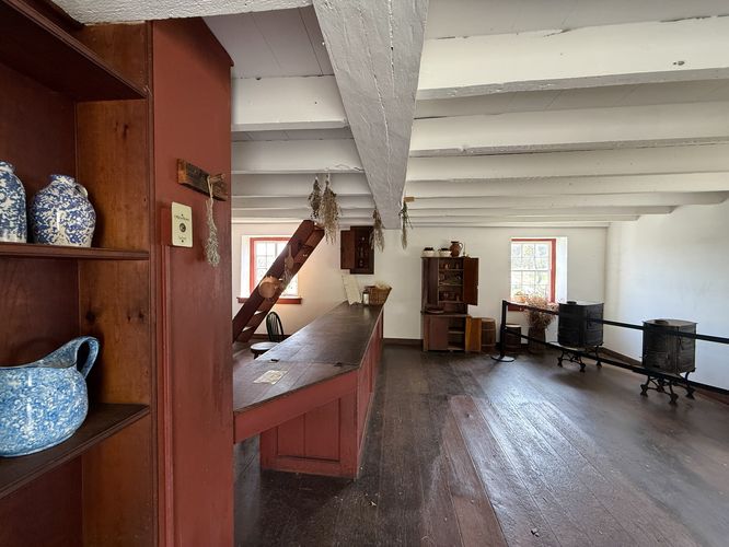
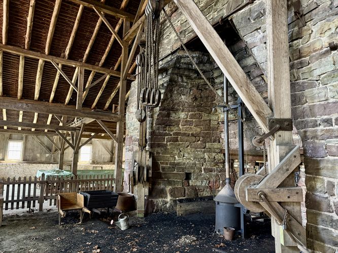
This hike begins at the National Historic Site and the route leads westward, passing the majority of the historic site attractions first. To head toward Hopewell Lake, simply walk down the stairs to pass the visitor center and keep right on the trail system. Hikers will first pass the long-abandoned anthracite coal furnace, which is worth checking out before you continue along the trail. You can even walk right into the old coal furnace to see where they used to smelt iron. Just beyond the old furnace are the abandoned remnants of coal kilns. All that's left today are the foundations of the buildings. Right nextdoor to the old kilns is the old charcoal pit. This is where workers would turn wood into charcoal, a necessary ingredient to processing iron ore.French Creek State Park Boundary - Mile 0.3
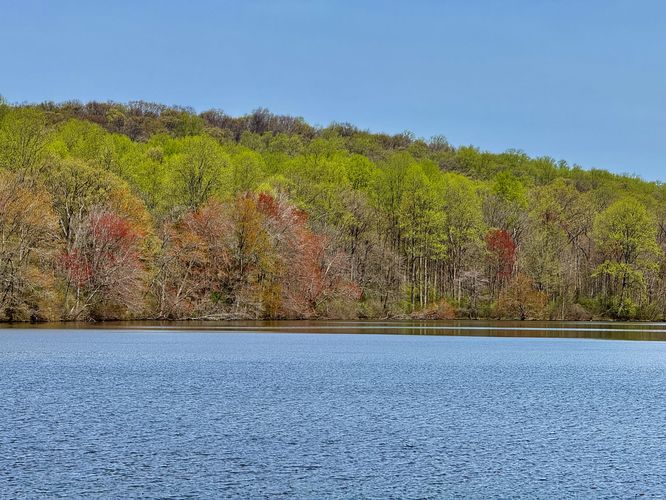
Located west of the charcoal pit, the trail continues onward toward Hopewell Lake where you'll find a fork in the trail. Here, this guide keeps right at the fork, saving the best for last, as the trail heads toward the boundary with the neighboring state park. At mile 0.3 from the parking lot, you'll enter French Creek State Park with Hopewell Lake at your feet.Hiking the Hopewell Lake Loop - mile 0.3 to 2.5
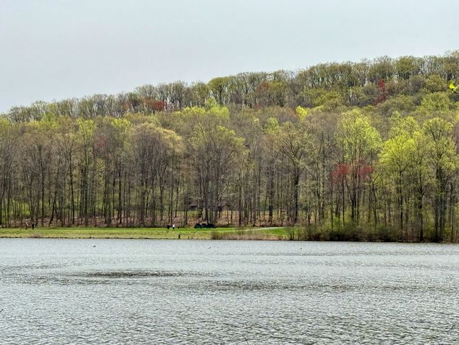
Keep right, then keep left, to stay on the Hopewell Lake Loop Trail after exiting the National Historic Site. This green blazed trail encompasses the lake and provides hikers with several viewpoints to enjoy the water or scout for wildlife. When we hiked this trail in April 2025, the northern section of the trail was a bit muddy and had a re-routed path that bypassed some of this mud, however, we stayed on-course and dealt with it. Outside of the occassional muddy spot, the trail is pleasant and easy to follow along the north side of the lake.On the west side of Hopewell Lake sits a scenic picnic area, adjacent to the parking lot, where you'll find views of the water, a place to sit and relax, and a small island located off of the shore. On the island, as of April 2025, was a beaver hut and plenty of bird activity in the trees above it. This is a great spot to take a break and watch for wildlife. The trail crosses the parking lot and heads south to reach a small inlet before it follows the southern half of Hopewell Lake. Along this inlet, during our hike, we found about 20 turtles sunbathing on a fallen tree that was left floating in the water. This is yet another good spot to be on the lookout for wildlife.
As the trail follows the southern half of Hopewell Lake, you'll pass several more viewpoints of the water, a small picnic area with tables and benches, and then you'll follow a paved section of trail as it makes its way toward the lake's spillway waterfall.
If you followed this route, you'll save the best point-of-interest (POI) for last, Hopewell Lake Falls. This 25-foot tall waterfall cascades over the human-made spillway at Hopewell Lake. The water from the lake flows eastward to reach the Hopewell Furnace area, where you'll hike to next. Before leaving, you can hang out on the footbridge that spans the creek as you take in sights of the waterfall's tranquil scenery.