Hogback Mountain via Charcoal Trail at Buchanan State Forest near Fort Loudon, Pennsylvania is a moderate 4.5-mile out-and-back hike that leads to the summit of Hogback Mountain, features seasonal views of Jordan's Knob, Big Mountain, Cape Horn, and includes an off-trail hike to a rock slide overlook.
Trails
This hike follows two named trails in the following order to reach the summit: Charcoal Trail (yellow blazes), Hogback Mountain Trail (yellow blazes). Hiking to Hogback Mountain's Summit
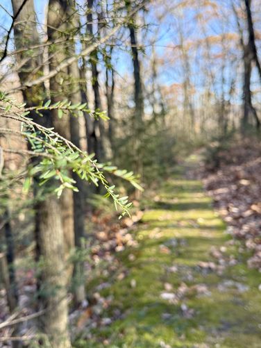
This hike begins at a dirt parking lot located on the west side of Path Valley Road where hikers will find a steep uphill dirt road that leads to a round-about parking area. Hikers will find the trailhead for the Charcoal Trail located at the yellow service road gate with an official trailhead sign post adjacent to the gate. The uphill hike to Hogback Mountain begins here. The Charcoal Trail begins with a fairly-steep uphill climb from the parking lot as it traverses over fist-sized rocks that can easily roll an ankle. Shortly after the uphill, the trail turns northward as it encompasses the base of Hogback Mountain where it follows an easy grade. The rocks in the trail will come and go between mile 0 and mile 1. Note that the trail can be somewhat difficult to follow between mile 0.75 and mile 1 as the yellow blazes become scarce along this section of the hike. Moss Carpet Trail - Mile 1
Around mile 1, hikers will reach a section of the trail where the forest floor is covered in a thick, vibrant green, moss carpet. Here, the trail is lined with mostly hemlock trees that provide a break from the leaf-covered fist-sized rocks that previously lined the trail. Don't get too excited, however, because the trail leads right back to annoying rocks not long after the green moss carpet ends. Campsite - Mile 1.2
Just uptrail from the vibrant green moss carpet, the trail hits a small campsite with an old fire ring. This campsite is great for an overnight of dispersed / backcountry / primitive camping and has enough space to accommodate about two tents. Steep Hill - Mile 1.4 to 1.5
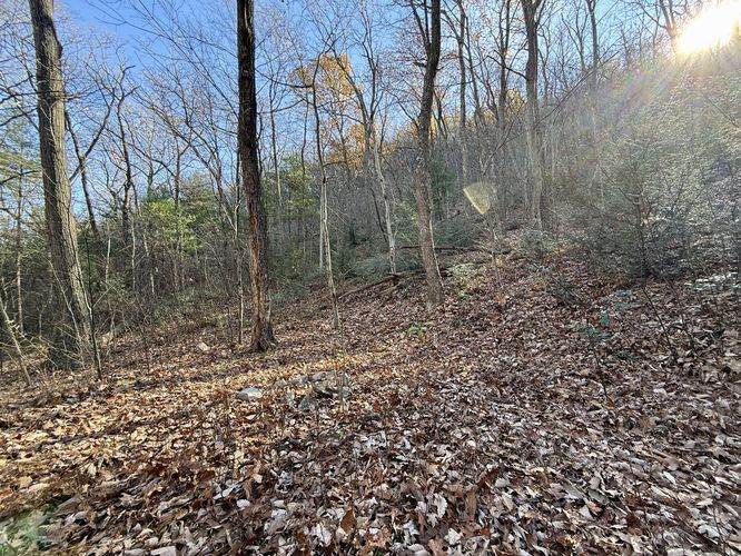
After the campsite, hikers will meander up the mountain hollow between Big Mountain and Hogback Mountain before reaching a very-steep but short hill climb around mile 1.4. This steep hill lasts until approximately mile 1.5 where it eases up. After this short climb the trail is littered with tons of ankle-rolling rocks so watch your step. Hogback Mountain Trail (Left Turn) - Mile 1.8
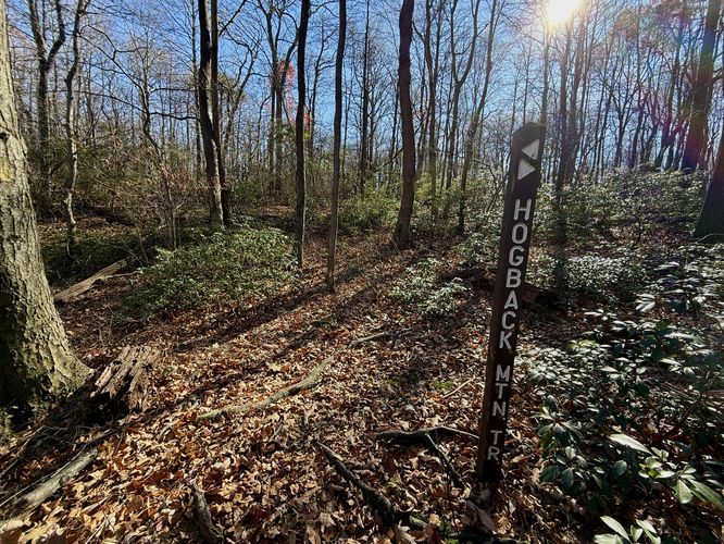
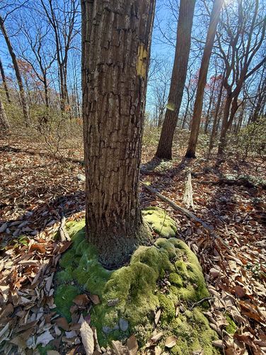
At the top of the mountain hollow, hikers will eventually reach a trail junction where the Charcoal Trail meets the Hogback Mountain Trail. Take a left-hand turn here to head up to the summit of Hogback Mountain. Along the way up to the summit is one noteworthy natural phenomenon -- thick moss carpets encompassing several trees along with a thick moss carpet along the trail. Around mile 1.93, you'll find several of these very-thick moss carpet rings that encompass the trunks of trees along the slopes of Hogback Mountain. Hogback Mountain Summit & Seasonal Views - Mile 2.15
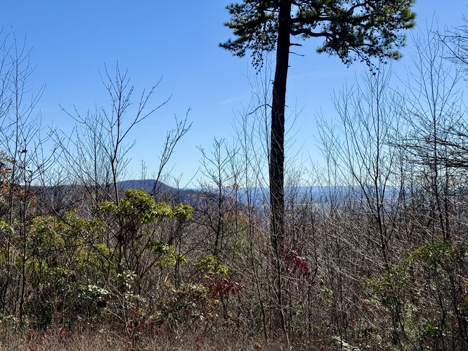
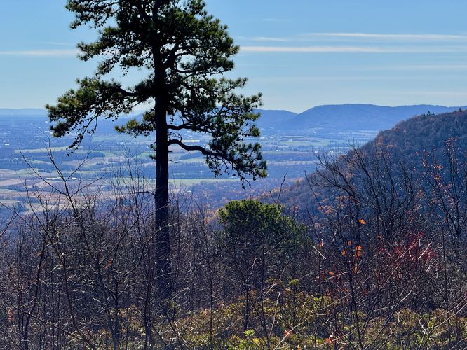
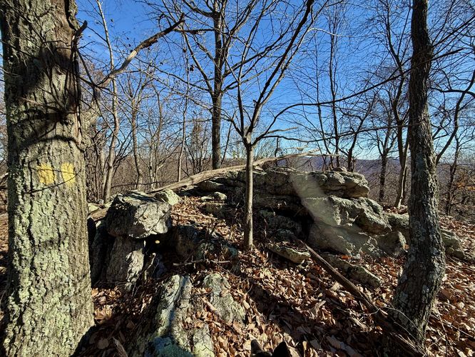
Hikers will follow a few switchbacks as the trail ascends the southern slope of Hogback Mountain to finally reach the summit. Just before the actual summit of Hogback Mountain are a couple of spots where you'll find seasonal views (when leaves are off of the trees) facing east and south, located around mile 2.1 and 2.13. At mile 2.1 is the east-facing view where you'll find Jordan's Knob sitting behind a veil of tree branches. At mile 2.13 is a more cut-out vista area (still seasonal) with south views into Maryland with Cape Horn jutting into view as the closest mountain peak. The summit of Hogback Mountain sits just uptrail, around mile 2.15. No summit marker can be found, but there is a large bedrock outcropping that denotes the summit. Off-Trail Hike to Rockslide - Mile 2.15 to 2.26
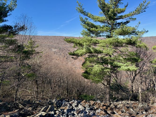
Just beyond the summit, as of November 2024, is an unofficial blue blazed "path" that leads out to rock slides along the northern slopes of Hogback Mountain and acts as an optional continuation of this hike. This unofficial path leads through sketchy and rocky terrain with holes and pockets hiking between the rocks, so you must be extremely careful traversing this section of the mountain. Eventually, the path leads out to a view of Big Mountain's eastern slopes from the rock slide. If you wish to traverse the rock slide, you can likely reach even-better views located further down the mountain. Due to the sketchiness, having to leave my dog, and separate from my dog and my wife at the time, I opt'd to reach the first series of rock cliffs atop the rock slide before turning back. Hiking Out (Summit to Parking) - Mile 2.26 to 4.5
The hike out, from the summit or the rock slide, to reach parking is fairly obvious but it's not necessarily easy. Make sure you do not miss the right-hand turn to hike down the Charcoal Trail. If you miss the turn, it'll be obvious that you'll end up hiking up Big Mountain instead. On the way down, be mindful of the ankle-sized rocks that can easily trip your step. Also note the scarce yellow blazes along the north side of the Charcoal Trail. Eventually, you'll make it back to parking around mile 4.5 for a moderate hike to the summit of Hogback Mountain. Parking
Hikers will find a large parking area at the coordinates provided, located on the west side of Path Valley Road just north of Fort Loudon, PA. The parking lot has a steep dirt service road that leads to the parking area. The parking area is large enough to fit more than a dozen vehicles as of November 2024. Pets
Dogs are allowed only if leashed and should be cleaned up after. Backpacking & Camping
Camping is permitted only within state forest boundaries. All campers and backpackers must follow the state forest rules and regulations when backcountry / primitive / dispersed camping.