The Highline Trail to Oberlin Falls Lookout at Glacier National Park near Saint Mary, Montana is an easy 2.1-mile out-and-back hike that follows a short section of the Highline Trail to reach a beautiful view of Upper and Lower Oberlin Falls and features panoramic views from the Garden Wall.
Rockfall: This trail leads under a cliff line where rockfall is a common occurrence, especially after periods of heavy rain which loosens the cliff's face. For this reason, it's best to keep moving while hiking the cliff line.
Grizzly bears: This trail is frequented often by grizzly bears, especially in late Summer and early Fall as they scrounge for 20 hours/day bulking for the winter. Always give wild animals plenty of space, including several hundred feet for grizzlies. It's best to bring bear spray on this hike as a last defense just in case a grizzly were to charge at you. Always make plenty of noise while hiking to alert animals to your presence long before you see them. It's also smart to hike with another person. Note that one day after we hiked this trail, a hiker was pulled ~400-feet off of the trail by a grizzly bear and the bear appeared to be unaffected by bear spray, according to a NY Times article. A large portion of the trail was closed for a couple of weeks afterward.
Hiking the Highline Trail
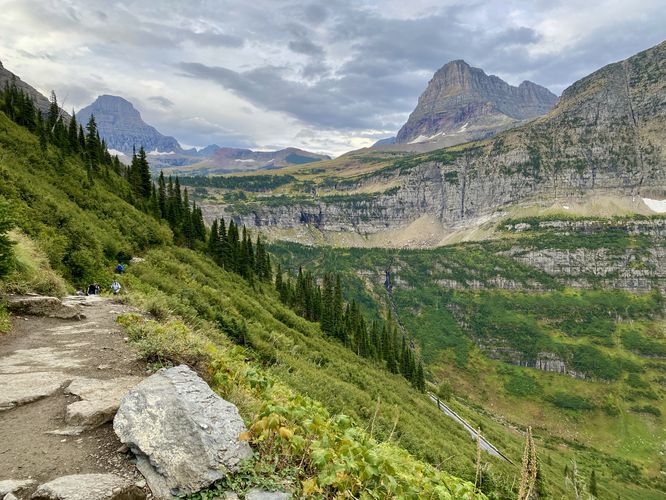
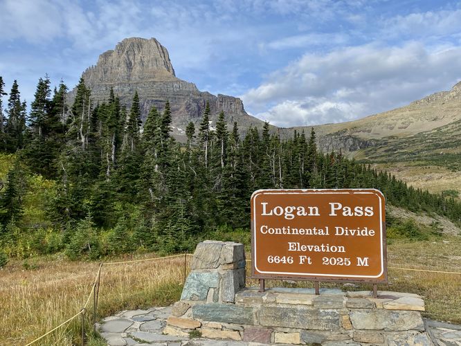
Hikers will begin their trek along the Highline Trail at the Logan Pass Visitor Center with the trailhead located across the street to the north. The trail leads downhill from Logan Pass to begin its traverse along the western side of the Garden Wall. The Garden Wall, which separates Many Glacier from the Lake McDonald Valley, is a glacial arête with high rocky alpine ecosystems and, during the summer, has mountain slopes full of vibrant wildflowers. As you hike the Highline Trail, you'll be high above the Going-to-the-Sun Road where breathtaking alpine mountain views just don't stop -- so be sure to bring plenty of lung capacity for this hike. After the initial descent, it makes its way toward the cliff of the Garden Wall, passing views of Mount Oberlin on the left and the rocky alpine of the Garden Wall on your right-hand side.Garden Wall Cliff - Mile 0.25 to 0.45
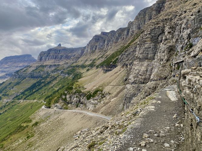
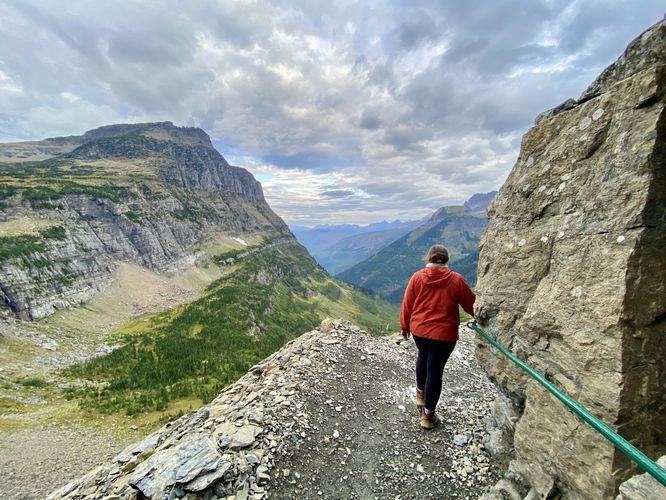
One of the main attractions of the Highline Trail is the Garden Wall's cliff, located just 0.25-miles from the trailhead. This is where the trail gets dicey for hikers who are terrified of heights (like myself). The cliff of the Garden Wall / Highline Trail, arguably is not that bad, but it does follow 0.2-miles (~1,056-feet) of cliff line with sheer drops to one side. The Highline Trail includes a decent amount of space so hikers can pass one-another along this cliff line, but there are certainly a handful of spots where you should not attempt to pass other hikers as the trail becomes very skinny and dangerous. The cliff includes pitons (metal anchors) and a thick green hose-like railing that you can hold on to for safety or for your own mental sanity as you traverse this slightly-terrifying cliff. As you hike the cliff, you'll see cars driving up the Going-to-the-Sun Road and wide-open vast landscape views to your left; however, this can cause a somewhat dizzying-effect as you try to keep your focus on the trail. The height of the cliff is approximately 120-feet tall, so a fall from this height is sure to be deadly, however, the trail and cliff should be considered "safe" as long as you're always paying attention. One last danger to the cliff area is rockfall -- after heavy rains or periods of constant rain, these mountains can shed more rocks in the from of rockfall than normal, so it's best to keep moving while hiking this section just in case.Hiking to Oberlin Falls Lookout - Mile 0.45 to 1
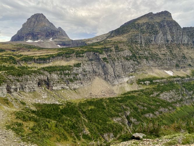
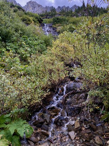
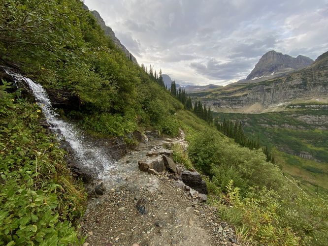
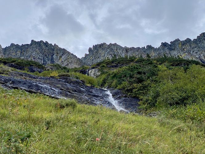
As stated previously, this is just a short section of the Highline Trail. The entire length of the Highline Trail is closer to 7-miles one-way and leads to the Granite Park Chalet which sits along the Garden Wall just north of "The Loop". During our hike here in mid-to-late September 2024, we didn't realize that the shuttle services were not running anymore so we decided to change our goal to hike this as a ~6-mile out-and-back. Due to some unexpected back pain, we had to shorten the hike to just 2.1-miles out-and-back. Regardless of the distance that we walked, the Highline Trail provides hikers with some of the best views that Glacier National Park has to offer, which is why the trail is so popular. After passing the cliff area, the trail becomes a lot easier to hike, mentally, as you'll be traversing very-steep terrain with countless shrubs and vegetation below your feet. If you're used to hiking in or around steep canyons, this trail will be no different. The views, again, are continuous and vast 180-degree panorama of some of Montana's best alpine mountains. Hikers will pass several waterfalls along the trail, mostly located close to where this route turns-around, near mile 1 from the trailhead. Once you pass the waterfall section, if you turn around you'll find views of Upper and Lower Oberlin Falls as it cascades down from Logan Pass to make its way toward the McDonald Creek and flows out to Lake McDonald. Here is where we turned around, but you can choose to continue onward for a thru-hike or an out-and-back trek of your choice.Hiking Out and the Highline Cliff - Mile 1 to 2.1
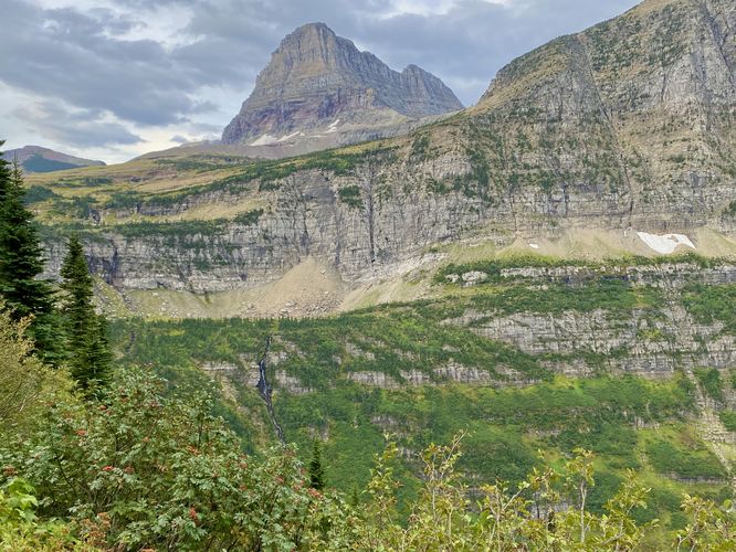
On the hike out, you might not realize how far you've already hiked down in elevation from Logan Pass. While the Highline Trail does not lose a lot of elevation throughout its entire trek, the downward slope of the Garden Wall certainly leads downhill from Logan Pass, which makes for a bit more effort to get back to the trailhead. Along the way back, you'll find beautiful views of Oberlin Falls and the alpine mountains that surround Logan Pass like Clements Mountain, Mount Oberlin, and Reynolds Mountain. This out-and-back hike obviously leads along the Garden Wall's cliff line to reach the trailhead, which might not be ideal for hikers who are afraid of heights. The cliff line, I found, was easier to traverse the second time around than the first time. I felt significantly more comfortable, despite the super steep drop-offs, and I even spent time taking photographs instead of clinging to the safety guide line. After the cliff, the trail ascends back toward the trailhead and parking lot for a very-short but awe-inspiring hike along the Highline Trail.Shuttle Service
Note that the Highline Trail is often hiked in combination with the Granite Park Trail, which hikers can take down to "The Loop" (a switchback) on the Going-to-the-Sun Road. Right by The Loop is a shuttle stop that you can take back to parking at Logan Pass; however, the Shuttle Service stops running each year around mid-September. In 2024, the shuttles stopped running on September 15, but we hiked this on September 17, which would have made for at least a ~14-mile out-and-back hike which we were not interested in at the time.Vehicle Reservations
Depending on what time of year you visit, you may need to reserve a vehicle entrance pass to get into the park, in addition to a park entry fee (or annual National Parks pass). Before planning this hike, ensure you've checked the NPS website for when and where Glacier NP vehicle reservations are required.Parking
Visitors will find a large parking lot at the Logan Pass Visitor Center, located at the coordinates provided. The lot is large enough to fit many dozens of vehicles as of September 2024. Parking here, however, can be challenging depending on what time of year you arrive -- during vehicle reservation season, you may still find the parking lot is a challenge to park in but you may not need to arrive too early in the morning. After vehicle reservation season is over, this parking lot fills up extremely fast. During our visit here in mid-to-late September 2024, the parking lot was mostly-full by 6:45AM on a weekday. When the temperatures fell further, the parking lot was much quieter. Note that depending on when you arrive, you may need to wait around for a parking space to open up.Pets
Dogs are not allowed on any trails at Glacier National Park.Wildlife
This trail is great for possible wildlife viewing opportunities including mountain goats and longhorn sheep high in the cliffs. While most visitors are "almost guaranteed" to see mountain goat or longhorn sheep at Logan Pass, during our 1-week trip and driving by Logan Pass ~10 times, we only saw longhorn sheep.Warning
Steep cliffs: This hike follows a very-steep cliff line with sheer drop-offs that plunge over 100-feet down to the Going-to-the-Sun Road. While on the cliff section, hikers should be mindful of their surroundings and hikers that might be passing-by from the opposite direction.Rockfall: This trail leads under a cliff line where rockfall is a common occurrence, especially after periods of heavy rain which loosens the cliff's face. For this reason, it's best to keep moving while hiking the cliff line.
Grizzly bears: This trail is frequented often by grizzly bears, especially in late Summer and early Fall as they scrounge for 20 hours/day bulking for the winter. Always give wild animals plenty of space, including several hundred feet for grizzlies. It's best to bring bear spray on this hike as a last defense just in case a grizzly were to charge at you. Always make plenty of noise while hiking to alert animals to your presence long before you see them. It's also smart to hike with another person. Note that one day after we hiked this trail, a hiker was pulled ~400-feet off of the trail by a grizzly bear and the bear appeared to be unaffected by bear spray, according to a NY Times article. A large portion of the trail was closed for a couple of weeks afterward.