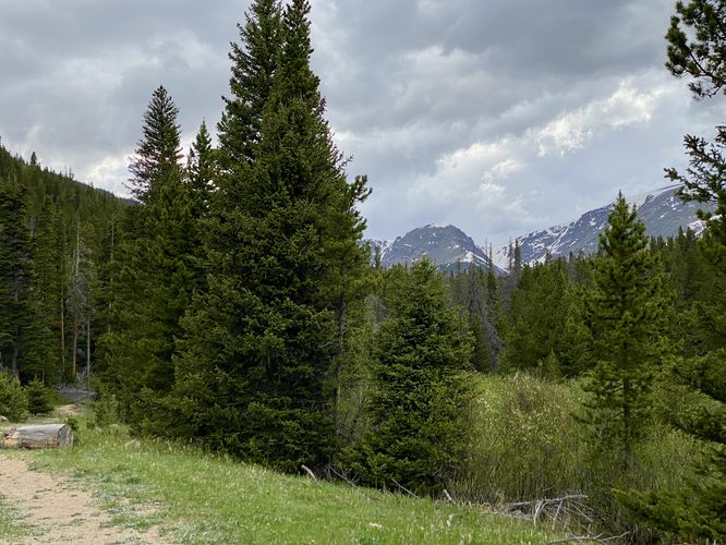
The Hidden Valley Creek Trail at Rocky Mountain National Park near Estes Park, Colorado is an easy 0.3-mile out-and-back walk that features wildlife viewing opportunities and views of the neighboring mountains.
This short out-and-back walk leads hikers along Hidden Valley Creek as it cuts through the valley adjacent to Trail Ridge Road. The trail itself is dirt and only leads into the woods for about 0.15-miles before coming to an abrupt end. During our walk here in early June 2024, we found at least four elk eating dinner in and around the creek. This walk took less than 5 minutes or so, but unfortunately the elk surrounded the trail as we walked out - when we only saw 1 elk on our walk in. I only mention this because despite the brush, trees, and leaves, there may be far more animals near the trail than you realize. We took our time getting back to parking and swung a far path out to the road to give the animals plenty of space, hence the wonky GPS track that appears like a loop instead of an out-and-back. Great wildlife viewing, just a bit too close for comfort!
Wildlife Viewing
This trail is great for viewing wildlife, especially deer, elk, and moose due to the open spaces for grazing and finding food in addition to the creek's water source for drinking. If you wish to spot wildlife, your best chances are in the early morning or in the early evening. Always keep a safe distance while viewing - approx. 75-feet for elk and longhorn sheep; 120-feet for bear and moose.
Pets
Dogs are not allowed on this trail.
Parking
Hikers will find a small parking turnout at the coordinates provided along Trail Ridge Road. The turnout is large enough to fit no more than 4 vehicles as of June 2024.
Timed-Entry Reservations
Between the months of late May through early October you must purchase a timed-entry pass to visit Rocky Mountain National Park. If you wish to visitor and hike anything off of the Bear Lake Road, you must purchase a dedicated Bear Lake timed-entry pass. You can find more information about timed entry on the park's website.
Warnings
Elevation sickness: This trail brings hikers through terrain that ascends up to 9,000-feet above sea level. Around the 7,000-foot mark above sea level, hikers may start to experience symptoms of elevation sickness including headache, muscle aches, shortness of breath, among other warning signs. In order to avoid elevation sickness it's recommended to ascend to higher elevations and take short walks to acclimate over the course of several days before taking a long or physically-demanding hike. At any time you feel elevation sickness kicking in, that's the time to turn back and head for lower altitude or the parking lot.
Wild animals: While rare, hikers may encounter bears or mountain lion along the trail. Again, this is rare due to the insane amount of people who hike these trails each day; however, it's smart to know that these wild animals could be on-trail. Please read-up on how to properly handle a bear or mountain lion encounter before hitting the trails.