Heberly Run Waterfalls at State Game Lands 13 near Jamison City, Pennsylvania is a strenuous 2.9-mile off-trail loop hike that leads to several waterfalls within Heberly Run including Lewis Falls, Upper Twin Falls, Lower Twin Falls, Shanty Falls, Foundation Falls, Quinn Falls, and Big Falls (located south of this GPS route).
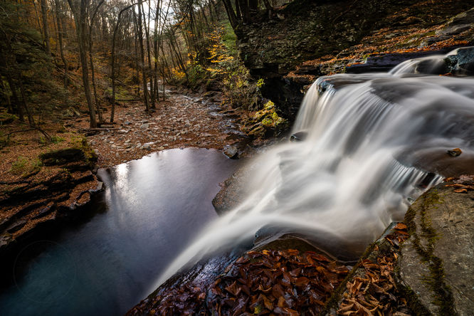
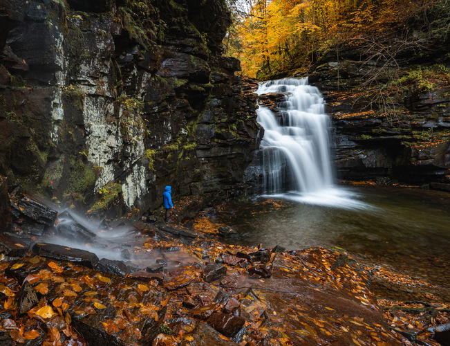
There is an excellent vantage point of the waterfall a short distance through the woods and just beyond this view is an opening in the rock cliffs that will allow you to descend to the bottom of the falls, but use caution and stay within your comfort as it is very steep.
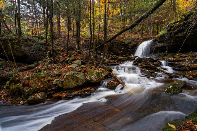
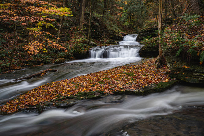
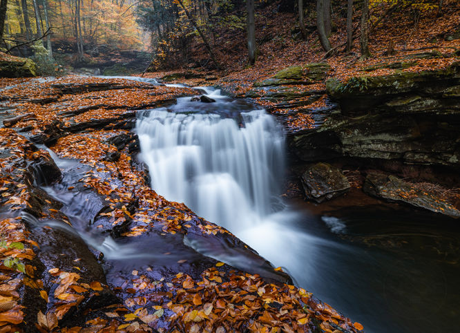
Once on the opposite of the run, the hike to the waterfalls above Lewis Falls follows an old grade and the first waterfall along this section is Foundation Falls that is just above the ruins of an old foundation. As you continue on the grade there will be a split in the grade (41.34372, -76.36709) and you want to follow the lower grade to Shanty Run Falls. Quinn Falls will be nearby following Shanty Run down to where it meets with Quinn Run.
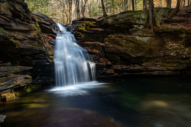
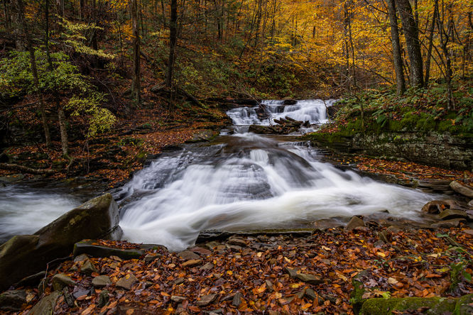
My hike continued by retracing my steps back to Lewis Falls and descending the steep route as previously mentioned to reach the bottom of Lewis Falls. The hike then continues down along the run and requires many water crossings and depending on water level, expect wet feet. The distance from Lewis Falls to Upper Twin Falls is about .7 of mile via the run. A short distance below the first waterfall is Lower Twin Falls.
I finished out the hike by locating the old grade on the right side of the run as you go downstream which leads up to the Twin Falls parking area and then I looped back following the forest road back to my vehicle at Lewis Falls Parking.
Lewis Falls: 41.3383, -76.36399
Foundation Falls: 41.34023, -76.36555
Shanty Run Falls: 41.34455, -76.36855
Quinn Run Falls: 41.34438, -76.36852
Upper Twin Falls: 41.33391, -76.35657
Lower Twin Falls: 41.33337, -76.35643
Big Falls: 41.32847, -76.35198
Primary Parking at Gate: 41.31934, -76.34330
Parking near Twin Falls: 41.33119, -76.35576 (aprox 1 mile from gate)
Parking near Lewis Falls: 41.337196, -76.363751 (aprox 1.7 miles & 450 ft elevation gain from gate)
Timber Rattlesnakes: This area is home to the Timber Rattlesnake which can be found roaming the forest floor between the end of April and early October each year. Be on the lookout and give any rattlers you find plenty of space.
Exploring Heberly Run's Waterfalls
The hike to enjoy these waterfalls can vary depending where you park and how you decide to tackle them. My most recent hike, I started at the Lewis Falls parking area. There is an obvious path from the parking area that leads to Heberly Run and the top of Lewis Falls. There is a view looking down at the falls from this side of the run, however the better view and access to get down to the waterfall is on the opposite of the run. Heberly Run typically has a good flow and more often than not, expect wet feet to get across, on my most recent visit it was a lower flow and I was able to rock hop across.There is an excellent vantage point of the waterfall a short distance through the woods and just beyond this view is an opening in the rock cliffs that will allow you to descend to the bottom of the falls, but use caution and stay within your comfort as it is very steep.
Once on the opposite of the run, the hike to the waterfalls above Lewis Falls follows an old grade and the first waterfall along this section is Foundation Falls that is just above the ruins of an old foundation. As you continue on the grade there will be a split in the grade (41.34372, -76.36709) and you want to follow the lower grade to Shanty Run Falls. Quinn Falls will be nearby following Shanty Run down to where it meets with Quinn Run.
My hike continued by retracing my steps back to Lewis Falls and descending the steep route as previously mentioned to reach the bottom of Lewis Falls. The hike then continues down along the run and requires many water crossings and depending on water level, expect wet feet. The distance from Lewis Falls to Upper Twin Falls is about .7 of mile via the run. A short distance below the first waterfall is Lower Twin Falls.
I finished out the hike by locating the old grade on the right side of the run as you go downstream which leads up to the Twin Falls parking area and then I looped back following the forest road back to my vehicle at Lewis Falls Parking.
Big Falls
Big Falls is the most downstream waterfall on Heberly Run and I provided coordinates but didn't not visit on my most recent hike. There is a small pull-off along Grassy Hollow Road and a narrow, short, but extremely steep descent to Big Falls.Lewis Falls: 41.3383, -76.36399
Foundation Falls: 41.34023, -76.36555
Shanty Run Falls: 41.34455, -76.36855
Quinn Run Falls: 41.34438, -76.36852
Upper Twin Falls: 41.33391, -76.35657
Lower Twin Falls: 41.33337, -76.35643
Big Falls: 41.32847, -76.35198
About SGL 13
State Game Lands Number 13 is an incredibly beautifully place with many waterfalls similar to nearby Ricketts Glen, however there are no trails and it is much more rugged which means it is a great place to avoid the crowds for experienced hikers.Parking
Grassy Hollow is a gated forest road that is open during hunting season. For this hiking route, I parked at Lewis Falls within the gated section. Below are details on the parking options. If visiting when the gate is closed, it would add about 2 miles of road hiking to this route. Note that this road is not maintained during the Winter, so the road may be impassible during Winter, even if the gate is opened.Primary Parking at Gate: 41.31934, -76.34330
Parking near Twin Falls: 41.33119, -76.35576 (aprox 1 mile from gate)
Parking near Lewis Falls: 41.337196, -76.363751 (aprox 1.7 miles & 450 ft elevation gain from gate)
Warning
Dangerous terrain: This hike follows terrain that leads up the sides of waterfalls, which can be dangerous. The hike does not follow a defined path that leads to or from the waterfalls, so you must be comfortable with off-trail hiking.Timber Rattlesnakes: This area is home to the Timber Rattlesnake which can be found roaming the forest floor between the end of April and early October each year. Be on the lookout and give any rattlers you find plenty of space.