Loading...

WINTER SALE! 50% OFF Supporter Accounts — now through January 31st. Learn More.

Heather Meadows & Bagley Lakes Hike

The Heather Meadows & Bagley Lakes hike at Mt. Baker National Forest near Glacier, Washington is a moderate 1.5-mile loop hike that features stunning alpine, glacier, and lake views from the Mt. Baker Ski Area.

Hiking to Bagley Lakes

This hike begins at the main parking lot for Heather Meadows and first leads uphill toward the visitor center to get a birds-eye view of the lakes below. Depending on what time of year you visit, you may find that the trail is covered in snow, especially in late spring or early summer. We hiked this on the very first day of summer and found that most of the trails were still covered by several feet of snow.

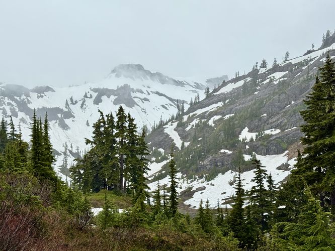
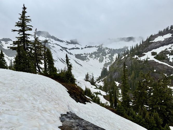
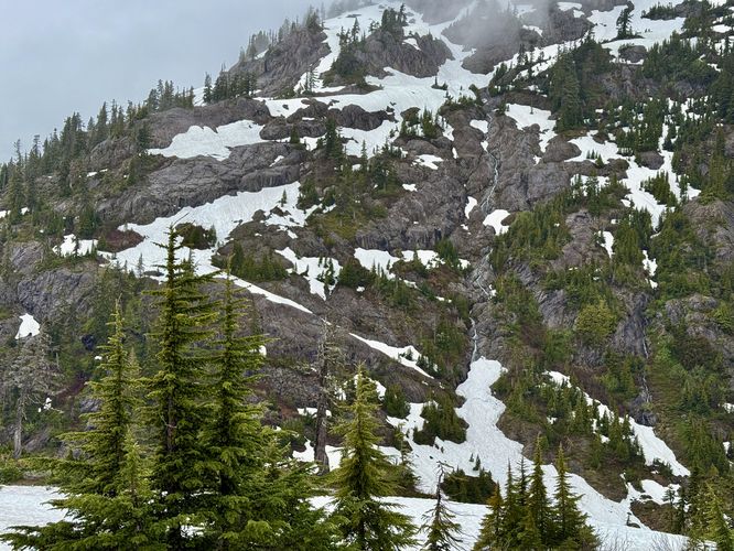
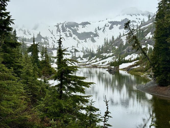
Following this route clockwise, the hike first starts up the trail that leads to the visitor center as it passes through the Heather Meadows. Along the way, you'll find sweeping alpine views of Table Mountain and the Bagley Lakes below. During snowmelt season, you'll also find a massive waterfall that cascades down Mount Herman.

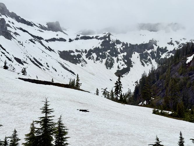
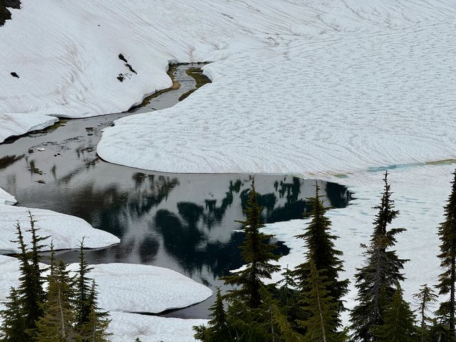
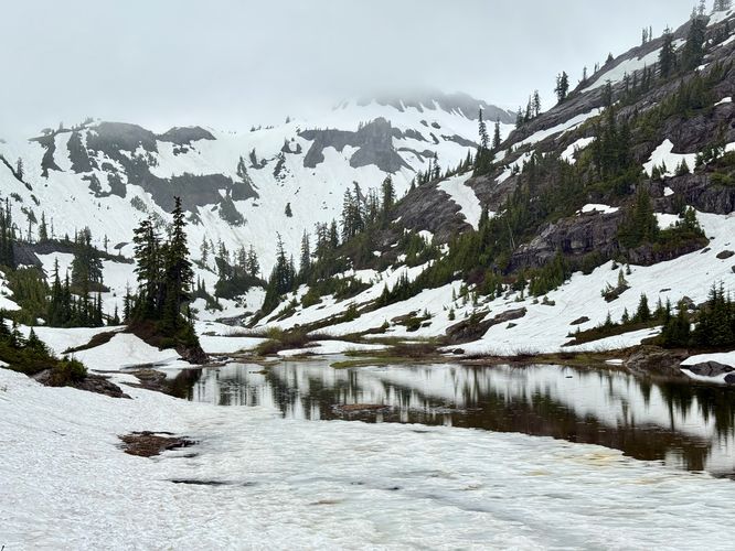
Around mile 0.5, the hike hits the highest point with the Austin Pass Picnic Area located to the south. Here, take the trail as it leads downhill toward the Bagley Lakes. On your way down, you can enjoy the blue water of Bagley Lakes, even if there's some snow covering them as the rock flour from the Table Mountain Glacier fills Bagley Creek with turquoise-tinted waters.

Bagley Lakes - Mile 0.8

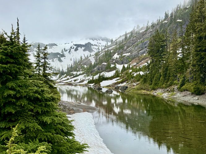
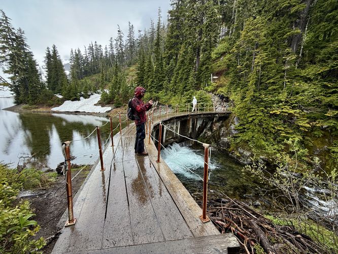
After hiking down from the Heather Meadows, the trail will reach the eastern side of Bagley Lake where you'll take a right-hand turn. Following the Bagley Lakes Trail, you'll hike along Bagley Creek as it continues to widen into Lower Bagley Lake. Along the way are nice views of the creek, the lower lake, and the alpine and glaciated slopes of Table Mountain behind you. On the far side of lower Bagley Lake is an outflow dam with a footbridge that spans the top and a small waterfall below. The footbridge is a nice place to enjoy views of the water while listening to the cascade of the small waterfall.

Once you're done exploring Lower Bagley Lake, the hike leads back up to the parking lot, passing neat exposed rock outcroppings of volcanic basalt columns. The hike ends at mile 1.5 at the parking lot.

Parking

Hikers will find a very large parking lot at the coordinates provided, located at the main section for Heather Meadows. The lot is large enough to fit many dozens of vehicles as of June 2025.

Pets

Dogs are allowed only if leashed and must be cleaned up after.

Seasonal Road Closures

The Mt. Baker Highway is subject to seasonal road closures. Before heading out, make sure you check current road statuses which can be found https://www.fs.usda.gov/r06/mbs/alerts

Warning

Snowfields: If you hike this trail when the road is open in the late spring, you'll likely find that the terrain is covered in several feet of snowpack. Following this route up into the Heather Meadows on deep snowpack can be challenging if you do not have ice spikes / micro spikes for your feet. Additionally, it's smart to bring a pair of sunglasses as you'll likely get sunblind on the trail even on very-cloudy days, like we did.
Explore 15 trails near Glacier, WA

Know Before You Go

  • The Heather Meadows & Bagley Lakes hike is a 1.5-mile moderate loop near Glacier, WA, offering alpine, glacier, and lake views from the Mt. Baker Ski Area.
  • The trail can be snow-covered, especially in late spring and early summer, potentially requiring microspikes and sunglasses.
  • The hike features highlights like the Heather Meadows viewpoint, Austin Pass Picnic Area, Bagley Lakes, and volcanic basalt columns.
Interactive topographic map for Heather Meadows & Bagley Lakes Hike located in Glacier, WA. Click the "View Map" button to load GPS coordinates and trail markers.
Get directions
Distance
1.5 mi
Difficulty
Moderate
Type
Loop
Est. Time
45 min
Elev. Gain
253'
Rating
4.0
Added
June 21, 2025
Updated
July 11, 2025

Weather Forecast

Loading...
Total Change
216'
Ascent
253'
Descent
253'
Loading...

Download the GPX Data for Offline Use

Supporters get exclusive access to download trail routes to the MyHikes app for offline use. Stay prepared on your adventure, even without an internet connection! Become a Supporter today to unlock this feature and hike with confidence.

Download Heather Meadows & Bagley Lakes Hike GPX Data to the MyHikes Mobile App

Features

Vista / Lookout Point
Dogs
Waterfalls

Points of interest

  1. Parking

    48.86145, -121.682631
  2. Main Trailhead

    48.86145, -121.682631
  3. View of Table Mountain from the trail

    48.860611, -121.682503
    View of Table Mountain from the trail
  4. Snowboard memorial to Sam Carter (1982 - 2012), located high up a tree

    48.857389, -121.683511
    Snowboard memorial to Sam Carter (1982 - 2012), located high up a tree

Safety information

For your own safety: plan ahead, let someone know where you'll be, and hike at your own risk.

Availability

All seasons

Surface type

Dirt

Trip Reports (Reviews)

Rated 4.0 out of 5 based on 1 rating.

Ready to help fellow hikers? Add a trip report to share your experience and provide valuable insights for other hikers!

1.5 miles / 2.4 km
June 20, 2025
Hiking
No community routes found. To add your own hike as a Community Route for this Trail guide, leave a Trip Report with an attached GPX file.

Popular categories

Scenic mountain view representing vista trails
Vista trails
Scenic gorge of cascades representing waterfall trails
Waterfall hikes
Rugged mountain terrain representing summit trails
Summit trails
Scenic mountain view representing dog-friendly trails
Dog-friendly
Scenic campsite with a view representing camping trails
Camping trails
Appalachian Trail logo representing A.T. hikes
A.T. hikes

You May Also Like

Glacier's Going-to-the-Sun Road - Discover the breathtaking beauty of Glacier National Park along the iconic Going-to-the-Sun Road. From stunning roadside stops to picturesque waterfalls and vistas, this engineering marvel offers endless opportunities for exploration.
Explore

Glacier's Going-to-the-Sun Road

Discover the breathtaking beauty of Glacier National Park along the iconic Going-to-the-Sun Road. From stunning roadside stops to picturesque waterfalls and vistas, this engineering marvel offers endless opportunities for exploration.

Read
Colorado's Million Dollar Highway - Plan a day's drive adventure along the iconic Million Dollar Highway in Colorado. Explore the best short trails, roadside stops, waterfalls, vistas, ghost towns, and hot springs within a ~6 hour road trip.
Explore

Colorado's Million Dollar Highway

Plan a day's drive adventure along the iconic Million Dollar Highway in Colorado. Explore the best short trails, roadside stops, waterfalls, vistas, ghost towns, and hot springs within a ~6 hour road trip.

Read
🍪 We use cookies to learn about site usage and to serve map tiles. You may block cookies manually in the browser. By continuing you agree. Learn more