The Hays Woods Loop Trail is a moderate 2.1 mile trail that passes through the western side of Hays Woods with lookout points above the Monongahela River.
The trails at Hays Woods can be a bit confusing, so heading into the woods with a map and GPS device are recommended. Also note that this trail was tracked in April 2019 and Hays Woods is going to undergo changes in the future as the City of Pittsburgh has plans to revitalize the area.
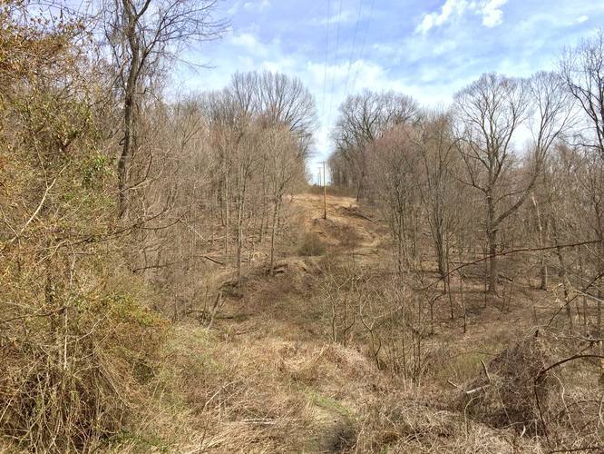
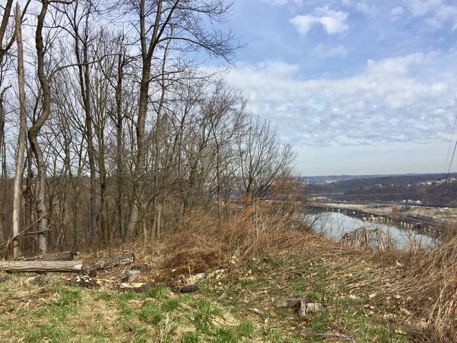
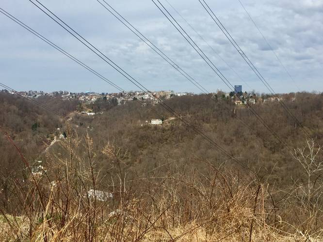
The trail starts off at the parking area and follows West Agnew Road beyond the gate and into Hays Woods for about 0.15 miles until you reach the power lines. Follow the power lines trail downhill and back uphill for almost exactly 0.5-miles before the trail heads north and away from the power lines and then northeast towards a lookout point along the Monongahela River with views of the river and the Cathedral of Learning at the University of Pittsburgh.
After visiting the first lookout point, follow the dirt road which heads west and then northwest. Most of the short trails to your left just head back to the original power line trail you followed to get to the first lookout point. After following the dirt road from the first lookout point, you'll pass a large dirt ditch and shortly after the ditch is another fork in the road -- stay right at this fork to head to the 2nd lookout point. This right-hand fork is located roughly 1-mile into the hike from the parking lot (see the elevation chart).
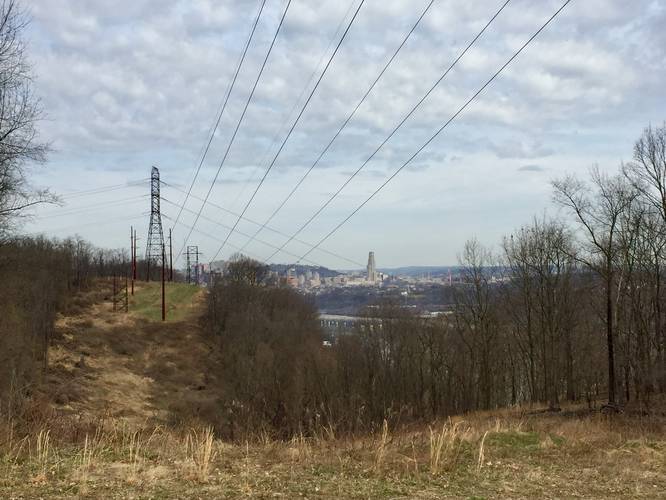
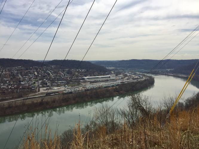
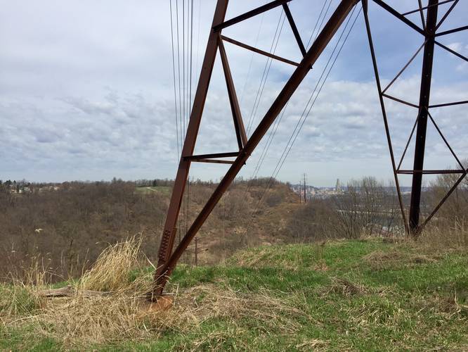
At the 2nd lookout point, you'll get views of the US Steel / UPMC Tower in downtown Pittsburgh along with the Cathedral of Learning at the University of PIttsburgh across the river. Following the trail from the 2nd lookout is a bit confusing, but head towards the western powerline tower and hike down next to it, following some short switchbacks to head back downhill.
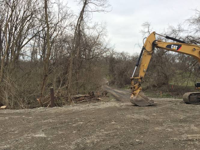
After visiting the 2nd lookout and hiking down the switchbacks heading west, you'll start hiking back uphill on your way out of Hays Woods. From this point you can follow the dirt road all the way until you reach a large hillside with a barbed-wire fence at the top of the hill. There's a trail to the left of the fork and heads back to the parking area. You can also stay right to stay on the road, but the hike out is much longer as you have to hike all the way around this school. As of April 2019, the section of this part of the hike was under construction.
Parking: Parking can be found at the very end of West Agnew Road in Pittsburgh at the parking coordinates provided.
The trails at Hays Woods can be a bit confusing, so heading into the woods with a map and GPS device are recommended. Also note that this trail was tracked in April 2019 and Hays Woods is going to undergo changes in the future as the City of Pittsburgh has plans to revitalize the area.
The trail starts off at the parking area and follows West Agnew Road beyond the gate and into Hays Woods for about 0.15 miles until you reach the power lines. Follow the power lines trail downhill and back uphill for almost exactly 0.5-miles before the trail heads north and away from the power lines and then northeast towards a lookout point along the Monongahela River with views of the river and the Cathedral of Learning at the University of Pittsburgh.
After visiting the first lookout point, follow the dirt road which heads west and then northwest. Most of the short trails to your left just head back to the original power line trail you followed to get to the first lookout point. After following the dirt road from the first lookout point, you'll pass a large dirt ditch and shortly after the ditch is another fork in the road -- stay right at this fork to head to the 2nd lookout point. This right-hand fork is located roughly 1-mile into the hike from the parking lot (see the elevation chart).
At the 2nd lookout point, you'll get views of the US Steel / UPMC Tower in downtown Pittsburgh along with the Cathedral of Learning at the University of PIttsburgh across the river. Following the trail from the 2nd lookout is a bit confusing, but head towards the western powerline tower and hike down next to it, following some short switchbacks to head back downhill.
After visiting the 2nd lookout and hiking down the switchbacks heading west, you'll start hiking back uphill on your way out of Hays Woods. From this point you can follow the dirt road all the way until you reach a large hillside with a barbed-wire fence at the top of the hill. There's a trail to the left of the fork and heads back to the parking area. You can also stay right to stay on the road, but the hike out is much longer as you have to hike all the way around this school. As of April 2019, the section of this part of the hike was under construction.
Parking: Parking can be found at the very end of West Agnew Road in Pittsburgh at the parking coordinates provided.