The Gunn Brook Falls Trail at the UMass Mt. Toby Forest in Sunderland, Massachusetts is an easy 0.2-mile out-and-back hike featuring two waterfalls. This hike is
extremely short and is great for families with little kids.
Hikers should note that depending on what time of year you visit, you may need to cross Gunn Brook during high water (generally the Spring and Winter). In this case, if you wish to see both cascades, it's probably best to park in both Lower and Upper parking lots to avoid getting your feet wet. Otherwise, during the Summer this is less of an issue.
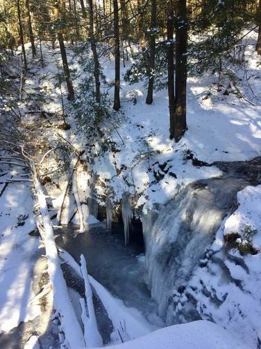
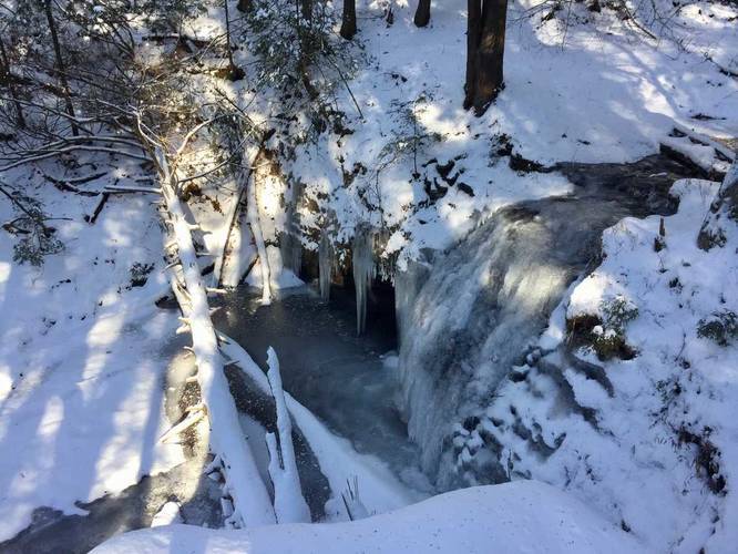
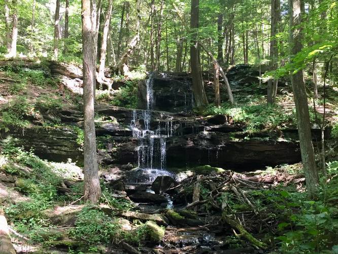
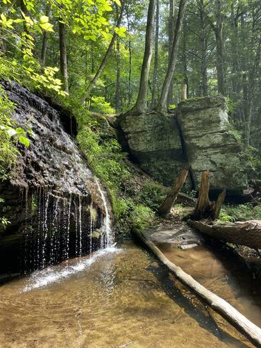
Waterfalls: The main attraction on this trail are the two waterfalls - Upper Gunn Brook Falls and Lower Gunn Brook Falls. The Upper Falls is about 15 feet high and 6 - 8 feet wide. The Lower Falls is slightly shorter, at approximately 10 to 12-feet tall and 4-feet wide. It's best to visit the waterfalls after a spout of consistent rain, in the early Spring, or in the winter when the waterfalls are frozen over. In the Summer you may find Gunn Brook a bit more dried up. Be sure to check out Gunn Brook Falls during the Spring to see waterfall at its peak.
Parking: There are two parking locations for this hike - the direction coordinates provided will bring hikers to the Lower Falls parking area, which is large enough for about 2 vehicles. You can also find parking at the opposite end of the trail, at the Upper Falls section of Gunn Brook Falls - at approximately 42.49696, -72.559113. During the winter, if Gunn Cross Rd is covered in snow, you can park at the intersection of Falls Rd and Gunn Cross Rd (without blocking the road) and hike up the road for an additional 0.1 mile one-way to the trailhead.
Pets: Dogs are allowed if leashed and their waste must be carried out.
Water source: If you have a water filter, you can refill in Gunn Brook.
Hikers should note that depending on what time of year you visit, you may need to cross Gunn Brook during high water (generally the Spring and Winter). In this case, if you wish to see both cascades, it's probably best to park in both Lower and Upper parking lots to avoid getting your feet wet. Otherwise, during the Summer this is less of an issue.
Waterfalls: The main attraction on this trail are the two waterfalls - Upper Gunn Brook Falls and Lower Gunn Brook Falls. The Upper Falls is about 15 feet high and 6 - 8 feet wide. The Lower Falls is slightly shorter, at approximately 10 to 12-feet tall and 4-feet wide. It's best to visit the waterfalls after a spout of consistent rain, in the early Spring, or in the winter when the waterfalls are frozen over. In the Summer you may find Gunn Brook a bit more dried up. Be sure to check out Gunn Brook Falls during the Spring to see waterfall at its peak.
Parking: There are two parking locations for this hike - the direction coordinates provided will bring hikers to the Lower Falls parking area, which is large enough for about 2 vehicles. You can also find parking at the opposite end of the trail, at the Upper Falls section of Gunn Brook Falls - at approximately 42.49696, -72.559113. During the winter, if Gunn Cross Rd is covered in snow, you can park at the intersection of Falls Rd and Gunn Cross Rd (without blocking the road) and hike up the road for an additional 0.1 mile one-way to the trailhead.
Pets: Dogs are allowed if leashed and their waste must be carried out.
Water source: If you have a water filter, you can refill in Gunn Brook.