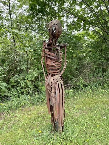
The Griffis Sculpture Park Loop at Griffis Sculpture Park in East Otto, New York is a moderate 2-mile loop hike that brings visitors through a large portion of the sculpture park, featuring sculptures like The Bathers, Insects, Amazons, Castle Tower, and the Griffis Family Heads.
Fees and Hours
As of July 2021, there's a $5 per adult, $3 per child or senior requested donation to keep this private non-profit available to the public. The park's official season is May 1st through October 31st. Hours are sunrise to sunset. More information can be found here.
Hike Description
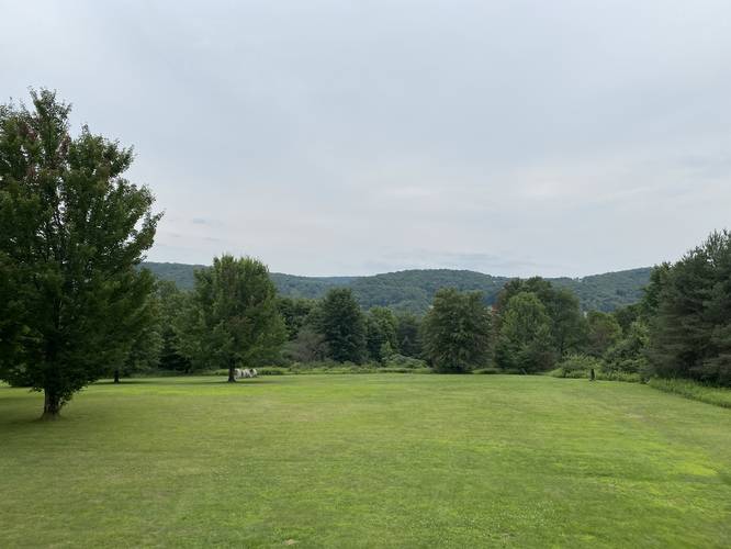
This hike while mostly being easy, can be an uphill and somewhat muddy walk, depending on what you wish to see in the park. The uphill muddy section separates the Castle Tower and view point area from the lower section of the park which features The Bathers - see the map and POI for more information.
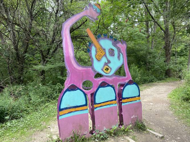
The trail starts just behind the Admissions building near the main parking lot along Mill Valley Road. The large colorful gate - located on the left-hand side of the service road - is the trailhead for the main trail that leads into the park. This first section of trail follows a shallow creek and passes several sculptures along the way before crossing a footbridge that leads into an open field.
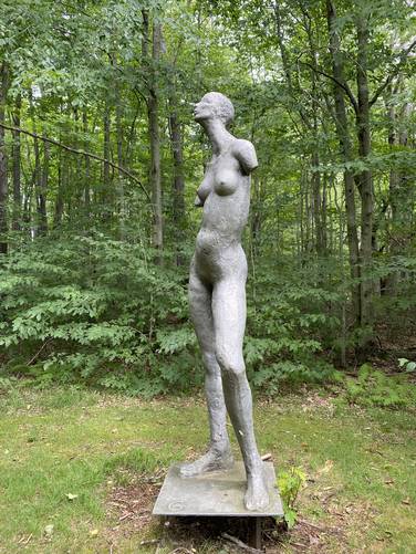
The Bathers
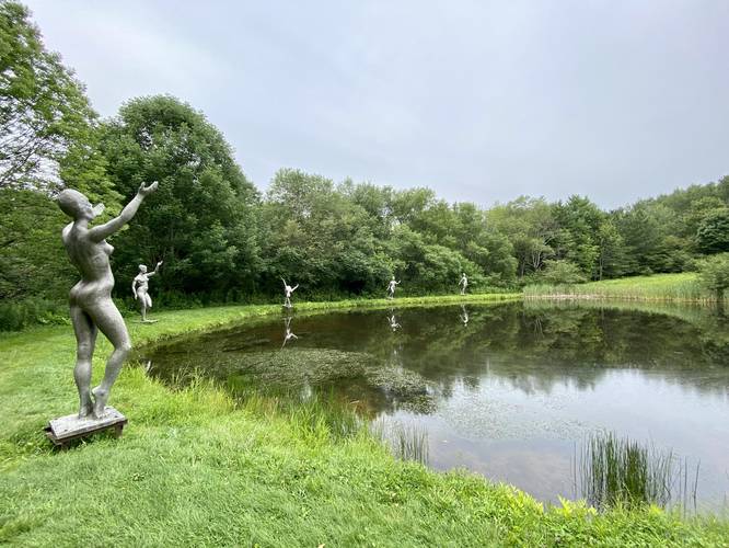
Just beyond where the initial wooded area ends, hikers will find the first main sculpture attraction - The Bathers. They can be found adjacent to and alongside the pond. This track then heads around the pond and uphill toward the Insects sculptures.
Insects
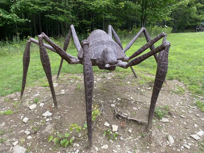
On the hillside above The Bathers lies several large insect sculptures that are worth taking a look at labelled on the map "Insects", located on the edge of the forest.
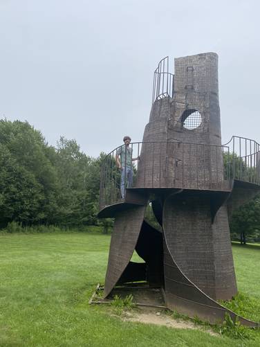
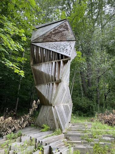
Castle Tower with Lookout Point
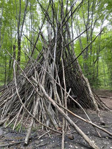
After visiting the Insects, this track heads uphill passing a large teepee, approximately 20-feet tall, with another Insect sculpture inside. This section of the trail is not very long, but can be very muddy and tricky to navigate without the proper footwear. We initially did not wear hiking boots or hiking shoes for this, but wish we did in the end. At the top of the hill, the trail leads hikers to a large field atop the hill, with Castle Tower (a climbable sculpture) located dead-ahead. Castle Tower is a fun way for kids or adults to spend a break from walking and just enjoy the scenery or view of the neighboring mountains from the tower.
Griffis Family Heads
After visiting Castle Tower, this track heads north to make a loop along a large open field. There are countless sculptures along the way, but the one noted on the map is the Griffis Family Heads.
Quiet Pond
Just after the Griffis Family Heads, this track heads south to reach a small pond. It then loops around the pond to reach a trail that leads to the field that includes Castle Tower, some interesting chair-like sculptures, and a stage.
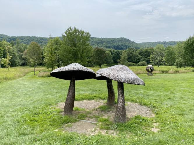
Mushrooms and Hiking Out
After reaching the hill just above the stage area, this track heads downhill beyond the stage and then winds up near the Insects once again. Near the Insects is a neat sculpture of mushrooms that are worth taking a look at. After visiting the Mushrooms, this track heads down toward The Bathers and back out to parking. There's a less-worn trail that leads across the creek, without using a footbridge, that this track follows before passing the metal gate to reach the parking area.
Parking
Hikers will find parking at the coordinates provided. The driveway is about a tenth of a mile long with a large parking lot that can accommodate a couple dozen vehicles.
Pets
Dogs are allowed if leashed and their waste must be carried out by the hiker.
Fees and Hours
As of July 2021, there's a $5 per adult, $3 per child or senior requested donation to keep this private non-profit available to the public. The park's official season is May 1st through October 31st. Hours are sunrise to sunset. More information can be found here.
Hike Description
This hike while mostly being easy, can be an uphill and somewhat muddy walk, depending on what you wish to see in the park. The uphill muddy section separates the Castle Tower and view point area from the lower section of the park which features The Bathers - see the map and POI for more information.
The trail starts just behind the Admissions building near the main parking lot along Mill Valley Road. The large colorful gate - located on the left-hand side of the service road - is the trailhead for the main trail that leads into the park. This first section of trail follows a shallow creek and passes several sculptures along the way before crossing a footbridge that leads into an open field.
The Bathers
Just beyond where the initial wooded area ends, hikers will find the first main sculpture attraction - The Bathers. They can be found adjacent to and alongside the pond. This track then heads around the pond and uphill toward the Insects sculptures.
Insects
On the hillside above The Bathers lies several large insect sculptures that are worth taking a look at labelled on the map "Insects", located on the edge of the forest.
Castle Tower with Lookout Point
After visiting the Insects, this track heads uphill passing a large teepee, approximately 20-feet tall, with another Insect sculpture inside. This section of the trail is not very long, but can be very muddy and tricky to navigate without the proper footwear. We initially did not wear hiking boots or hiking shoes for this, but wish we did in the end. At the top of the hill, the trail leads hikers to a large field atop the hill, with Castle Tower (a climbable sculpture) located dead-ahead. Castle Tower is a fun way for kids or adults to spend a break from walking and just enjoy the scenery or view of the neighboring mountains from the tower.
Griffis Family Heads
After visiting Castle Tower, this track heads north to make a loop along a large open field. There are countless sculptures along the way, but the one noted on the map is the Griffis Family Heads.
Quiet Pond
Just after the Griffis Family Heads, this track heads south to reach a small pond. It then loops around the pond to reach a trail that leads to the field that includes Castle Tower, some interesting chair-like sculptures, and a stage.
Mushrooms and Hiking Out
After reaching the hill just above the stage area, this track heads downhill beyond the stage and then winds up near the Insects once again. Near the Insects is a neat sculpture of mushrooms that are worth taking a look at. After visiting the Mushrooms, this track heads down toward The Bathers and back out to parking. There's a less-worn trail that leads across the creek, without using a footbridge, that this track follows before passing the metal gate to reach the parking area.
Parking
Hikers will find parking at the coordinates provided. The driveway is about a tenth of a mile long with a large parking lot that can accommodate a couple dozen vehicles.
Pets
Dogs are allowed if leashed and their waste must be carried out by the hiker.