The Godfrey Windmill and Labyrinth in Chatham, Massachusetts is an easy 0.2-mile out-and-back walk along a paved and universally-accessible path that leads to the historic windmill and the Chatham Labyrinth.
Walk Description
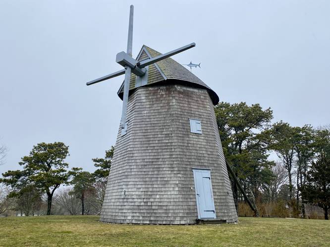
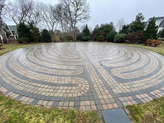
This is not a hike but rather a short walk through a neighborhood park. The trail itself follows a paved pathway that winds its way up the hill to reach the historic Godfrey Windmill. The path continues down the hill from the windmill to reach a fun labyrinth maze known as the Chatham Labyrinth.
Godfrey Windmill History
As stated on the trailhead info sign: "This wind powered grist mill was built in 1797 by Colonel Benjamin Godfrey on a hill by his home on Stage Harbor Road overlooking the Mill Pond, where it served the growing needs of Chatham residents for corn meal, a staple among early settlers. The Godfrey Windmill is an eight-sided smock type, wind powered grist mill with four sails. Ownership and historical use of the windmill - 1797: Built and operated by Colonel Benjamin Godfrey. 1819: Owned and operated by Christopher Taylor. 1850: Cogged wooden wheel and double flanges replaced by iron. 1869: Purchased by Oliver Eldridge. 1874: Owned and operated by Zenas Nickerson. 1908: Purchased by Stuart Crocker. 1956: Stuart Crocker donated the Mill to the Town and it was moved to present location. 1978: Accepted by The Heritage Conservation and Recreation Service for listing in the National Register of Historic Places."
Parking
Visitors will find a small parking lot at the coordinates provided, large enough to fit less than 10 vehicles.
Pets
Dogs are allowed only if leashed and must be cleaned up after.
Walk Description
This is not a hike but rather a short walk through a neighborhood park. The trail itself follows a paved pathway that winds its way up the hill to reach the historic Godfrey Windmill. The path continues down the hill from the windmill to reach a fun labyrinth maze known as the Chatham Labyrinth.
Godfrey Windmill History
As stated on the trailhead info sign: "This wind powered grist mill was built in 1797 by Colonel Benjamin Godfrey on a hill by his home on Stage Harbor Road overlooking the Mill Pond, where it served the growing needs of Chatham residents for corn meal, a staple among early settlers. The Godfrey Windmill is an eight-sided smock type, wind powered grist mill with four sails. Ownership and historical use of the windmill - 1797: Built and operated by Colonel Benjamin Godfrey. 1819: Owned and operated by Christopher Taylor. 1850: Cogged wooden wheel and double flanges replaced by iron. 1869: Purchased by Oliver Eldridge. 1874: Owned and operated by Zenas Nickerson. 1908: Purchased by Stuart Crocker. 1956: Stuart Crocker donated the Mill to the Town and it was moved to present location. 1978: Accepted by The Heritage Conservation and Recreation Service for listing in the National Register of Historic Places."
Parking
Visitors will find a small parking lot at the coordinates provided, large enough to fit less than 10 vehicles.
Pets
Dogs are allowed only if leashed and must be cleaned up after.