Loading...

Distance:
0.8 Miles / 1.3 km
Type:
Out-and-Back
Difficulty:
Easy
Time to Hike:
~24 minutes
Features:
Surface Type:
Dirt
Town:
Friar's Bay - Saint Martin
Directions:
18.094201, -63.07416
Added:
September 08, 2019
Updated:
September 09, 2019
Loading...
Loading...
89 '

Total Change
157 '

Ascent
153 '

Descent

The Friar's Bay to Happy Bay Trail in Saint Martin (French side) is an easy 0.8-mile out-and-back trail that leads visitors to Happy Bay Beach along a beautiful beach-side trail.

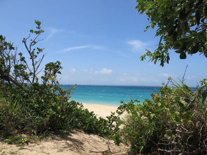
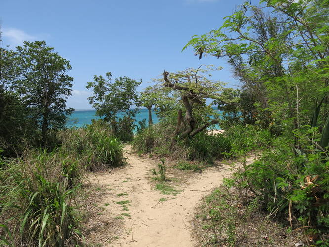
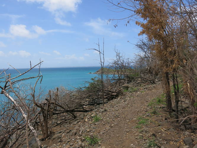
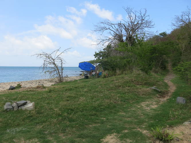
Happy Bay Beach is accessible by taking this short trail at the far end of Friar's Bay Beach, which is approximately 0.4-miles long one-way. Happy Bay beach is a beautiful stretch of sand with rocks at one end and is well-worth the short hike in.

The trail takes visitors along the water with excellent vistas and lookout points. The trail itself is well-traveled and easy to follow, but still lightly trafficked. There's a little bit of elevation gain, but it's all easy walking. You can hike this trail in flip flops but might feel a little better with proper footwear.

Keep an eye out for iguana that hangout along the trail!

Accommodations
As of August 2019 Friar's Bay has two restaurants on it while Happy Bay has just one small drink stand.

  1. Parking

    18.094201, -63.07416
  2. Main Trailhead

    18.094481, -63.07406
  3. Happy Bay Beach

    18.098998, -63.073892
    Happy Bay Beach
  4. End of the trail at Happy Bay

    18.098848, -63.073907
    End of the trail at Happy Bay
  5. Views along the way!

    18.095852, -63.074137
    Views along the way!
  6. Entrance to the trail on Friar's bay

    18.09444, -63.074112
    Entrance to the trail on Friar's bay
No community routes found. To add your own hike as a Community Route for this Trail guide, leave a Trip Report with an attached GPX file.

Seasons

All

Photo Albums

1 Trip Report

No Star-Ratings
Write-up by:
Johnnybegoo user profile picture
0.8 miles / 1.3 km
Trail added
September 08, 2019
Hiked on
September 08, 2019
Updated on
September 09, 2019

Weather Forecast

In Friar's Bay, AA

Explore Hiking Trails

New Hikes

Sugar Hill Pond and Twin Lean-Tos Hike
2.3 Miles
3.7 km
Moderate
Out-and-Back
Sandford Lake Trail
1.3 Miles
2.1 km
Easy
Out-and-Back
Sewee Shell Ring Trail
1.1 Miles
1.8 km
Easy
Loop
Angel Falls Loop
2.8 Miles
4.5 km
Moderate
Loop

Before you leave...

MyHikes is an indie web platform aimed to make exploring public trails easier for everyone. The site has no investors and is owned and operated by one person, Dave Miller (Founder & Admin). As the Founder, main contributor, and doer-of-all-things for MyHikes, I share my trips with over-detailed write-ups for fun on a volunteer basis and I believe that public trail information should be available to everyone.

It takes a lot of time 🕦, money 💰, and effort (including espresso shots ☕) to run MyHikes, including hiking , mapping , writing , and publishing new trails with high-quality content... along with building new features, moderating, site maintainance, and app development for iOS and Android . I simply ask that if you find MyHikes' trail guides helpful to please consider becoming a Supporter to help keep the site, iOS, and Android apps available to everyone.

Supporters unlock website and in-app perks with a one-time payment of $25 (you renew) 😎👍. Or you can simply make a Donation of your choice without a MyHikes user account. Otherwise, telling your friends about MyHikes is the next-best thing - both quick and free 🎉

Thanks for visiting MyHikes and have a great hike!️

Admin user profile picture

Dave Miller
MyHikes Founder & Admin