The Fort Stark Loop Trail at Fort Stark State Historic Site in New Castle, New Hampshire is an easy 0.4-mile loop trail that leads to several abandoned military batteries and features beautiful views of the ocean.
Hike
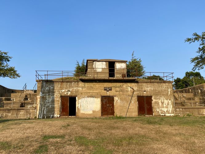
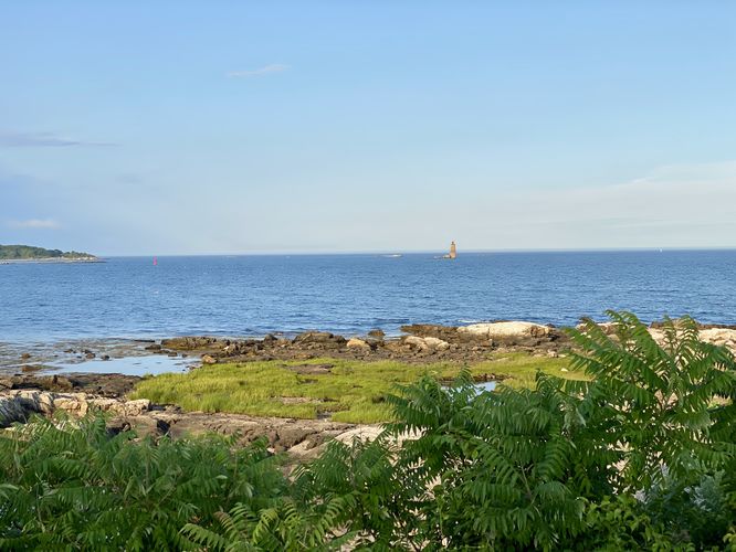
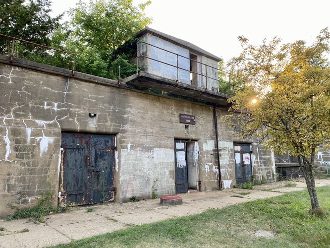
This short hike begins at the main parking lot at the park and heads eastward toward Battery Hays first. The route leads up the steps of the abandoned Battery Hays to reach the top of the bunker where you'll find ocean views including Whaleback Lighthouse located in the bay. To the north, you'll find views of the Piscataqua River as it leads into and feeds the Atlantic Ocean. From Battery Hays, the trail leads south passing a barbed-wire fence around Battery Kirk to reach a view point above the abandoned Battery Hunter. At Battery Hunter, you'll find a better view into the old military fort. The route continues south until it leads downhill to reach an old Oil Storage House with a view of the breakwater that juts into the ocean. The path then leads between the towering concrete walls between Battery Hunter and Battery Lytle before reaching the backside view (with black-painted doors) of Battery Lytle. From here, the trail runs along Battery Hunter before reaching the fenced-in Battery Kirk once more. Along the way is a row of black-painted doors that lead into long-abandoned rooms within these military bunkers. You can also hop on an adjacent trail that leads through the woods to reach the parking lot, but that trail has less to see along the way. Hikers will soon reach the parking lot, after passing Battery Kirk, for a short 0.4-mile walk.
Parking
Visitors will find a large parking lot at the park that provides enough space for a couple dozen vehicles. This parking lot fills up quickly, especially during the summer and on weekends.
Pets
Dogs are allowed only if leashed and must be cleaned up after.
Warning
Abandoned structures: This hike passes abandoned structures that should never be entered. Entering these buildings is against the law and can carry a hefty fine. Please stay out of the abandoned military bunkers.
Hike
This short hike begins at the main parking lot at the park and heads eastward toward Battery Hays first. The route leads up the steps of the abandoned Battery Hays to reach the top of the bunker where you'll find ocean views including Whaleback Lighthouse located in the bay. To the north, you'll find views of the Piscataqua River as it leads into and feeds the Atlantic Ocean. From Battery Hays, the trail leads south passing a barbed-wire fence around Battery Kirk to reach a view point above the abandoned Battery Hunter. At Battery Hunter, you'll find a better view into the old military fort. The route continues south until it leads downhill to reach an old Oil Storage House with a view of the breakwater that juts into the ocean. The path then leads between the towering concrete walls between Battery Hunter and Battery Lytle before reaching the backside view (with black-painted doors) of Battery Lytle. From here, the trail runs along Battery Hunter before reaching the fenced-in Battery Kirk once more. Along the way is a row of black-painted doors that lead into long-abandoned rooms within these military bunkers. You can also hop on an adjacent trail that leads through the woods to reach the parking lot, but that trail has less to see along the way. Hikers will soon reach the parking lot, after passing Battery Kirk, for a short 0.4-mile walk.
Parking
Visitors will find a large parking lot at the park that provides enough space for a couple dozen vehicles. This parking lot fills up quickly, especially during the summer and on weekends.
Pets
Dogs are allowed only if leashed and must be cleaned up after.
Warning
Abandoned structures: This hike passes abandoned structures that should never be entered. Entering these buildings is against the law and can carry a hefty fine. Please stay out of the abandoned military bunkers.