The Fort Hill Trail to Indian Rock at Cape Cod National Seashore in Eastham, Massachusetts is an easy 0.5-mile out-and-back hike that leads to the top of Skiff Hill and features an ancient Native American sharpening rock and views of the Nauset Bay Marshes.
Hike Description
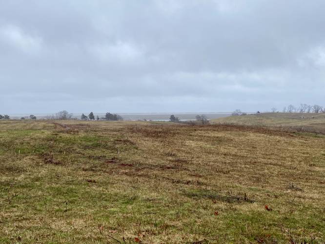
This hike begins at the main trailhead and parking lot for the Fort Hill Trail along Fort Hill Road in Eastham, MA and follows the well-defined path heading north. Along the way, hikers will be following a trail that skirts the outside of a large field, so there's virtually no shade during hot Summer days unless you head off-trail a bit.
Skiff Hill Turn - Mile 0.17
Around mile 0.17, hikers will reach a left-hand turn with no signage as of April 2023 - this trail leads to the top of Skiff Hill.
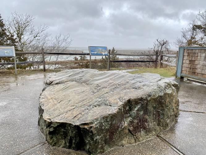
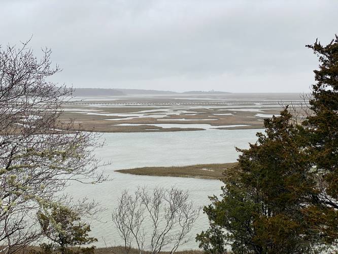
Skiff Hill Summit: Views, Native American Sharpening Rock - Mile 0.26
At mile 0.26, hikers will reach the top of Skiff Hill which is where this hike turns around to head back to parking. At the top of Skiff Hill are some nice views of the Nauset Bay Marshes. The main attraction for this hike, however, is the large Native American / American Indian sharpening rock. This large rock was once used by the Nauset band of the Wampanoag tribe when they lived in thriving villages along the marshes thousands of years before any Europeans arrived. This community sharpening rock is a reminder of that time. Visitors can touch the rock to get a deeper connection to it and the land, while being reminded that this area was once home to the Wampanoag. The rock provided a hard and abrassive surface for grinding, shaping, and polishing. As they used the rock, over time, it became worn. Today we see depressions in the boulder where they sharpened stone axes.
After visiting the sharpening rock and views, hikers can choose to head back to parking for a 0.5-mile out-and-back hike or continue exploring the trail systems here.
Parking
Hikers will find a medium-sized parking lot at the coordinates provided, which is large enough to fit about a dozen vehicles at most.
Pets
Dogs are not allowed on this trail.
Hike Description
This hike begins at the main trailhead and parking lot for the Fort Hill Trail along Fort Hill Road in Eastham, MA and follows the well-defined path heading north. Along the way, hikers will be following a trail that skirts the outside of a large field, so there's virtually no shade during hot Summer days unless you head off-trail a bit.
Skiff Hill Turn - Mile 0.17
Around mile 0.17, hikers will reach a left-hand turn with no signage as of April 2023 - this trail leads to the top of Skiff Hill.
Skiff Hill Summit: Views, Native American Sharpening Rock - Mile 0.26
At mile 0.26, hikers will reach the top of Skiff Hill which is where this hike turns around to head back to parking. At the top of Skiff Hill are some nice views of the Nauset Bay Marshes. The main attraction for this hike, however, is the large Native American / American Indian sharpening rock. This large rock was once used by the Nauset band of the Wampanoag tribe when they lived in thriving villages along the marshes thousands of years before any Europeans arrived. This community sharpening rock is a reminder of that time. Visitors can touch the rock to get a deeper connection to it and the land, while being reminded that this area was once home to the Wampanoag. The rock provided a hard and abrassive surface for grinding, shaping, and polishing. As they used the rock, over time, it became worn. Today we see depressions in the boulder where they sharpened stone axes.
After visiting the sharpening rock and views, hikers can choose to head back to parking for a 0.5-mile out-and-back hike or continue exploring the trail systems here.
Parking
Hikers will find a medium-sized parking lot at the coordinates provided, which is large enough to fit about a dozen vehicles at most.
Pets
Dogs are not allowed on this trail.