The Fort Foster Loop at Fort Foster Park in Kittery, Maine is an easy 1.8-mile loop hike that features old WWII military fortifications and views of the Wood Island Lifesaving Station's lighthouses.
Hike Description
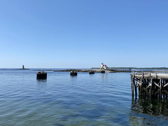
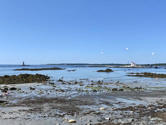
This hike begins at the large main parking lot at Fort Foster, located near the pier and leads hikers out along the pier to begin - which arguably provides the best view along the hike. From the pier, hikers get views of the Wood Island Lifesaving Station, which predated the U.S. Coastguard. Hikers will also notice the submarine net cribs that sit in the water - these were built during WWII to prevent any submarines from navigating up the Piscataqua River.
Battery Chapin - Mile 0.3
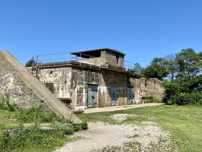
After leaving the pier, hikers will want to explore Battery Chapin which is located at mile 0.3, by hiking north from the entrance to the pier. Battery Chapin is another WWII military fortification that visitors can walk the steps to explore the upper ramparts of the structure. Long ago, large guns were mounted on this fortification to provide defenses against any enemy forces that might be attempting to invade the U.S. via the Piscataqua River.
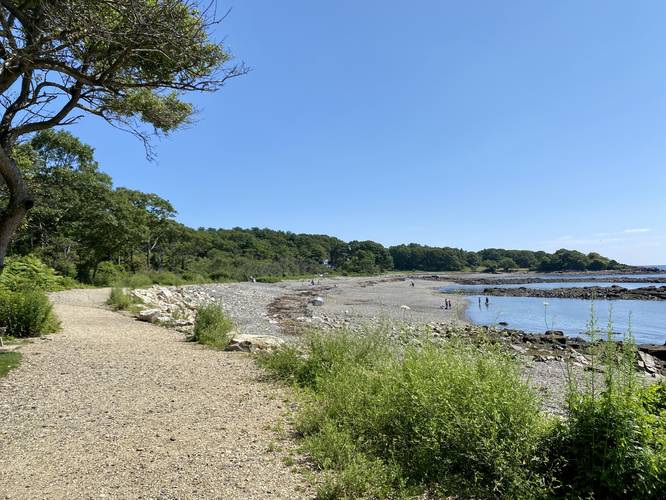
After visiting Battery Chapin, the trail heads back to the main parking lot, cutting through it, heading south, to reach more beaches. Along the way are more views of Wood Island and the lighthouses it adorns.
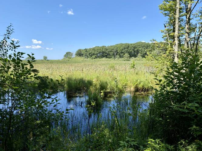
Marsh View - Mile 0.7
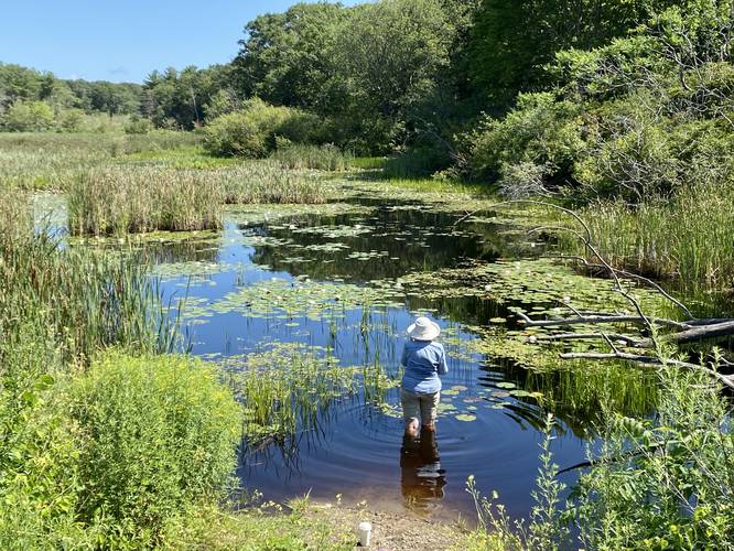
Around mile 0.7, hikers will reach a nice view of a marsh that sits north of the trail. This is a great place to bird watch.
Battery 205 - Mile 0.95
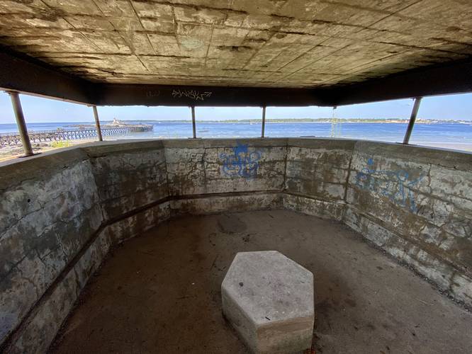
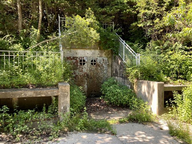
Around mile 0.95, after taking a left-hand turn into the woods, hikers will reach Battery 205 - another WWII military fortification. Here, another massive gun would have been mounted to provide additional defenses. Adjacent to the circular gun platform is a bunker carved into the hillside with two very large (closed) rusted doors.
Observation Tower - Mile 1
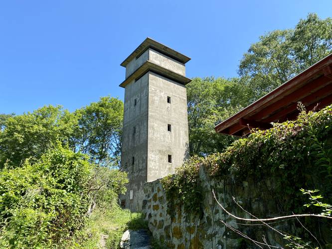
If you hike northeast through the woods just a bit further, hikers will reach the south side of the tall observation tower - another WWII military installation. This observation tower was built as a lookout to help spot enemies in the distance.
After visiting the Observation Tower, hike southeast to reach the main trail once more. The trail then heads north to reach Rocky Beach (aka Scuba Beach) before taking a left-hand turn to reach a parking lot for Rocky Beach. The trail then follows the road as it circles back to the Observation Tower. Once at the observation tower, take a right-hand turn to follow the road once more.
Marsh View - Mile 1.4
At mile 1.4, along the road walk, hikers will find another view of the marsh.
After visiting the marsh, hikers will follow the road as it heads north. Take a left-hand turn at the road to head back to parking. Along the way, feel free to stop over at the last obvious military fortification - Battery Bohlen.
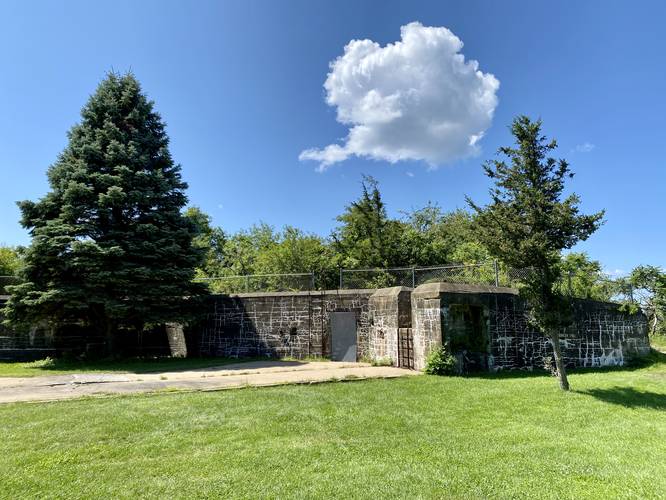
Battery Bohlen - Mile 1.75
Around mile 1.75, just before the parking lot, is the last military fortification worth taking a look at on this hike - Battery Bohlen. This long and short fortification is another remnant of WWII.
Hikers will complete the loop after visiting Battery Bohlen by hiking downhill to the parking lot, for a 1.8-mile hike.
Fees
Regardless of walk-in or drive-in, there's a $20 entry fee as of July, 2023.
Parking
Hikers will find plenty of parking at the large parking lots Fort Foster has to provide. Considering this is a loop, you can park nearly anywhere at Fort Foster to explore this trail.
Pets
Dogs are allowed only if leashed and must be cleaned up after.
Hike Description
This hike begins at the large main parking lot at Fort Foster, located near the pier and leads hikers out along the pier to begin - which arguably provides the best view along the hike. From the pier, hikers get views of the Wood Island Lifesaving Station, which predated the U.S. Coastguard. Hikers will also notice the submarine net cribs that sit in the water - these were built during WWII to prevent any submarines from navigating up the Piscataqua River.
Battery Chapin - Mile 0.3
After leaving the pier, hikers will want to explore Battery Chapin which is located at mile 0.3, by hiking north from the entrance to the pier. Battery Chapin is another WWII military fortification that visitors can walk the steps to explore the upper ramparts of the structure. Long ago, large guns were mounted on this fortification to provide defenses against any enemy forces that might be attempting to invade the U.S. via the Piscataqua River.
After visiting Battery Chapin, the trail heads back to the main parking lot, cutting through it, heading south, to reach more beaches. Along the way are more views of Wood Island and the lighthouses it adorns.
Marsh View - Mile 0.7
Around mile 0.7, hikers will reach a nice view of a marsh that sits north of the trail. This is a great place to bird watch.
Battery 205 - Mile 0.95
Around mile 0.95, after taking a left-hand turn into the woods, hikers will reach Battery 205 - another WWII military fortification. Here, another massive gun would have been mounted to provide additional defenses. Adjacent to the circular gun platform is a bunker carved into the hillside with two very large (closed) rusted doors.
Observation Tower - Mile 1
If you hike northeast through the woods just a bit further, hikers will reach the south side of the tall observation tower - another WWII military installation. This observation tower was built as a lookout to help spot enemies in the distance.
After visiting the Observation Tower, hike southeast to reach the main trail once more. The trail then heads north to reach Rocky Beach (aka Scuba Beach) before taking a left-hand turn to reach a parking lot for Rocky Beach. The trail then follows the road as it circles back to the Observation Tower. Once at the observation tower, take a right-hand turn to follow the road once more.
Marsh View - Mile 1.4
At mile 1.4, along the road walk, hikers will find another view of the marsh.
After visiting the marsh, hikers will follow the road as it heads north. Take a left-hand turn at the road to head back to parking. Along the way, feel free to stop over at the last obvious military fortification - Battery Bohlen.
Battery Bohlen - Mile 1.75
Around mile 1.75, just before the parking lot, is the last military fortification worth taking a look at on this hike - Battery Bohlen. This long and short fortification is another remnant of WWII.
Hikers will complete the loop after visiting Battery Bohlen by hiking downhill to the parking lot, for a 1.8-mile hike.
Fees
Regardless of walk-in or drive-in, there's a $20 entry fee as of July, 2023.
Parking
Hikers will find plenty of parking at the large parking lots Fort Foster has to provide. Considering this is a loop, you can park nearly anywhere at Fort Foster to explore this trail.
Pets
Dogs are allowed only if leashed and must be cleaned up after.