The Forest and Fire Trail at Glacier National Park near West Glacier, Montana is an easy 0.9-mile loop hike that leads through an evergreen and aspen forest before passing through an old wildfire burn scar.
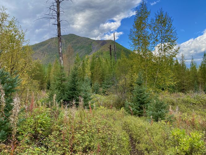
After following the trail back downhill, you'll enter a shrub-filled meadow-like landscape where it's clear that a fire once raged through this forest, decimating everything in its path. Despite the destruction of wildfires, their presence is a necessity for the health of these forests. As you walk through the open meadow, you'll find huckleberry bushes and views of the nearby mountain to the north, Glacier View Mountain.
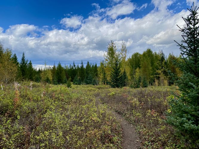
The trail then exists the meadow and ascends through the forest to reach the initial spur trail that lead to the loop. There's nothing to see on this part of the hike unfortunately, but you can appreciate the quiet and solitude here which is sometimes hard to find in the park. The trail then ends back at parking for a short and easy 0.9-mile hike.
Hiking the Forest and Fire Trail
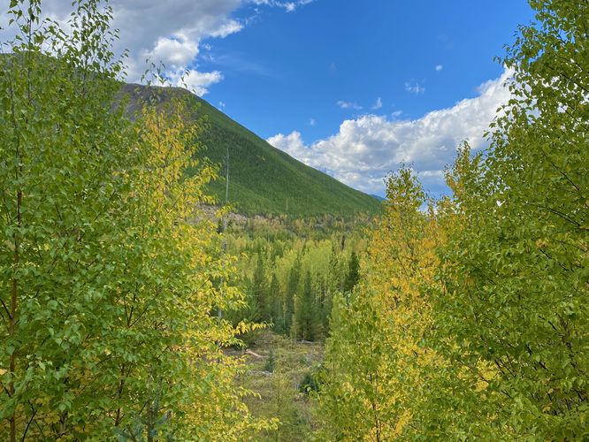
This quiet and secluded trail begins at the main trailhead, located just off of Camas Road. The trail leads into the evergreen-filled forest with views of Huckleberry Mountain hanging overhead to start. You'll find low-growing shrubs, like huckleberry and others growing along the trail, adjacent to the dark forest of the nearby spruce trees. The trail begins to head downhill after it reaches a loop junction around mile 0.1. The downhill walk does not last for too long before the trail ascends the foothills of Huckleberry mountain by a meager ~30-feet in elevation gain. This short ascent appears to be a small portion of a long-lost branch of trail that leads further uphill; however, the main trail, as of September 2024, leads hikers back downhill around mile 0.3 to reach an old wildfire burn scar. Before reaching this downhill section, you'll continue to hike through a beautiful forest filled with evergreens and quaking aspen. During our hike here in mid-September 2024, the quaking aspen trees were already turning a vibrant yellow.After following the trail back downhill, you'll enter a shrub-filled meadow-like landscape where it's clear that a fire once raged through this forest, decimating everything in its path. Despite the destruction of wildfires, their presence is a necessity for the health of these forests. As you walk through the open meadow, you'll find huckleberry bushes and views of the nearby mountain to the north, Glacier View Mountain.
The trail then exists the meadow and ascends through the forest to reach the initial spur trail that lead to the loop. There's nothing to see on this part of the hike unfortunately, but you can appreciate the quiet and solitude here which is sometimes hard to find in the park. The trail then ends back at parking for a short and easy 0.9-mile hike.