Falling Springs Falls near Duryea, Pennsylvania is a 50-foot free-falling roadside waterfall that cascades down a large bedrock cliff.
This is not a hike, but rather a roadside stop to view the 50-foot waterfall, and the lower 12-foot multi-tiered cascades of Falling Springs Falls. This creek is technically unnamed, but the water stems from the Falling Springs Reservoir, located at the top of the mountain just a couple miles east.
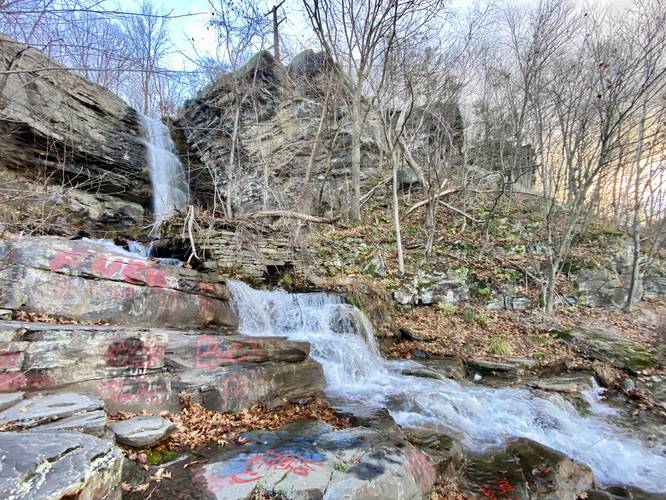
Lower Falling Springs Falls (12-foot tall)
The immediate waterfalls, adjacent to the road, are the lower falls - a multi-tiered cascade. This bedrock to the left-hand side provides a multi-tiered step and skinny trail that hikers can use to reach the 50-foot cascade, Falling Springs Falls. Be careful if you choose to scramble up the boulders and bedrock to reach the big waterfall.
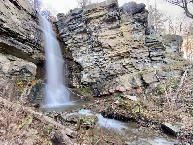
Falling Springs Falls (50-foot waterfall)
Just beyond the bedrock / boulder scramble is the free-falling cascade of Falling Springs Falls that spills over the bedrock at about 50-feet tall. The waterfall sits in its own amphitheater-type bedrock hollow and is a beautiful spot to view the waterfall.
Parking
There's a very small parking turnout located just north of the creek that can fit no more than 2 vehicles safely.
Pets
Dogs are allowed if leashed, but due to the bedrock scrambles, it might be best to just leave them in the car.
Warnings
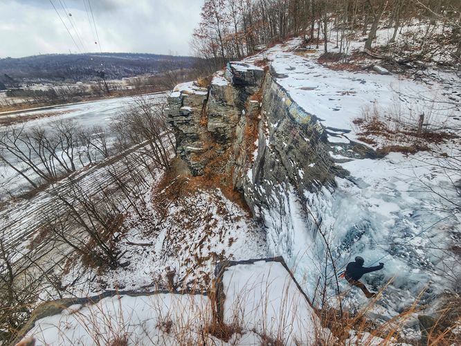
Bedrock scrambles and fall hazards: Note that some of the bedrock can be slippery when wet. Test the traction of your shoes or boots before attempting to walk on any of the rocks to reduce chance of injury. There's a skinny path that leads to a better view of the 50-foot cascade; however, it skirts uphill just above the rapid creek which can be dangerous during high water - watch your step, especially if walking in wet leaves.
Private Property and Access: Note that this waterfall is technically on private land, but the land owners provide public hunting access on the rest of the mountain (that they own) and there are no posted or "no trespassing" signs at the waterfall. According to the property map, the lower section of the waterfall and the viewing area for the large waterfall are both on the private land that allows hunting, thus, as of November 2022, the public is welcome here. It appears there's a different land owner that owns the actual 50-foot waterfall, just beyond the top of the 12-foot multi-tiered cascade. Please respect the land owners.
This is not a hike, but rather a roadside stop to view the 50-foot waterfall, and the lower 12-foot multi-tiered cascades of Falling Springs Falls. This creek is technically unnamed, but the water stems from the Falling Springs Reservoir, located at the top of the mountain just a couple miles east.
Lower Falling Springs Falls (12-foot tall)
The immediate waterfalls, adjacent to the road, are the lower falls - a multi-tiered cascade. This bedrock to the left-hand side provides a multi-tiered step and skinny trail that hikers can use to reach the 50-foot cascade, Falling Springs Falls. Be careful if you choose to scramble up the boulders and bedrock to reach the big waterfall.
Falling Springs Falls (50-foot waterfall)
Just beyond the bedrock / boulder scramble is the free-falling cascade of Falling Springs Falls that spills over the bedrock at about 50-feet tall. The waterfall sits in its own amphitheater-type bedrock hollow and is a beautiful spot to view the waterfall.
Parking
There's a very small parking turnout located just north of the creek that can fit no more than 2 vehicles safely.
Pets
Dogs are allowed if leashed, but due to the bedrock scrambles, it might be best to just leave them in the car.
Warnings
Bedrock scrambles and fall hazards: Note that some of the bedrock can be slippery when wet. Test the traction of your shoes or boots before attempting to walk on any of the rocks to reduce chance of injury. There's a skinny path that leads to a better view of the 50-foot cascade; however, it skirts uphill just above the rapid creek which can be dangerous during high water - watch your step, especially if walking in wet leaves.
Private Property and Access: Note that this waterfall is technically on private land, but the land owners provide public hunting access on the rest of the mountain (that they own) and there are no posted or "no trespassing" signs at the waterfall. According to the property map, the lower section of the waterfall and the viewing area for the large waterfall are both on the private land that allows hunting, thus, as of November 2022, the public is welcome here. It appears there's a different land owner that owns the actual 50-foot waterfall, just beyond the top of the 12-foot multi-tiered cascade. Please respect the land owners.