Elm Hollow Trail at Denton Hill State Park near Sweden Township, Pennsylvania is an easy 2.1-mile out-and-back trail that features an abandoned ski resort, an old farmstead valley, and is a great cross-country ski trail in the winter.
Trail Description
This trail was mapped as a combination of hiking, snowshoeing, and cross-country skiiing on Drift Boards in mid-December, 2022, so the description reflects that experience.
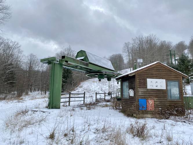
The trail begins at the main parking lot and follows the old service road that leads into the old Denton Hill Ski Resort. The trail heads toward a large green ski lift.
Left-Hand Turn - Mile 0.1
Just beyond the ski lift, the trail makes a left-hand turn, around mile 0.1.
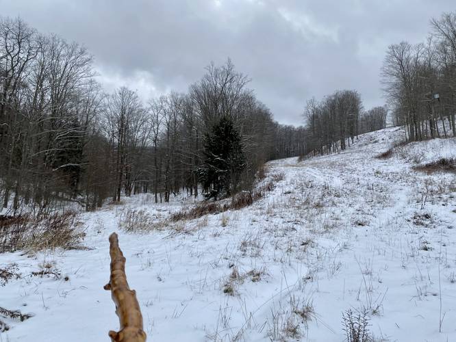
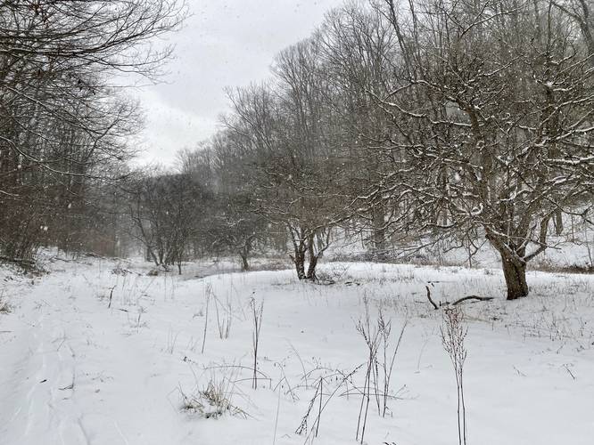
Apple Orchard / Old Homestead - Mile 0.35
Around mile 0.35, hikers will make their way into a flat valley where old apple trees can be found planted in a row. These old apple trees indicate that a homestead once sat in this valley - likely in the 1800s. Nothing remains of what used to be aside from the remaining trees.
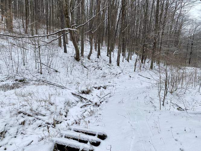
Creek Crossing - Mile 0.55
Around mile 0.55, hikers will have a shallow and easy creek crossing. During this Drift Board hike in December, 2022, there was virtually no water in the creek here; however, water was trickling further upstream.
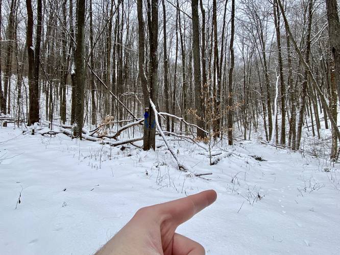
Right-Hand Turn - Mile 0.65
At mile 0.65, hikers will want to stay to the right-hand side of the trail as it splits with blue blazes on both sides. By taking a right-hand turn, hikers will stay on the Elm Hollow Trail as it follows alongside the creek. Not much further after mile 0.65 are some short, but steep uphill climbs. These can be trickier on cross-country skiis, Drift Boards, or snowshoes without heel risers.
Turning Back - Mile 1.05
Just beyond mile 1, or at mile 1, is where we decided to turn back. The goal for this adventure was to test out our Drift Boards on a well-defined ski trail (blue blazes) and they worked great. This trail was a secluded winter hike, snowshoe, cross-country ski combo that was well-worth the effort. The way out was fun - we rode down our packed-down snow path, fell a couple of times, but cruised down the trail on fresh snow for a 2.1-mile out-and-back hike.
Parking
Hikers will find a massive parking lot at the coordinates provided. It's large enough to fit many dozens of vehicles, but is generally completely empty as this abandoned ski resort-turned public state park is usually pretty quiet.
Pets
Dogs are allowed if leashed and their waste should be carried out by the hiker.
Warning
Timber Rattlesnakes: While there may not be an active rattlesnake den nearby, between the months of April and October, Timber Rattlesnakes may be out roaming the woods or drinking and hunting by the creeks. Chances of seeing a rattlesnake on this hike are slim.
Trail Description
This trail was mapped as a combination of hiking, snowshoeing, and cross-country skiiing on Drift Boards in mid-December, 2022, so the description reflects that experience.
The trail begins at the main parking lot and follows the old service road that leads into the old Denton Hill Ski Resort. The trail heads toward a large green ski lift.
Left-Hand Turn - Mile 0.1
Just beyond the ski lift, the trail makes a left-hand turn, around mile 0.1.
Apple Orchard / Old Homestead - Mile 0.35
Around mile 0.35, hikers will make their way into a flat valley where old apple trees can be found planted in a row. These old apple trees indicate that a homestead once sat in this valley - likely in the 1800s. Nothing remains of what used to be aside from the remaining trees.
Creek Crossing - Mile 0.55
Around mile 0.55, hikers will have a shallow and easy creek crossing. During this Drift Board hike in December, 2022, there was virtually no water in the creek here; however, water was trickling further upstream.
Right-Hand Turn - Mile 0.65
At mile 0.65, hikers will want to stay to the right-hand side of the trail as it splits with blue blazes on both sides. By taking a right-hand turn, hikers will stay on the Elm Hollow Trail as it follows alongside the creek. Not much further after mile 0.65 are some short, but steep uphill climbs. These can be trickier on cross-country skiis, Drift Boards, or snowshoes without heel risers.
Turning Back - Mile 1.05
Just beyond mile 1, or at mile 1, is where we decided to turn back. The goal for this adventure was to test out our Drift Boards on a well-defined ski trail (blue blazes) and they worked great. This trail was a secluded winter hike, snowshoe, cross-country ski combo that was well-worth the effort. The way out was fun - we rode down our packed-down snow path, fell a couple of times, but cruised down the trail on fresh snow for a 2.1-mile out-and-back hike.
Parking
Hikers will find a massive parking lot at the coordinates provided. It's large enough to fit many dozens of vehicles, but is generally completely empty as this abandoned ski resort-turned public state park is usually pretty quiet.
Pets
Dogs are allowed if leashed and their waste should be carried out by the hiker.
Warning
Timber Rattlesnakes: While there may not be an active rattlesnake den nearby, between the months of April and October, Timber Rattlesnakes may be out roaming the woods or drinking and hunting by the creeks. Chances of seeing a rattlesnake on this hike are slim.