The Eales Preserve Loop at Dick & Nancy Eales Preseve at Moosic Mountain in Jessup, Pennsylvania is a moderate 4.8-mile loop hike that follows several named trails and features beautiful views of the valley, mountains, and heath barrens near Scranton.
Trails
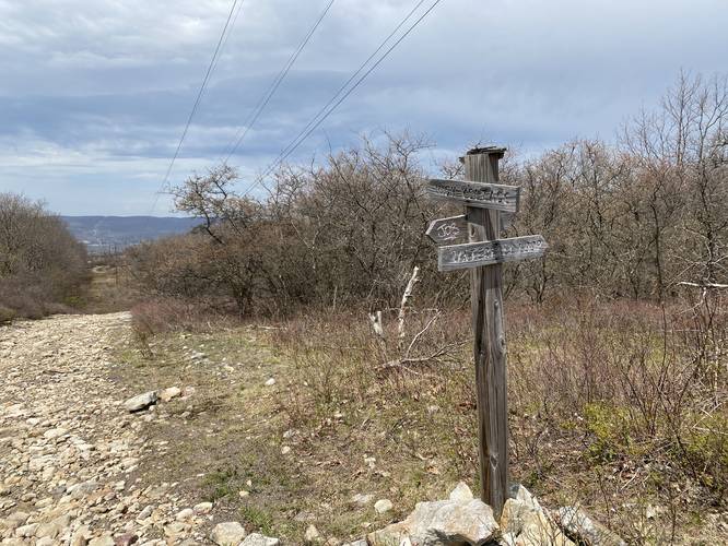
This hike follows the Bruised Ego Trail (purple blazes), Conglomerate Trail (yellow blazes), Stone Henge Trail / Tupelo Trail (pink blazes), The View Loop Trail (yellow blazes), Waterfall Loop (turquoise blazes), and an unnamed service road.
Hike Description
This trail begins at the large parking lot near the parking coordinates provided along Moosic Lake Rd and immediately takes a left-hand turn to follow the Bruised Ego Trail for a very short distance.
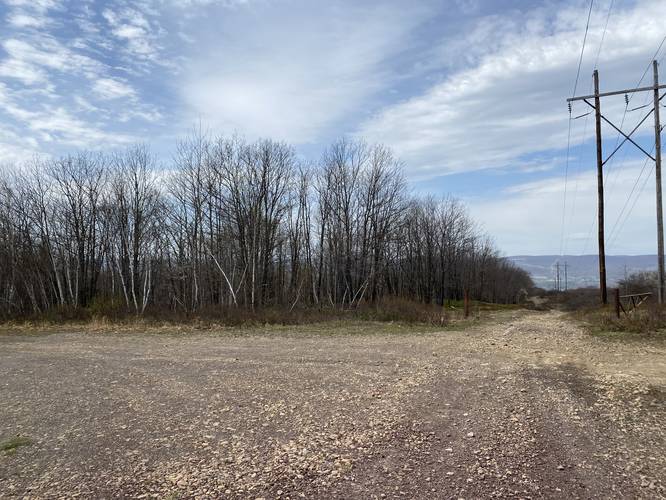
The Bruised Ego does not last very long - after the hiker makes their way downhill from the parking area, the trail will meet a service road. Take this service road with a left-hand turn to find the Conglomerate Trail (yellow blazes) about 100-feet down the road.
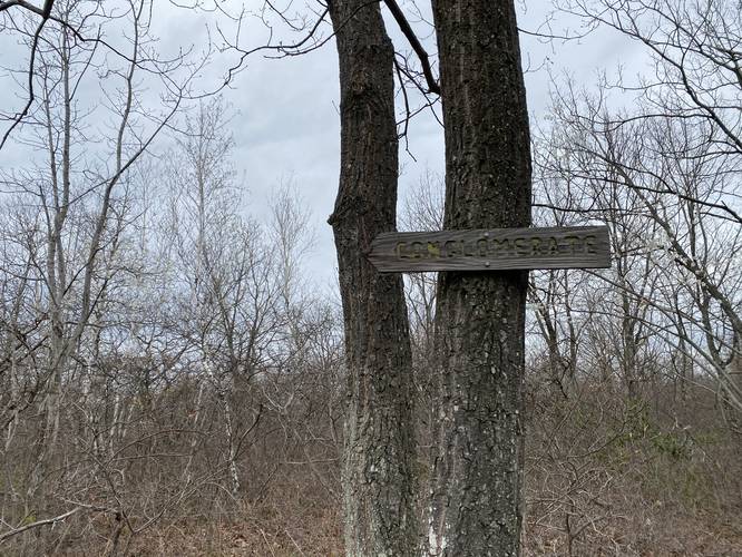
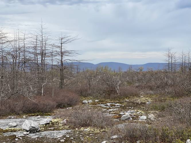
At the Conglomerate Trail, hikers have a choice to take a left or right-hand loop - both lead to the same place. We choice to stay right at this junction to follow the yellow blazes of the Conglomerate Trail - which included views of the neighboring mountains along with wide-open scrubland.
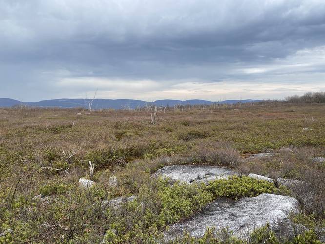
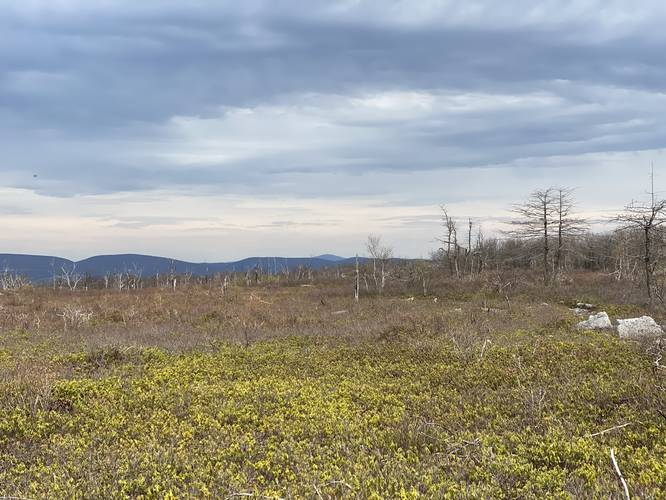
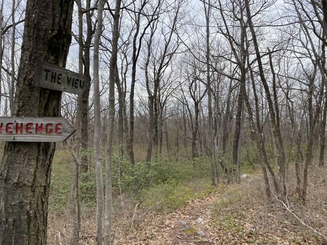
At the other side of the Conglomerate Trail is the beginning of the Stone Henge Trail (pink blazes) which has less to see until the hiker reaches The View Loop Trail. At The View Loop Trail, hikers will find a short cutoff that connects back to the Stone Henge Trail and includes more scrubland views of the nearby mountains and glimpse of the valley below.
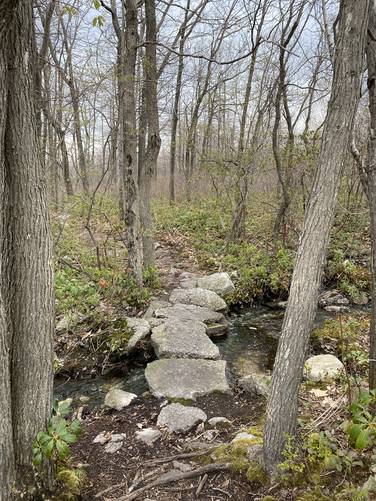
Hikers will again connect back to the Stone Henge Trail before continuing to hike north. Eventually, the Stone Henge Trail will terminate along a fairly-steep service road. Here, hikers will find the Waterfall Loop (turquoise blazes) straight ahead. Here, go straight to continue following this path. Our original destination was to reach the waterfall, located down this trail; however, the park map trail length is wrong - leading us to think this section of trail was only 0.5-miles one-way. This is wrong, the trail is probably closer to 2 or 3 miles one-way... making reaching the waterfall a lot more work than we anticipated, hence the GPS route.
This track eventually turns back along the Waterfall Loop, due to the total distance to reach the waterfall, and cuts back to the service road. Here, hikers will follow the service road back toward the Stone Henge Trail, but will take a left-hand turn along another wide service road before the hill descends at a steep angle.
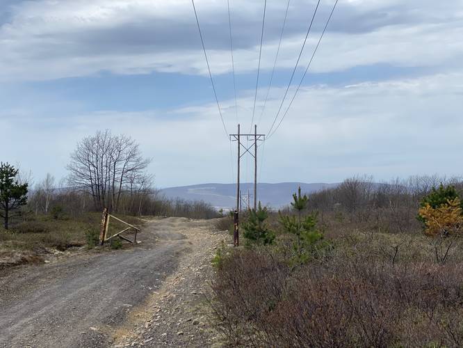
The hike out from here is simple - follow the wide service road all the way back to parking.
Parking
Hikers will find a large parking lot at the coordinates provided. As of May 2021, the lot is large enough to fit over a dozen vehicles.
Pets
Dogs are allowed if leashed, but their waste must be carried out by the hiker.
Biking
This area is very popular for mountain biking. The service roads along this hike allow biking, but the blazed hiking trails do not allow biking.
About the Heath Barrens
The Moosic Mountain heath barrens are made up of stunted pine and oak forests that are dominated by low-growing shrubs like blueberry, huckleberry, rhodora, and others species that affect an entire ecosystem of wildlife including birds, butterflies, deer, bear, and other native animals to Pennsylvania. Additionally, the globally-rare swallow moth and barrens buckmoth call this area home.
In 2001, The Nature Conservancy purchased 1,200 acres in the center of Moosic Mountain that were previously designated for development. With this purchase, TNC was able to protect this rare natural ecosystem.
In 2009, TNC named the preserve after Dick and Nancy Eales, whose generosity has allowed the expansion of the preserve, which today encompasses around 2,250 acres.
Trails
This hike follows the Bruised Ego Trail (purple blazes), Conglomerate Trail (yellow blazes), Stone Henge Trail / Tupelo Trail (pink blazes), The View Loop Trail (yellow blazes), Waterfall Loop (turquoise blazes), and an unnamed service road.
Hike Description
This trail begins at the large parking lot near the parking coordinates provided along Moosic Lake Rd and immediately takes a left-hand turn to follow the Bruised Ego Trail for a very short distance.
The Bruised Ego does not last very long - after the hiker makes their way downhill from the parking area, the trail will meet a service road. Take this service road with a left-hand turn to find the Conglomerate Trail (yellow blazes) about 100-feet down the road.
At the Conglomerate Trail, hikers have a choice to take a left or right-hand loop - both lead to the same place. We choice to stay right at this junction to follow the yellow blazes of the Conglomerate Trail - which included views of the neighboring mountains along with wide-open scrubland.
At the other side of the Conglomerate Trail is the beginning of the Stone Henge Trail (pink blazes) which has less to see until the hiker reaches The View Loop Trail. At The View Loop Trail, hikers will find a short cutoff that connects back to the Stone Henge Trail and includes more scrubland views of the nearby mountains and glimpse of the valley below.
Hikers will again connect back to the Stone Henge Trail before continuing to hike north. Eventually, the Stone Henge Trail will terminate along a fairly-steep service road. Here, hikers will find the Waterfall Loop (turquoise blazes) straight ahead. Here, go straight to continue following this path. Our original destination was to reach the waterfall, located down this trail; however, the park map trail length is wrong - leading us to think this section of trail was only 0.5-miles one-way. This is wrong, the trail is probably closer to 2 or 3 miles one-way... making reaching the waterfall a lot more work than we anticipated, hence the GPS route.
This track eventually turns back along the Waterfall Loop, due to the total distance to reach the waterfall, and cuts back to the service road. Here, hikers will follow the service road back toward the Stone Henge Trail, but will take a left-hand turn along another wide service road before the hill descends at a steep angle.
The hike out from here is simple - follow the wide service road all the way back to parking.
Parking
Hikers will find a large parking lot at the coordinates provided. As of May 2021, the lot is large enough to fit over a dozen vehicles.
Pets
Dogs are allowed if leashed, but their waste must be carried out by the hiker.
Biking
This area is very popular for mountain biking. The service roads along this hike allow biking, but the blazed hiking trails do not allow biking.
About the Heath Barrens
The Moosic Mountain heath barrens are made up of stunted pine and oak forests that are dominated by low-growing shrubs like blueberry, huckleberry, rhodora, and others species that affect an entire ecosystem of wildlife including birds, butterflies, deer, bear, and other native animals to Pennsylvania. Additionally, the globally-rare swallow moth and barrens buckmoth call this area home.
In 2001, The Nature Conservancy purchased 1,200 acres in the center of Moosic Mountain that were previously designated for development. With this purchase, TNC was able to protect this rare natural ecosystem.
In 2009, TNC named the preserve after Dick and Nancy Eales, whose generosity has allowed the expansion of the preserve, which today encompasses around 2,250 acres.