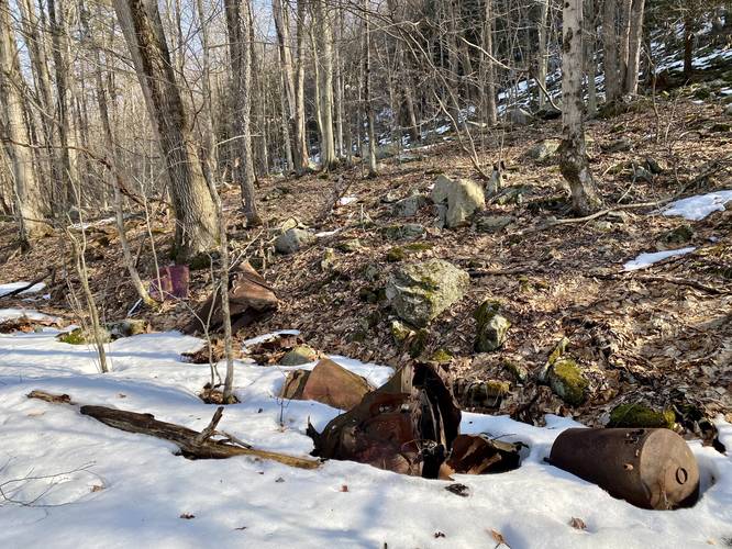
The Dutchman Run Falls Trail at the McIntyre Wild Area, within Loyalsock State Forest, in Ralston, Pennsylvania is a moderate 2.8-mile out-and-back trail that leads to the 35-foot tall waterfall named Dutchman Run Falls. Hikers will also find old abandoned building foundations, stone walls, and even an old building with walls still standing along this trail - which are small markers of the historical 19th-century mining town that once used to thrive in what is now the McIntyre Wild Area. Please note that as of March, 2021 this trail has not been marked or labeled on any public land maps that I (Admin) can find, but it does follow public land the entire time.
Hike Description
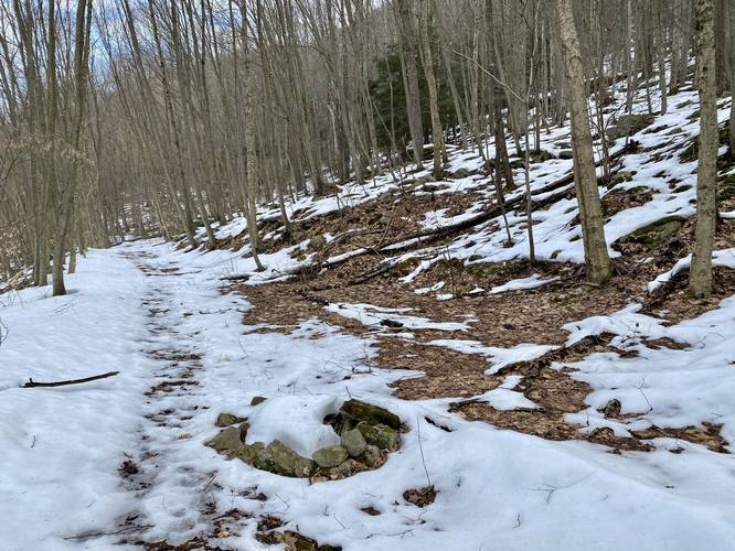
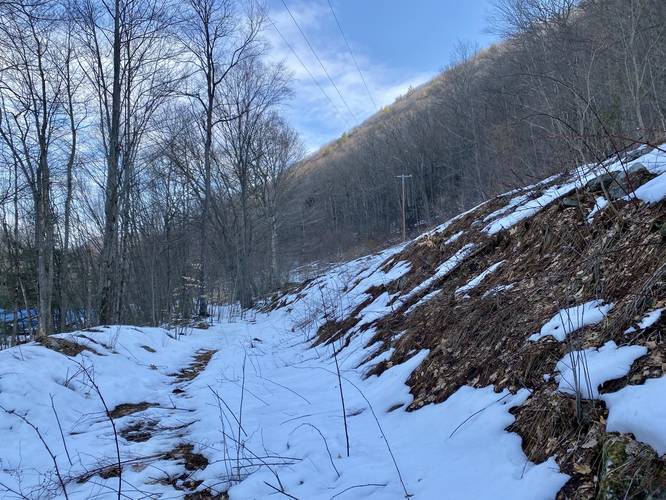
Hikers will start off at the parking lot by following the trail that passes just below the power lines. This trail is well-worn and runs uphill and adjacent to Lycoming Creek. The trail has several steep paths that lead down to the creek banks, which allow hikers access to fishing.
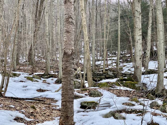
The trail continues onward at a gradual slope, passing an old stone wall in the woods, facing up the mountain. Hikers will also pass several rock ledges that sit right alongside the trail.
Private Property Hike-Around
Eventually, the trail will reach a section where the power lines head uphill around mile 0.7, where it seems to diverge in two directions. Here, the trail seemingly heads down toward a private residence. Please stay within the power lines section of the trail, even if it's overgrown, to continue following the public-land path. After this section of overgrowth, the trail will pass by one house before it heads back into the woods.
Dutchman Run House
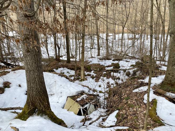
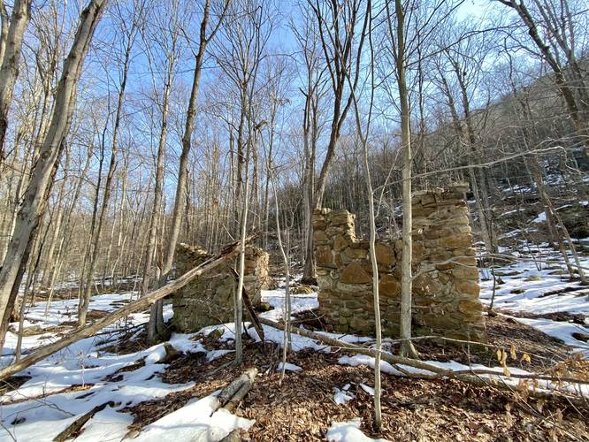
Around mile 1.1 hikers will reach the old home foundation that still has walls standing, as of March 2021. This old home is not much larger than 15 feet by 15 feet wide, but is a really neat stop along the way to Dutchman Run Falls. This old house has no name labeled, so the name given here "Dutchman Run House" was just made up for this trip report.
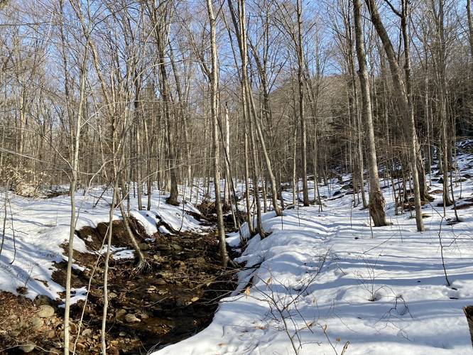
Just after the Dutchman Run House, the trail will hit Dutchman Run creek. This is actually the 1st fork of the creek, but hikers will want to hike upstream following this creek to reach the waterfall.
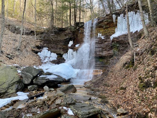
Reaching Dutchman Run Falls Bushwhack
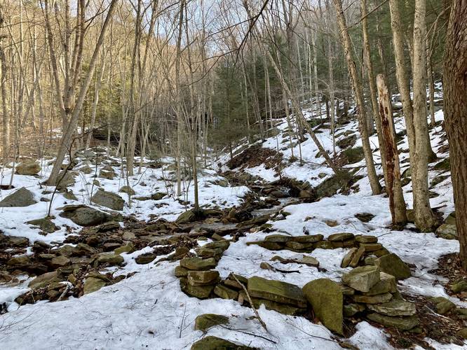
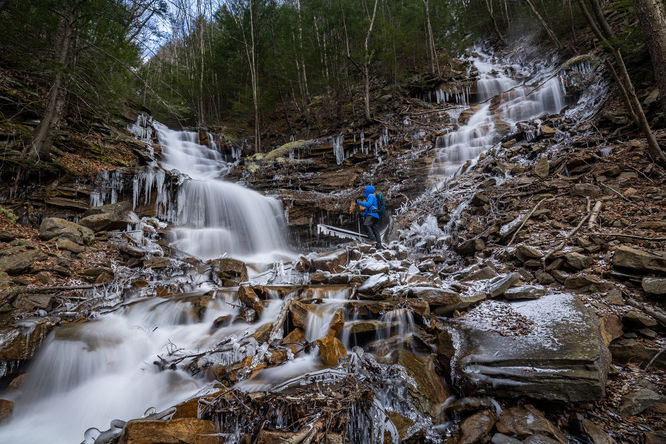
Once the hikers reaches the 1st fork of Dutchman Run creek and begin their walk upstream, the waterfall is no more than 0.3-miles away. The hike upstream is a bit rocky, so watch your step. At mile 1.4, hikers will reach a great viewing point of Dutchman Run Falls - approximately 100-feet downstream. During warmer months, crossing the creek here is easier and thus you can likely reach the base of the waterfall.
The hike back is identical to the hike in except that it's mostly all downhill from the waterfall.
Camping and Backpacking
There are several camp fire rings along this hike. One is located around mile 0.4, while the other is located just downstream from Dutchman Run Falls around mile 1.3. Please see the map for these locations. Also note that there are a couple of large open cutouts along the trail, especially near the Dutchman Run House, where backpackers can easily setup a tent. Please follow all state forest primitive / dispersed / backcountry camping rules when camping out here.
Must-Read Warnings
Note that this trail has overgrown sections and thus, might not be passable during warm months like mid-Summer. Additionally, hikers will need to bushwhack their way up Dutchman Run creek to reach the waterfall, which may be more difficult when the leaves and overgrowth are filled in. This trail follows the edge of private properties. If you stay on the trail, you'll stay on public land the entire time, but do not enter land with white blazes (marking private land) and do not hike directly into people's yards. Please respect all private property. Last, this trail might inhabit Timber Rattlesnakes during the warm months as there are a lot of rocky outcroppings and ledges along the trail, especially within the first 0.5-miles. Just beware of this between the end of April and beginning of October.
Parking
Hikers will find a large parking lot at the coordinates provided. The lot is large enough to fit about 10 vehicles.
Pets
Dogs are allowed if leashed.
Hike Description
Hikers will start off at the parking lot by following the trail that passes just below the power lines. This trail is well-worn and runs uphill and adjacent to Lycoming Creek. The trail has several steep paths that lead down to the creek banks, which allow hikers access to fishing.
The trail continues onward at a gradual slope, passing an old stone wall in the woods, facing up the mountain. Hikers will also pass several rock ledges that sit right alongside the trail.
Private Property Hike-Around
Eventually, the trail will reach a section where the power lines head uphill around mile 0.7, where it seems to diverge in two directions. Here, the trail seemingly heads down toward a private residence. Please stay within the power lines section of the trail, even if it's overgrown, to continue following the public-land path. After this section of overgrowth, the trail will pass by one house before it heads back into the woods.
Dutchman Run House
Around mile 1.1 hikers will reach the old home foundation that still has walls standing, as of March 2021. This old home is not much larger than 15 feet by 15 feet wide, but is a really neat stop along the way to Dutchman Run Falls. This old house has no name labeled, so the name given here "Dutchman Run House" was just made up for this trip report.
Just after the Dutchman Run House, the trail will hit Dutchman Run creek. This is actually the 1st fork of the creek, but hikers will want to hike upstream following this creek to reach the waterfall.
Reaching Dutchman Run Falls Bushwhack
Once the hikers reaches the 1st fork of Dutchman Run creek and begin their walk upstream, the waterfall is no more than 0.3-miles away. The hike upstream is a bit rocky, so watch your step. At mile 1.4, hikers will reach a great viewing point of Dutchman Run Falls - approximately 100-feet downstream. During warmer months, crossing the creek here is easier and thus you can likely reach the base of the waterfall.
The hike back is identical to the hike in except that it's mostly all downhill from the waterfall.
Camping and Backpacking
There are several camp fire rings along this hike. One is located around mile 0.4, while the other is located just downstream from Dutchman Run Falls around mile 1.3. Please see the map for these locations. Also note that there are a couple of large open cutouts along the trail, especially near the Dutchman Run House, where backpackers can easily setup a tent. Please follow all state forest primitive / dispersed / backcountry camping rules when camping out here.
Must-Read Warnings
Note that this trail has overgrown sections and thus, might not be passable during warm months like mid-Summer. Additionally, hikers will need to bushwhack their way up Dutchman Run creek to reach the waterfall, which may be more difficult when the leaves and overgrowth are filled in. This trail follows the edge of private properties. If you stay on the trail, you'll stay on public land the entire time, but do not enter land with white blazes (marking private land) and do not hike directly into people's yards. Please respect all private property. Last, this trail might inhabit Timber Rattlesnakes during the warm months as there are a lot of rocky outcroppings and ledges along the trail, especially within the first 0.5-miles. Just beware of this between the end of April and beginning of October.
Parking
Hikers will find a large parking lot at the coordinates provided. The lot is large enough to fit about 10 vehicles.
Pets
Dogs are allowed if leashed.