The Northland Nature Loop Trail at Dolly Sods Wilderness in Tucker County, West Virginia is an easy 0.5 mile loop hike and self-guided tour along a short and easy trail. The trail itself is 0.3 miles one-way, but the hike back along FR-75 is about 0.2 miles (not included in the GPS data provided).
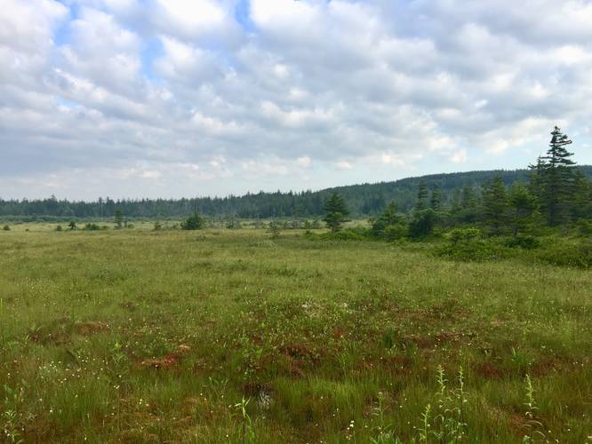
The southern trailhead can be found at the sign for the Northland Nature Loop and the northern trailhead is located about 0.2 miles north up FR-75. Along the trail you'll find a boardwalk that leads out to a viewing platform of a field in Dolly Sods' bogs which include surrounding plant life like cranberries. Aside from the boardwalk and field, there's also 'rock rivers' to see along the trail as well, which were formed from burning in the area that exposed the rock below the soil.
History: Dolly Sods was covered in a forest of Red Spruce and Eastern Hemlock - some of these trees were several feet in diameter. Native Americans used the land for hunting and agriculture and also used fire to maintain some of the land. These grassy patches, natural or human-man, were referred to as "sods" by early white settlers. In the 1800s, the Dahle family (for whom Dolly Sods is named after) expanded the sods for grazing sheep. In the early 1900s fires ravaged the land due to the 'tinderbox' of dead wood scattered throughout the land after massive logging efforts took down the forests. The fires, natural or human-made, would burn several feet of topsoil which caused the rocks under the surface to become exposed - you'll find these areas along some trails in the area and they're referred to as 'rock rivers' or 'rivers of rock'. These rock rivers now gives Dolly Sods a distinguished landscape.
Restoration: In the 1920 Monongahela National Forest was created to restore forests and reduce flooding. Over the next two decades the federal government purchased much of the surrounding landscape, including Dolly Sods. In the 1930s, the Sods were nursed back to life with the help of Civilian Conservation Corps members who developed Forest Road 75 (FR-75) and planted hundreds of aces of red pine and spruce.
Warning: Dolly Sods was used for military bombing training during WWII and there are still unexploded ordinances in the ground out in the wilderness. Most of these trails and the areas around them have been combed and searched, but not everything has been found. If you find any strange metal objects, especially bomb-shaped, do not tamper with them. Make a note of where you found it and alert the proper authorities. More information can be found at the wilderness trailheads.
Dolly Sods trail map PDF