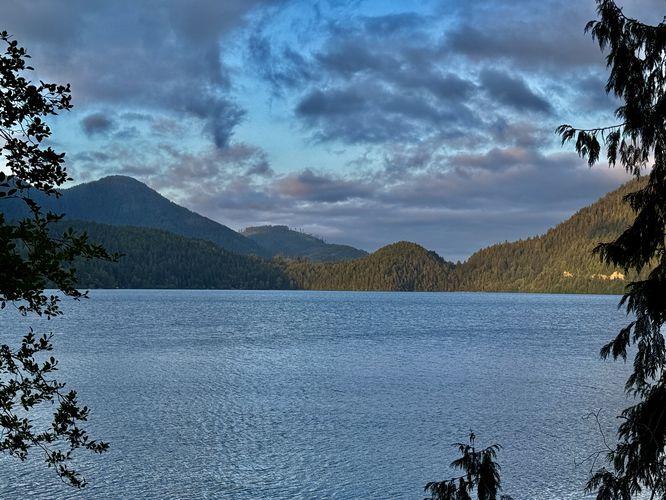
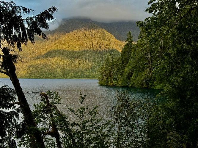
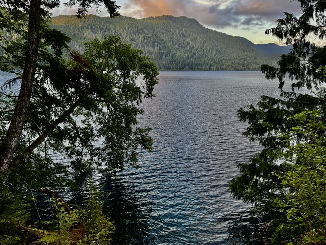
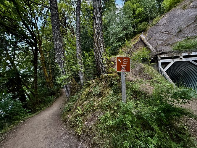
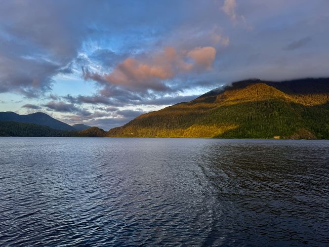
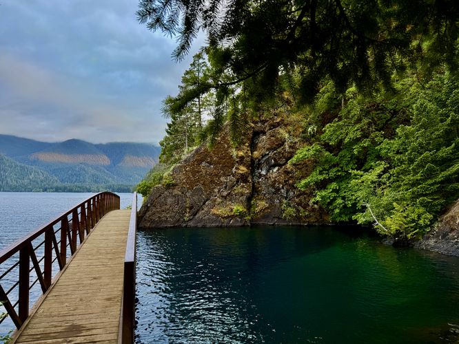
The Devil's Punch Bowl at Olympic National Park near Piedmont, Washington is an easy 2.3-mile out-and-back hike that follows a mostly-flat trail out to the turquoise water along Lake Crescent known as the Devil's Punch Bowl.
Interactive topographic map for Devil's Punch Bowl Hike located in Piedmont, WA. Click the "View Map" button to load GPS coordinates and trail markers.
View map
Get directions
- Distance
- 2.3 mi
- Difficulty
- Easy
- Type
- Out-and-Back
- Est. Time
- 1.2 hrs
- Elev. Gain
- 218'
- Rating
- 5.0
- Added
- June 15, 2025
- Updated
- June 29, 2025
Weather Forecast
Tonight
Low
67°F
Mostly Clear
Wednesday
High
82°F
Sunny
Wednesday Night
Low
66°F
Mostly Cloudy then Chance Light Rain
Thursday
High
73°F
Chance Light Rain
Thursday Night
Low
61°F
Partly Cloudy
Friday
High
69°F
Mostly Sunny
Friday Night
Low
56°F
Partly Cloudy
Saturday
High
61°F
Chance Light Rain
Saturday Night
Low
56°F
Chance Light Rain
Sunday
High
61°F
Chance Light Rain
Sunday Night
Low
53°F
Chance Light Rain
Monday
High
61°F
Chance Light Rain
Monday Night
Low
52°F
Chance Light Rain
Tuesday
High
61°F
Chance Light Rain
Don't let Google decide who you trust.


Loading...
<strong>Trail map and elevation chart not rendering in print mode?</strong> Simply scroll to the trail map section, then try printing again!
Total Change
105 ft.
32 m
32 m
Ascent
218 ft.
66 m
66 m
Descent
218 ft.
66 m
66 m
Loading...
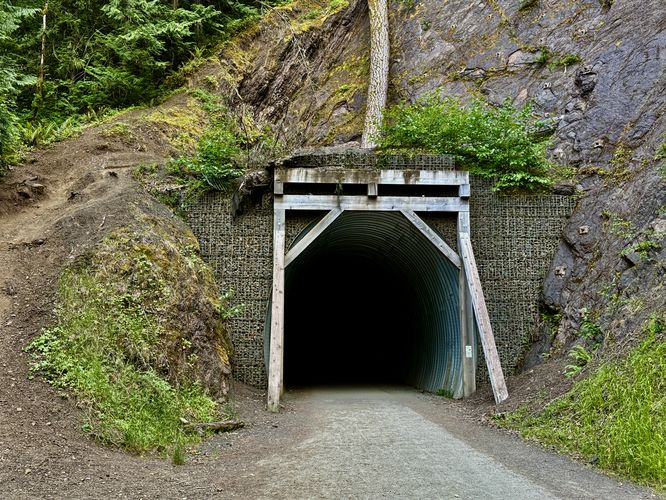
Features
- Vista / Lookout Point
- Dogs
- Waterfalls
Points of interest
-
Parking
48.09312, -123.802028 -
Main Trailhead
48.093407, -123.802866 -
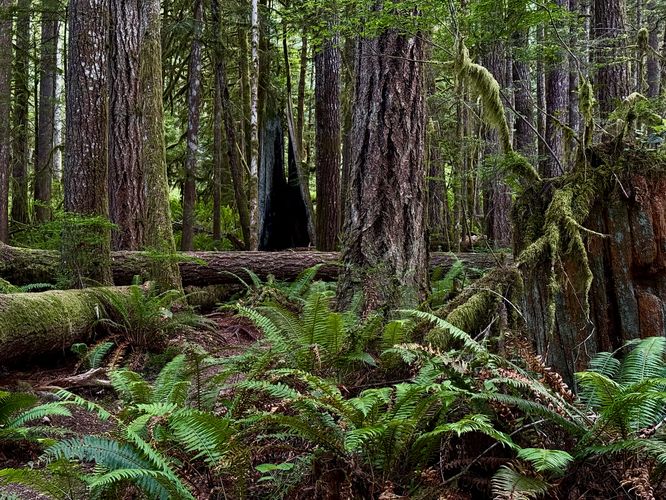
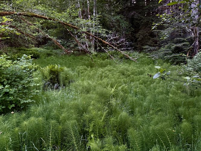
Lush rainforest with a burnt hollowed-out tree trunk
48.09135, -123.801444 -
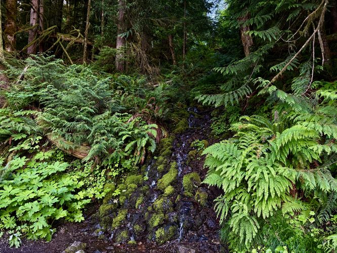
Hillside waterfall
48.087719, -123.792803
-
Parking
48.09312, -123.802028 -
Main Trailhead
48.093407, -123.802866
Safety information
For your own safety: plan ahead, let someone know where you'll be, and hike at your own risk.
Availability
All seasons
Surface type
Universal Access
Trip Reports (Reviews)
Ready to help fellow hikers? Add a trip report to share your experience!
No community routes found. To add your own hike as a Community Route for this Trail guide, leave a Trip Report with an attached GPX file.


You may also like

Explore
Hike Washington's National Parks & Forests
Find the best day hikes in Washington's National Parks and Forests. Explore panoramic alpine vistas, turquoise lakes, and stunning waterfalls.

Explore
Glacier's Going-to-the-Sun Road
Discover the breathtaking beauty of Glacier National Park along the iconic Going-to-the-Sun Road. From stunning roadside stops to picturesque waterfalls and vistas, this engineering marvel offers endless opportunities for exploration.

Explore
Colorado's Million Dollar Highway
Plan a day's drive adventure along the iconic Million Dollar Highway in Colorado. Explore the best short trails, roadside stops, waterfalls, vistas, ghost towns, and hot springs within a ~6 hour road trip.

Explore
Best of the Alps: Hiking, Adventure & Scenery
Plan your ultimate European Alps adventure! Discover the best hiking trails, epic scenery, and villages in the Swiss Alps, Dolomites, Chamonix, and Lake Como.
olympic national park

