The Cutthroat Lake Trail at Okanogan-Wenatchee National Forest near Winthrop, Washington is an easy 4-mile out-and-back hike that leads to a beautiful sub-alpine lake within the North Cascades.
Cougars: This area is cougar territory and as such, you must be mindful of their potential presence. It's best to hike in a group of two or more and keep small children close at all times. Note that cougar attacks on humans is rare and even more-rare are fatal cougar attacks.
Hike to Cutthroat Lake
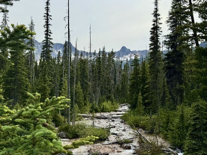
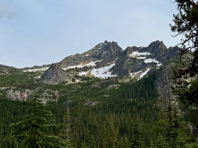
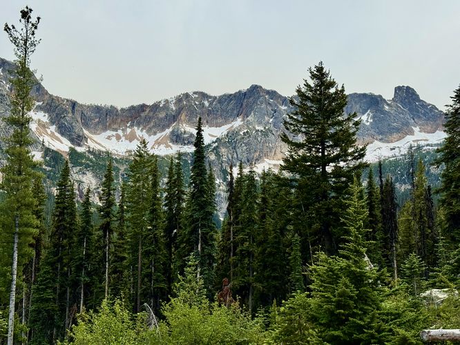
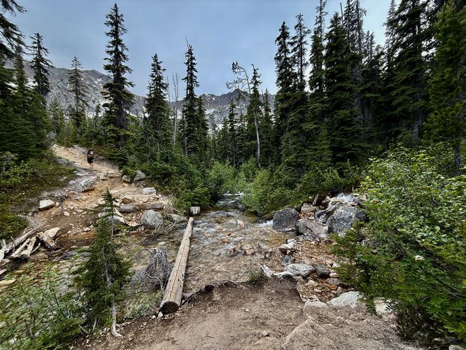
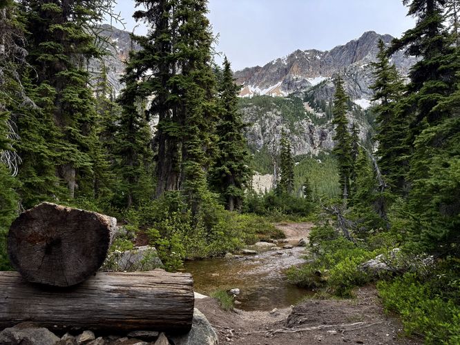
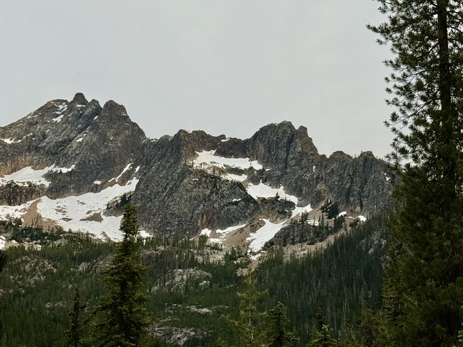
This trail begins at the end of NF400 where you'll find the Cutthroat Trail trailhead on the southwest side of the parking area. The trail heads into the forest and crosses a footbridge above Cutthroat Creek where you'll find scenic views of the water with surrounding evergreens and alpine peaks in the distance. From Cutthroat Creek, the trail ascends further toward Cutthroat Pass as more alpine peaks start coming into view like Hinkhouse Peak. Along the way, you'll find seasonal wildflowers of various species including the vibrant pink mountain heather. You'll also find stunning views of Cutthroat Peak as it begins to pop-up above the trail. To the north are alpine slopes of a mountain ridge that connects Cutthroat Pass to Granite Pass, so you won't run out of scenic alpine mountain views from the trail.Turn to Cutthroat Lake - Mile 1.7
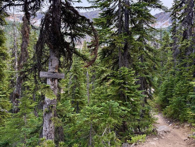
At mile 1.7, you'll take a left-hand turn to follow the trail downhill and out toward Cutthroat Lake. Make sure you take this turn. On our hike, we initially made the mistake of assuming the trail that lead to the water, adjacent to Cutthroat Pass, also provided a way to reach the lake. It technically does, but there's a difficult creek crossing by Cutthroat Lake and it becomes extremely muddy. Play it smart, take a left-hand turn at mile 1.7.Creek Crossings - Mile 1.72 & 1.93
Just beyond the trail junction sits a creek crossing that requires either getting your feet wet or crossing a downed tree to scoot across. Trekking poles really help with balance while crossing the creek, whether by following a downed tree or putting your feet directly in the water. Follow the trail back uphill and pass through sections of more mountain heather and evergreens before the trail makes one more creek crossing near mile 1.93. This last creek crossing follows a forestry footbridge made of a much-larger tree. Watch your step as this bridge is somewhat slanted and makes for another interesting creek crossing.Cutthroat Lake - Mile 2
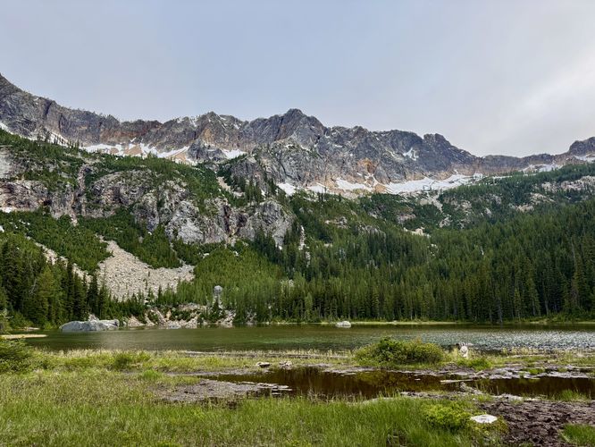
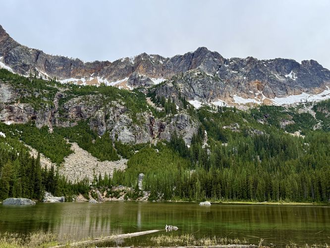
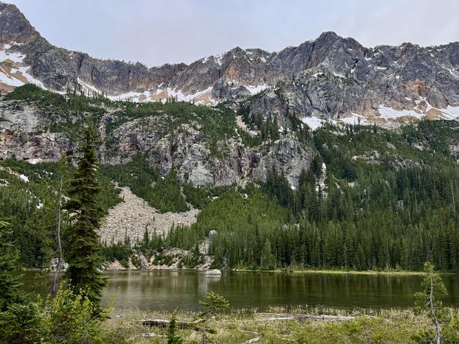
After crossing the last creek, you'll reach the northern side of Cutthroat Lake. From its northern shoreline, you'll find views of beautiful glassy, green-tinted water and a glacial cirque of alpine peaks overhead. During periods of snow melt, waterfalls over 1,500-feet in height plummet down the alpine slopes to reach the lake below. While these waterfalls are impressive in-person, they're a bit difficult to capture in a photo as many of them are fairly skinny in size. From the north shore, you can cruise around the adjacent evergreen-filled forest to find different views and perspectives, but between the forest's edge and the water is generally very muddy. On the western side of Cutthroat Lake's north shore is where the lake forms Cutthroat Creek and as such, creates a very wide and very muddy creek crossing that "connects" to the other section of trail.Hiking Out - Mile 2 to 4
After exploring the north shore of Cutthroat Lake and its surrounding alpine peaks, the hike back to the trailhead is straight forward. Take your time and carefully cross the two creek crossings, then take a right-hand turn at the Cutthroat Trail junction. Follow the Cutthroat Trail back to the trailhead for a relatively easy 4-mile out-and-back hike.Camping & Backpacking
Camping is permitted, but you must stay 1/4-mile from Cutthroat Lake when camping. Per signage rules, please find and use an existing campsite rather than disturbing natural habitats and practice the Leave No Trace principals.Parking & Fees
Hikers will find a medium-sized parking lot at the coordinates provided, located at the end of NF400, located just off of the North Cascades Highway. There are a couple of parking lots that can each fit about a dozen vehicles, or a bit more, as of June 2025. The forest road that leads to parking is mostly dirt and has a lot of deep potholes, so watch out. There's a day-use fee which can be paid online with information found at the trailhead, however, there's no cell service. If you have an Annual National Parks Pass, you can leave it on your dashboard instead of paying the day-use fee.Pets
Dogs are allowed only if leashed and must be cleaned up after.Warning
Creek crossings: It's important for hikers to note that to reach Cutthroat Lake, you'll have to cross a couple of creeks between the trail junction at mile 1.7 and the lake at mile 2. During June 2025, there was a downed tree at the first creek crossing which arguably wasn't very wide and made for a precarious balancing act. Trekking poles will help with stability when crossing downed trees. The 2nd creek crossing follows a much-wider fallen tree, but has a sloped angle and a more-dangerous fall into the outflow from the lake. You may need to cross these creeks without fallen trees as footbridges in case they're washed away at the time of your visit. Hike at your own risk.Cougars: This area is cougar territory and as such, you must be mindful of their potential presence. It's best to hike in a group of two or more and keep small children close at all times. Note that cougar attacks on humans is rare and even more-rare are fatal cougar attacks.