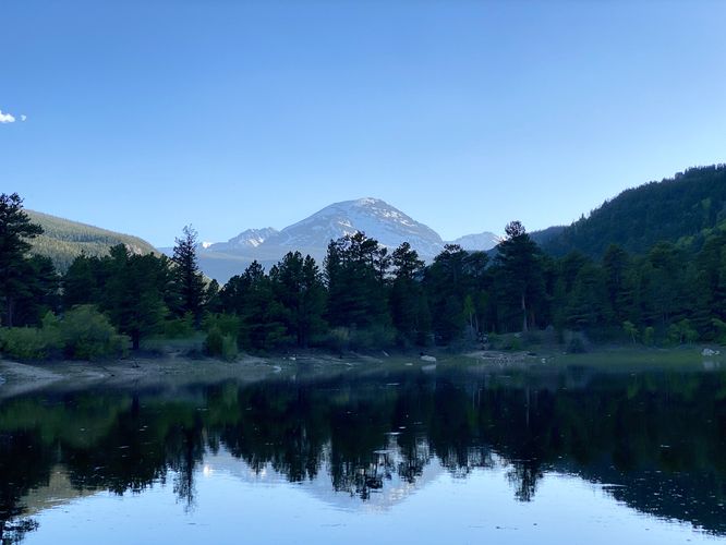
Copeland Lake at Rocky Mountain National Park
near Allenspark, Colorado is an easy 0.1-mile loop walk that features views of Copeland Lake, Saint Vrain Mountain, and Copeland Mountain.
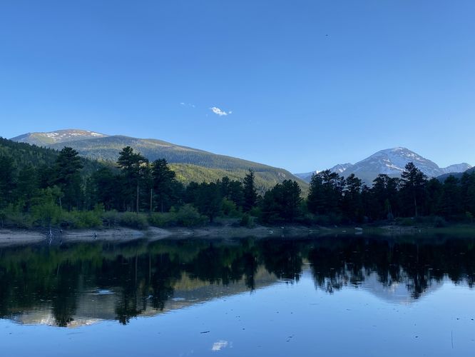
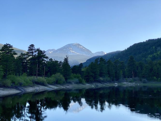
This is not a hike but rather a short off-trail walk that leads down to Copeland Lake's shoreline, passing through some brush, and along the shore to take in different views that the lake has to offer. Visitors may even want to skip walking around here but rather sit down and enjoy a sunset or sunrise along the lake -- or to look for wildlife in the early morning or evening. The views from Copeland Lake are that of the lake itself, Saint Vrain Mountain, and Copeland Mountain (usually snow-capped).
Due to this pathway's altitude, at 9,600-feet above sea level, it's a great place for visitors to take-in the natural beauty while also taking short walks to acclimatize.
Wildlife Viewing
This trail is great for viewing wildlife, especially deer, elk, and moose due to the open spaces for grazing and finding food in addition to the lake's water source for drinking. If you wish to spot wildlife, your best chances are in the early morning or in the early evening. Always keep a safe distance while viewing - approx. 75-feet for elk and longhorn sheep; 120-feet for bear and moose.
Pets
Dogs are not allowed here unless kept only at the parking lot.
Parking
Hikers will find a medium-sized parking turnout at the coordinates provided along County Highway 115. The turnout is large enough to fit just over a dozen vehicles as of June 2024.
Timed-Entry Reservations
Between the months of late May through early October you must purchase a timed-entry pass to visit Rocky Mountain National Park. If you wish to visitor and hike anything off of the Bear Lake Road, you must purchase a dedicated Bear Lake timed-entry pass. You can find more information about timed entry on the park's website.
Warnings
Elevation sickness: This trail brings hikers through terrain at 8,300-feet above sea level. Around the 7,000-foot mark above sea level, hikers may start to experience symptoms of elevation sickness including headache, muscle aches, shortness of breath, among other warning signs. In order to avoid elevation sickness it's recommended to ascend to higher elevations and take short walks to acclimate over the course of several days before taking a long or physically-demanding hike. At any time you feel elevation sickness kicking in, that's the time to turn back and head for lower altitude or the parking lot.