The Colchuck Lake hike at Okanogan-Wenatchee National Forest near Leavenworth, Washington is a difficult 8-mile out-and-back hike that leads to the turquoise waters of Colchuck Lake and breathtaking alpine views.
Parking & Fees
Hikers will find a massive parking lot at the coordinates provided, located at the very end of Eight Mile Road. The lot is large enough to fit many dozens of vehicles and the lot fills up quickly. There's also a day use fee that can be paid online (with information at the trailhead, no cell service!). To bypass the day use fee, simply leave your Annual National Parks Pass on the dashboard of your car.
Popularity: This is one of the most-popular hikes in the Leavenworth area and for good reason. Due to this, you should consider showing up early to ensure you can find a parking spot. When we hiked-in, there were less than 10 vehicles in the lot. When we arrived at parking after the hike, around 1PM, the lot was completely full (~100 cars?).
Swimming: The waters of Colchuck Lake are literally just above freezing temps. If you plan to take a dip here, be aware that jumping into freezing water can cause the body to inhale without much control. This natural response to the freezing water is how a lot of people end up drowning in very very cold bodies of water, when they simply wanted to cool down. If you plan to swim, swim at your own risk and know that you are over 10-miles from any real help.
Hike to Colchuck Lake
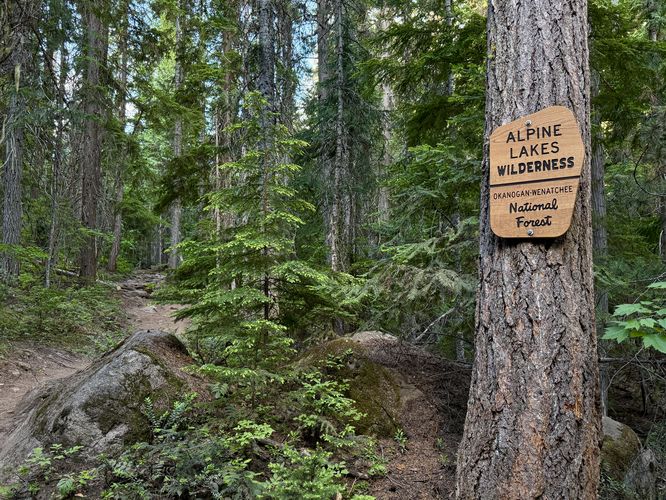
This hike begins at the very end of Eight Mile Road within Okanogan-Wenatchee National Forest at the coordinates provided and follows the Stuart Lake Trail (No. 1559) as it leads through the Alpine Lakes Wilderness.Trailhead to Mountaineer Creek Falls - Mile 0 to 1.55
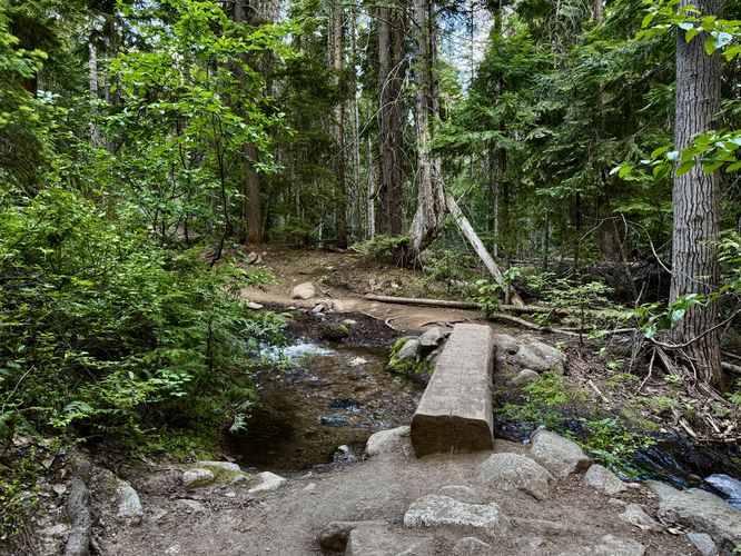
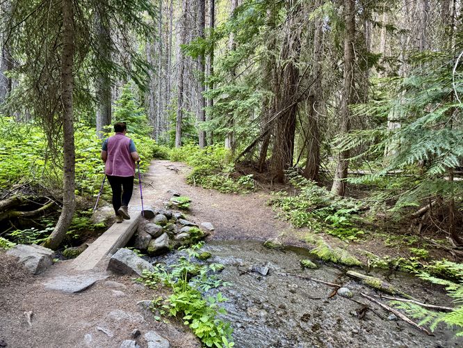
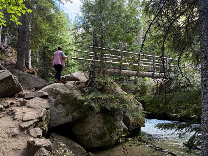
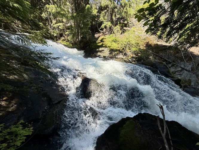
At the trailhead, hikers are required to self-register for a backcountry permit to hike through the Alpine Lakes Wilderness. Fill out the form, drop your card in the registration box, and you're good to go. The Stuart Lake Trail (No. 1559) leads southwest through this section of the wilderness and from miles 0 to 1.55, there isn't too much to see or explore outside of the trail. At mile 0.1, you'll officially enter the Alpine Lakes Wilderness and just beyond that is an easy creek crossing with a small footbridge. The trail will undulate slightly but it mostly leads along an easy-to-moderate grade as it heads toward a footbridge that spans Mountaineer Creek. At mile 1.23, you'll find another small footbridge that crosses a tiny creek. Around mile 1.53, however, you'll be just downstream of the large footbridge that crosses Mountaineer Creek. Here, you'll find Mountaineer Creek Falls as it cascades down the bedrock of the creek. The best views of the waterfall are just below the bridge (off-trail) and from the bridge facing upstream.Reaching the Colchuck Lake Trail - Mile 1.55 to 2.28
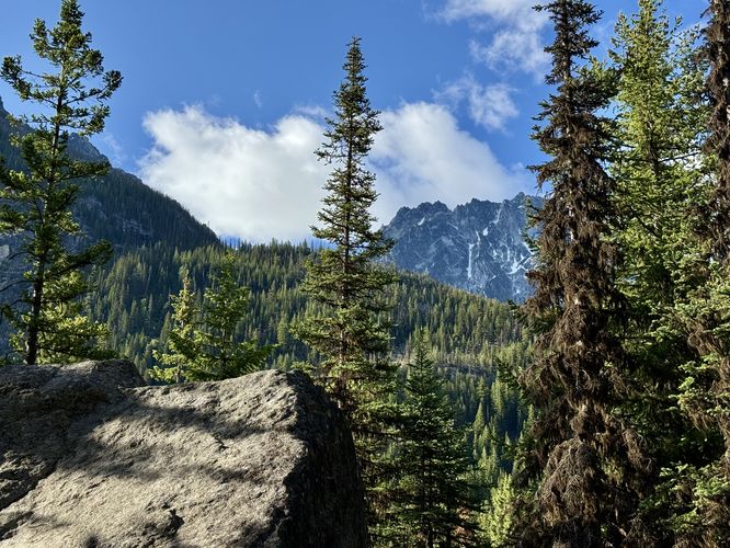
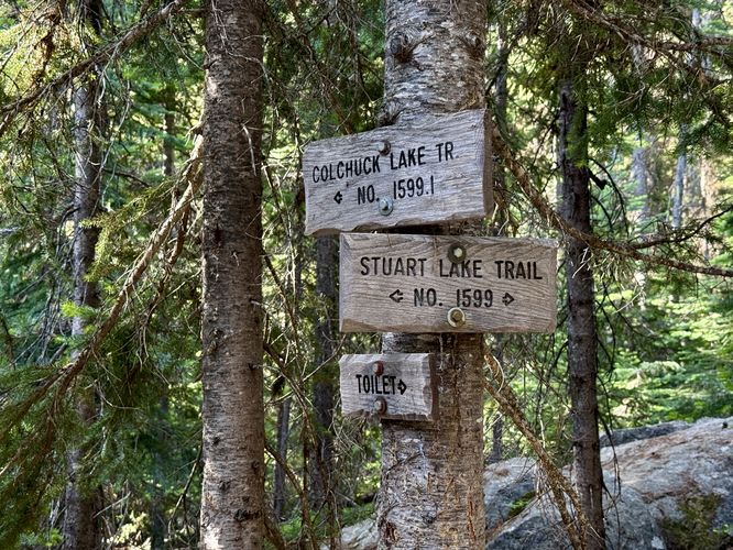
From the bridge crossing at Mountaineer Creek, the hike to reach the Colchuck Lake Trail becomes a bit more interesting and arguably harder. The trail begins to ascend the first difficult pitch of the route, but along the way are several exposed bedrock outcroppings where you'll find beautiful views of the alpine mountains that tower over the trail, including Dragontail Peak which sits above Colchuck Lake. Taking breaks along the way to enjoy the views makes this stretch of trail more enjoyable. At mile 2.28, be on the lookout for the trail junction with the Colchuck Lake Trail (No. 1559.1) and take a left-hand turn here.Creek Crossing & Boulder Field - Mile 2.35 to 2.4
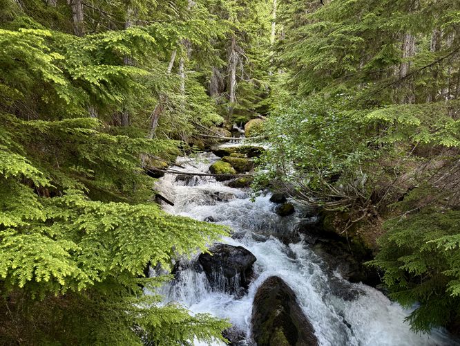
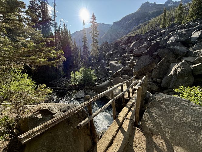
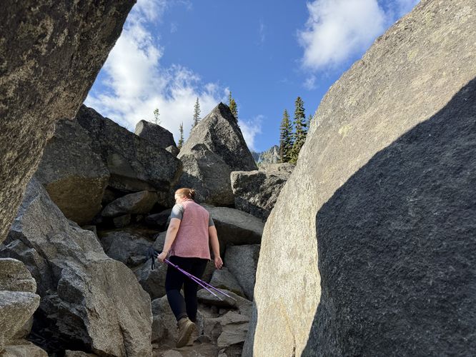
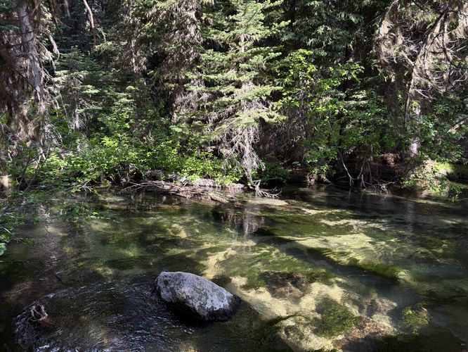
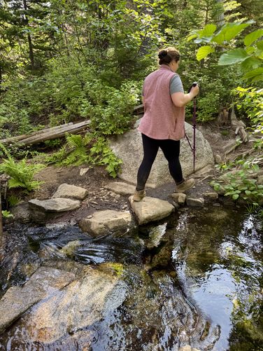
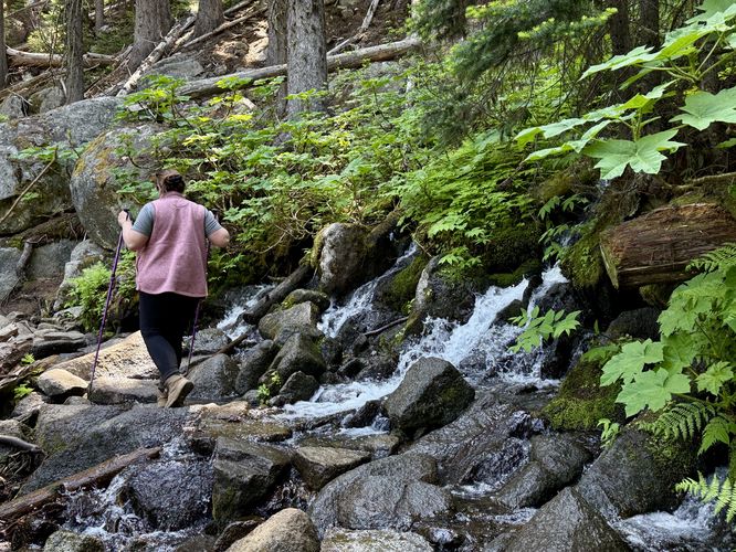
Once you hop on the Colchuck Lake Trail, it leads downhill slightly to reach yet another creek crossing over Mountaineer Creek. This crossing is significantly more challenging as the bridge is slightly tilted and it leads onto large boulders where you can (easily) accidentally fall between the cracks. Watch your step and take your time. On the opposite side of the bridge is a massive boulder field that fills in the mountainside. Here, you'll follow the trail as it winds through the boulders and runs adjacent to the creek. On the far side of the boulder field is a nice place where you can enjoy the crystal-clear waters of Mountaineer Creek and take a short break in the shade before you push it up the next difficult pitch.Cascades - Mile 2.6
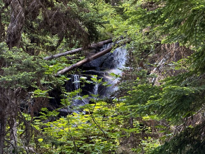
After passing the boulder field, the trail will begin to ascend once more, but this time it follows a moderate grade along switchbacks. At mile 2.6 is another creek crossing, but it's completely on-trail. There's also a small hillside waterfall that spills over the creek and makes for neat scenery. Watch your step to keep your feet dry. Just beyond this creek crossing is a view of the lower portion of Colchuck Creek Falls which can be seen from the trail through the vegetation. Follow the switchbacks further uphill to find another super shallow creek crossing around mile 3.Waterfall & Views - Mile 3.2 to 3.6
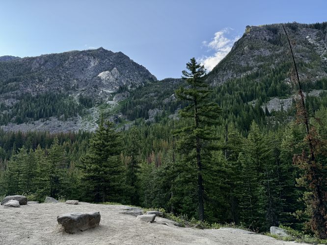
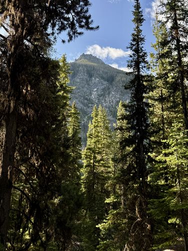
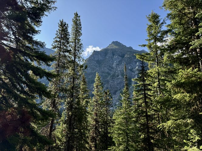
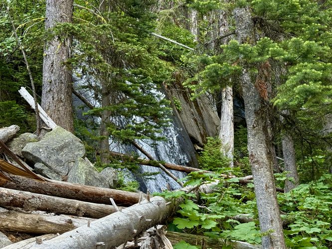
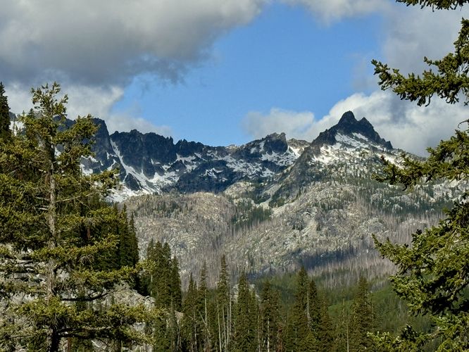
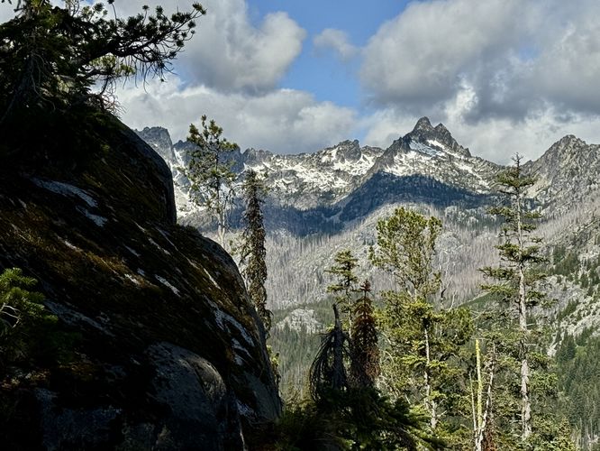
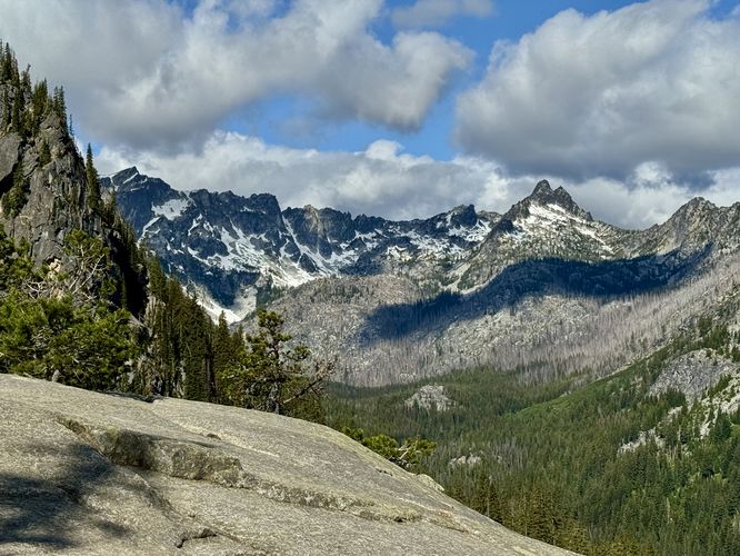
Just uphill from mile 3's shallow creek crossing is where you'll cross over into the 5,000-foot altitude of the Alpine Lakes Wilderness and you'll find a posted sign that states that no campfires are allowed beyond this point. Just after the sign is the scenic Upper Colchuck Creek Falls. This waterfall can be enjoyed from the trail or from just off-trail. While the entire waterfall may be obstructed, you can enjoy its flow around mile 3.25. After passing Upper Colchuck Creek Falls, the trail leads into more switchbacks and exposed bedrock outcroppings. Along the rocky outcroppings, you'll find westerly views that peer into the Mount Stuart and Stuart Lake area with Mount Stuart and Sherpa Peak towering over the valley with snow-capped slopes. These views crop up starting around mile 3.26 and last through mile 3.6.Last Climb to Colchuck Lake - Mile 3.6 to 4
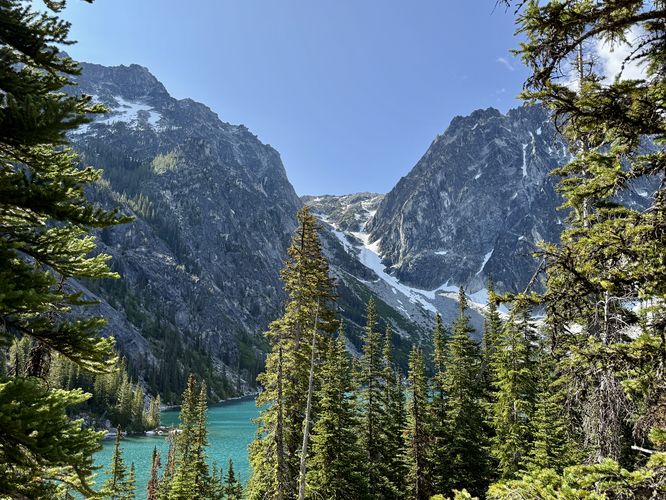
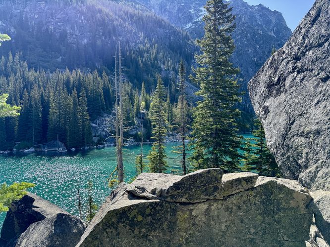
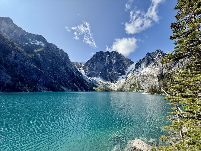
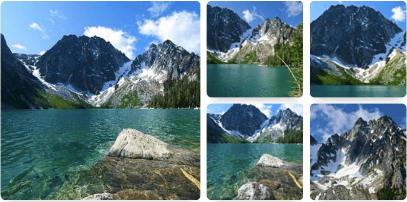
After passing the exposed bedrock views of Mount Stuart, the trail leads up one final difficult stretch of elevation to reach Colchuck Lake. Hike up the steep slopes, following short switchbacks, and pass more views of Mount Stuart (mile 3.75) as the trail climbs higher toward the turquoise waters of the lake. Around mile 3.85, you'll reach a junction near the lake. This route takes a right-hand turn to head up the last section of hill to reach the water. Along the way are some off-trail views of the lake which are not really worth poking at, but if you're excited to reach the water you may find them interesting. Hike just a bit further to find a "pit toilet" sign located on the right-hand side of the trail, which means you're very close. Take your next left-hand turn (after the pit toilet) to find a day use area at the edge of the lake. You'll find amazing views and plenty of space for sitting on the sloped bedrock along Colchuck Lake. From the water's edge, you'll find Dragontail Peak towering overhead with Colchuck Peak sitting to the side. In between these peaks sits the Colchuck Glacier, which is responsible for the stunning turquoise waters of Colchuck Lake. This glacier grinds and pummels rock into fine particles (rock flour) which flows downstream. When the rock flour enters the lake, it reflects turquoise-hued wavelengths of light back and thus creates the stunning colors in the water. Don't let the water's color fool you though, as it's literally snow and ice melt so the water is just above freezing temperatures. Sit back and enjoy the views of Colchuck Lake and its alpine peaks before heading out. Don't forget to eat a snack and take as many pictures as you like.Hiking Out - Mile 4 to 8
While the hike out is straight forward, you simply hike back the way you hiked-in, you'll find the same views and points-of-interest on your way out. If you missed any awesome spots to get a photograph of Mount Stuart, Sherpa Peak, Colchuck Creek Falls, or Mountaineer Creek Falls, now's your chance. Be mindful that if you hiked-up in the early morning, there will be many groups of hikers on their way up later in the day, so allow those folks to pass you on the trail. Finally, the hike wraps up at parking for 8-miles out-and-back.Parking & Fees
Hikers will find a massive parking lot at the coordinates provided, located at the very end of Eight Mile Road. The lot is large enough to fit many dozens of vehicles and the lot fills up quickly. There's also a day use fee that can be paid online (with information at the trailhead, no cell service!). To bypass the day use fee, simply leave your Annual National Parks Pass on the dashboard of your car. Pets
Dogs are not allowed on this hike.Backpacking & Camping
There are dispersed campsites along Colchuck Lake where backpackers and campers can setup shop for a night or two. Please follow all rules and regulations if camping and ensure you have the proper backpacking permits.Warning
Mosquitos: If you show up too early (like we did), then mosquitos will be feeding and they will haunt you down for the entire hike. We showed up early enough to be the 3rd day hikers at Colchuck Lake on this day, but the mosquitos did not let up and they pushed us up the trail as fast as we could hike. By the time 11AM rolled around, on our hike down, the mosquitos were gone but the people were crawling up to the lake by this point. Be smart, unlike us, and pack your bug spray.Popularity: This is one of the most-popular hikes in the Leavenworth area and for good reason. Due to this, you should consider showing up early to ensure you can find a parking spot. When we hiked-in, there were less than 10 vehicles in the lot. When we arrived at parking after the hike, around 1PM, the lot was completely full (~100 cars?).
Swimming: The waters of Colchuck Lake are literally just above freezing temps. If you plan to take a dip here, be aware that jumping into freezing water can cause the body to inhale without much control. This natural response to the freezing water is how a lot of people end up drowning in very very cold bodies of water, when they simply wanted to cool down. If you plan to swim, swim at your own risk and know that you are over 10-miles from any real help.