The Chimney Rocks Trail at Michaux State Forest in South Mountain, Pennsylvania is a moderate 5.4 out-and-back hike that leads out to the summit of Snowy Mountain and the vista point Chimney Rocks (aka Buzzard Peak).
The trail begins at the yellow gate along Biesecker Gap Rd (on google maps) / Snowy Mountain Tower Road (on opentopo maps) and follows the road until reaching the spur trail for Chimney Rocks/Buzzard Peak, 2.5 miles from the trailhead. Parking can be found just in front of the gate, but do not block it.
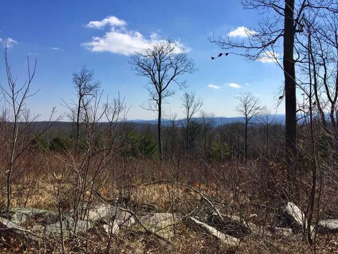
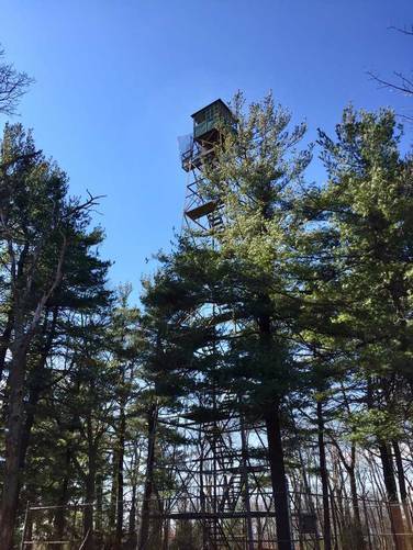
The trail slowly ascends the summit of Snowy Mountain, which is about a half-mile into the hike. The summit of Snowy Mountain does not have much other than a fire tower and some radio towers, but there are great views from the trail just below the summit.
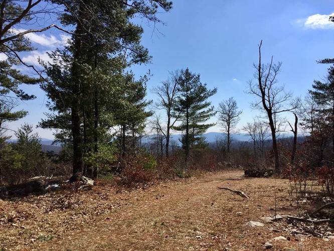
Continuing on from Snowy Mountain, the trail passes through mostly deciduous forests and some small patches of conifers. There are off-shoots along this trail, so just stay on the main road-like trail.
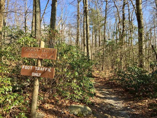
Eventually you'll reach a gas pipeline crossing - this your 2/3 marker for getting to Chimney Rocks. From here you'll hike uphill and then down a long slope before the trail finally reaches a trail junction with a wooden sign labeled 'Chimney Rocks Lookout'. Take this short blue-blazed spur trail all the way to Chimney Rocks, or Buzzard Peak. The Appalachian Trail also crosses this spur trail about half-way through, but there are signs for it so it should not be confusing.
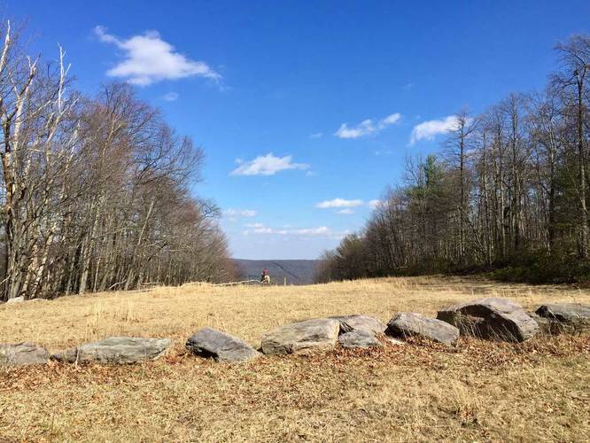
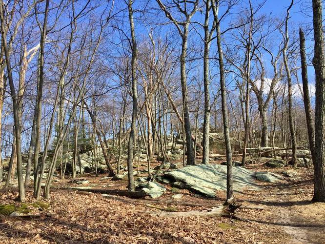
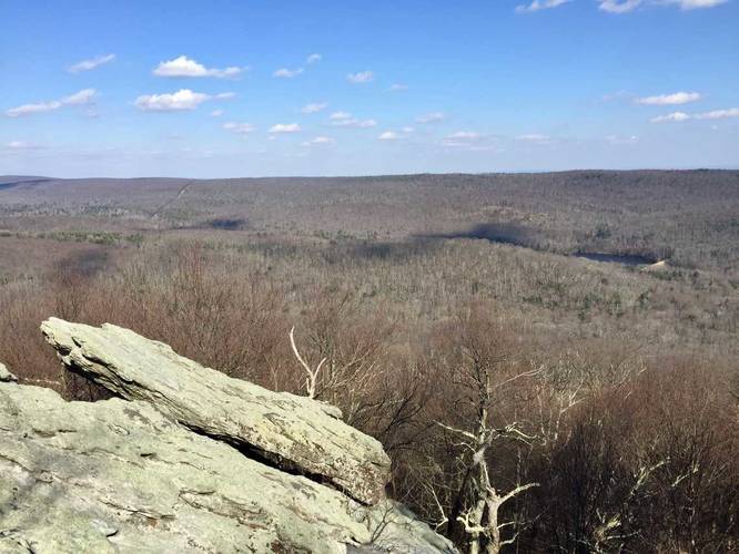
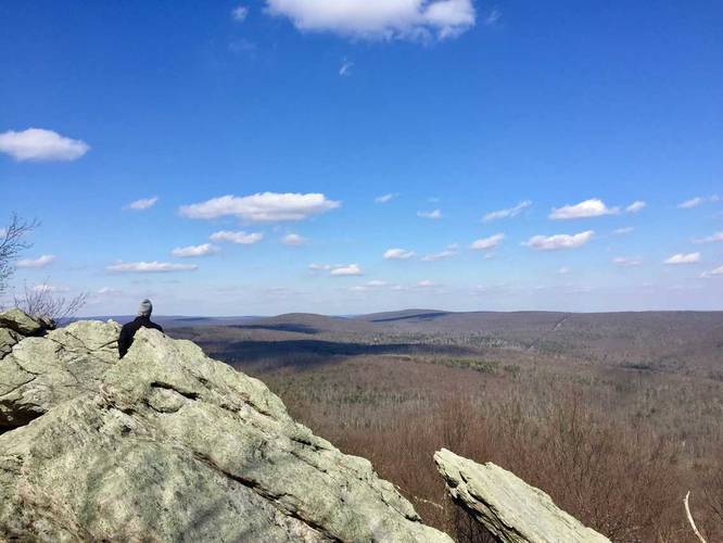
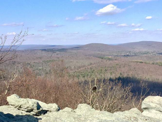
At Chimeny Rocks, you get views of the surrounding mountain sides of Michaux State Forest. The rock formation also has a massive cave in the middle, so watch your step while climbing the rocks.
The hike out is much more difficult as you'll have two main ascents before reaching Snowy Mountain again, but it's not too bad. Plan to bring plenty of water as there are no creeks or streams to filter water along this trail.
Road conditions: Please note that most of Michaux State Forest, including this trailhead, are on dirt roads. Most of Michaux's roads are well maintained, but there is little-to-no cell service so offline road maps are helpful here.
The trail begins at the yellow gate along Biesecker Gap Rd (on google maps) / Snowy Mountain Tower Road (on opentopo maps) and follows the road until reaching the spur trail for Chimney Rocks/Buzzard Peak, 2.5 miles from the trailhead. Parking can be found just in front of the gate, but do not block it.
The trail slowly ascends the summit of Snowy Mountain, which is about a half-mile into the hike. The summit of Snowy Mountain does not have much other than a fire tower and some radio towers, but there are great views from the trail just below the summit.
Continuing on from Snowy Mountain, the trail passes through mostly deciduous forests and some small patches of conifers. There are off-shoots along this trail, so just stay on the main road-like trail.
Eventually you'll reach a gas pipeline crossing - this your 2/3 marker for getting to Chimney Rocks. From here you'll hike uphill and then down a long slope before the trail finally reaches a trail junction with a wooden sign labeled 'Chimney Rocks Lookout'. Take this short blue-blazed spur trail all the way to Chimney Rocks, or Buzzard Peak. The Appalachian Trail also crosses this spur trail about half-way through, but there are signs for it so it should not be confusing.
At Chimeny Rocks, you get views of the surrounding mountain sides of Michaux State Forest. The rock formation also has a massive cave in the middle, so watch your step while climbing the rocks.
The hike out is much more difficult as you'll have two main ascents before reaching Snowy Mountain again, but it's not too bad. Plan to bring plenty of water as there are no creeks or streams to filter water along this trail.
Road conditions: Please note that most of Michaux State Forest, including this trailhead, are on dirt roads. Most of Michaux's roads are well maintained, but there is little-to-no cell service so offline road maps are helpful here.