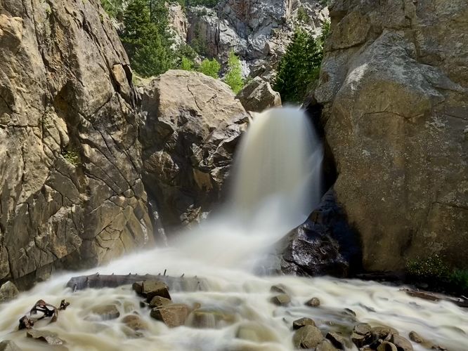
Boulder Falls Trail in Boulder County, Colorado is a moderate 0.2-mile out-and-back hike that leads to a ~40-foot tall waterfall nestled within the North Boulder Creek gorge, Boulder Falls.
Hike
This very short hike begins along the north side of Boulder Canyon Drive / CO-119. The trailhead is located just west of the trail's information kiosk. Hikers will have to carefully cross the highway to reach the trailhead along this somewhat dangerous curve in the road. Once on the trail, it heads downhill along a series of stone steps into the North Boulder Creek gorge. It then quickly begins to ascent out of the gorge and back uphill toward a dirt path that leads to a viewing point of Boulder Falls. Hikers can continue down the path just a bit further if they wish (beyond this route); however, the trail ends at the creek's edge. Boulder Falls plunges over in a free-falling cascade into the North Boulder Creek with a loud roar, which tends to deafen and drown out the noise from the plethora of nearby hikers.
After exploring the scenic Boulder Falls, the hike back to parking follows the same route you hiked-in on for a quick 0.2-mile out-and-back jaunt.
Parking
You'll find a large parking turnout at the coordinates provided, located along Boulder Canyon Drive. The turnout is large enough to fit over a dozen vehicles as of June 2024.
Popularity
This is a very popular day hike and especially busy on weekends. Plan on a full parking lot by 11AM on weekends at the very least.
Pets
Dogs are allowed on this trail only if leashed.
Warning
Rushing water: Due to previous deaths on this trail, you must stay on-trail at all times and never wade, swim, or enter the water.