The Blue Lake Trail at Okanogan-Wenatchee National Forest near Winthrop, Washington is a moderate 4.7-mile out-and-back hike that leads to the vibrant turquoise-blue waters of Blue Lake and features stunning alpine views of the North Cascades.
Cougars: This area is cougar territory and as such, you must be mindful of their potential presence. It's best to hike in a group of two or more and keep small children close at all times. Note that cougar attacks on humans is rare and even more-rare are fatal cougar attacks.
Hike to Blue Lake
This hike begins at the main trailhead for the Blue Lake Trail and the Washington Pass climbing routes (Liberty Bell, etc.) where hikers will find a trail kiosk and information about both the lake and climbing routes. Once you hop on the trail, it begins ascending the mountain, following switchbacks, to reach the sub-alpine ecosystem, but along the way the trail includes scenic points-of-interest worth enjoying on the way up.Alpine Views - Mile 0.95
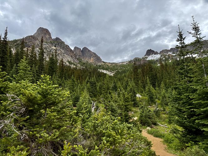
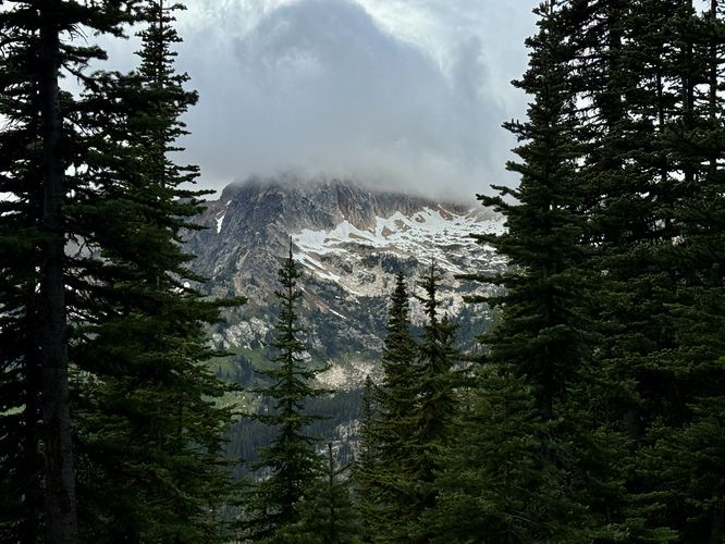
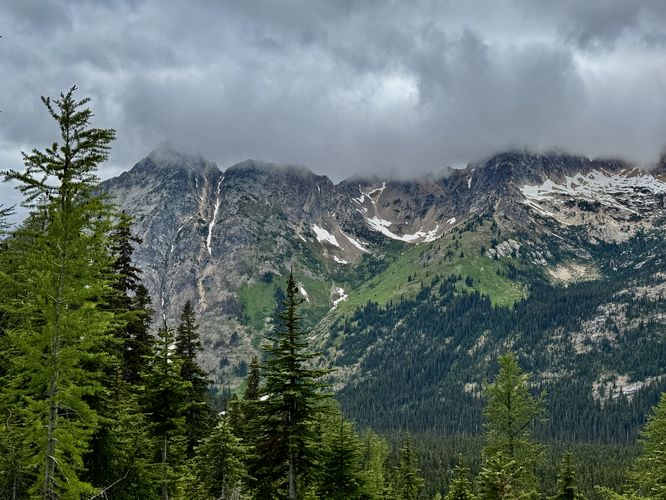
After the trail ascends approximately 300-feet, along the second switchback, the forest opens up to views to the north and south. To the south, facing uphill, will be views of the Liberty Bell and other peaks and spires that comprise the Washington Pass climbing routes. To the north sits a view of Whistler Peak and its steep slopes along with the wider but prominent Cutthroat Peak. This is a great place to take a short break to take-in the views or push on.Small Cascades / Water Source - Mile 1
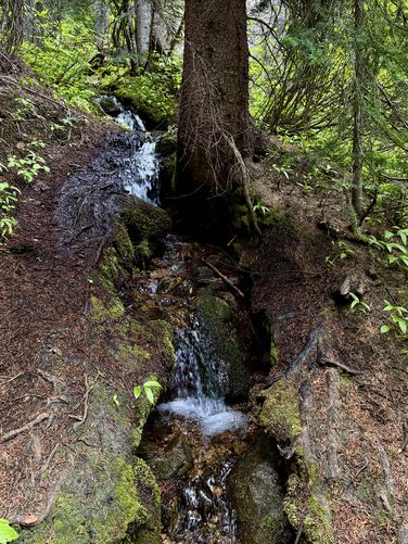
Just beyond the views of the second switchback, the trail dips back the dense forest where you'll find a stream that tumbles down the mountainside with very-small cascades. While the waterfalls aren't all that noteworthy, it's a great spot to filter water if you're in desperate need.Alpine Window View - mile 1.35
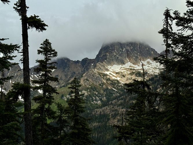
At the third switchback, the trail features a view of Cutthroat Peak as it stands between the dark boughs of the evergreen forest. This small window of a view isn't panoramic or sweeping, but it's another great spot along the trail to enjoy views.More Alpine Views - Mile 1.8 to 2.25
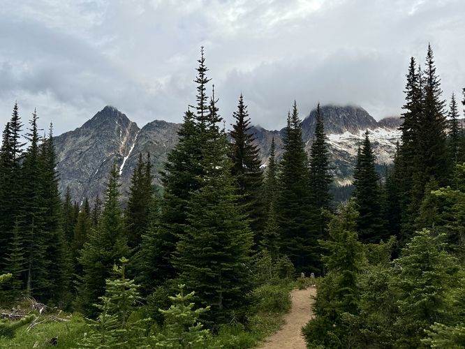
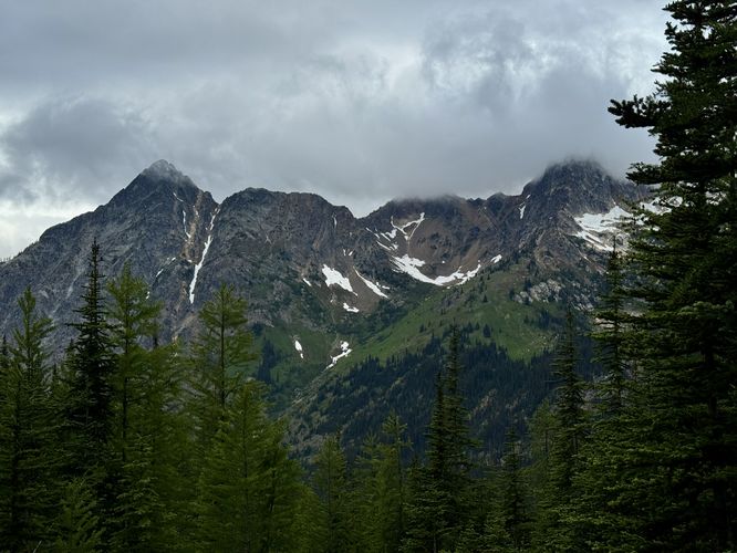
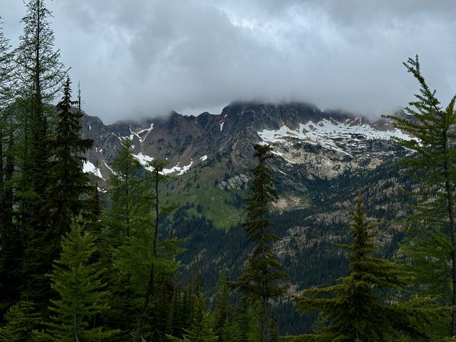
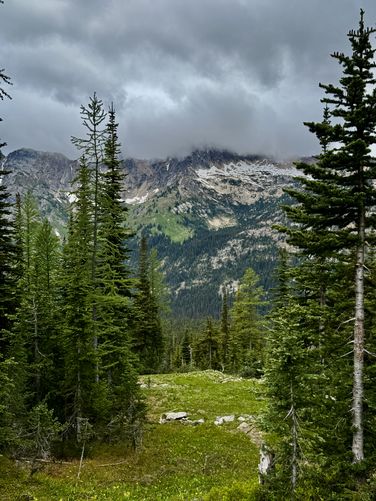
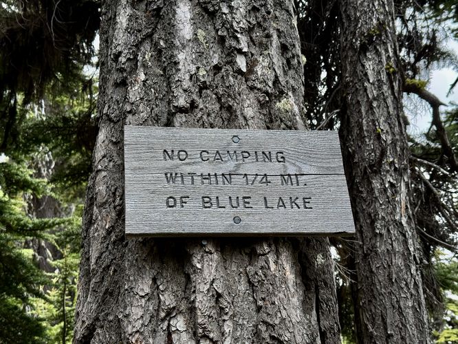
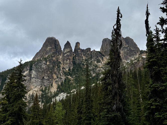
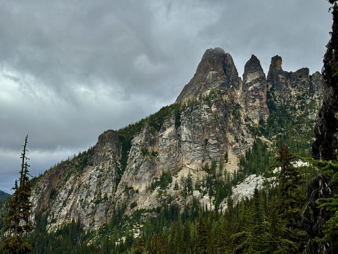
From mile 1.35, the trail leads through the dense forest as it climbs the steepest section of the mountain before it leads into more alpine views around mile 1.8. From mile 1.8 until mile 2.25, the trail features breathtaking views of the alpine slopes of Whistler Peak and Cutthroat Peak to the north. Below these alpine peaks are snowfields and rolling meadows that lead into more dark, dense evergreen forests. At mile 2.08, you'll find a sign on-trail that reminds backpackers and campers that you cannot setup camp within 1/4-mile of Blue Lake. This sign is essentially the boundary line. A bit further up trail sits views that peer back eastward with views of the alpine climbing peaks of Washington Pass like the Liberty Bell, Concord Tower, Lexington Tower, and the Winter Spires.Blue Lake - Mile 2.35
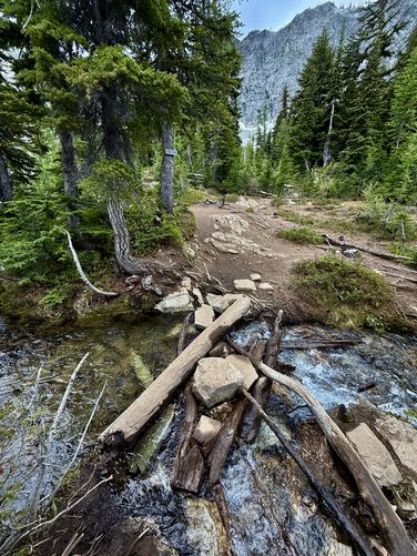
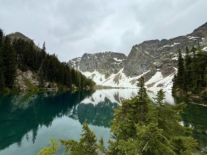
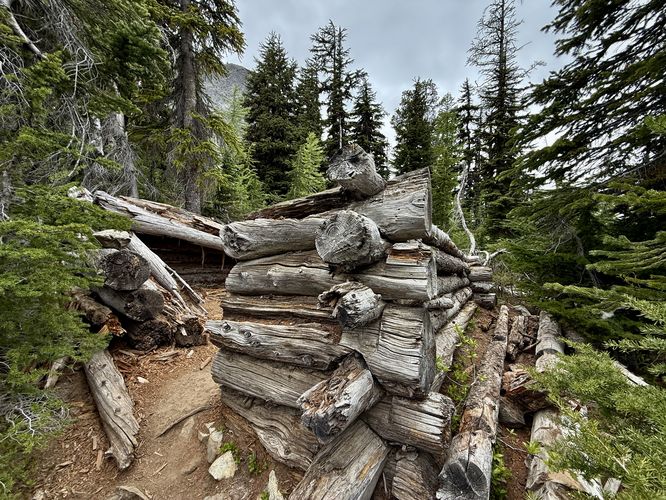
Just before Blue Lake is a short and relatively-easy creek crossing that spans a few large stones. On the other side is your entrance to Blue Lake and views of its vibrant turquoise-blue waters. Follow the trail as it runs alongside the northern outflow of the water to reach a bedrock outcropping viewpoint at mile 2.35 that sits above Blue Lake. Here, you'll find crystal-clear water below your feet. The lake's vibrant turquoise-blue tint is one of a kind, hence its name. Towering overhead are alpine mountain ridges that provide a stunning backdrop and can be found reflecting in the water. Stick around a while, snap photos, or have a snack before heading out. Another unique point-of-interest before hiking out is the cabin remnants near the creek crossing where you can walk inside of what was once a small shelter that sat near the edge of Blue Lake.Hiking Out - Mile 2.35 to 4.7
The hike out from Blue Lake is super straight forward, simply follow the trail downhill and back to the trailhead. Along the way, you'll find the same views of Whistler Peak, Cutthroat Peak, the Liberty Bell, and Washington Pass spires. The views of the alpine North Cascade mountains are some of the best in the area without having to put in a ton of effort to reach them. Follow the switchbacks down and finally reach the trailhead at mile 4.7 to complete the hike.Restrooms
There are pit toilets at the trailhead.Parking, Fees, & Popularity
Hikers will find a large parking lot at the coordinates provided, located on the south side of the North Cascades Highway. The lot is large enough to fit a few dozen vehicles as of June 2025. There's a day-use fee which can be paid online with information found at the trailhead, however, there's no cell service. If you have an Annual National Parks Pass, you can leave it on your dashboard instead of paying the day-use fee. Last, this is one of the most-popular day hikes in the North Cascades and as such, you may need to park along the North Cascades Highway if the parking lot is full.Pets
Dogs are allowed only if leashed and must be cleaned up after.Warning
Steep terrain: The mountain slopes that surround the trail are very steep. If you stay on-trail at all times, you'll be totally fine.Cougars: This area is cougar territory and as such, you must be mindful of their potential presence. It's best to hike in a group of two or more and keep small children close at all times. Note that cougar attacks on humans is rare and even more-rare are fatal cougar attacks.