Black Run Falls at State Game Lands 268 near Morris, Pennsylvania is a moderate 0.9-mile out-and-back off-trail bushwhack hike that
leads up Black Run creek to the 100-foot long and 30-foot tall
waterfall (with a 15-foot main cascade) named Black Run
Falls, which spills down a scenic rocky gorge.
Hike Description
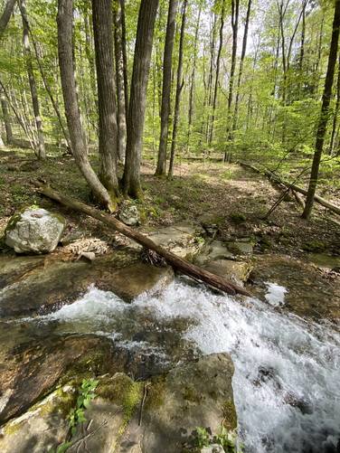
This hike begins along Lower Stony Fork Road within State Game Lands 268 (SGL 268). Hikers should stay on the left-hand side of Black Run creek when they first head into the woods to hike upstream. About 0.1-miles into the hike, hikers will reach a creek crossing where numbers have been painted on trees on the opposite side of the creek. Here, you'll want to cross the creek to avoid the steep terrain. The creek bottom here is mostly large flat bedrock and there's a small 2-foot waterfall located adjacent, so watch your footing.
Old Foundation or Rock Wall
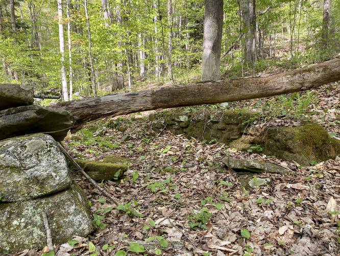
Just after the first creek crossing is, what appears to be a very small old abandoned rock wall or foundation. From what I saw, it looked like a three-sided foundation, but it was hard to tell exactly what this abandoned stone structure was once used for.
More Creek Crossings
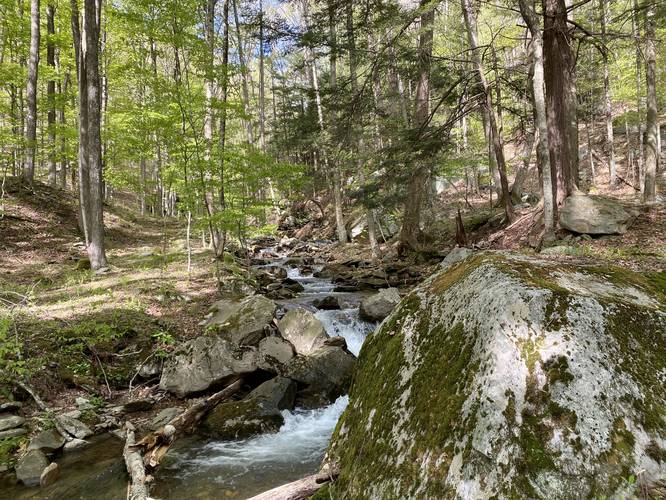
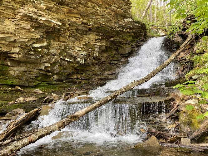
Shortly after the first creek crossing, hikers will reach a large series of boulders located next to Black Run. Here, cross the creek again to avoid more impassible terrain. Note that this is where the trail enters the rocky ledge gorge area. Just like clockwork, about 0.1-miles after the 2nd creek crossing is a 3rd crossing. This 3rd crossing is located below a two-tiered 6-foot tall waterfall. The easiest way to get around this one is to hike up the steep hillside to the right-hand side of it.
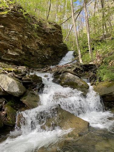
Reaching Black Run Falls
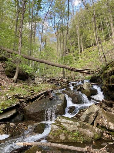
Just after passing the 6-foot tall cascade by hiking the steep hillside, hikers will get their first glimpse of Black Run Falls cascading down the creek upstream. Around mile 0.3, hikers will reach the base of the waterfall, which includes a handful of 5-foot waterfalls that spill down the creek, with the largest 15-foot cascade sitting in the back. Hikers will want to make their way upstream by hiking in the boulder field located next to the creek. This boulder field is created by large chunks of rocky ledge that fall over time, creating an uneven and difficult-to-hike terrain that leads up to the main cascade. The waterfalls height is different based on where you observe it. The entire waterfall of Black Run Falls is about 30-feet tall and approximately 100-feet long, or maybe a little shorter. The main attraction is the top-most cascade, which is approximately 15-feet tall as it tumbles down the rocky hillside before spilling off a slate ledge. Downstream are several 3, 4, and 6 foot tall waterfalls within the creek that make up the entire waterfall's 30-foot height.
Exploring more Waterfalls Upstream
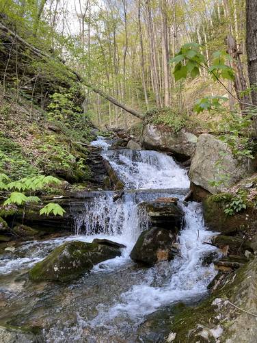
After visiting Black Run Falls, hikers may notice that there's a small path that leads up to the right-hand side of the waterfall where more waterfalls can be found. Most of these waterfalls upstream are anywhere between 2 and 6-feet tall. Some are free-falling, others spill over boulders, one waterfall ran over a red-colored rock... there's a lot of beauty in the cascades upstream from Black Run Falls; however, the main attraction is Black Run Falls.
After visiting Black Run Falls and possibly the smaller cascades upstream, hikers will find the hike out is identical to the hike in as an out-and-back. Follow Black Run creek and cross it where appropriate.
Warnings
Hunting: This hike sits within the State Game Lands, which allows hunting. Wear orange, make your presence known, and check hunting schedules before committing to this hike.
Wet Feet: Plan to get your feet wet, bring waders, waterproof boots, or all of the above as this hike is an off-trail bushwhack that follows a creek.
Rattlesnakes: Between May and early October, the Timber Rattlesnake may be found in the rocky terrain hunting or cooling down. Watch your steps and give any rattlers you find enough space.
Parking
Hikers will find a small parking turnout at the coordinates provided. It's large enough to fit a couple of vehicles.
Pets
Dogs are allowed if leashed; however, because of the terrain I would leave my dog at home (as I did on this hike) to avoid annoyances or complications while trying to safely cross the creek.
Difficulty
Due to the rocky uneven terrain, slippery rocks, creek crossings, and steep slopes, this hike should be considered moderate. The elevation gain is fairly low until you reach Black Run Falls, so the difficulty is mostly the terrain. Trekking poles will help on this hike.
Winter Maintenance
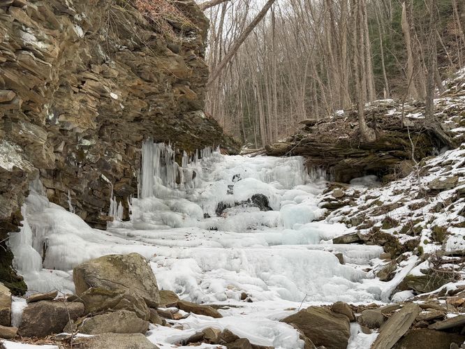
This road is not maintained during the winter, so this hike is seasonal between April and the end of November.
Hike Description
This hike begins along Lower Stony Fork Road within State Game Lands 268 (SGL 268). Hikers should stay on the left-hand side of Black Run creek when they first head into the woods to hike upstream. About 0.1-miles into the hike, hikers will reach a creek crossing where numbers have been painted on trees on the opposite side of the creek. Here, you'll want to cross the creek to avoid the steep terrain. The creek bottom here is mostly large flat bedrock and there's a small 2-foot waterfall located adjacent, so watch your footing.
Old Foundation or Rock Wall
Just after the first creek crossing is, what appears to be a very small old abandoned rock wall or foundation. From what I saw, it looked like a three-sided foundation, but it was hard to tell exactly what this abandoned stone structure was once used for.
More Creek Crossings
Shortly after the first creek crossing, hikers will reach a large series of boulders located next to Black Run. Here, cross the creek again to avoid more impassible terrain. Note that this is where the trail enters the rocky ledge gorge area. Just like clockwork, about 0.1-miles after the 2nd creek crossing is a 3rd crossing. This 3rd crossing is located below a two-tiered 6-foot tall waterfall. The easiest way to get around this one is to hike up the steep hillside to the right-hand side of it.
Reaching Black Run Falls
Just after passing the 6-foot tall cascade by hiking the steep hillside, hikers will get their first glimpse of Black Run Falls cascading down the creek upstream. Around mile 0.3, hikers will reach the base of the waterfall, which includes a handful of 5-foot waterfalls that spill down the creek, with the largest 15-foot cascade sitting in the back. Hikers will want to make their way upstream by hiking in the boulder field located next to the creek. This boulder field is created by large chunks of rocky ledge that fall over time, creating an uneven and difficult-to-hike terrain that leads up to the main cascade. The waterfalls height is different based on where you observe it. The entire waterfall of Black Run Falls is about 30-feet tall and approximately 100-feet long, or maybe a little shorter. The main attraction is the top-most cascade, which is approximately 15-feet tall as it tumbles down the rocky hillside before spilling off a slate ledge. Downstream are several 3, 4, and 6 foot tall waterfalls within the creek that make up the entire waterfall's 30-foot height.
Exploring more Waterfalls Upstream
After visiting Black Run Falls, hikers may notice that there's a small path that leads up to the right-hand side of the waterfall where more waterfalls can be found. Most of these waterfalls upstream are anywhere between 2 and 6-feet tall. Some are free-falling, others spill over boulders, one waterfall ran over a red-colored rock... there's a lot of beauty in the cascades upstream from Black Run Falls; however, the main attraction is Black Run Falls.
After visiting Black Run Falls and possibly the smaller cascades upstream, hikers will find the hike out is identical to the hike in as an out-and-back. Follow Black Run creek and cross it where appropriate.
Warnings
Hunting: This hike sits within the State Game Lands, which allows hunting. Wear orange, make your presence known, and check hunting schedules before committing to this hike.
Wet Feet: Plan to get your feet wet, bring waders, waterproof boots, or all of the above as this hike is an off-trail bushwhack that follows a creek.
Rattlesnakes: Between May and early October, the Timber Rattlesnake may be found in the rocky terrain hunting or cooling down. Watch your steps and give any rattlers you find enough space.
Parking
Hikers will find a small parking turnout at the coordinates provided. It's large enough to fit a couple of vehicles.
Pets
Dogs are allowed if leashed; however, because of the terrain I would leave my dog at home (as I did on this hike) to avoid annoyances or complications while trying to safely cross the creek.
Difficulty
Due to the rocky uneven terrain, slippery rocks, creek crossings, and steep slopes, this hike should be considered moderate. The elevation gain is fairly low until you reach Black Run Falls, so the difficulty is mostly the terrain. Trekking poles will help on this hike.
Winter Maintenance
This road is not maintained during the winter, so this hike is seasonal between April and the end of November.