The Birdsboro Climbing Quarry & Reservoir hike in Birdsboro, Pennsylvania is an easy 3.1-mile out-and-back hike that leads to rock climbing walls within the old quarry, views of the quarry lake and the scenic Birdsboro Reservoir, and features an engaging creek crossing with a steel cable tightrope.
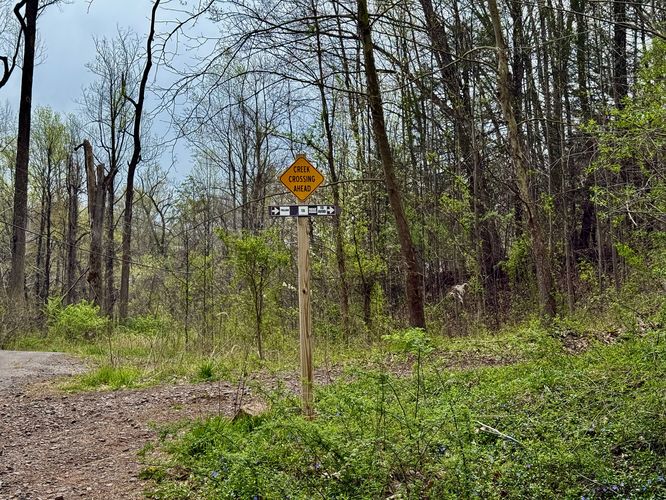
Steel cable creek crossing: This route includes a steel cable creek crossing that requires some extra strength to cross. There is an optional bypass route. Please read the trail guide for more details.
Hiking to the Climbing Quarry
This hike begins at the Hay Creek pedestrian bridge, located on the south side of the very large access parking lot. The trail starts off by crossing Hay Creek with scenic views of the water as it tumbles below your feet.Creek Crossing Bypass Route - Mile 0.1
If you do not wish to cross Hay Creek by balancing on a steel cable tightrope system (with a steel cable to hold onto), then at mile 0.1, you should take a right-hand turn to follow the creek crossing bypass route. Note that the rest of this guide does not follow that route, however.Hiking along Hay Creek - Mile 0 to 0.6
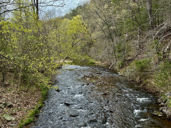
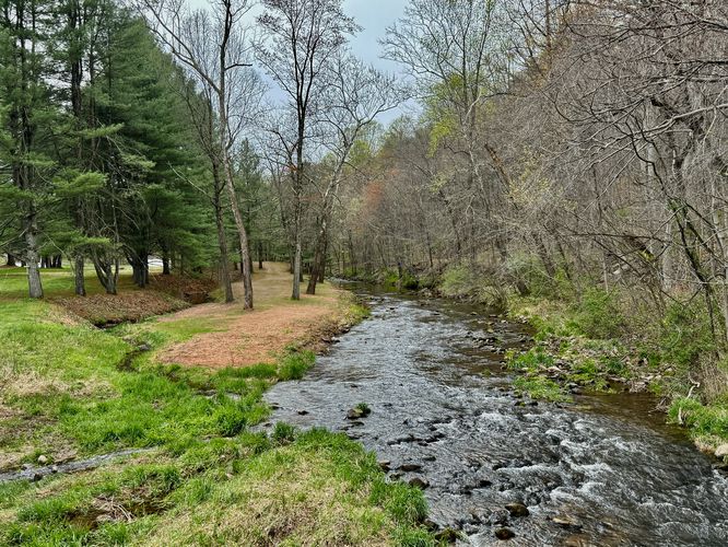
From the trailhead until mile 0.6, you'll be walking alongside Hay Creek as it winds in and out from the old paved service road-turned-trail. Along the way are several views of the creek and during the Spring, you'll likely find tons of fishermen trying their hand at catching the freshly-stocked waters.Hay Creek Steel Cable Crossing - Mile 0.6
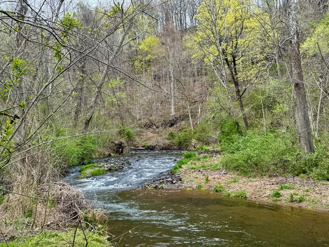
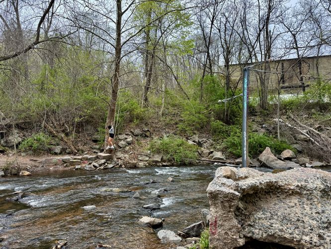
As promised, a fun and engaging creek crossing will present itself to hikers around mile 0.6. Here, you'll find two very strong steel cables that are affixed to steel posts which are used for crossing. The creek is approximately 30-feet wide here, so crossing via the cable system can be a bit slow. Take your time and watch your step. There are some large rocks in the creek below, so you do not want to accidentally fall on them. Cross at your own risk!Birdsboro Climbing Quarry - Mile 0.7 to 0.85
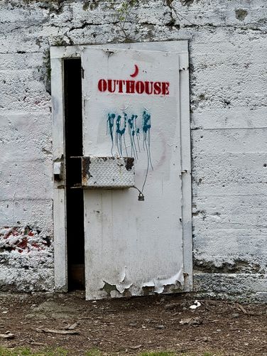
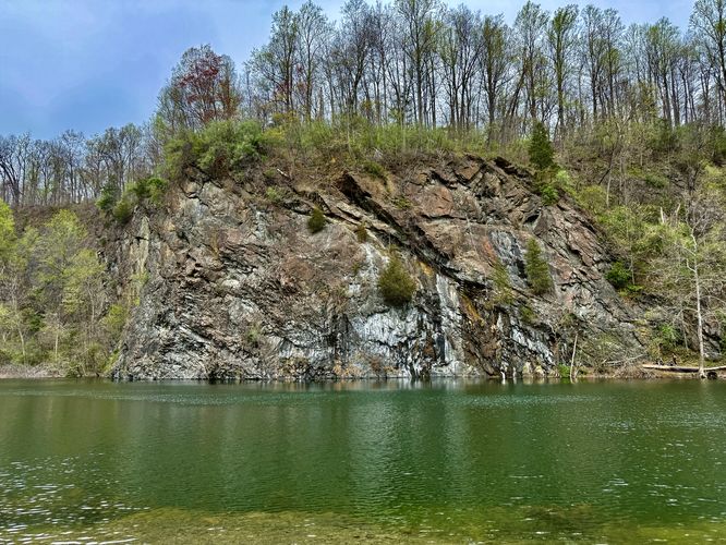
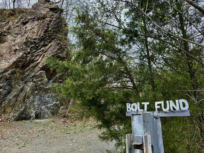
After crossing Hay Creek, to reach the climbing quarry, you'll want to keep right at the two trail junctions ahead. The trail will pass a sketchy-looking outhouse / restroom (likely used primarily by climbers), before it reaches the first trail that leads to the quarry climbing walls. You'll find a climbing quarry info kiosk and a metal post donation station labeled "Bolt Fund". If you have a few extra US dollars in your pocket, consider keeping the "climbing" in "Birdsboro Climbing Quarry" by donating to help them build new routes or repair old ones. If you follow the trail down to the quarry's waters, you'll find awesome views of the quarry's rock walls, potentially some climbers hanging out or on the walls, and beautiful views of the water.Hiking to the Birdsboro Reservoir - Mile 0.85 to 1.8
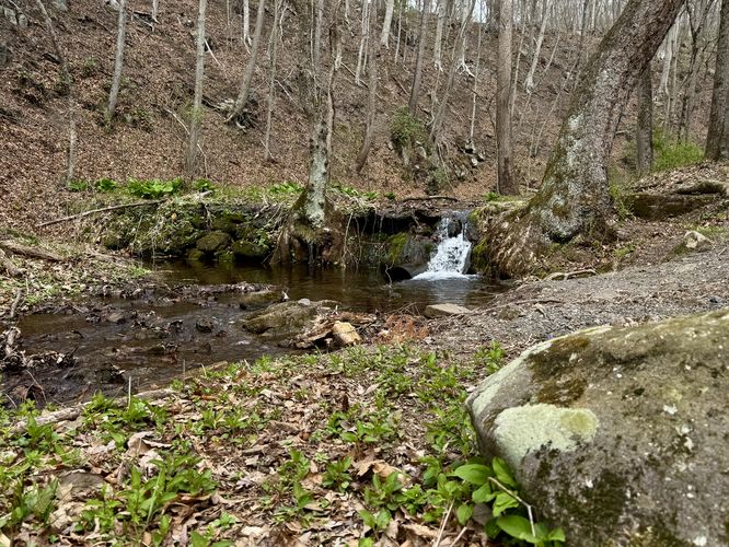
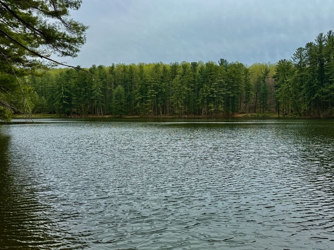
After exploring the climbing quarry, you'll want to check out the Birdsboro Reservoir next. To reach the reservoir, follow the trail as if you were to cross Hay Creek at the steel cable system. Instead of hiking to the creek crossing, continue following the trail south as it heads closer to the new quarry, located to the east. Eventually, you'll find another view of Hay Creek as the trail passes an open area with tall pine trees. Wait until the trail heads downhill and look for blue blazes. At mile 1.4, take a left-hand turn to head toward the reservoir. The trail will lead uphill through the forest, passing very small waterfalls along the way. Eventually, the trail reaches the western edge of the reservoir where this route turns around. At the reservoir, you'll find beautiful views of the water with its waters lined with tall evergreens. The scenery at the Birdsboro Reservoir is far superior to the climbing quarry as it feels like a backcountry lake in the middle of nowhere, but in fact is just down the street from a very-busy area of southeast Pennsylvania. Once done exploring the reservoir, the hike heads back to parking.Hiking Out - Mile 1.8 to 3.1
The hike out follows the main route that you hiked in on. On the way back you have two options once again - either cross Hay Creek with the steel cable system or hike up the nearby hill via the bypass route. Choose your poison. We chose to take the cable system at the creek crossing to save time and energy. The hike ends at the parking lot around mile 3.1.Parking
Hikers will find a massive parking lot at the coordinates provided. The parking lot can fit many dozens of vehicles as of April 2025.Pets
Dogs are allowed if leashed and must be cleaned up after.Biking
Biking is permitted along this trail.Warning
Poison ivy: There are certainly spot of poison ivy along this trail. Know what it looks like, be on the lookout, and watch your step if heading off-trail for any reason.Steel cable creek crossing: This route includes a steel cable creek crossing that requires some extra strength to cross. There is an optional bypass route. Please read the trail guide for more details.