The Big Blue Hole Hike at the Hammersley Wild Area within Susquehannock State Forest is a difficult 10-mile one-way hike that leads through the most remote area of Pennsylvania and features a ~6-foot deep backcountry swimming hole, nicknamed the Big Blue Hole, which is the main attraction for this hike.
Trails
This hike follows several named trails in order: Bunnell Ridge Trail - easy to follow, Susquehanna Trail System / aka STS (orange blazes) - easy to follow, Cow Run Trail (90% bushwhack with basically no blazes) - difficult to follow, Hammersley Fork Trail (very few yellow blazes near the Cow Run Trail) - moderately difficult to follow.
Trail Description
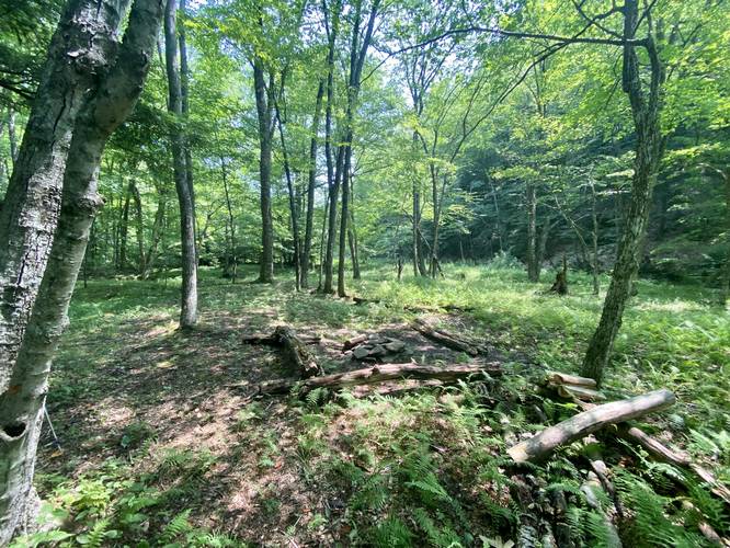
This hike begins along McConnell Road in the Hammersley Wild Area at the Bunnell Ridge Trailhead. The Bunnell Ridge trail is 50% service road for private gas well access and 50% well-beaten wilderness trail that leads downhill to Hammersley Fork creek and the STS. The trail follows yellow blazes, which were once blazed red, downhill for almost the entire way until you reach the STS. During early July, hikers will likely find hundreds of thousands of wildflowers perched atop wild leeks or wild onions on the hillside along the Bunnell Ridge Trail, located east of the gas well.
STS to the Big Blue Hole (The Pool)
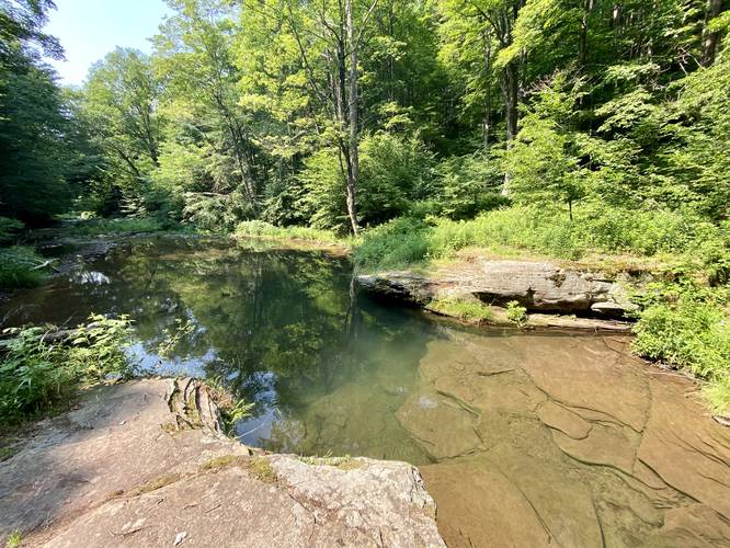
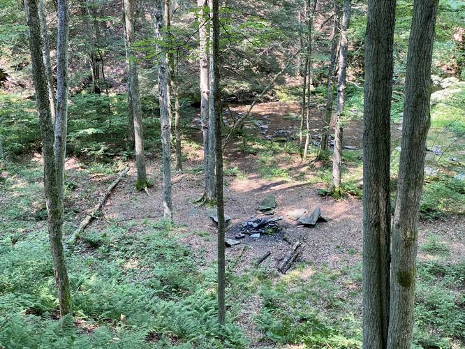
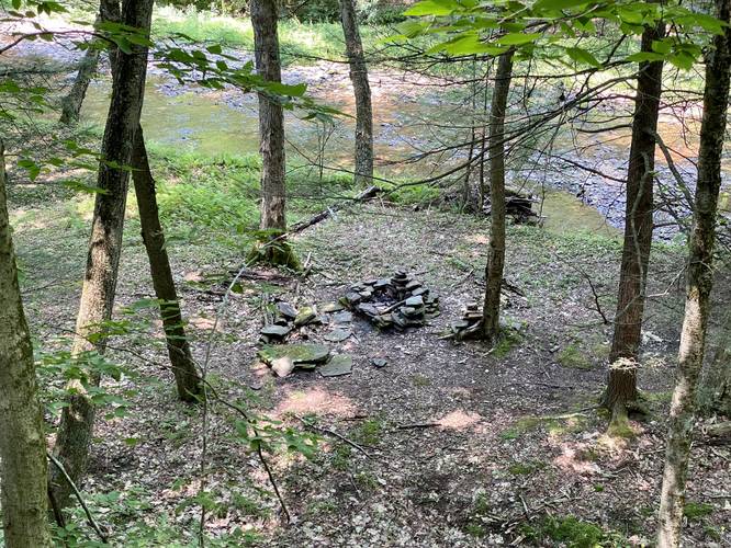
Hikers will need to be on the lookout for the orange blazes of the STS when they reach the bottom of the hill along the Bunnell Ridge Trail, as the junction comes up quickly. Take a right-hand turn to head south along the STS toward the Big Blue Hole. The terrain along this section of the hike is a bit more narrow with some steeper hillsides that slope down into Hammersley Fork creek - watch your step. Around mile 4.2, hikers will finally reach the Big Blue Hole which also has two decent-sized campsites nearby. The Big Blue Hole is a large ~6-foot deep swimming area with crystal clear, but very cold, stream water to swim or cool down in. Usually plenty of Native Brown Trout can be found in the stream and swimming hole. Note that the Big Blue Hole is labeled "The Pool" on the official Hammersley Wild Area map.
STS to Bushwhack Start at Dump Hollow Run
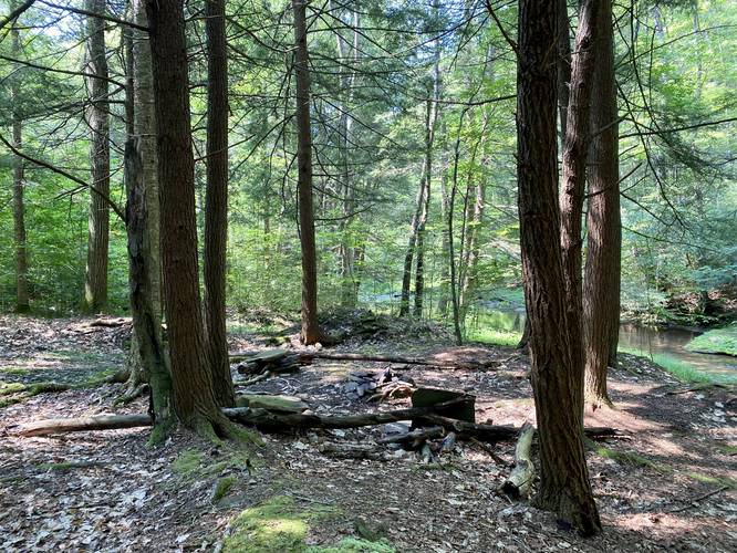
After visiting the Big Blue Hole, hikers will head south along the STS - crossing Hammersley Fork several times - and passing campsites along the way. The terrain of the STS continues to be mostly easy-going, but some sections get a bit narrow and have a slight slope to them with steeper hillsides that slope downward to Hammersley Fork. The elevation changes a bit between flat, downhill, and uphill sections but overall the difficulty is moderate.
Around mile 5.5, hikers will reach Dump Hollow Run - a creek that feeds into Hammersley Fork - which is also where the STS heads uphill and away from where this trek leads. Here, hikers will want to head off of the STS to follow Hammersley Fork instead, heading southwest. This section of the trail is the official bushwhack - as the official park map does not show any blazed trails in this section of Hammersley Wild Area. However, that does not mean that there isn't a bushwhack along what should be a blazed trail. Here, hikers will need to follow Hammersley Fork creek downstream and bushwhack for approximately 1.7-miles to reach the next yellow blaze marker along the Cow Run Trail.
Cow Run Trail Bushwhack
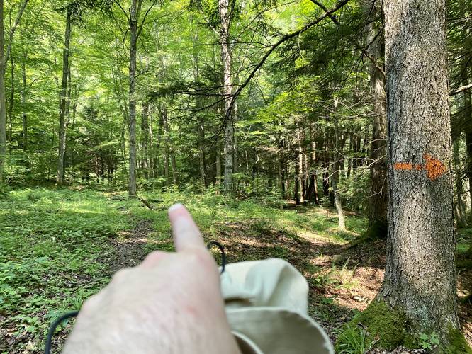
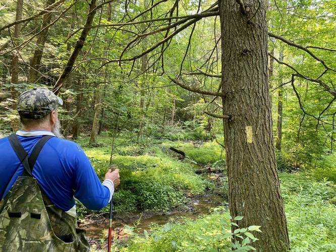
As mentioned previously, as of July 2021, when the hiker reaches the Cow Run Trail (yellow blazes), there are still no signs of a trail anywhere. Hikers will need to continue bushwhacking along Hammersley Fork creek, crossing the stream several times again, before finally reaching a yellow blaze marker located around mile 7.2. Here, the Cow Run Trail actually exists with yellow blazes and heads uphill to follow a moderate grade before dropping back down toward the Hammersley Fork Trail where the blazes mostly disappear once again.
Hammersley Fork Trail to Parking
Once the Cow Run Trail heads downhill, the blazes will disappear as the hiker approaches the large bend in Hammersley Fork. Here, the hiker should head south until they find what "feels" like an old trail - this is actually an old road that leads up Hammersley Fork all the way through the bushwhack you just hiked through - as there used to be an established logging town located along the creek circa early 1900s. Hikers should follow this "trail" which disappears and reappears over and over again - with seldom yellow blazes located on trees along the way. Finally, around mile 8.8, hikers will reach the Beech Bottom Trail which boasts a nice waterfall. From here, it's very easy hiking as you follow the service road that leads back to the southern parking area just on the other side of Hammersley Fork. From the Beech Bottom Trail, it's about 1.2-miles to reach parking, which requires one more creek crossing to reach your car.
Parking
Hikers will find parking at the northern terminus located at the parking coordinates provided and will bring the hiker to the Bunnell Ridge Trail. For a shuttle hike, you'll want to leave a 2nd car at the southern side of Hammersley Wild Area around 41.45609, -77.87452.
Warnings
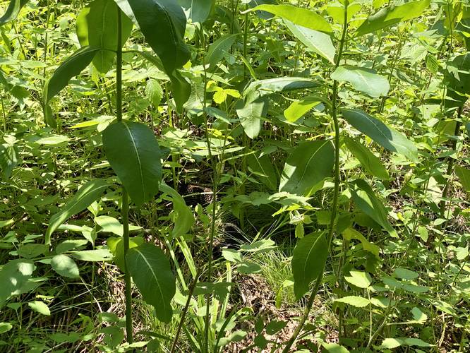
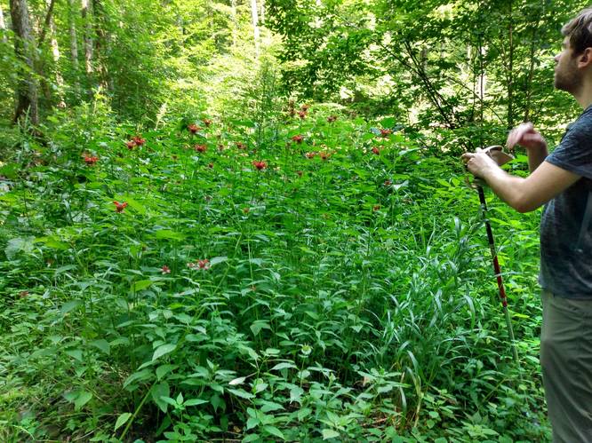
Rattlesnakes: This wild area is ripe with Timber Rattlesnakes between the months of late April to early October. They love to sun themselves in rocky outcroppings, on the trail, or in sunny patches of tall grass. On our hike, I (Admin) almost stepped on a massive rattlesnake while bushwhacking in tall grassy areas along Hammersley Fork creek. Bring trekking poles, listen for rattlers, and watch your steps. With the lack of cell phone service here, if you get bitten by a rattler, you may not make it out of the woods.
No cell service: The only area where cell service is accessible (I have Verizon) is in the southern end of Hammersley Wild Area, within ~0.5-miles of the parking area. Even on the ridge at the Bunnell Ridge Trail, there is no cell service. There's absolutely no cell service within the wild area itself.
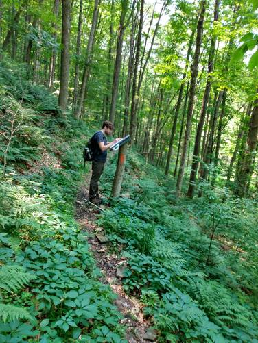
Bushwhacking: Between miles 5.5 and 7.2, hikers will basically be bushwhacking and navigating on their own to reach the yellow blazes near the Cow Run Trail. Bringing offline maps with a mobile app and the official park map help you navigate the terrain. Plan ahead and bring the necessary gear to bushwhack. If you do not know how to read topographic maps, this hike may not be for you.
Spring creek crossings: During the Spring, Hammersley Fork creek runs fairly deep, about 1.5-feet to 2-feet deep in places. Hikers will need to cross the creek several times to complete this entire 10-mile trek; however, during the Summer, the creek is not much more than 6-inches deep in most places. The most difficult crossing, during any season, is located next to the southern parking area.
Most-remote area of Pennsylvania: According to the Pennsylvania DCNR, Hammersley Wild Area is the most remote location in the entire state measured by distance to the nearest road. The most remote location in Hammersley, likely located off-trail, is approximately 5-miles away (as the crow flies) to the nearest road. On foot, this is a much longer distance. The Big Blue Hole sits 4.2-miles on foot from the nearest road headed north and ~6-miles on foot to the nearest road headed south. Additionally, the closest "roads" are also extremely remote with very little cell service, if any. So along this hike, you will be in the most remote part of Pennsylvania with no cell service, poisonous rattlesnakes, and the possibility of crossing a rabid animal. Come prepared with all of the necessary gear to ensure your own safety on this trek.
Camping and Backpacking
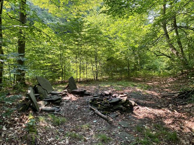
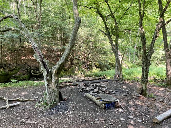
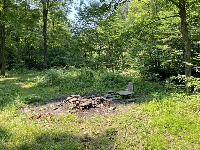
Backpackers will find ample campsites along the STS and Hammersley Fork along this hike - see the trail map for campsites we mapped out. The best campsite, in my opinion, is located next to the Big Blue Hole as you can sunbathe on the rocks and cool down in the swimming hole. Please follow all state forest rules and regulations when dispersed / primitive / backcountry camping.
Difficulty
While this trail is mostly all downhill, the difficulty rating is set to "hard" for this trail mostly because of the lack of cell service, difficult navigating and bushwhacking, dangers like hidden Timber Rattlesnakes, and the lack of ability to call for help if needed as this trek leads hikers into the most remote location in the state of Pennsylvania.
Pets
While technically allowed on these trails, hikers may want to leave their dogs at home on this hike because of the warnings listed here; however, if you plan an out-and-back hike to the Big Blue Hole, bringing your dog is likely not a big issue. Keep them leashed in case of rattlesnakes and clean up after your pet.
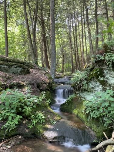
Waterfall
This hike features one nice, but small, waterfall located just off of the Beech Bottom Trail. Heading north to south, the waterfall is located around mile 8.8. Headed south to north, it's located around mile 1.2. The waterfall is not much larger than 3-feet tall and 2-feet wide as it cascades down the creek in three separate tiers.
Big Blue Hole (The Pool)
The main attraction to this hike is the ~6-foot deep swimming hole nicknamed the Big Blue Hole. Since Hammersley Wild Area is considered the most remote and secluded part of Pennsylvania, and because this swimming hole is located in the heart of Hammersley Wild Area, it's safe to say that this is likely Pennsylvania's most secluded backcountry swimming hole.
Trails
This hike follows several named trails in order: Bunnell Ridge Trail - easy to follow, Susquehanna Trail System / aka STS (orange blazes) - easy to follow, Cow Run Trail (90% bushwhack with basically no blazes) - difficult to follow, Hammersley Fork Trail (very few yellow blazes near the Cow Run Trail) - moderately difficult to follow.
Trail Description
This hike begins along McConnell Road in the Hammersley Wild Area at the Bunnell Ridge Trailhead. The Bunnell Ridge trail is 50% service road for private gas well access and 50% well-beaten wilderness trail that leads downhill to Hammersley Fork creek and the STS. The trail follows yellow blazes, which were once blazed red, downhill for almost the entire way until you reach the STS. During early July, hikers will likely find hundreds of thousands of wildflowers perched atop wild leeks or wild onions on the hillside along the Bunnell Ridge Trail, located east of the gas well.
STS to the Big Blue Hole (The Pool)
Hikers will need to be on the lookout for the orange blazes of the STS when they reach the bottom of the hill along the Bunnell Ridge Trail, as the junction comes up quickly. Take a right-hand turn to head south along the STS toward the Big Blue Hole. The terrain along this section of the hike is a bit more narrow with some steeper hillsides that slope down into Hammersley Fork creek - watch your step. Around mile 4.2, hikers will finally reach the Big Blue Hole which also has two decent-sized campsites nearby. The Big Blue Hole is a large ~6-foot deep swimming area with crystal clear, but very cold, stream water to swim or cool down in. Usually plenty of Native Brown Trout can be found in the stream and swimming hole. Note that the Big Blue Hole is labeled "The Pool" on the official Hammersley Wild Area map.
STS to Bushwhack Start at Dump Hollow Run
After visiting the Big Blue Hole, hikers will head south along the STS - crossing Hammersley Fork several times - and passing campsites along the way. The terrain of the STS continues to be mostly easy-going, but some sections get a bit narrow and have a slight slope to them with steeper hillsides that slope downward to Hammersley Fork. The elevation changes a bit between flat, downhill, and uphill sections but overall the difficulty is moderate.
Around mile 5.5, hikers will reach Dump Hollow Run - a creek that feeds into Hammersley Fork - which is also where the STS heads uphill and away from where this trek leads. Here, hikers will want to head off of the STS to follow Hammersley Fork instead, heading southwest. This section of the trail is the official bushwhack - as the official park map does not show any blazed trails in this section of Hammersley Wild Area. However, that does not mean that there isn't a bushwhack along what should be a blazed trail. Here, hikers will need to follow Hammersley Fork creek downstream and bushwhack for approximately 1.7-miles to reach the next yellow blaze marker along the Cow Run Trail.
Cow Run Trail Bushwhack
As mentioned previously, as of July 2021, when the hiker reaches the Cow Run Trail (yellow blazes), there are still no signs of a trail anywhere. Hikers will need to continue bushwhacking along Hammersley Fork creek, crossing the stream several times again, before finally reaching a yellow blaze marker located around mile 7.2. Here, the Cow Run Trail actually exists with yellow blazes and heads uphill to follow a moderate grade before dropping back down toward the Hammersley Fork Trail where the blazes mostly disappear once again.
Hammersley Fork Trail to Parking
Once the Cow Run Trail heads downhill, the blazes will disappear as the hiker approaches the large bend in Hammersley Fork. Here, the hiker should head south until they find what "feels" like an old trail - this is actually an old road that leads up Hammersley Fork all the way through the bushwhack you just hiked through - as there used to be an established logging town located along the creek circa early 1900s. Hikers should follow this "trail" which disappears and reappears over and over again - with seldom yellow blazes located on trees along the way. Finally, around mile 8.8, hikers will reach the Beech Bottom Trail which boasts a nice waterfall. From here, it's very easy hiking as you follow the service road that leads back to the southern parking area just on the other side of Hammersley Fork. From the Beech Bottom Trail, it's about 1.2-miles to reach parking, which requires one more creek crossing to reach your car.
Parking
Hikers will find parking at the northern terminus located at the parking coordinates provided and will bring the hiker to the Bunnell Ridge Trail. For a shuttle hike, you'll want to leave a 2nd car at the southern side of Hammersley Wild Area around 41.45609, -77.87452.
Warnings
Rattlesnakes: This wild area is ripe with Timber Rattlesnakes between the months of late April to early October. They love to sun themselves in rocky outcroppings, on the trail, or in sunny patches of tall grass. On our hike, I (Admin) almost stepped on a massive rattlesnake while bushwhacking in tall grassy areas along Hammersley Fork creek. Bring trekking poles, listen for rattlers, and watch your steps. With the lack of cell phone service here, if you get bitten by a rattler, you may not make it out of the woods.
No cell service: The only area where cell service is accessible (I have Verizon) is in the southern end of Hammersley Wild Area, within ~0.5-miles of the parking area. Even on the ridge at the Bunnell Ridge Trail, there is no cell service. There's absolutely no cell service within the wild area itself.
Bushwhacking: Between miles 5.5 and 7.2, hikers will basically be bushwhacking and navigating on their own to reach the yellow blazes near the Cow Run Trail. Bringing offline maps with a mobile app and the official park map help you navigate the terrain. Plan ahead and bring the necessary gear to bushwhack. If you do not know how to read topographic maps, this hike may not be for you.
Spring creek crossings: During the Spring, Hammersley Fork creek runs fairly deep, about 1.5-feet to 2-feet deep in places. Hikers will need to cross the creek several times to complete this entire 10-mile trek; however, during the Summer, the creek is not much more than 6-inches deep in most places. The most difficult crossing, during any season, is located next to the southern parking area.
Most-remote area of Pennsylvania: According to the Pennsylvania DCNR, Hammersley Wild Area is the most remote location in the entire state measured by distance to the nearest road. The most remote location in Hammersley, likely located off-trail, is approximately 5-miles away (as the crow flies) to the nearest road. On foot, this is a much longer distance. The Big Blue Hole sits 4.2-miles on foot from the nearest road headed north and ~6-miles on foot to the nearest road headed south. Additionally, the closest "roads" are also extremely remote with very little cell service, if any. So along this hike, you will be in the most remote part of Pennsylvania with no cell service, poisonous rattlesnakes, and the possibility of crossing a rabid animal. Come prepared with all of the necessary gear to ensure your own safety on this trek.
Camping and Backpacking
Backpackers will find ample campsites along the STS and Hammersley Fork along this hike - see the trail map for campsites we mapped out. The best campsite, in my opinion, is located next to the Big Blue Hole as you can sunbathe on the rocks and cool down in the swimming hole. Please follow all state forest rules and regulations when dispersed / primitive / backcountry camping.
Difficulty
While this trail is mostly all downhill, the difficulty rating is set to "hard" for this trail mostly because of the lack of cell service, difficult navigating and bushwhacking, dangers like hidden Timber Rattlesnakes, and the lack of ability to call for help if needed as this trek leads hikers into the most remote location in the state of Pennsylvania.
Pets
While technically allowed on these trails, hikers may want to leave their dogs at home on this hike because of the warnings listed here; however, if you plan an out-and-back hike to the Big Blue Hole, bringing your dog is likely not a big issue. Keep them leashed in case of rattlesnakes and clean up after your pet.
Waterfall
This hike features one nice, but small, waterfall located just off of the Beech Bottom Trail. Heading north to south, the waterfall is located around mile 8.8. Headed south to north, it's located around mile 1.2. The waterfall is not much larger than 3-feet tall and 2-feet wide as it cascades down the creek in three separate tiers.
Big Blue Hole (The Pool)
The main attraction to this hike is the ~6-foot deep swimming hole nicknamed the Big Blue Hole. Since Hammersley Wild Area is considered the most remote and secluded part of Pennsylvania, and because this swimming hole is located in the heart of Hammersley Wild Area, it's safe to say that this is likely Pennsylvania's most secluded backcountry swimming hole.