Loading...

Distance:
0.2 Miles / 0.3 km
Type:
Out-and-Back
Difficulty:
Moderate
Time to Hike:
~6 minutes
Features:
PA Wilds
Surface Type:
Dirt
Park:
Allegheny National Forest
Town:
Warren, Pennsylvania
Directions:
41.835282, -78.996557
Added:
May 06, 2018
Updated:
June 29, 2020
Loading...
Loading...
68 '

Total Change
72 '

Ascent
72 '

Descent

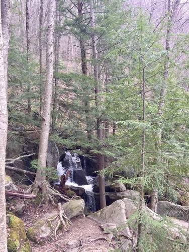
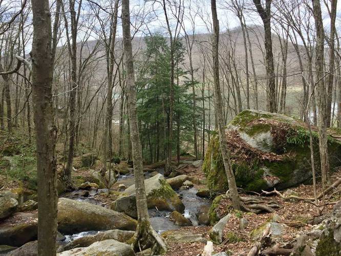
The Bent Run Waterfall Trail at Allegheny National Forest in Warren, Pennsylvania is a moderate 0.2 mile out-and-back trail that leads uphill along Bent Run and passes several cascades of Bent Run Falls. This trail is one of the more popular day hike trails in the national forest since it's a quick hit and you get to see at least 3 waterfalls.

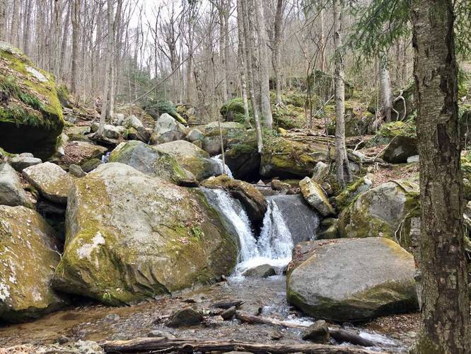
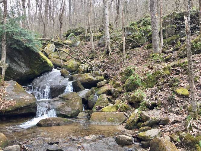
The trail itself kind of disappears and splits into various directions as it leads around large boulders and out to different waterfalls along the creek.

To see an even better view of the falls, which is not shown in this GPS data, you can find a very steep and uneven trail that leads downhill from the parking lot to the base of Bent Run Falls.

Explore 9 trails near Warren, PA
  1. Parking

    41.835282, -78.996557
  2. Main Trailhead

    41.835204, -78.996542
  3. Waterfall

    41.835075, -78.996575
    Waterfall
  4. Waterfall

    41.834689, -78.996619
    Waterfall
  5. Waterfall

    41.834372, -78.996553
    Waterfall
  6. View / Overlook / Vista

    41.834581, -78.996406
    View / Overlook / Vista
No community routes found. To add your own hike as a Community Route for this Trail guide, leave a Trip Report with an attached GPX file.

Hazards

Ticks - Lyme Disease More Info (CDC)

Seasons

All

Photo Albums

2 Trip Reports

No Star-Ratings
Trail Guide By:
Admin user profile picture
0.2 miles / 0.3 km
Trail added
May 06, 2018
Hiked on
May 05, 2018
Updated on
June 29, 2020
0.2 miles / 0.3 km
May 05, 2018
Dogs Hiking

Weather Forecast

In Warren, PA

Explore Hiking Trails

New Hikes

Knoll-Willows Overlook Trail
0.2 Miles
0.3 km
Easy
One-Way
Mary's Lake Trail
0.6 Miles
1 km
Easy
Out-and-Back
Beaver Ponds Trail
0.1 Miles
0.2 km
Easy
Out-and-Back
West Rim Trail (Stony Brook)
0.7 Miles
1.1 km
Moderate
One-Way

Before you boogie...

Find our trail guides useful? Consider becoming a Supporter to unlock perks!

MyHikes is an indie platform that makes exploring public trails easier for everyone. The platform has no investors, runs no ads, and is owned and operated by one person, Dave Miller. Dave has personally mapped and written over 1,600 trail guides on MyHikes for the public to explore. As of 2024, MyHikes has helped over 1,300,000 outdoor enthusiasts plan their next adventure.

But it takes a lot of time 🕦, money 💰, and work, and espresso shots ☕ to run MyHikes, including hiking , mapping , writing , and publishing new trails with high-quality (accurate) information... along with software engineering (coding) the platform like building new features, site and mobile app development for iOS and Android, site maintainance . and much much more.

Supporters unlock website and mobile app perks with an annual one-time payment of $25 (you renew) 😎👍. Or you can simply make a Donation of your choice. Otherwise, you can support us by telling your friends about MyHikes - both quick and free 🎉

Admin user profile picture

Dave Miller
MyHikes Founder