Explore the scenic Belfry Mountain Fire Tower Trail in Mineville, New York, nestled within Adirondack Park. This easy 0.7-mile out-and-back hike promises stunning views from the summit of Belfry Mountain, culminating in an unforgettable outdoor adventure that doesn't require much time or effort.
Hike
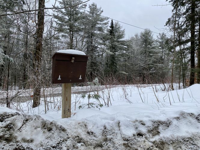
Begin your journey on the West side of Dalton Hill Road, where a marked service road for Belfry Mountain awaits. Though gated with a yellow gate, rest assured this is an official public trail. Before ascending the mountain, hikers will find a trail registry conveniently located on the East side of the trail. The service road gradually ascends the mountain, passing several radio transmission towers along the way. Feel free to bypass these towers until reaching the end of the service road around mile 0.25. From there, follow a narrow forested trail leading to the Belfry Mountain Fire Tower.
Belfry Mountain Summit, Views, Fire Tower - Mile 0.35
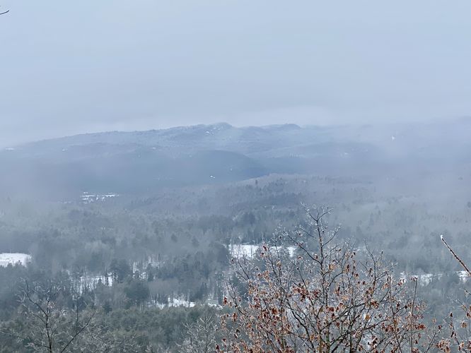
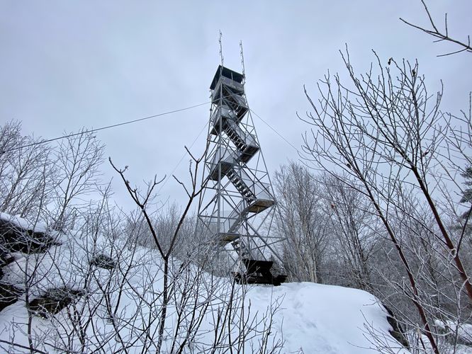
En route to the tower, enjoy a picturesque clearing in the forest offering southward-facing views of the surrounding mountains and hills. Beyond lies the Belfry Mountain summit, characterized by its exposed bedrock and the iconic Belfry Mountain Fire Tower. While visitors can ascend the tower for even more breathtaking vistas, be mindful that our January 2024 hike was shrouded in clouds, limiting visibility.
Please note that the tower's steps may show signs of wear and tear, so exercise caution while climbing.
After savoring the views and exploring the historic fire tower, retrace your steps back to the parking area, following the same trail in reverse. Don't miss the opportunity to experience the tranquility and beauty of the Belfry Mountain Fire Tower Trail during your Adirondack adventure.
Parking
Hikers will find a very small parking turnout at the coordinates provided, located on the East side of Dalton Hill Road in Mineville, NY. The parking turnout has "posted" signs; however, those signs are meant for the non-public land. The parking turnout is technically public. Do not block the entrance gate to the service road -- there's no parking available there.
Pets
Dogs are allowed only if leashed and must be cleaned up after.
Hike
Begin your journey on the West side of Dalton Hill Road, where a marked service road for Belfry Mountain awaits. Though gated with a yellow gate, rest assured this is an official public trail. Before ascending the mountain, hikers will find a trail registry conveniently located on the East side of the trail. The service road gradually ascends the mountain, passing several radio transmission towers along the way. Feel free to bypass these towers until reaching the end of the service road around mile 0.25. From there, follow a narrow forested trail leading to the Belfry Mountain Fire Tower.
Belfry Mountain Summit, Views, Fire Tower - Mile 0.35
En route to the tower, enjoy a picturesque clearing in the forest offering southward-facing views of the surrounding mountains and hills. Beyond lies the Belfry Mountain summit, characterized by its exposed bedrock and the iconic Belfry Mountain Fire Tower. While visitors can ascend the tower for even more breathtaking vistas, be mindful that our January 2024 hike was shrouded in clouds, limiting visibility.
Please note that the tower's steps may show signs of wear and tear, so exercise caution while climbing.
After savoring the views and exploring the historic fire tower, retrace your steps back to the parking area, following the same trail in reverse. Don't miss the opportunity to experience the tranquility and beauty of the Belfry Mountain Fire Tower Trail during your Adirondack adventure.
Parking
Hikers will find a very small parking turnout at the coordinates provided, located on the East side of Dalton Hill Road in Mineville, NY. The parking turnout has "posted" signs; however, those signs are meant for the non-public land. The parking turnout is technically public. Do not block the entrance gate to the service road -- there's no parking available there.
Pets
Dogs are allowed only if leashed and must be cleaned up after.