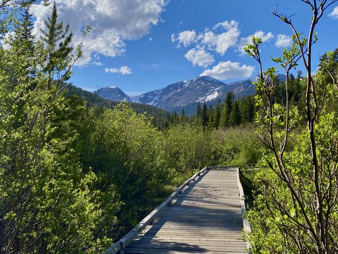
The Beaver Ponds Trail at Rocky Mountain National Park near Estes Park, Colorado is an easy 0.1-mile out-and-back walk that leads to a viewing platform along Hidden Valley Creek with views of the neighboring mountains.
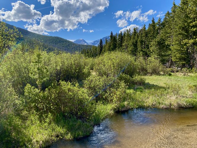
This is not a hike but rather a short roadside walk that leads along a paved pathway and boardwalk. The boardwalk leads visitors out above Hidden Valley Creek (and its flood plain) to where you can enjoy views or potential wildlife. From the end of the boardwalk, visitors get views westward and "views" eastward; however, the eastward views are simply that of Hidden Valley Creek. To the west, you'll find views of Mount Chapin and Mount Chiquita.
During our hike here in early June 2024 one evening, we found a couple on the trail that had just captured a moose on video, but we were just a few minutes too late to see it in-person. Despite not seeing the moose, this trail is great for viewing wildlife, depending on the time of day.
Universal Access
This trail is universally accessible with a paved pathway and boardwalk as of June 2024.
Wildlife Viewing
This trail is great for viewing wildlife, especially deer, elk, and moose due to the open spaces for grazing and finding food in addition to the creek's water source for drinking. If you wish to spot wildlife, your best chances are in the early morning or in the early evening. Always keep a safe distance while viewing - approx. 75-feet for elk and longhorn sheep; 120-feet for bear and moose.
Pets
Dogs are not allowed on this trail.
Parking
Hikers will find a small parking turnout at the coordinates provided along Trail Ridge Road. The turnout is large enough to fit no more than 8 vehicles as of June 2024.
Timed-Entry Reservations
Between the months of late May through early October you must purchase a timed-entry pass to visit Rocky Mountain National Park. If you wish to visitor and hike anything off of the Bear Lake Road, you must purchase a dedicated Bear Lake timed-entry pass. You can find more information about timed entry on the park's website.
Warnings
Elevation sickness: This trail brings hikers through terrain at 9,000-feet above sea level. Above the 7,000-foot mark above sea level, hikers may start to experience symptoms of elevation sickness including headache, muscle aches, shortness of breath, among other warning signs. In order to avoid elevation sickness it's recommended to ascend to higher elevations and take short walks to acclimate over the course of several days before taking a long or physically-demanding hike. At any time you feel elevation sickness kicking in, that's the time to turn back and head for lower altitude or the parking lot.
Wild animals: While rare, hikers may encounter bears or mountain lion along the trail. Again, this is rare due to the insane amount of people who hike these trails each day; however, it's smart to know that these wild animals could be on-trail. Please read-up on how to properly handle a bear or mountain lion encounter before hitting the trails.