The Battery Warren Trail at Francis Marion National Forest in Berkeley County, South Carolina is an easy 1-mile out-and-back hike that leads to a Civil War era artillery battery.
This trail leads from the Battery Warren trailhead, passing through a primarily-evergreen and pine forest, out to the edge of the Santee River. Along the way, hikers may find flooded or muddy sections of trail, especially during wet months, Carolina Jasmine wildflowers, and hanging spanish moss that grow along the trail.
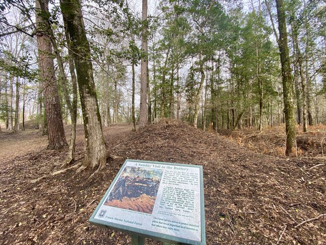
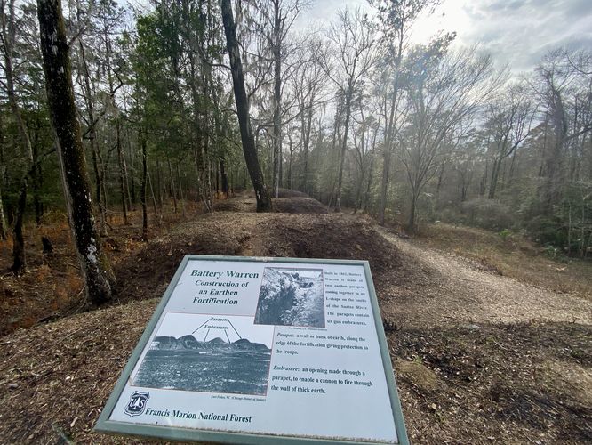
Battery Warren - Mile 0.4 to 0.5
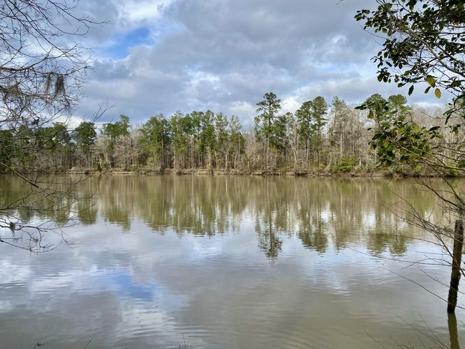
At mile 0.4, hikers will reach an interpretive sign at the southern end of Battery Warren. You'll notice the artillery battery's hills immediately. As of March 2024, the vegetation around Battery Warren was killed-off so visitors can see the topography of the hills that the civil war soldiers built. The Battery is about 0.1-miles long (~500-feet) so you can walk the length of the outpost either along the very-top of it or in between the multi-tiered levels. On the far side of Battery Warren, around mile 0.5, hikers will find a view of the Santee River along with additional historical interpretive signs. As of March 2024, there's also a staircase that leads down from Battery Warren to reach a steep embankment along the Santee River -- possibly for fishing access.
After exploring Battery Warren, hikers will head back to parking for a 1-mile out-and-back hike.
Parking
Hikers should be aware that they must drive several miles through backcountry dirt roads to reach this trailhead. Some of the roads are filled with potholes, so watch out. The parking situation at the trailhead is easy - plenty of parking spaces that can fit over a dozen vehicles as of March 2024.
Camping & Backpacking
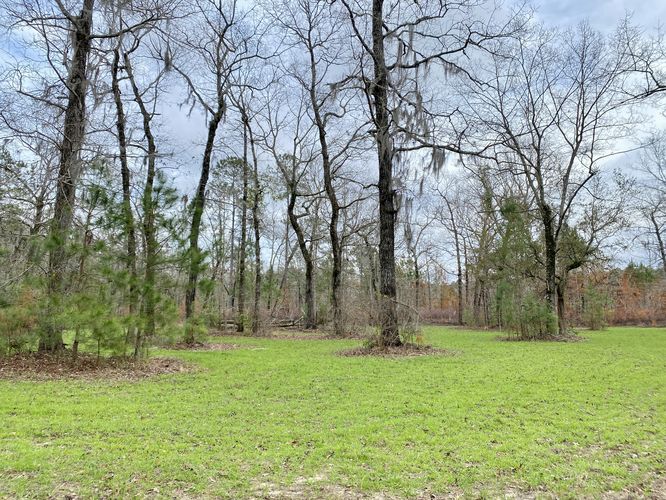
Camping is permitted within the national forest and near the trailhead is a wide-open grassy space that provides enough room to setup a campsite. No defined fire pits were found here as of March 2024, but backpackers or short-term campers will find plenty of space. Please follow all national forest rules & regulations when dispersed / primitive / backcountry camping.
Pets
Dogs are allowed only if leashed and must be cleaned up after.
This trail leads from the Battery Warren trailhead, passing through a primarily-evergreen and pine forest, out to the edge of the Santee River. Along the way, hikers may find flooded or muddy sections of trail, especially during wet months, Carolina Jasmine wildflowers, and hanging spanish moss that grow along the trail.
Battery Warren - Mile 0.4 to 0.5
At mile 0.4, hikers will reach an interpretive sign at the southern end of Battery Warren. You'll notice the artillery battery's hills immediately. As of March 2024, the vegetation around Battery Warren was killed-off so visitors can see the topography of the hills that the civil war soldiers built. The Battery is about 0.1-miles long (~500-feet) so you can walk the length of the outpost either along the very-top of it or in between the multi-tiered levels. On the far side of Battery Warren, around mile 0.5, hikers will find a view of the Santee River along with additional historical interpretive signs. As of March 2024, there's also a staircase that leads down from Battery Warren to reach a steep embankment along the Santee River -- possibly for fishing access.
After exploring Battery Warren, hikers will head back to parking for a 1-mile out-and-back hike.
Parking
Hikers should be aware that they must drive several miles through backcountry dirt roads to reach this trailhead. Some of the roads are filled with potholes, so watch out. The parking situation at the trailhead is easy - plenty of parking spaces that can fit over a dozen vehicles as of March 2024.
Camping & Backpacking
Camping is permitted within the national forest and near the trailhead is a wide-open grassy space that provides enough room to setup a campsite. No defined fire pits were found here as of March 2024, but backpackers or short-term campers will find plenty of space. Please follow all national forest rules & regulations when dispersed / primitive / backcountry camping.
Pets
Dogs are allowed only if leashed and must be cleaned up after.