Bartlett Mountain at State Game Lands 57 near Forkston, Pennsylvania is a strenuous 8.3-mile out-and-back off-trail hike that leads to a 20-foot tall waterfall, White Brook Falls, and summits Bartlett Mountain where large outcroppings of bedrock (aka the "Bartlett Balds") create unique ecosystems and landscapes.
Private Property
Note that this hike crosses private property, not on purpose but by accident. The signage in the eastern section of SGL 57, near White Brook, is lacking and leaves the woods up to the interpretation of the hiker, which is not easy. I (Admin) plan to hike this again, bypassing all section of private land, but please be aware of where the private land is and how to avoid it!
Hike Description
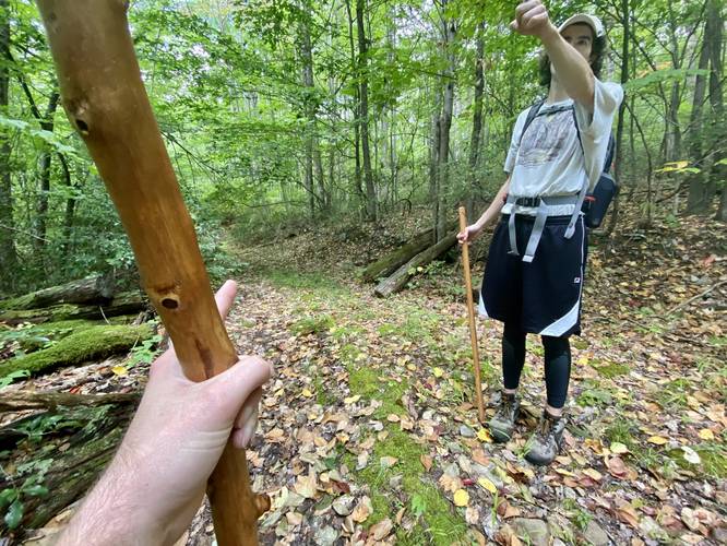
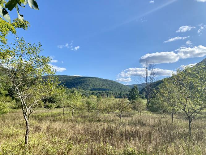
This hike begins along State Route 3001 in Forkston, just south of White Brook Lane at a large parking turnout for State Game Lands 57 and there is no trail that leads in - hikers will begin their off-trail adventure here. Hikers will head due-west into a large field, passing an old stone wall along the way. On our hike we went into the northern-most section of the field where a small path (likely created by deer) led west. Eventually, we left the field and went north slightly to reach yet another rock wall in the woods which can be found several-hundred feet south of White Brook Lane. Here, the State Game Lands boundary follows this rock wall, passing two houses (camps) which have their own fencing setup. Just beyond the two houses is where the private property becomes a bit tricky. There's a private shooting range to the north, which we ultimately walked directly through (like dummies) to reach White Brook, but hikers should notice an old "road" (likely an old logging grade) that runs west - hike this road instead of following the recording to avoid the private land!
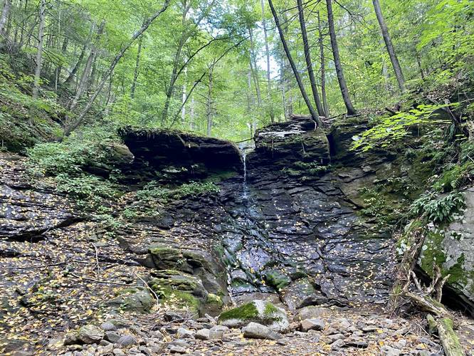
Reaching White Brook Falls - Mile 0.85
Once hikers are in White Brook (assuming the water level is low), the hike upstream is not very difficult, but you'll pass blowdown trees and other obstacles to finally reach the 20-foot tall White Brook Falls around mile 0.85. The waterfall cascades down the bedrock between a narrow cut-out in the rock to a small pool below, for a total height of about 20-feet tall. Hikers will want to enjoy White Brook Falls as long as they can because despite the "Bartlett Balds", the top of the mountain does not have any views or much water.
Logging Grade Trail Ascent - Mile 1.15
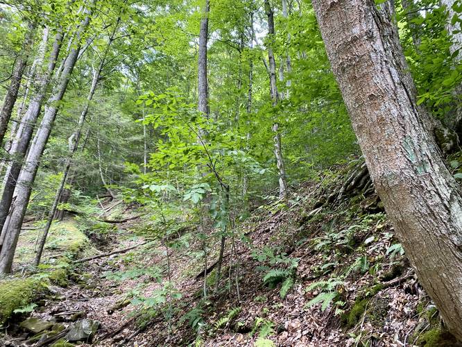
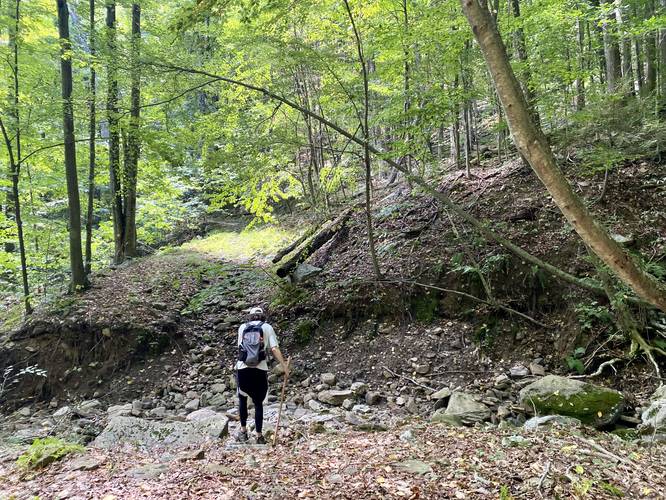
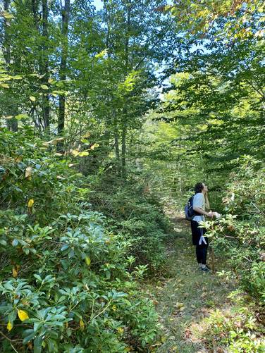
After visiting White Brook Falls, you'll hike back downstream to reach a rocky path that leads uphill. This rocky path looks like a creek bed - and likely is during snow melt season in early Spring. This is where the hike becomes a lot more difficult as the trail makes its way up the mountain following mostly-unmarked turns, so keep note. The uphill hike begins around mile 1.15.
Hairpin Right-Hand Turn - Mile 1.6
Around mile 1.6, hikers will reach a junction with the old logging road where it hits a sharp right-hand turn. Take this turn to continue up Bartlett Mountain.
Hairpin Left-Hand Turn - Mile 1.75
Around mile 1.75, hikers will reach a junction with a sharp left-hand turn. As of August 2022, there were very faint turquoise blazes that marked a turn, but they were barely visible.
Keep Left - Mile 2
Around mile 2, hikers will want to keep left (head straight) at another trail junction. This is important to note for the hike down.
White Brook Creek Crossing - Mile 2.4
Around mile 2.4, hikers will reach another turn in the trail with, what looks like, several directions to go. Simply cross White Brook at the widest crossing that looks like an old logging road - this is your turn. The trail will then slowly make its way around another bend in the mountain before heading up the mountain to a private property marker - a bike in a tree.
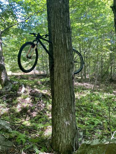
Bike In a Tree - Mile 3
Around mile 3, hikers will reach a bike that was lodged in between a split growth in a large tree. After our hike, I (Admin) overlaid the trail on the State Game Lands 57 map and it appears as though this long-abandoned mountain bike is actually a private property marker! Despite there being no posted signs here, this bike seems to indicate a property line. From here, the easiest way to continue up the mountain is by following the path as it runs along White Brook before reaching the next junction.
Junction at the Top of White Brook - Mile 3.05
Take a left-hand turn once you reach the top of White Brook, just a few hundred yards uphill from the bike in the tree. Immediately after that, stay left again to continue hiking toward the Bartlett Balds. Stay on this trail as it leads through fern-filled woods on the last ascent to the bedrock balds area.
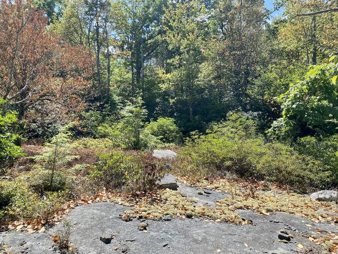
Bedrock Junction - Mile 3.4
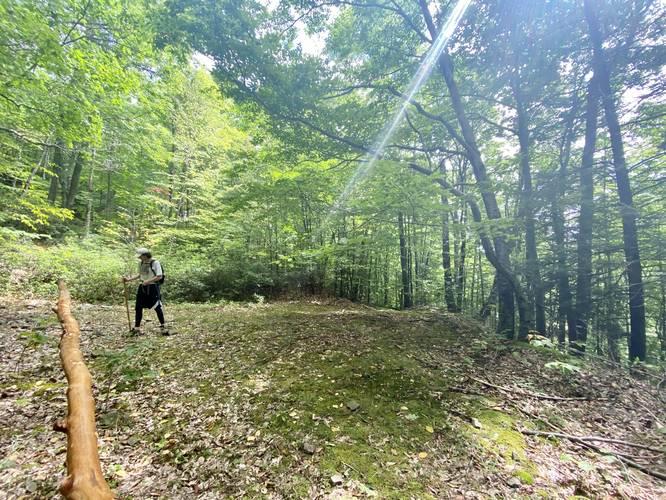
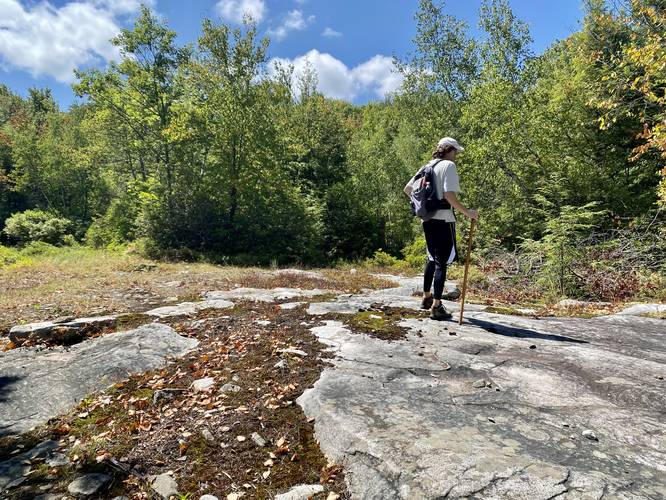
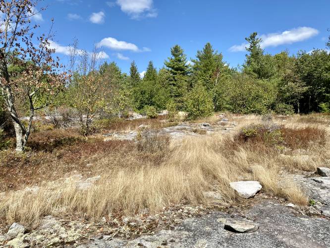
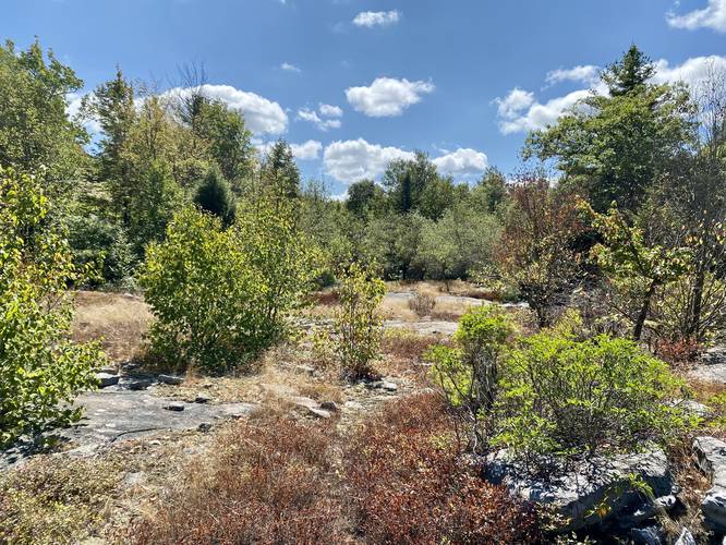
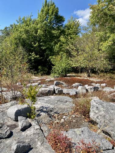
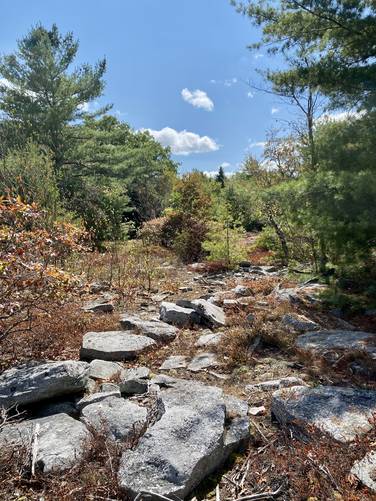
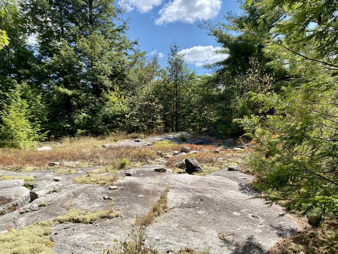
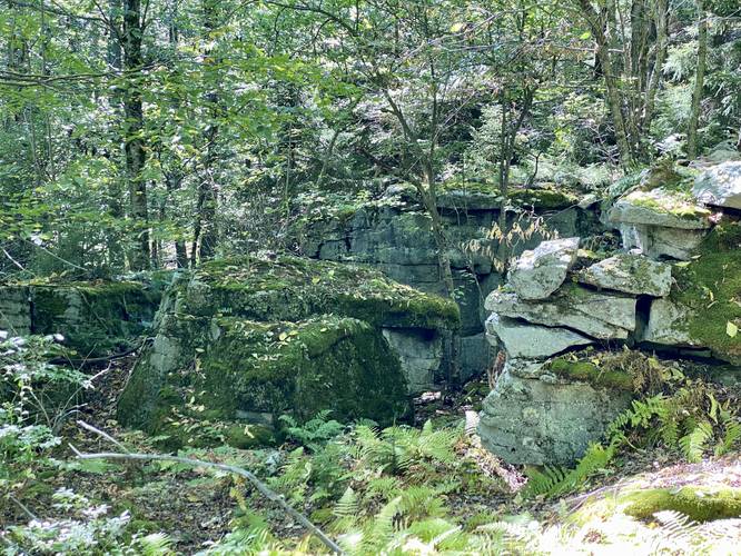
Around mile 3.4, hikers will reach the first bedrock outcropping, located directly on the path that led up the mountain, which also denotes the "top" of Bartlett Mountain. At this junction is where three paths diverge and this can get confusing. The two southern paths lead to a scenic rocky outcropping with blueberry and teaberry bushes and then eventually head south along the mountain top. The path that heads west from here leads to the much larger Bartlett Balds outcropping area, but this track ends several hundred feet before reaching that area, due to our lack of understanding / cell service at the time. This is also where the hike becomes extremely confusing because most of the woods atop Bartlett Mountain all look the same. Depending on where you venture-off from, hikers will likely need to bushwhack through thick forests to reach the best sections of the Bartlett Balds.
Bushwhacking Bartlett Balds - Miles 3.4 to 5.5
This GPS track includes several off-trail bushwhacks that lead to rocky outcroppings within the Bartlett Balds. Because of this, it's recommended to always use an offline mapping tool / app / device when hiking here to ensure you do not get lost! Please note that during our hike, we found several rocky outcroppings in the Bartlett Balds, but we did not find the largest open areas as bushwhacking to them was not easy without cell service or satellite images to guide us. The track provided, including loops and out-and-back walks, was due to us trying to find the largest rock outcroppings with deep cuts / ledges in them; however, we mostly found very-flat bedrock outcroppings instead which were interesting in their own right as these areas create unique ecosystems. We bushwhacked, followed the defined paths, and meandered around the bedrock outcroppings of the Bartlett Balds from miles 3.4 to 5.5 before heading back down the mountain.
Hiking Out
Hikers should be aware that hiking out is not easy unless you're good at making mental maps about which turn to take, or if you take pictures on the way up to help plan the hike down. It's best to note each turn on your hike up to ensure a safe hike down - or simply track your hike using an offline mapping tool.
Warnings
Off-Trail Bushwhacking: This hike requires a lot of off-trail hiking and bushwhacking, not just to reach the top of Bartlett Mountain, but to also reach the different sections of the rocky outcroppings known as the Bartlett Balds. Combined with a lack of cell service, this hike can be very dangerous and should only be attempted by experienced hikers that use offline tracking apps and/or devices to ensure their safety.
No cell service: This hike has virtually no cell service (Verizon) for the entire hike. I (Admin) was able to snag a scrap of 1x service, enough to send a text, but never receive one. Including the 5-hour hike and drive time, I was without cell service for a good 7-hours for this hike.
Lack of Summer water: During the Summer, there's not much water along this hike except for in small sections within White Brook. The top of Bartlett Mountain has some swampy areas, but there's not much moving water, thus hikers should pack-in all of the water they plan to use instead. I (Admin) went through just under 64oz of water for this hike.
Timber Rattlesnakes: North-central Pennsylvania is home to the Timber Rattlesnake, which often lives in rocky outcroppings. While we did not see any rattlers on this hike, it's not uncommon to find them in areas like this, so be on the lookout and don't step on any.
Private Property: This hike passes through some small sections of private property, by accident. Please note where the boundaries lie before hiking this to try and avoid them; however, it seems the land owners who own parts of White Brook seem to know hunters and hikers have a difficult time navigating these woods due to the lack of posted signs; however, they do exist closer to White Brook Lane.
Spiders: We found a crazy amount of fairly-large spiders along this hike and one of us even got bit! Watch your face as you walk through endless spiderwebs which often house brightly-colored yellow/red/black spiders.
Private Property
Note that this hike crosses private property, not on purpose but by accident. The signage in the eastern section of SGL 57, near White Brook, is lacking and leaves the woods up to the interpretation of the hiker, which is not easy. I (Admin) plan to hike this again, bypassing all section of private land, but please be aware of where the private land is and how to avoid it!
Hike Description
This hike begins along State Route 3001 in Forkston, just south of White Brook Lane at a large parking turnout for State Game Lands 57 and there is no trail that leads in - hikers will begin their off-trail adventure here. Hikers will head due-west into a large field, passing an old stone wall along the way. On our hike we went into the northern-most section of the field where a small path (likely created by deer) led west. Eventually, we left the field and went north slightly to reach yet another rock wall in the woods which can be found several-hundred feet south of White Brook Lane. Here, the State Game Lands boundary follows this rock wall, passing two houses (camps) which have their own fencing setup. Just beyond the two houses is where the private property becomes a bit tricky. There's a private shooting range to the north, which we ultimately walked directly through (like dummies) to reach White Brook, but hikers should notice an old "road" (likely an old logging grade) that runs west - hike this road instead of following the recording to avoid the private land!
Reaching White Brook Falls - Mile 0.85
Once hikers are in White Brook (assuming the water level is low), the hike upstream is not very difficult, but you'll pass blowdown trees and other obstacles to finally reach the 20-foot tall White Brook Falls around mile 0.85. The waterfall cascades down the bedrock between a narrow cut-out in the rock to a small pool below, for a total height of about 20-feet tall. Hikers will want to enjoy White Brook Falls as long as they can because despite the "Bartlett Balds", the top of the mountain does not have any views or much water.
Logging Grade Trail Ascent - Mile 1.15
After visiting White Brook Falls, you'll hike back downstream to reach a rocky path that leads uphill. This rocky path looks like a creek bed - and likely is during snow melt season in early Spring. This is where the hike becomes a lot more difficult as the trail makes its way up the mountain following mostly-unmarked turns, so keep note. The uphill hike begins around mile 1.15.
Hairpin Right-Hand Turn - Mile 1.6
Around mile 1.6, hikers will reach a junction with the old logging road where it hits a sharp right-hand turn. Take this turn to continue up Bartlett Mountain.
Hairpin Left-Hand Turn - Mile 1.75
Around mile 1.75, hikers will reach a junction with a sharp left-hand turn. As of August 2022, there were very faint turquoise blazes that marked a turn, but they were barely visible.
Keep Left - Mile 2
Around mile 2, hikers will want to keep left (head straight) at another trail junction. This is important to note for the hike down.
White Brook Creek Crossing - Mile 2.4
Around mile 2.4, hikers will reach another turn in the trail with, what looks like, several directions to go. Simply cross White Brook at the widest crossing that looks like an old logging road - this is your turn. The trail will then slowly make its way around another bend in the mountain before heading up the mountain to a private property marker - a bike in a tree.
Bike In a Tree - Mile 3
Around mile 3, hikers will reach a bike that was lodged in between a split growth in a large tree. After our hike, I (Admin) overlaid the trail on the State Game Lands 57 map and it appears as though this long-abandoned mountain bike is actually a private property marker! Despite there being no posted signs here, this bike seems to indicate a property line. From here, the easiest way to continue up the mountain is by following the path as it runs along White Brook before reaching the next junction.
Junction at the Top of White Brook - Mile 3.05
Take a left-hand turn once you reach the top of White Brook, just a few hundred yards uphill from the bike in the tree. Immediately after that, stay left again to continue hiking toward the Bartlett Balds. Stay on this trail as it leads through fern-filled woods on the last ascent to the bedrock balds area.
Bedrock Junction - Mile 3.4
Around mile 3.4, hikers will reach the first bedrock outcropping, located directly on the path that led up the mountain, which also denotes the "top" of Bartlett Mountain. At this junction is where three paths diverge and this can get confusing. The two southern paths lead to a scenic rocky outcropping with blueberry and teaberry bushes and then eventually head south along the mountain top. The path that heads west from here leads to the much larger Bartlett Balds outcropping area, but this track ends several hundred feet before reaching that area, due to our lack of understanding / cell service at the time. This is also where the hike becomes extremely confusing because most of the woods atop Bartlett Mountain all look the same. Depending on where you venture-off from, hikers will likely need to bushwhack through thick forests to reach the best sections of the Bartlett Balds.
Bushwhacking Bartlett Balds - Miles 3.4 to 5.5
This GPS track includes several off-trail bushwhacks that lead to rocky outcroppings within the Bartlett Balds. Because of this, it's recommended to always use an offline mapping tool / app / device when hiking here to ensure you do not get lost! Please note that during our hike, we found several rocky outcroppings in the Bartlett Balds, but we did not find the largest open areas as bushwhacking to them was not easy without cell service or satellite images to guide us. The track provided, including loops and out-and-back walks, was due to us trying to find the largest rock outcroppings with deep cuts / ledges in them; however, we mostly found very-flat bedrock outcroppings instead which were interesting in their own right as these areas create unique ecosystems. We bushwhacked, followed the defined paths, and meandered around the bedrock outcroppings of the Bartlett Balds from miles 3.4 to 5.5 before heading back down the mountain.
Hiking Out
Hikers should be aware that hiking out is not easy unless you're good at making mental maps about which turn to take, or if you take pictures on the way up to help plan the hike down. It's best to note each turn on your hike up to ensure a safe hike down - or simply track your hike using an offline mapping tool.
Warnings
Off-Trail Bushwhacking: This hike requires a lot of off-trail hiking and bushwhacking, not just to reach the top of Bartlett Mountain, but to also reach the different sections of the rocky outcroppings known as the Bartlett Balds. Combined with a lack of cell service, this hike can be very dangerous and should only be attempted by experienced hikers that use offline tracking apps and/or devices to ensure their safety.
No cell service: This hike has virtually no cell service (Verizon) for the entire hike. I (Admin) was able to snag a scrap of 1x service, enough to send a text, but never receive one. Including the 5-hour hike and drive time, I was without cell service for a good 7-hours for this hike.
Lack of Summer water: During the Summer, there's not much water along this hike except for in small sections within White Brook. The top of Bartlett Mountain has some swampy areas, but there's not much moving water, thus hikers should pack-in all of the water they plan to use instead. I (Admin) went through just under 64oz of water for this hike.
Timber Rattlesnakes: North-central Pennsylvania is home to the Timber Rattlesnake, which often lives in rocky outcroppings. While we did not see any rattlers on this hike, it's not uncommon to find them in areas like this, so be on the lookout and don't step on any.
Private Property: This hike passes through some small sections of private property, by accident. Please note where the boundaries lie before hiking this to try and avoid them; however, it seems the land owners who own parts of White Brook seem to know hunters and hikers have a difficult time navigating these woods due to the lack of posted signs; however, they do exist closer to White Brook Lane.
Spiders: We found a crazy amount of fairly-large spiders along this hike and one of us even got bit! Watch your face as you walk through endless spiderwebs which often house brightly-colored yellow/red/black spiders.