Art's Trail, the Moore's Run Fire Trail and the Blue Coat Trail at Susquehannock State Forest near Coudersport, Pennsylvania is a moderate 5.7-mile including a long (1 mile one-way) spur on the Windfall Hollow Trail.
This post chronicles, part of a continuing series, this hiker's early explores through this intriguing area in the Susquehannock State Forest near Coudersport, Pennsylvania. This edition scouts four unmarked but useable trails, called Art's Trail, Moore's Run Fire Trail, Blue Coat Trail and Windfall Hollow Trail, with the hope to reopen the trails that track along old footpaths used by the early settlers and with the intent to establish a State Forest Hiking Trail.
What's to know about hiking the untamed woods on the shortest day is the feature story of this trek. Hikers should be aware that this hike does not follow well defined trails. Some parts of this hike included some bushwhacking, climbing over or around fallen trees, and the need for topographical map reading. Hikers should bring an offline tracker, a physical map, and be prepared to understand how to traverse the topography off-trail in order to prepare for this hike. Don't be overly apprehensive about hiking on unmarked trails but be prepared and be careful to only do short outings so as not to go too far into unexplored sections.
When exploring those unbeaten footpaths through the rough country in Potter County, the hiker might find almost anything on those unmarked trails. On this adventure, it has again been proven again that serendipity is the purposeful wanderer's strongest ally. Read further on below, in the individual trail sections, to learn about the chance occurrences of stumbling upon lost relics from olden times.
Trails
Scouting is an important first step in preserving these old trails for future generations to use. The good news for the hiking community is that there are oodles of old footpaths that are still here and can be hiked on still yet today. Getting them categorized, cataloged and connected into an usable trail system, this hiker believes are very worthwhile endeavors.
So toward that end, here lays four more old unmarked trails along the proposed route between the two established State Forest Hiking Trails; and on a section of the route from the Bucktail Path Trail in the west, crossing into the Austin Dam Memorial Park as a midpoint and then connects to the Susquehanna Trail System to the east. This route continues on existing roads, trails, and old railroad beds in connecting the two State Forest Hiking Trails.
Hike Description
Two hikes were needed to chart this section. First one was done as a Winter solstice hike on December 20, 2021. A second hike was done in the New Year on January 6, 2022. These hikes explored four trails: Art's Trail, the Moore's Run Fire Trail and the Blue Coat as a loop; with the Windfall Hollow Trail as a spur. These trails are unmarked and seldom used, but provided for a spectacular explore at this time of the year.
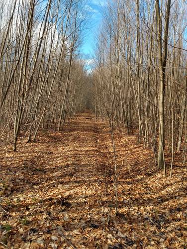
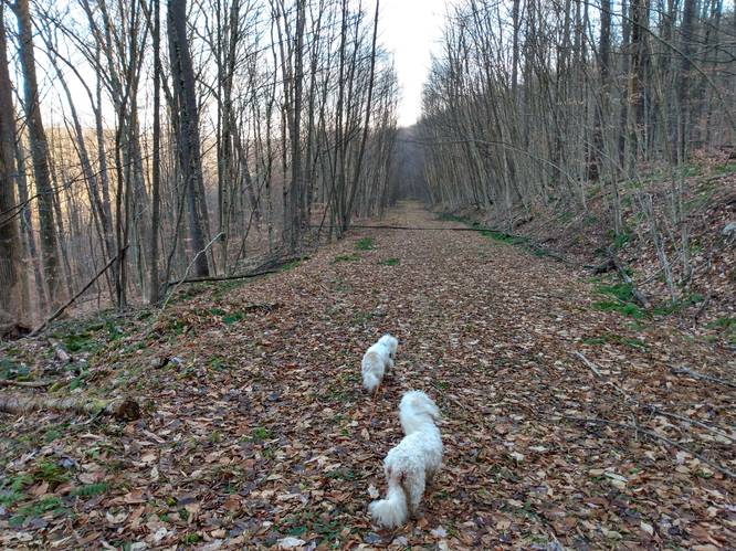
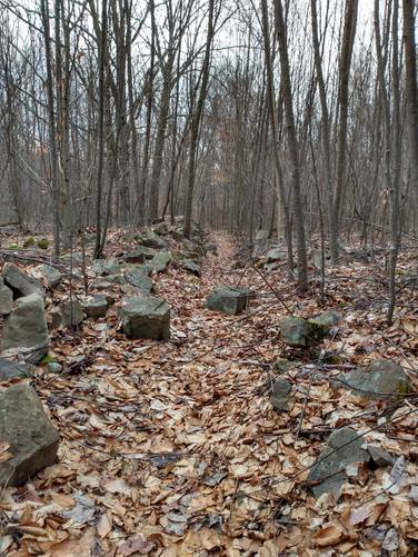
Art's Trail (Unmarked) - 1.0 mile
From the parking spot on the west side of the Big Moores Run Road, the hike begins to the northwest at the very bottom section of Blue Coat Trail. The Blue Coat trail is also a forest service road that has a walk-through gate that is observable from the parking area. Within about 300 feet beyond the walk-through gate, the unmarked trailhead for Art's Trail is on the left-hand side of the Blue Coat Trail. The junction for Art's Trail is noticeable, even though it could benefit from being cleared away of its brushy entrance. Art's Trail's is wide and firm; and gradually ascends the hillside to the southwest for 1 mile.
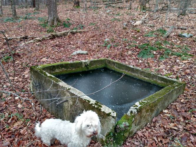
A lost relic can be seen on the upper hillside, and was found on this part of the trek just beginning the hike on Art's Trail. It is a Spring Water Box that appeared to be constructed to collect spring water in olden times. These spring water boxes and spring houses, were constructed both to collect spring water as a drinking water supply and to provide refrigeration using cold spring water, since prehistoric times and are found worldwide. And, the concrete box held spring water, up to where it's sides were still intact, as it was noted that one corner had a missing upper edge. This one was found on the lower end of Art's Trail, near Big Moore's Run in Potter County Pennsylvania. It is likely that this spring structure was used as a fresh water supply for the of Civilian Conservation Corps (CCC) once known as Camp Costello which operated in the 1930s and 1940s in this location.
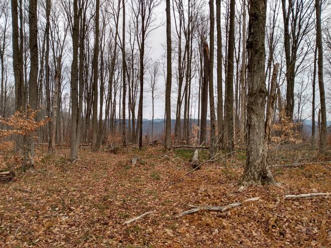
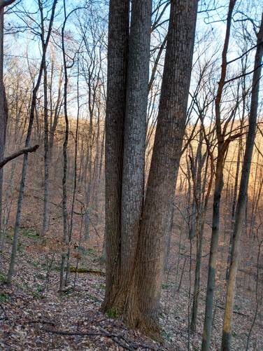
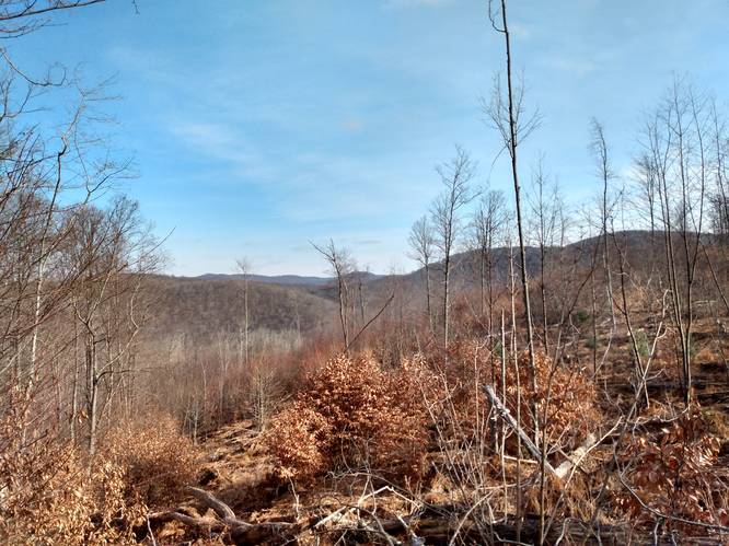
From this point and along the remaining climb, Art's Trail became a hiker's delight. Although, it could use some clearing of both brush and blowdowns along the way, it had the right feel of what a good hiking should have. At the top of this wonderful old trail, there were blowdowns that did required walk arounds. On the ridge line above, the hiker did find winter-time Vistas (obstructed views in summer).
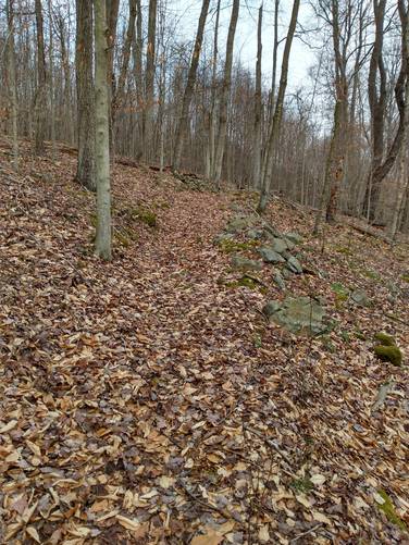
Moore's Run Fire Trail (Unmarked) - 1.5 miles
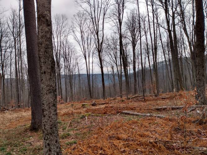
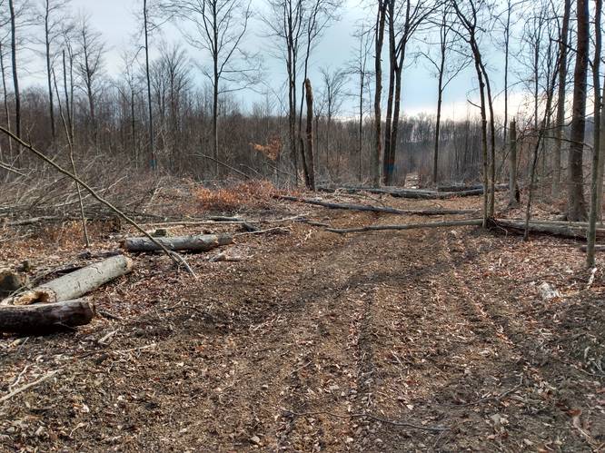
One could say that finding the southern section of the unmarked Moore's Run Fire Trail caused this hiker a slight perturbation. This drove the need for the additional scouting hike. Technically, the Moore's Run Fire Trail is a ridgeline trail. But exactly where is starts or ends, and where it goes at the upper end of Art's Trail was hard to get a handle on. During the hike of December 20, 2021 into this section, a good amount of scouting was done on the upper end of Rock Hollow, which had active logging operations on-going at that time. Rock Hollow is an mostly open field with nice vistas; but it was felt that high weeds and briars, along with the freshly made logging roads were not suitable for further exploration. This moved the hiker's focus to the hollow to the north, labelled as Windfall Hollow on the map, that also intersected along the same ridge line with a Moore's Run Fire Trail junction at its upper end.
It took awhile, but the Moore's Run Fire Trail was found. The trailhead junction with the Windfall Hollow Trail was also found. The Windfall Hollow Trail was partially hiked on the first hike. And then completely hiked on the next hike. See that trail description below. The Windfall Hollow Trail is a nice hiking trail.
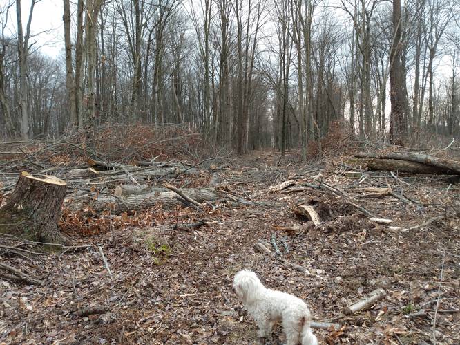
It was noted that on the second hike, on January 6, 2022, the logging operation had moved into the area of Moore's Run Fire Trail at the junction with Art's Trail. In fact, it appears the main skid way road for the logging is the Moore's Run Fire Trail. Through being determined, and with careful exploration, it can be safe to say it was more-or-less found, and is now well-enough known for the most part.
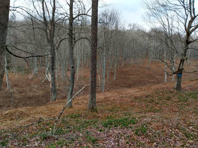
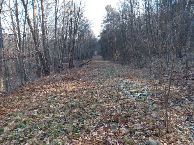
Once past the modern-day logging, Moore's Run Fire Trail is easy to follow. It goes along as a wide footpath across the ridgeline, which has grown into a brushy thicket on both side of the trail with seemly endless brushy saplings. It appears that this forest was once clear cut sometime ago, and it has never grew back any mature-sized trees. Considerable tracts clear cutting on the State Forest lands has been done in this manner on the hilltops in this area, and to the north along the ridgeline to the top end of the Blue Coat Trail. Not particularly scenic.
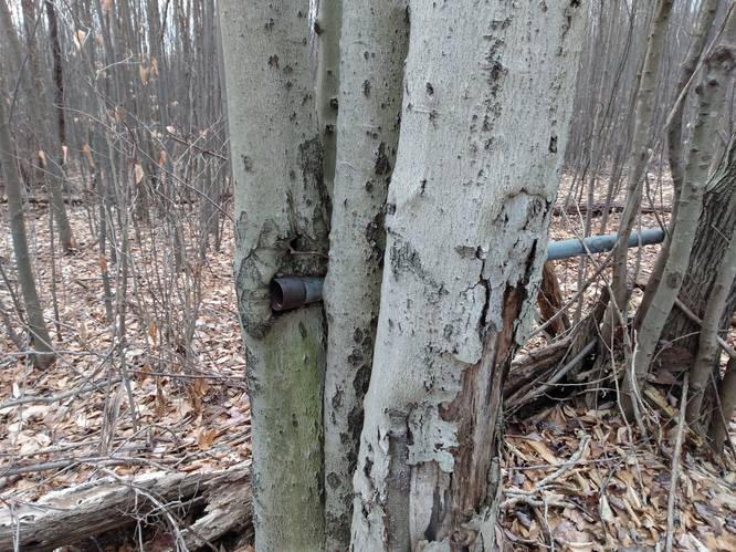
A second lost relic was found along the Moore's Run Fire Trail not too far north of junction with the Windfall Hollow Trail. What appears to be an old gas pipe section can be seen on the west side of the trail. The gas pipe looks like cybernetic outgrowth of the trees that have encapsulated it.
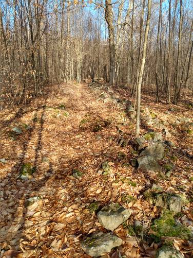
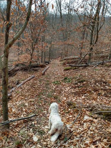
Windfall Hollow Trail (Unmarked) - 1 mile (one-way)
Windfall Hollow Trail probably began as one of those old footpaths used by the early settlers. This trail was hiked as an out-and-back beginning at the ridgeline junction with the Moores Run Fire Trail. The entrance and upper part of Windfall Hollow Trail is a narrow footpath into an overgrown brushy thicket on west side of the Moores Run Fire Trail, and is hard to find without looking carefully. Interestingly, the Windfall Hollow Trail at this section tracks through an expansive Stone Field where the larger stones have been cleared from the trail's treadway and were neatly stacked to form short walls along the pathway. It is thought that this stone arrangement, that appears here today, was probably was done long ago, likely to aid early travelers coming through, either going on-foot or by horse back travel. This stone lined pathway is something interesting for sure; it has been here for while and has been done for a intentional purpose.
This upper end on the Windfall Hollow Trail could benefit from clearing of brush on the sides of the trail and having at the entrance to the trail marked with a sign. Beyond the thicket, after about one-quarter mile point the Windfall Hollow Trail tracks through a more open forest with older-growth trees and continues on the descent down the woodland draft for the distance of about one-mile to intersect with Little Moores Run Road.
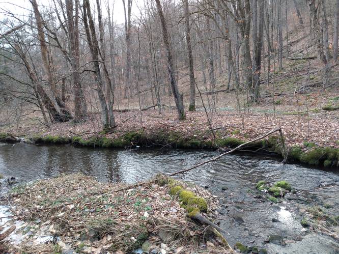
On the lower end of the Windfall Hollow Trail is the Little Moores Run Road (no trail marker sign). A short distance, about 300 feet, below the Little Moores Run Road flows the Little Moores Run. Little Moores Run normally flows with less than one-foot depth; and appeared to be an easy creek crossing. At this point, however, the hiker simply turned around and hiked back up the Windfall Hollow Trail to the Moores Run Fire Trail. There are a few springs at the bottom, that cause the area at the lower end of the Windfall Hollow Trail to be wet. After the soggy bottom start, the more agreeable treadway soon begins on the ascend up the woodland draft for the distance of about one-mile to the hilltop above the Windfall Hollow.
Blue Coat Trail (Unmarked) - 1.75 mile
The Blue Coat Trail essentially is the main forest service road that tracks from parking spot on the west side of the Big Moores Run Road, tracks to the northwest for about a mile, to a switchback intersection where this forest roadway splits into three additional forest service road branches. At this intersection, one of the service roadway branches turns to the southwest and tracks to the junction with the Moores Run Fire Trail at the ridgeline. These wide forest roadways, are fine multi-use trails open to horses, bikes and hiking, but closed to motor vehicles (ATVs).
This track was used as the return loop, to complete the hike from the Moores Run Fire Trail junction high on the ridge line back to the parking spot on the west side of the Big Moores Run Road .Near the parking area, there are old foundation Ruins point of interest, and the likely location of the remains of lodging buildings of CCC once known as Camp Costello.
Parking
This hike begins and ends on the eastern terminus along the low-volume Big Moores Run Road in Homer Township. There is a suitable for parking along the west-side of Big Moores Run Road about 500 feet south of the Moores Run bridge
Hikers can find parking at the coordinates provided; next to the Blue Coat trailhead, along Big Moores Run Road. It is important not park in front of the gate across the State Forest Access Road, which would block authorized vehicles from using the state forest road.
Pets
Dogs are allowed if leashed.
Camping
No suitable campsites were identified along these trails. For dispersed and primitive camping in other areas of the state forest, please follow the state forest rules and regulations and only camp on state lands.
Hiker's Brain Teaser (Riddle): From across the water reservoir, the hiker calls his good and faithful dog, who immediately crosses the pond or in this case an old spring water box, without getting wet. How did the miraculous dog do it?
Still Stumped? Looking for Answer below the next section.
Active Forest Management (In Theory)
Active forest management involves harvesting or cutting trees to create desired future conditions.
Because of the broad and sweeping logging practices in the early part of the twentieth century, much of Pennsylvania's forests contains mature trees that are all approximately the same age. In Pennsylvania's even-aged forests, small trees are usually about the same age as large ones; however these small trees may be of a different species, genetically inferior, or in a poor location. Diameter-limit cutting shifts species composition toward more valuable species that grow best with lots of light, and it may improve quality by retaining and promoting healthy trees. Such cutting increases future management options, speeds recovery following disturbance, and may increases seed sources for trees species better suited to the site.
Proactive forest management can also be used to reduce insect or plant threats by removing invasive species, and diseased or dead or dying beech, white ash and hemlock to improve forest health.
Hiker's Brain Teaser Answer: The spring water was frozen.
The Last Word: Who knows what else could be out there in those uncharted woods waiting to be found. Only the Gnomes know for sure. And, they were heard to say, "Just don't go into the woods and find yourself lost.".