The Andrews Lake Trail at San Juan National Forest
near Silverton, Colorado is an easy 0.8-mile out-and-back hike that
leads to Andrews Lake and features views of the surrounding snow-capped mountains, located along the Million Dollar Highway.
Hike
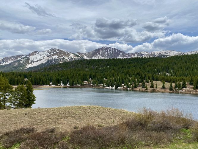
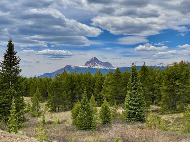
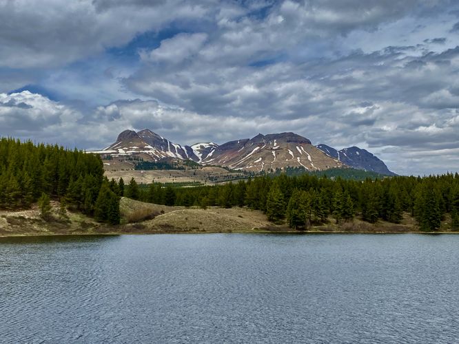
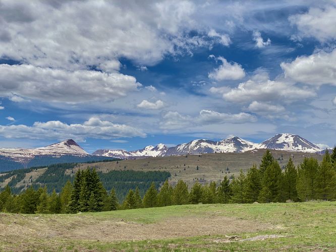
This short hike begins at the upper-most parking lot for Andrews Lake and leads-in along the off-shoot trail adjacent to the main trailhead at the parking lot. We cut down a bit of time by starting here, but this is the unofficial trailhead. Hikers will soon find signs for Andrews Lake in addition to wide-open meadow views with mountains in the background like Twin Sisters Peaks and Engineer Mountain. The trail then leads northward before cutting south to head toward the lake. The trail's scenery doesn't end at the meadow though, as the way downhill to the lake provides views of Snowdon Peak and Andrews Lake.
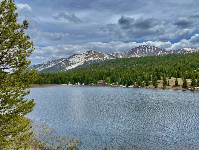
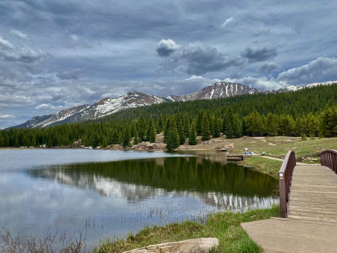
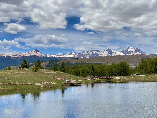
This route follows the shoreline of Andrews Lake, passing through the lower parking lot, to reach views of Engineer Mountain on the far side of the parking lot. The trail then runs along the shoreline, crossing a footbridge that sits adjacent to an overflow spillway. Here, you'll find more scenic views of Snowdon Peak and the surrounding mountains. We hiked along the south side of Andrews Lake, taking in the views of Grand Turk Mountain, Engineer Mountain, and the distant peaks before the trail became extremely buggy. In hopes of hiking the entire loop back to parking (which was not very long) we opted to turn back at the middle of the south shore, as the views wouldn't get much better.
The hike back to parking wasn't difficult, but at 10,600-feet above sea level, it was definitely harder to breathe for us non-locals. The hike completed at the open meadow / upper parking lot for a short 0.8-mile hike.
Parking
Hikers will find two parking lots for this hike, both located at the Andrews Lake section of the national forest on of the Million Dollar Highway. The coordinates for this hike will bring you to the upper-most parking lot which is very quiet but provides additional mileage to hike and scenery to enjoy. You can also follow signs to reach the lower parking lot for faster access to Andrews Lake.
Pets
Dogs are allowed if leashed and should be cleaned up after.
Warning
Elevation sickness: This trail leads through an altitude of 10,600-feet above sea level. Around the 7,000-foot mark above sea level, hikers may start to experience symptoms of elevation sickness including headache, muscle aches, shortness of breath, among other warning signs. In order to avoid elevation sickness it's recommended to ascend to higher elevations and take short walks to acclimate over the course of several days before taking a long or physically-demanding hike. At any time you feel elevation sickness kicking in, that's the time to turn back and head for lower altitude or the parking lot.
Hike
This short hike begins at the upper-most parking lot for Andrews Lake and leads-in along the off-shoot trail adjacent to the main trailhead at the parking lot. We cut down a bit of time by starting here, but this is the unofficial trailhead. Hikers will soon find signs for Andrews Lake in addition to wide-open meadow views with mountains in the background like Twin Sisters Peaks and Engineer Mountain. The trail then leads northward before cutting south to head toward the lake. The trail's scenery doesn't end at the meadow though, as the way downhill to the lake provides views of Snowdon Peak and Andrews Lake.
This route follows the shoreline of Andrews Lake, passing through the lower parking lot, to reach views of Engineer Mountain on the far side of the parking lot. The trail then runs along the shoreline, crossing a footbridge that sits adjacent to an overflow spillway. Here, you'll find more scenic views of Snowdon Peak and the surrounding mountains. We hiked along the south side of Andrews Lake, taking in the views of Grand Turk Mountain, Engineer Mountain, and the distant peaks before the trail became extremely buggy. In hopes of hiking the entire loop back to parking (which was not very long) we opted to turn back at the middle of the south shore, as the views wouldn't get much better.
The hike back to parking wasn't difficult, but at 10,600-feet above sea level, it was definitely harder to breathe for us non-locals. The hike completed at the open meadow / upper parking lot for a short 0.8-mile hike.
Parking
Hikers will find two parking lots for this hike, both located at the Andrews Lake section of the national forest on of the Million Dollar Highway. The coordinates for this hike will bring you to the upper-most parking lot which is very quiet but provides additional mileage to hike and scenery to enjoy. You can also follow signs to reach the lower parking lot for faster access to Andrews Lake.
Pets
Dogs are allowed if leashed and should be cleaned up after.
Warning
Elevation sickness: This trail leads through an altitude of 10,600-feet above sea level. Around the 7,000-foot mark above sea level, hikers may start to experience symptoms of elevation sickness including headache, muscle aches, shortness of breath, among other warning signs. In order to avoid elevation sickness it's recommended to ascend to higher elevations and take short walks to acclimate over the course of several days before taking a long or physically-demanding hike. At any time you feel elevation sickness kicking in, that's the time to turn back and head for lower altitude or the parking lot.