The Agnew Road Trail at Hays Woods, Pittsburgh, PA, is a 2 mile one-way hike that starts at end of Agnew Road (off Becks Run Road), leads into the center of Hay's Woods, before heading downhill and ends at the intersection of Glass Run Rd and Route 885.
Hay's Woods can be tricky to navigate, so follow these tips for turns along the trail (if heading west to east):
Miles 0 - 0.3: Stay straight on the trail at the first left-hand turn. Upon 0.3 miles in, you'll find a fork, stay left here.
Miles 0.3 - 0.45: Stay left after the first fork, for the next 2 trail intersections.
Miles 0.45 - 0.9: Continue straight and at the next trail intersection, take your right-hand turn.
Mile 0.9: Head straight through this trail junction.
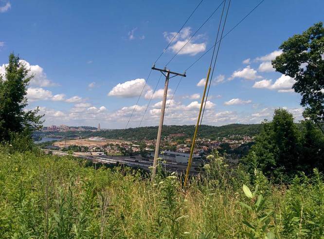
Mile 1.1: Lookout point of the Monongahela River, Cathedral of Learning, and Oakland.
Mile 1.3: Small loop that connects back to main trail - stay right, but does not matter.
Mile 1.4: You have 3 options - stay straight, go left (depicted in trail map), or take a right-hand turn and head south. Each of these trails meets back up to one another on the eastern side. To follow the trail map here, take a left. This is the last trail junction before heading down and out of Hay's Woods at the eastern trail terminus.
Dogs and biking are allowed on this trail.
Hay's Woods can be tricky to navigate, so follow these tips for turns along the trail (if heading west to east):
Miles 0 - 0.3: Stay straight on the trail at the first left-hand turn. Upon 0.3 miles in, you'll find a fork, stay left here.
Miles 0.3 - 0.45: Stay left after the first fork, for the next 2 trail intersections.
Miles 0.45 - 0.9: Continue straight and at the next trail intersection, take your right-hand turn.
Mile 0.9: Head straight through this trail junction.
Mile 1.1: Lookout point of the Monongahela River, Cathedral of Learning, and Oakland.
Mile 1.3: Small loop that connects back to main trail - stay right, but does not matter.
Mile 1.4: You have 3 options - stay straight, go left (depicted in trail map), or take a right-hand turn and head south. Each of these trails meets back up to one another on the eastern side. To follow the trail map here, take a left. This is the last trail junction before heading down and out of Hay's Woods at the eastern trail terminus.
Dogs and biking are allowed on this trail.