This 1.2 mile moderate loop trail at the Otto & Magdalene Ackerman Nature Preserve in Ardara, Pennsylvania is one of the best hidden gem hikes outside of Pittsburgh. This trail features three waterfalls and a cliff lookout. Dogs and biking are both allowed.
The trail starts off between two houses and heads back into the nature preserve. The trail immediately follows the Old Dirt Road Trail, which is blazed orange. If you plan on an easier hike and just want to see the waterfalls, head down the orange blaze trail and plan on an out-and-back hike.
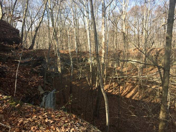
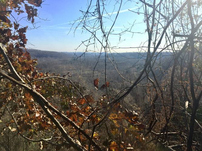
However, if you plan to follow this recording, stay left at the first fork in the trail and follow the white blazes - this is named the Cliff Trail. Soon after the fork, the trail heads uphill at a somewhat steep grade, but the hike up is not very long. Once you reach the top of the hill, there are a couple of lookout points with views of the surrounding hills. These views are best during late autumn, winter, and early spring when there are no leaves on the trees. You'll also find a blue-blaze trail that leads into the middle of the hill to an area with rock bluffs - an old stone quarry. This blue-blaze trail does lead to the other side of the park and over to the Waterfall Trail, but this recording continues on the white-blazed Cliff Trail.
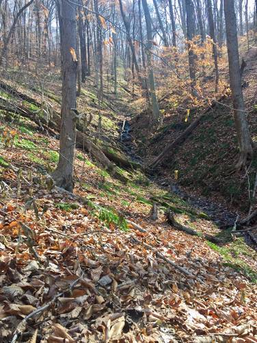
Follow the white blazes until you reach a triple white-blazed tree - this is where the loop takes a right-hand turn and runs adjacent to the gorge and creek that heads down towards the waterfalls. Please note that the trail here is not easy to follow - we technically followed large white blazes and pink ribbons on the trees before we found the Waterfall Trail (a mix of white, pink ribbons, and some yellow and blue blazes). You know you're on the Waterfall Trail when you're hiking along a skinny trail that runs next to the gorge.
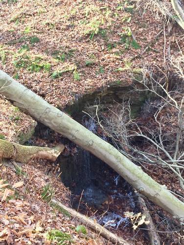
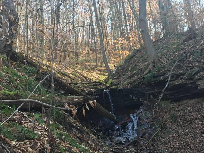
Waterfall: Eventually you'll start to see some blue blazes around mile 0.7 along the Waterfall Trail - some run uphill and some run adjacent to the gorge. Around this area you should start to hear the sound of a trickling waterfall within the gorge too. You can't miss the main 10-foot free fall waterfall. Follow the blue, yellow, and orange blaze Waterfall Trail further until you reach a bench with blue blazes heading to your left. Here, you can follow the blue blazes down a couple of switchbacks to two more waterfalls. If you skipped the Cliff Trail and only followed the orange blazes from the parking area, you can expect to hit these backwards - first the small blue blaze switchback waterfalls and then the main waterfall further up the hill.
Parking: The nature preserve sits behind a small neighborhood along Ardara Rd and is easy to miss. There's a brown sign that sits along the road between two houses (at the parking coordinates provided) with a small parking turnout. You can technically drive down the right-of-way to the trailhead, but this recording starts at the road where we decided to park.
Hunting: Hunting is allowed here during certain seasons and between certain dates. As of Nov 23, 2018 bow hunting is allowed. It's best to wear orange here despite the low amount of traffic in this park.
The trail starts off between two houses and heads back into the nature preserve. The trail immediately follows the Old Dirt Road Trail, which is blazed orange. If you plan on an easier hike and just want to see the waterfalls, head down the orange blaze trail and plan on an out-and-back hike.
However, if you plan to follow this recording, stay left at the first fork in the trail and follow the white blazes - this is named the Cliff Trail. Soon after the fork, the trail heads uphill at a somewhat steep grade, but the hike up is not very long. Once you reach the top of the hill, there are a couple of lookout points with views of the surrounding hills. These views are best during late autumn, winter, and early spring when there are no leaves on the trees. You'll also find a blue-blaze trail that leads into the middle of the hill to an area with rock bluffs - an old stone quarry. This blue-blaze trail does lead to the other side of the park and over to the Waterfall Trail, but this recording continues on the white-blazed Cliff Trail.
Follow the white blazes until you reach a triple white-blazed tree - this is where the loop takes a right-hand turn and runs adjacent to the gorge and creek that heads down towards the waterfalls. Please note that the trail here is not easy to follow - we technically followed large white blazes and pink ribbons on the trees before we found the Waterfall Trail (a mix of white, pink ribbons, and some yellow and blue blazes). You know you're on the Waterfall Trail when you're hiking along a skinny trail that runs next to the gorge.
Waterfall: Eventually you'll start to see some blue blazes around mile 0.7 along the Waterfall Trail - some run uphill and some run adjacent to the gorge. Around this area you should start to hear the sound of a trickling waterfall within the gorge too. You can't miss the main 10-foot free fall waterfall. Follow the blue, yellow, and orange blaze Waterfall Trail further until you reach a bench with blue blazes heading to your left. Here, you can follow the blue blazes down a couple of switchbacks to two more waterfalls. If you skipped the Cliff Trail and only followed the orange blazes from the parking area, you can expect to hit these backwards - first the small blue blaze switchback waterfalls and then the main waterfall further up the hill.
Parking: The nature preserve sits behind a small neighborhood along Ardara Rd and is easy to miss. There's a brown sign that sits along the road between two houses (at the parking coordinates provided) with a small parking turnout. You can technically drive down the right-of-way to the trailhead, but this recording starts at the road where we decided to park.
Hunting: Hunting is allowed here during certain seasons and between certain dates. As of Nov 23, 2018 bow hunting is allowed. It's best to wear orange here despite the low amount of traffic in this park.