The Abandoned Ironton Townsite Trail in Ouray County, Colorado is an easy 0.5-mile out-and-back hike that leads to the historic ghost town of Ironton.
Hike
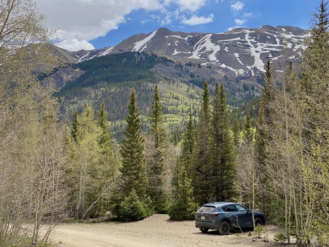
This short hike begins at the coordinates provided just south of the Million Dollar Highway. Hikers will find a dirt road that leads-in from the highway -- this old dirt road is just a small section of the long-lost town of Ironton. There's a small parking turnout at the coordinates provided where you'll start the hike. In the route provided, we hiked-in and passed a campsite before reaching the wider and easier-to-follow dirt road that lead to Ironton. Note that if you have a high-clearance vehicle, you don't necessarily need to hike to the Ironton Townsite.
Ironton Townsite - Mile 0.16
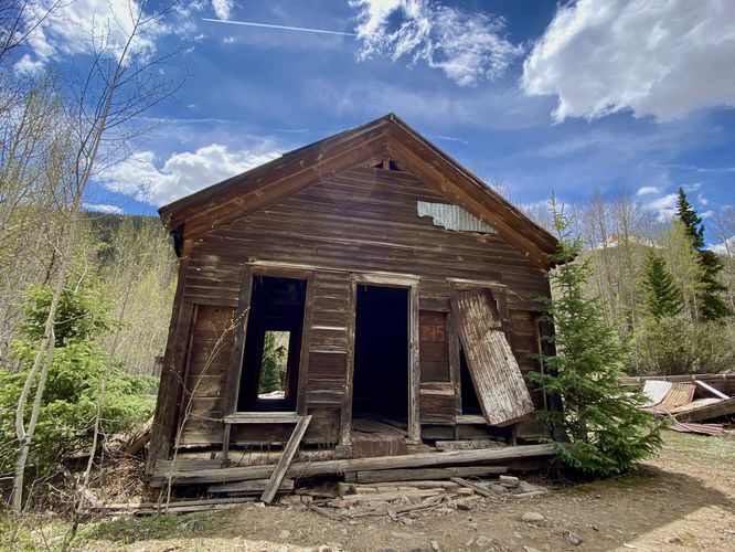
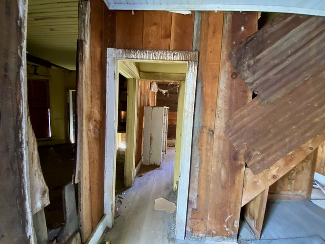
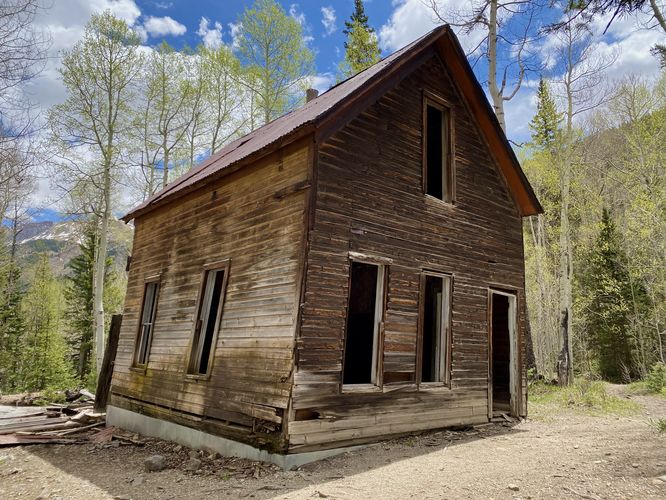
The dirt road eventually reaches the preserved abandoned buildings of Ironton around mile 0.16. Here, you'll find several abandoned houses that once comprised the town of Ironton. You can also peek inside if you wish to get a feel for the deteriorating decor from a bygone era. This route leads to the main buildings before looping back to the beginning. Along the way are a few historical signs about Ironton and its mining history from the late 1880s - 1890s silver boom and crash, to the WWI metal mining efforts, and even WWII mining efforts. The town saw people come and go seasonally and throughout the decades due to Ironton's constantly-changing need and droughts for prospecting silver, gold, copper, lead and zinc, within the Red Mountain Mining District. The area and historic houses are maintained and owned by Ouray County and are protected and conserved by the Ouray County Historical Society.
Views
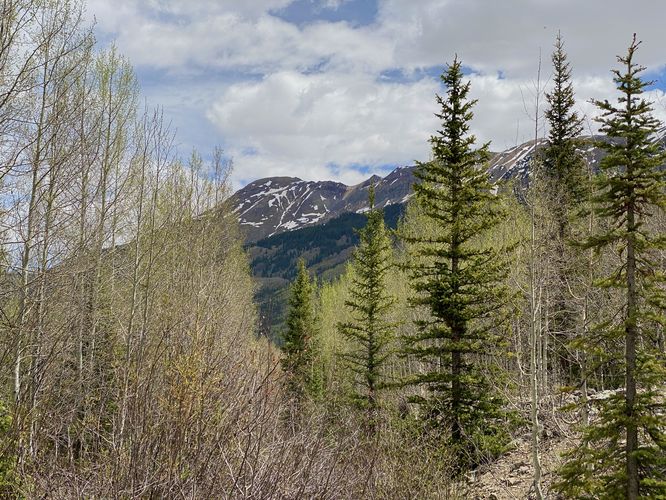
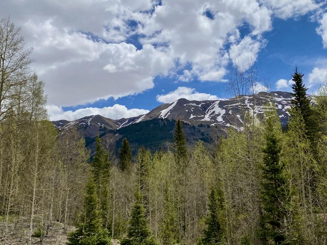
On the hike back to parking, via the high-clearance vehicle road, hikers will find views of Brown Mountain towering overhead. While there are no lookouts or overlooks, there are views from between the trees.
Camping
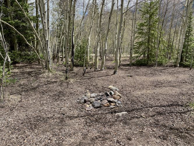
This area along the dirt road that you drove-in on has several car camping spots. This trail includes just one of those campsites, located near the road. The site is open and has nearby views of Brown Mountain. There's a small fire ring at the campsite and enough room to hold a few tents as of June 2024. Do not camp in the historic town and instead camp at the designated campsites to help preserve these historical buildings.
Pets
Dogs are allowed only if leashed and should be cleaned up after.
History of Ironton, CO (Ghost Town)
The mining town of Ironton was founded in 1883 and over 100 buildings were constructed here in that year alone. By the mid-1880s, Ironton's population fluctuated from 200 during the winter to almost 1000 people in the summer. Ironton served as the supply point for the rich silver mines of the Red Mountain Mining District. By 1890 Ironton, with its plank sidewalks, saloons, brothels, graded streets, schoolhouse and two churches, was booming. In that year the United States Congress passed the Sherman Silver Purchase Act that required the government to buy 4.5 million ounces of silver per month, the total output of the western silver mines.
When the Sherman Act was repealed in 1893, the price of silver plunged, as did the population of Ironton. The Red Mountain Mining District never recovered, and by the late 1890s most of the mines in this area had closed. Mining rebounded during the First World War, but the Great Depression of the 1930s dealt another blow to mining in the San Juan Mountains. Large-scale mining began again on Red Mountain during and after the Second World War
as demand for copper, lead, and zinc continued to increase, but this period of growth did not last. Ironton's post office closed in 1920, and in 1921 the railroad ceased all operations. The last remaining resident and "Mayor" of Ironton, Milton Larson, passed away in the 1960s, when the town of Ironton officially became a ghost town. Ouray County purchased this property from the Carl Turk family in 2001 with the assistance of the Great Outdoors Colorado Trust Fund and the Idarado Resource Damage Fund. Today the only activity in the mining district is the continued efforts of the Idarado Mining Company to mitigate the environmental problems caused by over 100 years of mining on Red Mountain.
Hike
This short hike begins at the coordinates provided just south of the Million Dollar Highway. Hikers will find a dirt road that leads-in from the highway -- this old dirt road is just a small section of the long-lost town of Ironton. There's a small parking turnout at the coordinates provided where you'll start the hike. In the route provided, we hiked-in and passed a campsite before reaching the wider and easier-to-follow dirt road that lead to Ironton. Note that if you have a high-clearance vehicle, you don't necessarily need to hike to the Ironton Townsite.
Ironton Townsite - Mile 0.16
The dirt road eventually reaches the preserved abandoned buildings of Ironton around mile 0.16. Here, you'll find several abandoned houses that once comprised the town of Ironton. You can also peek inside if you wish to get a feel for the deteriorating decor from a bygone era. This route leads to the main buildings before looping back to the beginning. Along the way are a few historical signs about Ironton and its mining history from the late 1880s - 1890s silver boom and crash, to the WWI metal mining efforts, and even WWII mining efforts. The town saw people come and go seasonally and throughout the decades due to Ironton's constantly-changing need and droughts for prospecting silver, gold, copper, lead and zinc, within the Red Mountain Mining District. The area and historic houses are maintained and owned by Ouray County and are protected and conserved by the Ouray County Historical Society.
Views
On the hike back to parking, via the high-clearance vehicle road, hikers will find views of Brown Mountain towering overhead. While there are no lookouts or overlooks, there are views from between the trees.
Camping
This area along the dirt road that you drove-in on has several car camping spots. This trail includes just one of those campsites, located near the road. The site is open and has nearby views of Brown Mountain. There's a small fire ring at the campsite and enough room to hold a few tents as of June 2024. Do not camp in the historic town and instead camp at the designated campsites to help preserve these historical buildings.
Pets
Dogs are allowed only if leashed and should be cleaned up after.
History of Ironton, CO (Ghost Town)
The mining town of Ironton was founded in 1883 and over 100 buildings were constructed here in that year alone. By the mid-1880s, Ironton's population fluctuated from 200 during the winter to almost 1000 people in the summer. Ironton served as the supply point for the rich silver mines of the Red Mountain Mining District. By 1890 Ironton, with its plank sidewalks, saloons, brothels, graded streets, schoolhouse and two churches, was booming. In that year the United States Congress passed the Sherman Silver Purchase Act that required the government to buy 4.5 million ounces of silver per month, the total output of the western silver mines.
When the Sherman Act was repealed in 1893, the price of silver plunged, as did the population of Ironton. The Red Mountain Mining District never recovered, and by the late 1890s most of the mines in this area had closed. Mining rebounded during the First World War, but the Great Depression of the 1930s dealt another blow to mining in the San Juan Mountains. Large-scale mining began again on Red Mountain during and after the Second World War
as demand for copper, lead, and zinc continued to increase, but this period of growth did not last. Ironton's post office closed in 1920, and in 1921 the railroad ceased all operations. The last remaining resident and "Mayor" of Ironton, Milton Larson, passed away in the 1960s, when the town of Ironton officially became a ghost town. Ouray County purchased this property from the Carl Turk family in 2001 with the assistance of the Great Outdoors Colorado Trust Fund and the Idarado Resource Damage Fund. Today the only activity in the mining district is the continued efforts of the Idarado Mining Company to mitigate the environmental problems caused by over 100 years of mining on Red Mountain.