The 7 Sisters Trail (Seven Sisters) is a difficult 5.1 mile one-way hike that runs along the ridge of the Holyoke Range in Massachusetts from Mount Holyoke to the Notch. The trail can be picked up in two different locations - from the base of Mount Holyoke or the base of Bare Mountain on the Notch. There are no shuttle services for this hike, so to complete it one-way, you'll need two cars or you'll need a friend to pick you up afterward. You can also hike it out-and-back for just over 10 miles and close to 3000 feet of elevation gain, but the out-and-back hike is much more strenuous.
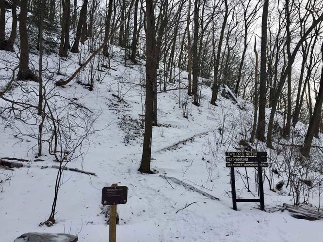
This hike starts at the base of Mount Holyoke along Old Mountain Rd in Hadley, Massachusetts and follows Skinner State Park Rd up the mountain until you reach the M&M Trail (white blazes). You'll see a small sign that lists the '7 Sisters Trail' - follow the M&M Trail east until you reach the parking at the Notch.
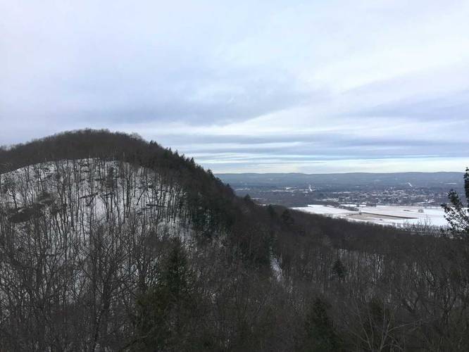
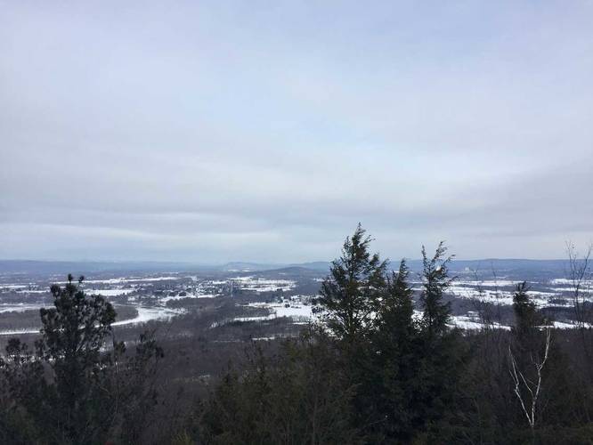
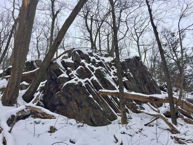
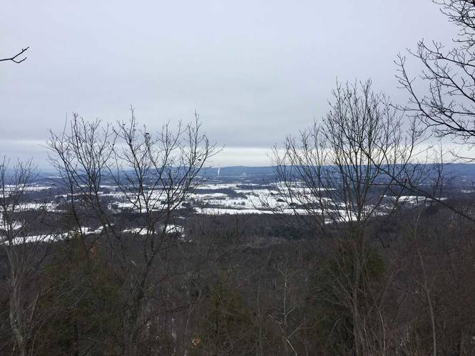
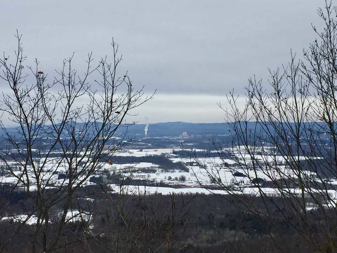
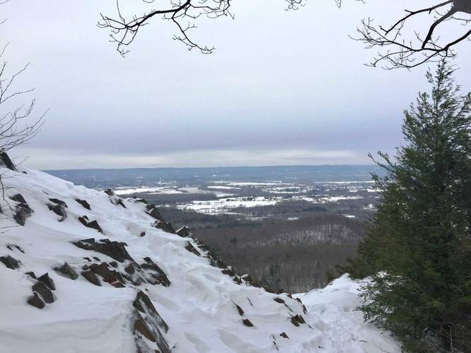
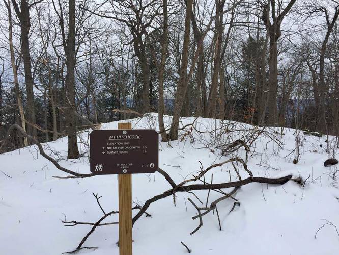
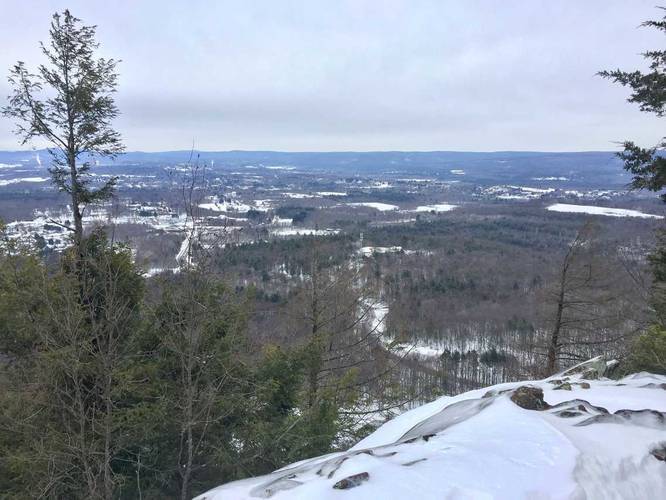
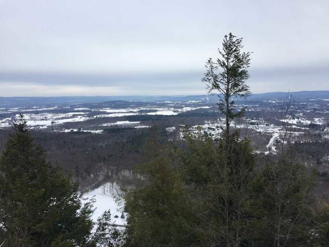
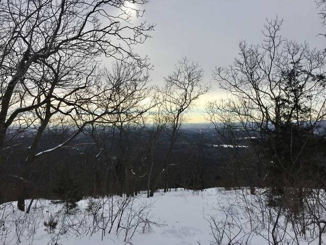
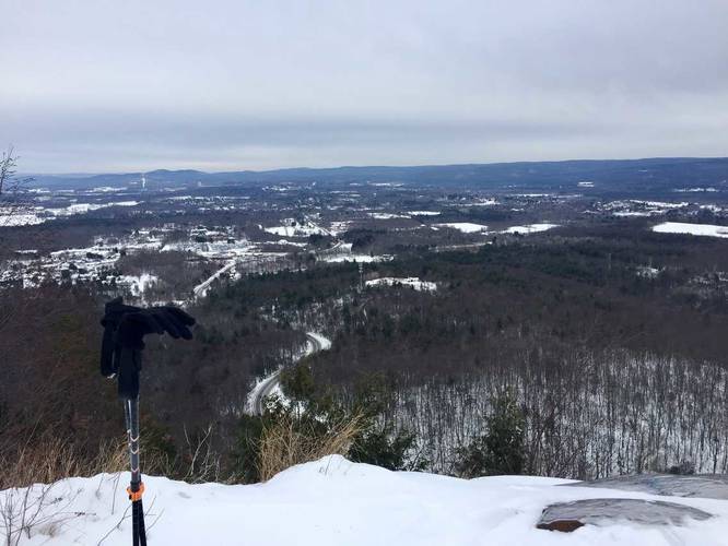
Just after you hop on the M&M Trail, you'll reach Taylor Notch, which is an overlook just above the intersection for the M&M. Taylor Notch gives you an overlook of Hadley, the Connecticut River, Mount Holyoke, and even Mount Tom in the distance. After stopping at Taylor Notch, continue hiking east and you'll find a small geocache box along the trail on the left-hand side. After Taylor Notch, the trail's elevation becomes very wave-like where you end up hiking uphill and downhill over and over again before finally reaching Mount Hitchcock. The trail makes a large descent just before Mount Hitchcock and then shoots up a steep climb up the mountain. Once you make it to the top of Mount Hitchcock, there's another overlook with views of Hadley, Amherst, Sunderland, and the rest of the valley. You can see Mount Toby in the distance and even Mount Greylock on good days.
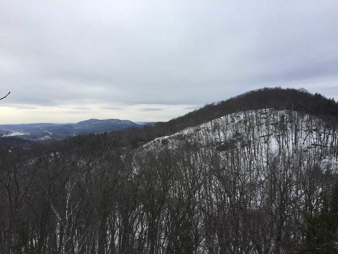
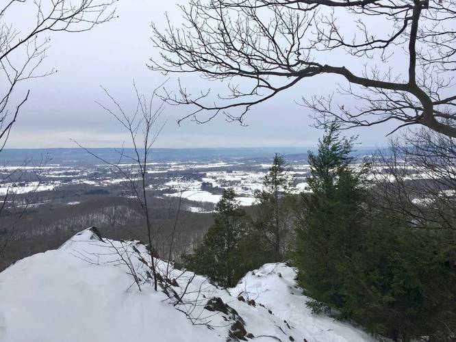
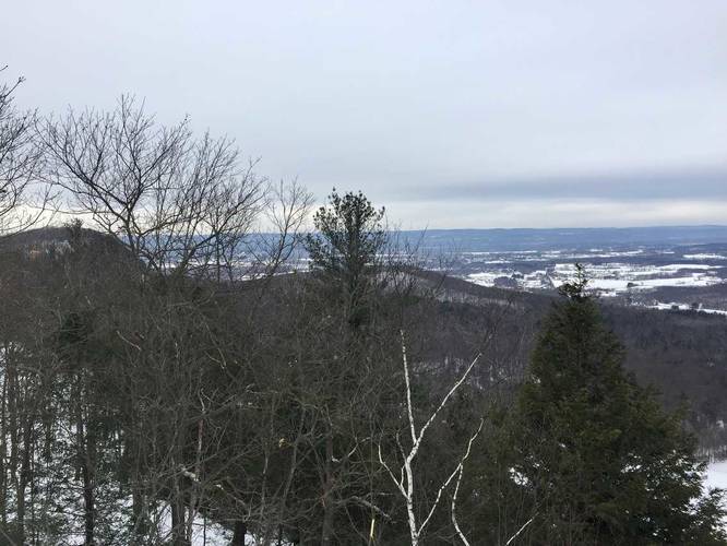
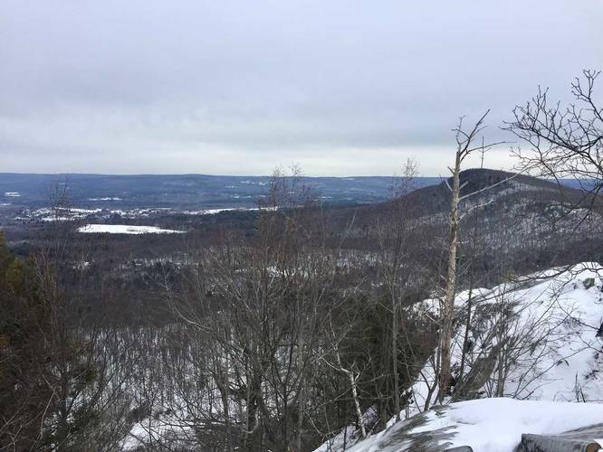
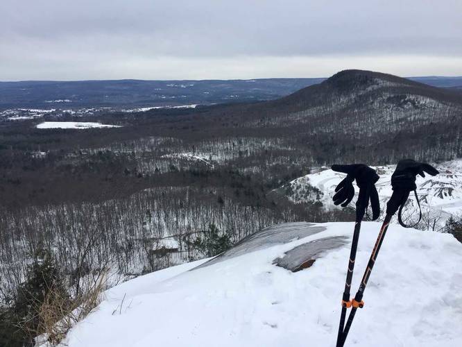
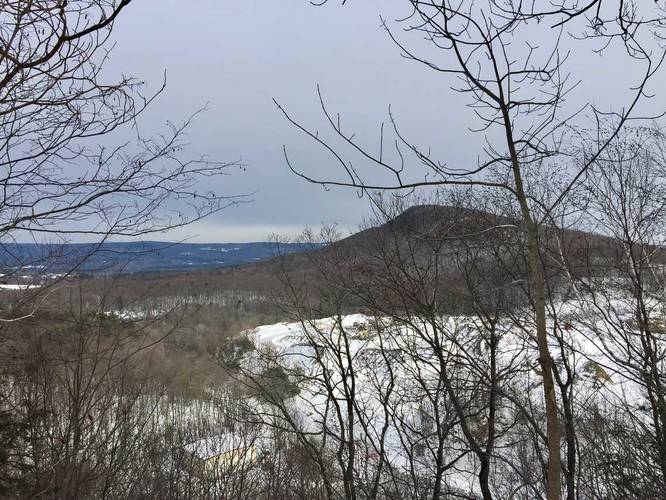
After reaching the summit of Mount Hitchcock, continue east toward Bare Mountain. The trail again dips back downhill before shooting up Bare Mountain, which is yet another steep climb. Bare Mountain has two main lookout points - on the west side and one on the east side just above the Notch. Make sure to stop at these two lookout points before heading down Bare Mountain to parking.
Parking
Parking can be found on Old Mountain Road at the base of Mount Holyoke, just by the gate and at the Notch Visistor's center in Amherst, Massachusetts.
Note
Some sections of this trail are steep and require a little bit of climbing along steeper edges. Nothing too crazy, but the trail is not as accessible to little children.
Pets
Dogs are allowed on this trail.
Biking
Mountain Biking is allowed on this trail, but it'd be very difficult to bike on the 7 Sisters considering there are many steep cliff-like climbs.
This hike starts at the base of Mount Holyoke along Old Mountain Rd in Hadley, Massachusetts and follows Skinner State Park Rd up the mountain until you reach the M&M Trail (white blazes). You'll see a small sign that lists the '7 Sisters Trail' - follow the M&M Trail east until you reach the parking at the Notch.
Just after you hop on the M&M Trail, you'll reach Taylor Notch, which is an overlook just above the intersection for the M&M. Taylor Notch gives you an overlook of Hadley, the Connecticut River, Mount Holyoke, and even Mount Tom in the distance. After stopping at Taylor Notch, continue hiking east and you'll find a small geocache box along the trail on the left-hand side. After Taylor Notch, the trail's elevation becomes very wave-like where you end up hiking uphill and downhill over and over again before finally reaching Mount Hitchcock. The trail makes a large descent just before Mount Hitchcock and then shoots up a steep climb up the mountain. Once you make it to the top of Mount Hitchcock, there's another overlook with views of Hadley, Amherst, Sunderland, and the rest of the valley. You can see Mount Toby in the distance and even Mount Greylock on good days.
After reaching the summit of Mount Hitchcock, continue east toward Bare Mountain. The trail again dips back downhill before shooting up Bare Mountain, which is yet another steep climb. Bare Mountain has two main lookout points - on the west side and one on the east side just above the Notch. Make sure to stop at these two lookout points before heading down Bare Mountain to parking.
Parking
Parking can be found on Old Mountain Road at the base of Mount Holyoke, just by the gate and at the Notch Visistor's center in Amherst, Massachusetts.
Note
Some sections of this trail are steep and require a little bit of climbing along steeper edges. Nothing too crazy, but the trail is not as accessible to little children.
Pets
Dogs are allowed on this trail.
Biking
Mountain Biking is allowed on this trail, but it'd be very difficult to bike on the 7 Sisters considering there are many steep cliff-like climbs.