The 1957 Plane Crash Site Hike at Mount Holyoke Range State Park in Belchertown, Massachusetts is a moderate 2.9-mile out-and-back hike that passes through a long-forgotten plane crash site and features a view of the mountains surrounding Pioneer Valley from the power lines.
Hike Description
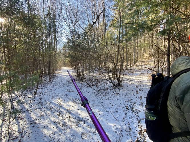
This hike begins along Bay Road at the coordinates provided. There's a small parking turnout near the large metal gate that provides access into this eastern section of the state park. Hikers will head into the field, cutting southeast, to reach an old county road. This county road once ran up the mountain, connecting to private property along the way; however, all of this land was eventually acquired by the State of Massachusetts. This abandoned road explains the abandoned telephone pole lines, old lamp post in the field, and fencing before the first trail junction.
Keep-Left - Mile 0.5
At mile 0.5 hikers will want to say left along the main path.
Abandoned Old County Road
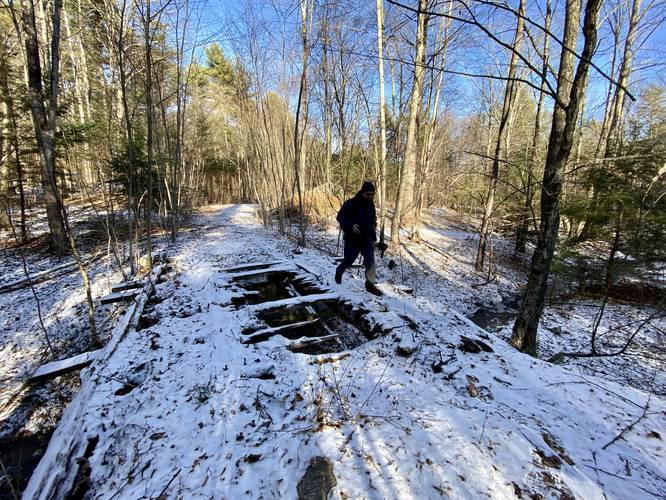
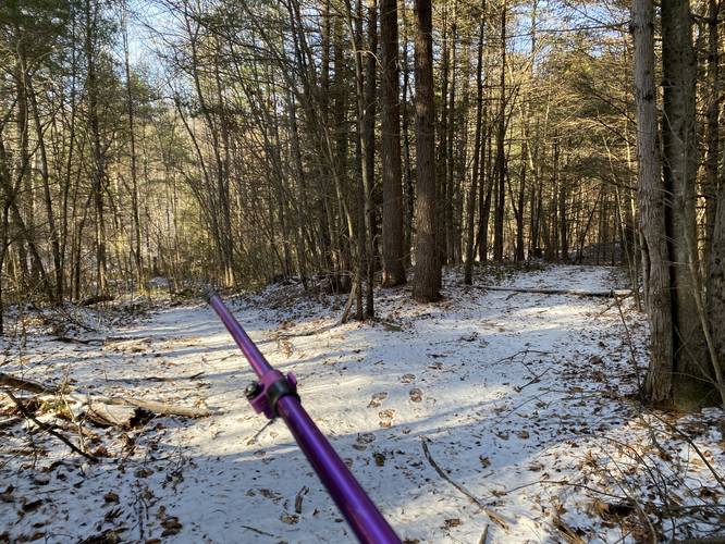
Shortly after that, the trail will eventually begin to climb the nearby hill up toward the old plane crash site and the power lines, undulating along the way, as it follows the very old long-abandoned county road. The trail will cross a sketchy wooden bridge that crosses over a brook at mile 0.6 (watch your step), then it passes through a cut-out hillside with an obviously-fortified road built through the middle. Most of the off-shoot trails that lead up the mountain along this trail are smaller or overgrown, so the main trail / abandoned county road is generally easy to follow; however, the turns are documented below.
Stay Left - Mile 0.75
Around mile 0.75, hikers will reach a trail junction - stay left to continue up the mountain.
Stay Left - Mile 1
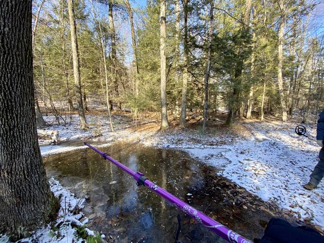
At mile 1, hikers will reach a very wet swampy section of the trail where a nearby stream generally spills over into the trail. There's a trail junction here, which connect to the first junction you passed earlier. Stay left here to head up the mountain.
Keep-Left - Mile 1.1
Around mile 1.1, hikers will reach a more obvious trail junction - the right-hand turn here leads to private property, so keep left here. Rule of thumb is, just keep hiking up the mountain.
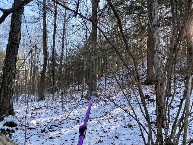
Plane Crash Site - Mile 1.2 to 1.3
Just after the turn at mile 1.1, hikers will head up the mountain a bit before finding a very flat location just off-trail to the south. Around mile 1.2, located off-trail from the main path, is where we're claiming the plane crash site approximately located; however, this is based on the couple of small pieces of metal we found in December 2022 in addition to an eye-witness account of the crash in 1957. In hopes of finding more pieces of the plane, I bushwhacked through the forest and back up the mountain to reach the main trail once more; however, following this bushwhack is entirely optional.
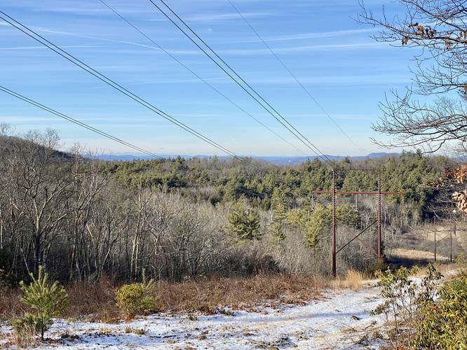
Power Line View - Mile 1.5
At mile 1.5, hikers will reach a decent view of the mountains surrounding the Pioneer Valley. The view sits just below the large power lines that run down the mountain. After visiting this view, unless you plan to hike further, the hike out follows the main trail back for approximately 2.9-miles total. Note that the mileage may be shorter if you skip the bushwhack portion of the hike.
Parking
Hikers will find a grassy parking turnout near the large gate at the coordinates provided, located just off of Bay Road. The turnout can fit a handful of vehicles. Do not block the gate.
Pets
Dogs are allowed if leashed and cleaned up after.
Plane Crash History
Found on New England Aviation History, sourced from the Springfield Union (Feb 29, 1957): "On February 28, 1957, two F-86D Sabre jets from Westover Air Force Base were on a routine training flight when they collided in mid-air over the Quabbin Reservoir in central Massachusetts.
One aircraft, piloted by Lieutenant Robert Smyth, (28),went down in a wooded area off Bay Road in Belchertown. Smyth ejected safely, and landed about 1.5 miles from the wreckage.
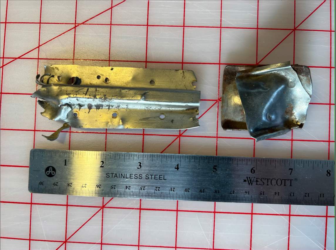
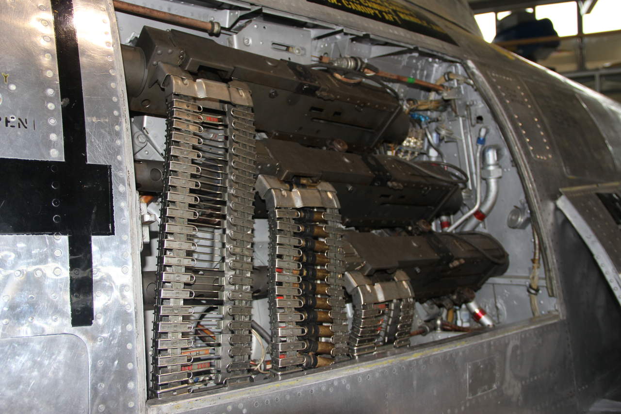
All credit for this hike goes to one member of our hiking group - Jon Fournier - who's father witnessed this plane crash as a kid - and helped us narrow down where to search. Jon also did a bunch of local research, aside from information from his father, about this crash, which helped narrow down where to look. Additionally, according to local lore, the fuselage was either buried or hauled out by the military very shortly after the accident. Upon our hike here in late December 2022, we brought a small metal detector to try and at least locate a possible spot where the plane crashed. We got lucky and found some small pieces of aircraft metal half-buried in the soil. The small pieces of metal we found appear to match the riveted sheet metal connecting pieces which appear inside of the F-86 gun bays. Combining the witness account and small metal pieces that appear to match, it's very likely that at mile 1.2, or around mile 1.2 in the GPS data provided, is where the plane went down in 1957. These small pieces would've been scattered across the a debris field, so it's hard to tell exactly where the plane crashed.
Hike Description
This hike begins along Bay Road at the coordinates provided. There's a small parking turnout near the large metal gate that provides access into this eastern section of the state park. Hikers will head into the field, cutting southeast, to reach an old county road. This county road once ran up the mountain, connecting to private property along the way; however, all of this land was eventually acquired by the State of Massachusetts. This abandoned road explains the abandoned telephone pole lines, old lamp post in the field, and fencing before the first trail junction.
Keep-Left - Mile 0.5
At mile 0.5 hikers will want to say left along the main path.
Abandoned Old County Road
Shortly after that, the trail will eventually begin to climb the nearby hill up toward the old plane crash site and the power lines, undulating along the way, as it follows the very old long-abandoned county road. The trail will cross a sketchy wooden bridge that crosses over a brook at mile 0.6 (watch your step), then it passes through a cut-out hillside with an obviously-fortified road built through the middle. Most of the off-shoot trails that lead up the mountain along this trail are smaller or overgrown, so the main trail / abandoned county road is generally easy to follow; however, the turns are documented below.
Stay Left - Mile 0.75
Around mile 0.75, hikers will reach a trail junction - stay left to continue up the mountain.
Stay Left - Mile 1
At mile 1, hikers will reach a very wet swampy section of the trail where a nearby stream generally spills over into the trail. There's a trail junction here, which connect to the first junction you passed earlier. Stay left here to head up the mountain.
Keep-Left - Mile 1.1
Around mile 1.1, hikers will reach a more obvious trail junction - the right-hand turn here leads to private property, so keep left here. Rule of thumb is, just keep hiking up the mountain.
Plane Crash Site - Mile 1.2 to 1.3
Just after the turn at mile 1.1, hikers will head up the mountain a bit before finding a very flat location just off-trail to the south. Around mile 1.2, located off-trail from the main path, is where we're claiming the plane crash site approximately located; however, this is based on the couple of small pieces of metal we found in December 2022 in addition to an eye-witness account of the crash in 1957. In hopes of finding more pieces of the plane, I bushwhacked through the forest and back up the mountain to reach the main trail once more; however, following this bushwhack is entirely optional.
Power Line View - Mile 1.5
At mile 1.5, hikers will reach a decent view of the mountains surrounding the Pioneer Valley. The view sits just below the large power lines that run down the mountain. After visiting this view, unless you plan to hike further, the hike out follows the main trail back for approximately 2.9-miles total. Note that the mileage may be shorter if you skip the bushwhack portion of the hike.
Parking
Hikers will find a grassy parking turnout near the large gate at the coordinates provided, located just off of Bay Road. The turnout can fit a handful of vehicles. Do not block the gate.
Pets
Dogs are allowed if leashed and cleaned up after.
Plane Crash History
Found on New England Aviation History, sourced from the Springfield Union (Feb 29, 1957): "On February 28, 1957, two F-86D Sabre jets from Westover Air Force Base were on a routine training flight when they collided in mid-air over the Quabbin Reservoir in central Massachusetts.
One aircraft, piloted by Lieutenant Robert Smyth, (28),went down in a wooded area off Bay Road in Belchertown. Smyth ejected safely, and landed about 1.5 miles from the wreckage.
The second aircraft, piloted by Lieutenant John Young, (25), dove down through the ice covered reservoir and sank to the bottom. Young also ejected safely, and came down on a small un-named island in the reservoir. He was rescued a short time later by helicopter.
Neither pilot suffered serious injury.
The men were assigned to the 337th Fighter Interceptor Squadron based at Westover Field in Chicopee, Mass.
Source: Springfield Union, “Jets Collide Over Quabbin; Two Pilots Bail Out Safely”, February 29, 1957, page 1.".All credit for this hike goes to one member of our hiking group - Jon Fournier - who's father witnessed this plane crash as a kid - and helped us narrow down where to search. Jon also did a bunch of local research, aside from information from his father, about this crash, which helped narrow down where to look. Additionally, according to local lore, the fuselage was either buried or hauled out by the military very shortly after the accident. Upon our hike here in late December 2022, we brought a small metal detector to try and at least locate a possible spot where the plane crashed. We got lucky and found some small pieces of aircraft metal half-buried in the soil. The small pieces of metal we found appear to match the riveted sheet metal connecting pieces which appear inside of the F-86 gun bays. Combining the witness account and small metal pieces that appear to match, it's very likely that at mile 1.2, or around mile 1.2 in the GPS data provided, is where the plane went down in 1957. These small pieces would've been scattered across the a debris field, so it's hard to tell exactly where the plane crashed.


