- 1.7 mi
- Easy
- Out-and-Back
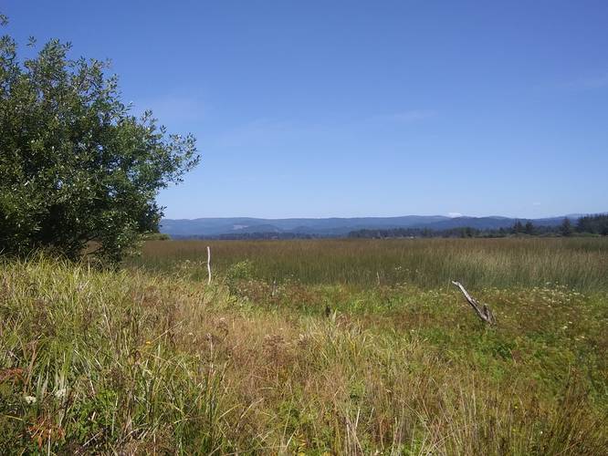
Explore the serene beauty of the Lake Earl Wildlife Area in Del Norte County, California! This protected area offers a fantastic opportunity to immerse yourself in the rich coastal wetlands south of Lake Earl. The centerpiece for outdoor enthusiasts is the Lake Earl Wildlife Area Trail, an easy 1.7-mile out-and-back path near Crescent City. Perfect for a leisurely stroll or a family outing, the trail allows you to observe a diverse array of wildlife and enjoy the tranquil atmosphere of this unique ecosystem.
The Lake Earl Wildlife Area Trail is well-suited for casual hikers of all skill levels. With ample parking available (ten or more vehicles), getting started is easy. The trail itself involves two clearly marked right-hand turns at 0.2 and 0.25 miles from the trailhead, guiding you deeper into the wetlands. Biking is also permitted, providing an alternative way to experience the area's natural splendor. Remember to turn around approximately 0.4 miles after the second turn to complete the out-and-back route. Enjoy the sights and sounds of nature at this easily accessible and rewarding location!
Plan your ultimate European Alps adventure! Discover the best hiking trails, epic scenery, and villages in the Swiss Alps, Dolomites, Chamonix, and Lake Como.
Plan a day's drive adventure along the iconic Million Dollar Highway in Colorado. Explore the best short trails, roadside stops, waterfalls, vistas, ghost towns, and hot springs within a ~6 hour road trip.
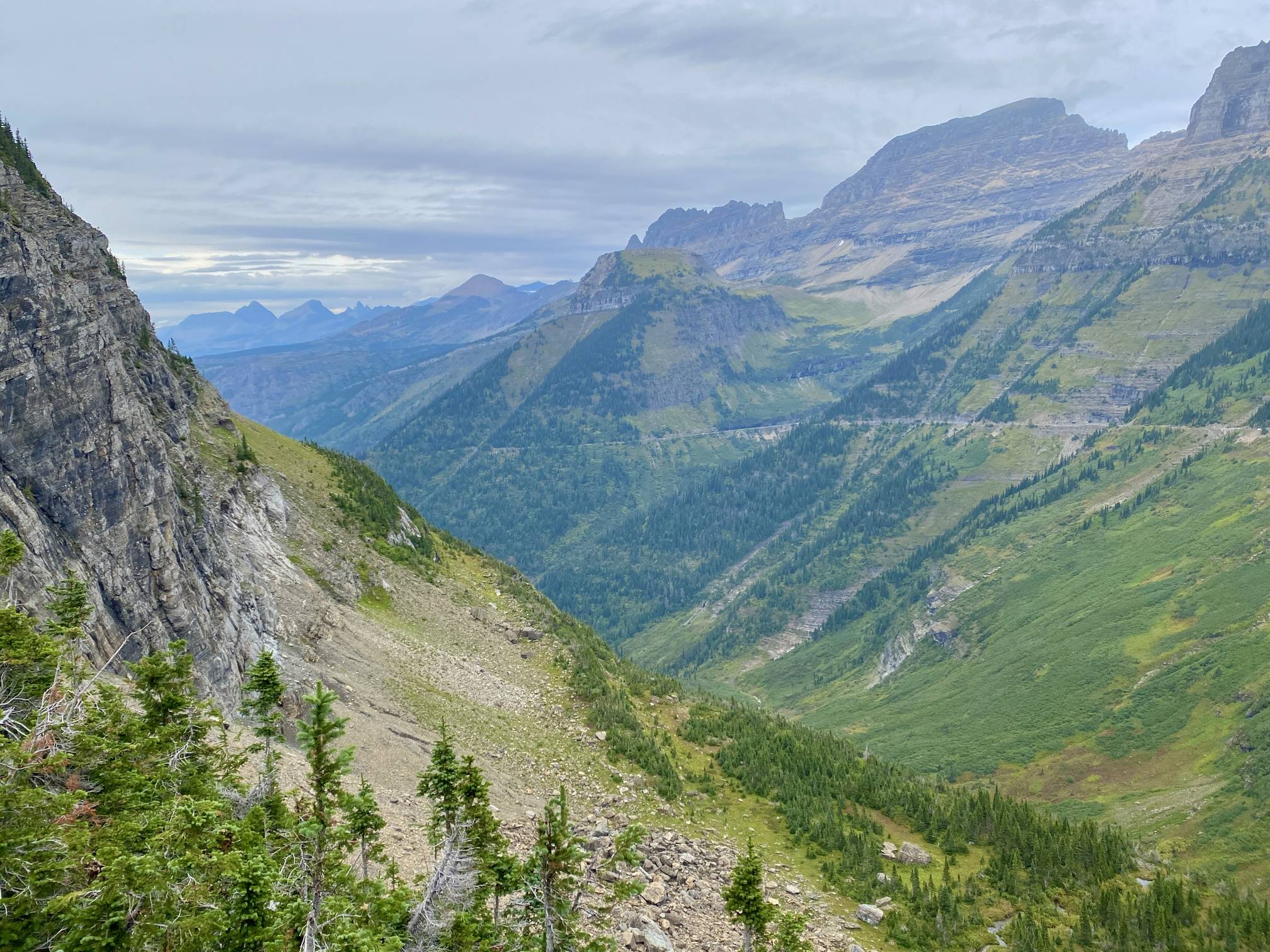
Discover the breathtaking beauty of Glacier National Park along the iconic Going-to-the-Sun Road. From stunning roadside stops to picturesque waterfalls and vistas, this engineering marvel offers endless opportunities for exploration.
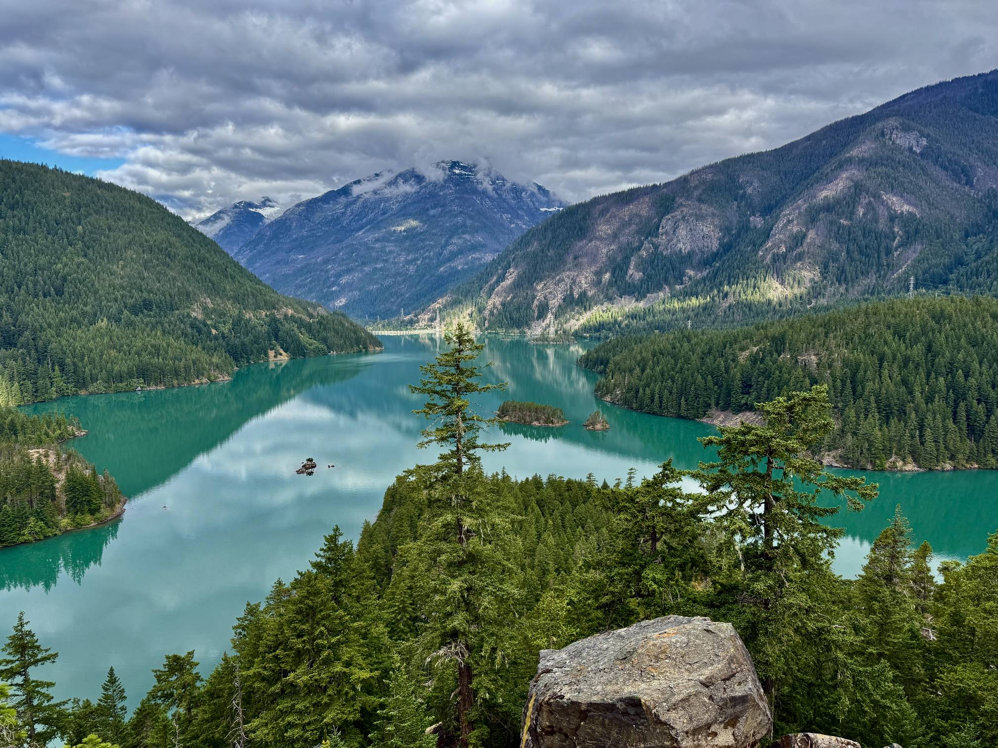
Find the best day hikes in Washington's National Parks and Forests. Explore panoramic alpine vistas, turquoise lakes, and stunning waterfalls.